Curbside congestion is a growing issue for airport operators around the world. As passenger volumes increase, the curbside becomes a critical pressure point. Limited visibility and unpredictable behavior create safety risks and operational inefficiencies.
The airport curbside is one of the first physical point of interaction between travelers and the airport.
As global air travel continues to rebound and grow, airports are experiencing record volumes of passenger traffic. With global air travel rebounding, airports are handling record levels of passenger traffic.
How LiDAR Enhances Passengers’ Experience at Airports
According to the New York Times, the cumulative wait time in airport queues is 37 billion hours. LiDAR Software can help.
Read article →

According to the Airports Council International (ACI), global passenger traffic is forecast to exceed 12 billion by 2030. As a result, pressure on infrastructure, especially curbside zones, is intensifying.
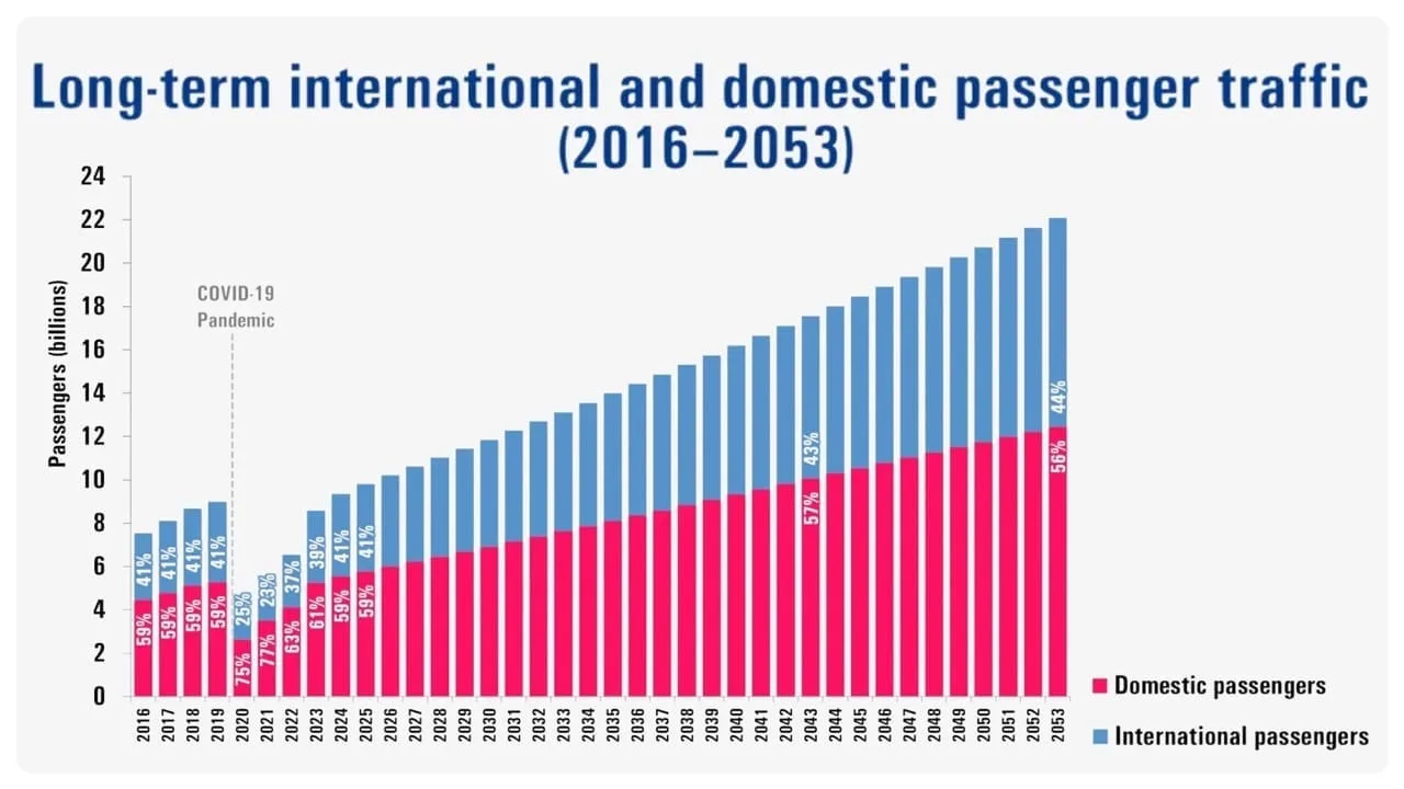
Long term international and domestic passenger traffic
Curbside traffic has become a major cause of delays and inefficiencies at many major international airports.
For example, according to Los Angeles World Airports (LAWA), at LAX during peak hours, curbside demand exceeds available capacity by approximately 60% on the upper level and nearly 50% on the lower level. This sustained capacity shortfall frequently disrupts curbside operations, creating ripple effects across the entire passenger journey.
These bottlenecks frustrate travellers, raise emissions, hinder ground operations, and create potential security risks, ultimately undermining the airport’s ability to ensure a seamless flow from arrival to check-in.
Traditional solutions rely on manual supervision and basic sensors like cameras. Some airports implement traffic marshals or redesign curbside zones with physical barriers. Others use time-based vehicle restrictions or enforce drop-off time limits.
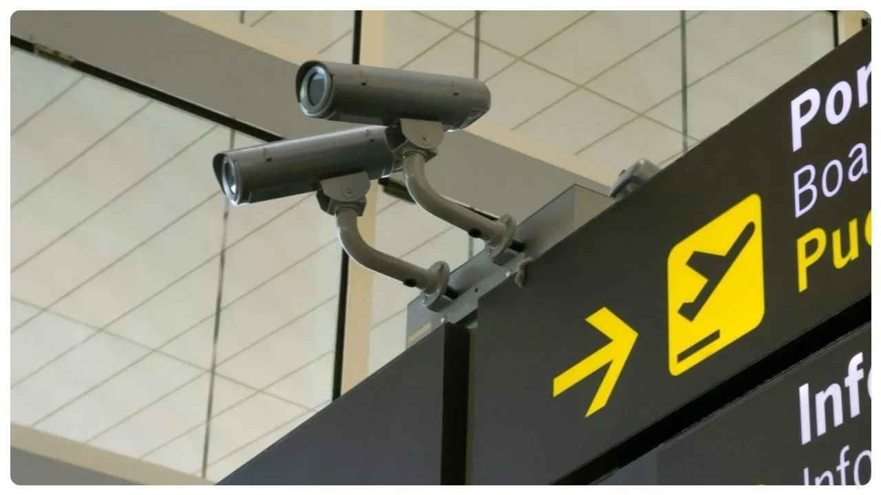
CCTV cameras at an airport.
While these methods provide temporary relief, they lack scalability, precision, and real-time adaptability.
Most conventional technologies fail to deliver the real-time, detailed, and anonymous data that modern airports need.
LiDAR Tech for Improving Airport Touchpoint Operations
LiDAR-based Spatial AI significantly enhances airport operations, improving passenger flow and reducing wait times at key touchpoints.
Read article →
LiDAR (Light Detection and Ranging) is a remote sensing method that uses laser pulses to measure distances and generate highly accurate 3D representations of an environment.
LiDAR technology gives airports a clear, real-time 3D view of what’s happening at the curbside. It works in all lighting and weather conditions, and it doesn’t collect personal information, which makes it safe and ethical to use in public places.
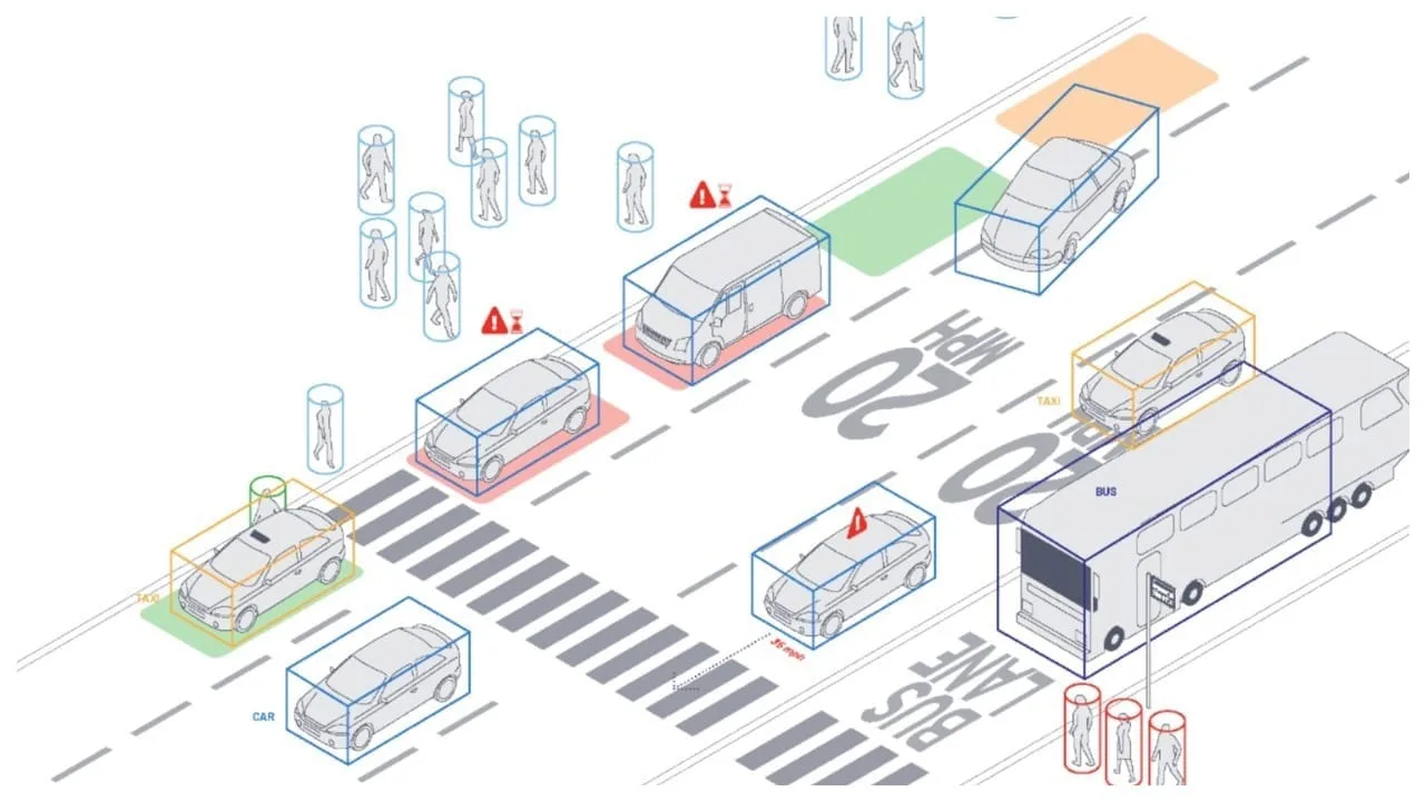
LiDAR technology gives airports 3D view of what’s happening at the curbside.
Outsight’s Shift Spatial Intelligence Platform is a key component of a complete real-time Spatial AI software solution that turns raw 3D LiDAR data into actionable insights through advanced Physical AI.
LiDAR Manages Increased Airport Traffic
See how and why Airports are increasingly using LiDAR-based software solutions to tackle their biggest challenges, leveraging the unique value of Spatial Intelligence.
Read article →

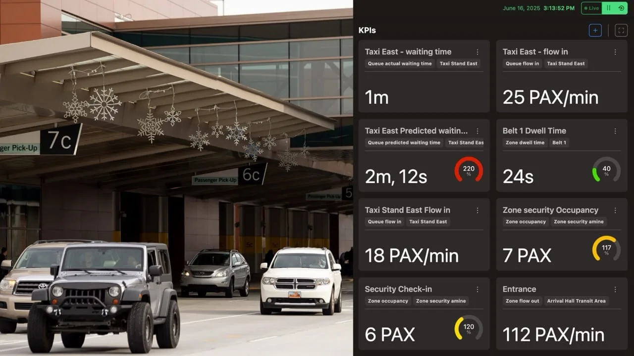
- Real-time monitoring of both pedestrian and vehicle flows
- Dwell time measurement to detect parking overstays
- Congestion alerts before bottlenecks develop
- Anonymous tracking that respects privacy regulations
Outsight’s software solution turns curbside activity into clear, digital data.
This helps airport staff spot problems early and make smart decisions before disruptions occur. It leads to safer operations, less traffic congestion, and a smoother experience for passengers as soon as they arrive.