Skip to content
Insights
Motional Digital Twin built using Spatial AI (also known as Physical AI) and Lidar data, in real-time

Why Outsight uses Lidar

LiDAR combined with Physical AI enables a fundamentally new capability for airports, delivering real-time, airport-wide understanding, powering Motional Digital Twins.


In his recent article “Why Xovis doesn’t use Lidar” in International Airport Review, Xovis co-founder and CEO addressed the increasing market demand for LiDAR, comparing it with their in-house-developed stereo-vision sensors.

As pioneers, global leaders, and the most experienced team in LiDAR-enabled Spatial Intelligence solutions, we believe it is our responsibility to contribute to a healthy debate. One that, as you will see, is not truly about sensors.

First, I must say, as an entrepreneur myself, that I have great respect for what the Xovis team has accomplished, introducing new technology to a market is never easy.

Their success is all the more impressive because understanding the physical world is fundamentally a 3D problem. Seventeen years ago, true 3D sensors didn’t exist, so the company cleverly built its solution around essentially a 2.5D approach, called stereo-vision (more on this below), which remains their core technology today.

Looking at the situation, though, I can’t help but think of my old good Nokia 3310, which I also bought seventeen years ago. I loved it, it still sends texts and makes calls, but comparing it with modern smartphones wouldn’t be fair.

It’s not about Hardware

Smartphones are not just better phones, nor the result of incremental feature improvements.

Of course, smartphones expanded messaging to include images, and voice calls improved with VoIP and high-fidelity codecs, but focusing on that misses the point.

The real breakthrough was the entirely new set of possibilities they unlocked.

The value created by the smartphone era is many orders of magnitude greater than the hardware market that enabled it, driven by software and by the applications and services built on top of it.

Still, since the original article focuses on hardware and because real-time 3D data is a key enabler of an on-going powerful transformation for airports, it is worth bringing clarity to this aspect.

Real 3D changes everything

Stereo-vision uses two cameras separated by a fixed distance, called the baseline, and applies triangulation between their images to estimate depth, something a single camera cannot do.

Estimated Depth vs. True 3D Measurement

Because depth is inferred through triangulation rather than directly measured, stereo-vision accuracy varies with distance, meaning an adult’s head and a small child’s head or luggage will not be estimated with the same precision.

Also, because stereo-vision sensors are ceiling-mounted and look straight down, this fixed viewpoint does not provide a true 3D perspective: many different situations appear identical when viewed from a single angle.

Only true 3D perception can capture the full physical reality of a scene.

Looking at the reality from a single viewpoint is not 3D.

Looking at the reality from a single viewpoint is not 3D.

LiDAR works on a completely different principle: it emits millions of laser beams per second in multiple directions, often covering 360 degrees, to directly measure the distance to every object.

Unlike stereo vision, this laser-based accuracy does not degrade with distance: a child tens of meters away in a terminal is measured with the same precision as a bus at the curbside.

For more details, take a look at our article on this subject:

Understanding the basics of 3D LiDAR Technology

Light Detection and Ranging, also known as LiDAR, is a technology for remote sensing that is used to measure distances in an environment.

Read article →

Flexible mounting

Because LiDAR captures the environment in true 3D across all directions, it does not require fixed ceiling mounting and can be installed at any angle on walls, poles, or other supports, including the ceiling.

Also, because LiDAR emits its own laser beams, it is an active sensor, unaffected by external lighting conditions, whether direct sunlight or complete darkness.

Lidar is the only hardware sensor that you can use in any context.

This mounting flexibility, unavailable with 2.5D cameras, is also crucial for understanding the next key difference.

Solving the occlusions’ problem

With a 2.5D sensor, from a single viewpoint, (even worse with a 2D camera), occlusions are a major problem: an adult can easily hide a child from the camera’s view. Ceiling mounting helps reduce this issue but does not solve it.

Because LiDAR is natively 3D, data from multiple sensors can be seamlessly combined to form a complete view from different angles, allowing objects hidden from one device to be seen by another and effectively resolving occlusions.

To understand this concept in more detail, take a look at our article:

Understanding Occlusions-free 3D Perception

Unlike cameras or Stereo-vision, which perceive reality from a single point of view, 3D native data from LiDAR opens up new possibilities.

Read article →
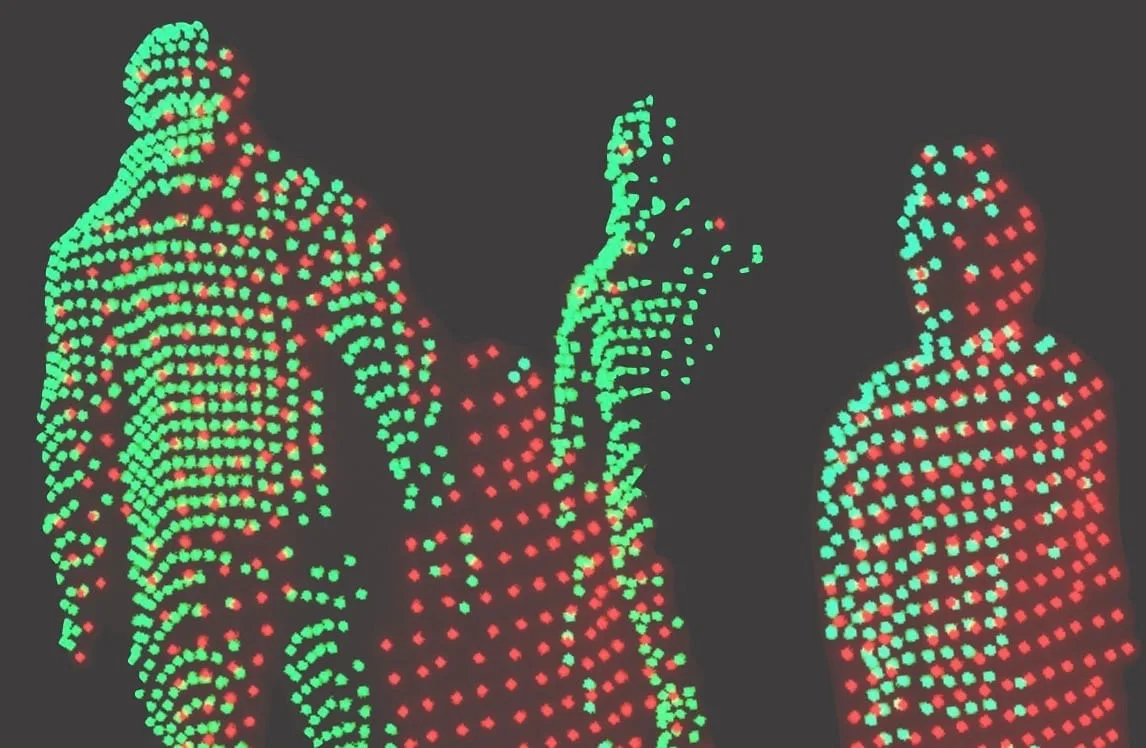
While this capability is enabled by LiDAR’s native 3D nature, it is the Spatial AI software, also known as Physical AI, that makes it a reality.

This Physical AI software layer is the most complex, which is why inexperienced teams and hardware-focused vendors without real LiDAR software expertise beyond simple demos, may mistakenly see occlusions as a limitation of LiDAR, when in reality the opposite is true.

Leveraging Automotive Reliability and Scale

While LiDAR was originally developed for 3D mapping, the automotive industry, where sensor failure can be life-threatening, has driven it to meet extremely stringent reliability standards and certifications, a level that is not comparable to stereo-vision sensors primarily designed for approximate footfall counting in retail stores.

The industrialization required for production in millions of units is also incomparable to the respectable but much more modest airport people-counting market, driving Lidar sensor prices down to hundreds of dollars per unit for some models.

Optimized Cost and Number of Devices

The falling price of sensors is not the only factor making native 3D perception more cost efficient to deploy: the much longer detection range (over 200 meters in some models), the wider field of view (up to 360°), and the mounting flexibility all result in a significantly lower sensor count, reducing installation, wiring, networking, processing, and maintenance costs.

Our experience at Outsight with international airports across five continents shows a clear pattern: 2 to 3 times fewer 3D sensors per square meter are required compared to the most favorable scenario for 2.5D stereo vision, and up to 10 times fewer in low-ceiling settings, where the narrow field of view of stereo cameras translates into a sometimes unacceptable number of sensors.

We could continue listing many other advantages of true 3D perception and LiDAR, including the fact that no images are ever captured, eliminating (not just reducing) the risk to privacy. If you want to understand why the most advanced airports globally are deploying Outsight and Lidar, just send us a message.

But the main point is neither hardware nor software; it is a transformative capability that simply was not possible before.

How 3D Spatial Intelligence powers Motional Digital Twins

The 3D data provided by LiDAR is only an enabler; the real value goes far beyond counting people in a specific area or calculating wait times, just as smartphones can send texts and make calls like older phones, but derive their true value from everything else they make possible.

Thanks to the unique characteristics of LiDAR listed above, Outsight’s Spatial Intelligence Platform uses Physical AI to accurately track, continuously, in real-time, the movement of every person and vehicle, airport-wide, as well as their behaviour and interactions with equipment and airport assets.

Each individual is represented with a unique ID with an accurate real-time position, meaning that external data from other sensors, boarding pass scanners with flight data, and point-of-sale systems, can be attributed to each specific person, a transformative capability that was unthinkable before.

This means, for the first time, capturing, understanding, and predicting the Full Passenger Journey, unlocking unique insights that improve operations, enhance passenger experience, and increase safety.

This is called a Motional Digital Twin: a real-time replica of the physical airport focused not on buildings or equipment, but on the dynamic reality of people and objects moving, interacting, and using available resources.

To learn more, take a look at our whitepaper describing this in more detail, as well as explaining why this new kind of Digital Twin is the right foundation for the most advanced AI workflows:

In conclusion, LiDAR cannot be meaningfully compared to limited, siloed legacy technologies with little or no integration into airport systems. On the contrary, it becomes the cornerstone for connecting information across the airport around what truly matters: the passenger.

Some predictions

It is always difficult to predict what will change in the future, but much easier to identify what is unlikely to change, as history has repeatedly shown across technology adoption cycles.

  1. In general, superior, cheaper, and more reliable hardware always replaces legacy technologies, even when those older solutions were once considered sufficient.
  2. When the new hardware reaches maturity, software that delivers tangible benefits makes the difference.
  3. That transformation is rarely driven by experts in the older technology, but by specialized companies, unencumbered by legacy approaches, yet equipped with years of experience in the new technology, deep know-how, and enterprise-grade solutions.

We could say that airport operators will experience this transformation in the future, but that would not be accurate: It’s not the future, is already happening, from Asia’s biggest hubs like Singapore Changi to the busiest airports in the US, South America, Africa and Europe, the technology is being adopted at scale.

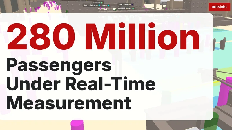
Outsight crosses 280 million passengers under real-time measurement, from the busiest US hubs to Singapore Changi

More than 280 million annual passengers now travel under real-time measurement by Outsight’s Spatial Intelligence Platform, from the busiest US hubs to Singapore Changi.

Read article →
While most deployments are not yet publicly communicated, if your airport is not yet working on leveraging the value of 3D Spatial Intelligence, we invite you to talk to your peers: the world’s most advanced international airports are already deploying, or preparing to deploy, LiDAR-based projects.

Related Articles

AIRPORTS

Why Now? The 7 Key Drivers Accelerating LiDAR Adoption in Airports

Discover the 7 key drivers making LiDAR-based Spatial Intelligence a reality in airports, real-time, anonymous, and ready for global deployment.

AIRPORTS

LiDAR Software Helps Airports to Manage Increased Traffic

See how and why Airports are increasingly using LiDAR-based software solutions to tackle their biggest challenges, leveraging the unique value of Spatial Intelligence.

Let's connect

Send us a Message

Drop your email and we'll get back to you as soon as possible.

Frequently Asked Questions

  • How does stereo vision differ from LiDAR in crowded airport terminals?

    Stereo vision infers depth by triangulating between two camera images separated by a fixed baseline. That triangulation accuracy degrades with distance, so a small child or piece of carry-on luggage is estimated less precisely than a full-height adult standing close to the sensor. LiDAR emits laser pulses that directly measure distance, giving consistent centimeter-level accuracy regardless of how far the object is from the sensor. In crowded terminals where children, wheelchairs, and luggage carts mix with adult passengers, that precision gap is operationally significant. Outsight's infrastructure-based approach exploits this LiDAR property to build a Motional Digital Twin of every person and object moving through a terminal, tracking position and geometry uniformly across the full volume of a gate, concourse, or security checkpoint.

  • Why does mounting angle matter so much when comparing LiDAR to stereo cameras for people tracking?

    Stereo-vision sensors like Xovis require ceiling mounting and a downward-looking orientation to function correctly: the depth-estimation geometry breaks if the angle shifts significantly. LiDAR emits beams across a wide field of view in all directions, so it can be installed on walls, poles, or gantries at any angle without compromising measurement accuracy. That flexibility matters for low-ceiling environments such as curbside canopies or underground concourses, where ceiling mounting is not always feasible and the narrow field of view of a downward-looking stereo camera would require a much higher sensor count to cover the same area. Outsight's infrastructure-based deployments, including at airports like Dallas Fort Worth and Rome Fiumicino, take advantage of this positional freedom to achieve full-site coverage with fewer sensors, feeding real-time 3D data into the Motional Digital Twin regardless of mounting constraints.

  • Can a single vendor's sensor platform track a passenger all the way from curbside drop-off to the departure gate?

    Achieving truly continuous end-to-end passenger tracking across an entire airport requires a system that fuses data from many sensors into one shared reference frame, maintaining a single anonymous ID for each individual across handoffs between sensor coverage zones. This is the architectural function of a Motional Digital Twin: not a collection of independent counting devices, but a live airport-wide spatial model that preserves identity continuity from curb to gate. Outsight deploys exactly this architecture across large-scale airports, including Dallas Fort Worth, the world's largest 3D LiDAR airport deployment, where infrastructure-mounted LiDAR sensors feed a unified spatial model rather than operating as isolated zone counters. Xovis and other single-viewpoint sensors like Footfallcam were not designed for that kind of multi-zone fusion at airport scale.

  • How does LiDAR-based tracking enable fusion with boarding pass or flight data?

    When a passenger is assigned a persistent anonymous ID at entry, any touchpoint event tied to that physical location can be joined to that ID. A boarding pass scan at a specific gate reader, for example, establishes which flight is associated with the passenger currently at that position. That join does not require biometric data: the spatial position links the physical presence to the business event. Outsight's Motional Digital Twin applies exactly this principle across large-scale airport deployments, including Dallas Fort Worth, where continuous LiDAR-based ID persistence across the full terminal enables journey-level analytics such as gate dwell time, connection time, and security wait durations. No people-counter or stereo-vision system can produce those insights because those systems lack the continuous, airport-wide ID continuity that infrastructure-based LiDAR tracking provides.

  • What reliability standards do automotive-grade LiDAR sensors meet that airport-specific stereo cameras do not?

    Automotive LiDAR sensors are validated to meet functional safety standards (including ISO 26262) and environmental certifications covering vibration, temperature range, and ingress protection at a level appropriate for a component where sensor failure could cause a fatality. Stereo-vision sensors designed primarily for retail footfall counting are validated to a different, lower standard. Outsight's infrastructure-based approach takes advantage of this automotive-grade rigor by deploying LiDAR hardware (across vendors including Hesai, RoboSense, and Ouster) as fixed infrastructure, so airports benefit from the same reliability bar originally set for safety-critical vehicle systems. The automotive supply chain also produces LiDAR in volumes measured in millions of units, which drives per-unit costs down in a way the comparatively small airport people-counting hardware market has never been able to achieve.

  • Is the shift from stereo vision to LiDAR in airports driven by hardware improvement or something else?

    The hardware improvement is real but secondary. The primary driver is that true 3D sensing, combined with Physical AI software, unlocks a category of capability that 2.5D stereo vision like Xovis cannot approach: real-time, airport-wide tracking of every individual with a persistent ID, behavior classification, anomaly detection, and prediction. Those capabilities feed a Motional Digital Twin, which connects operational data across the airport around the passenger journey. Outsight's SHIFT platform demonstrates this at scale, with deployments at airports such as Dallas Fort Worth, Paris-Charles de Gaulle, and Rome Fiumicino translating LiDAR infrastructure into live spatial intelligence. That is a qualitative jump, not an incremental upgrade, comparable to the difference between a feature phone and a smartphone rather than between two generations of the same device.

  • Why does stereo-vision depth accuracy drop with distance while LiDAR accuracy stays constant?

    Stereo-vision uses two cameras separated by a fixed distance, the baseline, and triangulates between their images to estimate depth. Because depth is inferred, accuracy varies with distance, so an adult's head, a small child's head or a piece of luggage are estimated with different precision. LiDAR emits millions of laser beams per second and directly measures the distance to every object, so its accuracy holds with distance: a child tens of meters away in a terminal is measured as precisely as a bus at the curbside.

  • How do multiple LiDAR sensors solve the occlusion problem in busy airport terminals?

    From a single viewpoint, a 2.5D stereo sensor or a 2D camera suffers from occlusions: an adult can easily hide a child, and ceiling mounting only reduces the issue. Because LiDAR is natively 3D, data from multiple sensors can be seamlessly combined into one complete view from different angles, so an object hidden from one device is seen by another. Outsight stresses that the Physical AI software layer is what makes this fusion work, and it is the most complex part of the system.

  • Why are stereo-vision people counters in airports compared to an old Nokia 3310 phone?

    Outsight notes that stereo-vision people counting was built around a 2.5D approach seventeen years ago, when true 3D sensors did not exist, and that this remains its core technology today. The article compares it to a Nokia 3310 bought around the same time: it still sends texts and makes calls, but comparing it with a modern smartphone would not be fair. The point of the analogy is that smartphones created value through the software, applications and services built on top of the hardware. Outsight argues the same holds for airports, where true 3D data enables Motional Digital Twins and full passenger journey insights.

  • Why have LiDAR sensor prices dropped so much for airport people-tracking projects?

    LiDAR was originally developed for 3D mapping, but the automotive industry pushed it to industrial production in millions of units. That scale is far larger than the airport people-counting market, and it has driven LiDAR prices down to hundreds of dollars per unit for some models. Combined with long detection range, wide field of view and flexible mounting, lower sensor prices make native 3D perception with Outsight's Spatial Intelligence Platform more cost efficient to deploy across a whole airport.

  • What detection range and field of view do LiDAR sensors offer for airport-wide tracking?

    Some LiDAR models offer a detection range of more than 200 meters and a field of view of up to 360 degrees. Together with the ability to mount sensors at any angle on walls, poles or ceilings, these characteristics result in a significantly lower sensor count, reducing installation, wiring, networking, processing and maintenance costs. Outsight reports needing 2 to 3 times fewer 3D sensors per square meter than the most favorable stereo vision scenario, and up to 10 times fewer in low-ceiling settings.

  • Does LiDAR people tracking work in direct sunlight and complete darkness at airports?

    Yes. LiDAR emits its own laser beams, which makes it an active sensor that is unaffected by external lighting conditions, whether direct sunlight or complete darkness. Outsight describes LiDAR as the only hardware sensor that can be used in any context. It can also be installed at any angle on walls, poles or other supports, including the ceiling, a flexibility Outsight says is unavailable with 2.5D cameras. This mounting flexibility helps reduce the number of sensors needed and allows data from multiple sensors to be combined to resolve occlusions.

  • How does LiDAR protect passenger privacy compared with camera-based airport sensors?

    LiDAR directly measures the distance to objects with laser beams, and Outsight highlights that no images are ever captured. According to Outsight, this eliminates the risk to privacy, beyond simply reducing it. Outsight's Spatial Intelligence Platform represents each individual with a unique ID and an accurate real-time position, so operators can track the movement of every person and vehicle airport-wide and attribute external data such as boarding pass scans to each specific person.

  • What is a Motional Digital Twin of an airport and how does LiDAR make it possible?

    A Motional Digital Twin is a real-time replica of the physical airport that focuses on the dynamic reality of people and objects moving, interacting and using available resources. It is made possible by LiDAR's true 3D measurement, which allows Outsight's Spatial Intelligence Platform to track the movement of every person and vehicle airport-wide, continuously and in real time. Outsight presents it as the right foundation for the most advanced AI workflows in airports.

  • What predictions exist about the shift from stereo vision to LiDAR in airports?

    Outsight makes three predictions based on past technology adoption cycles. First, superior, cheaper and more reliable hardware always replaces legacy technologies, even ones once considered sufficient. Second, once the new hardware matures, software that delivers tangible benefits makes the difference. Third, the transformation is usually led by specialized companies with years of experience in the new technology and enterprise-grade solutions. Outsight adds that this shift is already happening at the world's most advanced international airports.

  • Why do some vendors wrongly see occlusions as a weakness of LiDAR for people tracking?

    LiDAR's native 3D data makes it possible to combine several sensors and see objects hidden from any single viewpoint, but turning that into reliable tracking depends on the Physical AI software layer, which is the most complex part of the system. Outsight explains that inexperienced teams and hardware-focused vendors without real LiDAR software expertise beyond simple demos may mistakenly see occlusions as a limitation of LiDAR. In practice, multi-sensor fusion makes occlusion handling one of LiDAR's strengths.

  • Why use LiDAR instead of cameras for people flow analytics?

    LiDAR measures the world in 3D, giving the exact position, shape and movement of each person with centimeter precision, which makes counting and tracking reliable in crowds and across large spaces. It works in any lighting, covers more area per sensor, and captures no images or faces, so the data is anonymous by definition. Cameras remain useful where visual classification is needed, and their outputs can be fused onto the same 3D reference. Outsight builds its Spatial Intelligence Platform on LiDAR for these reasons.