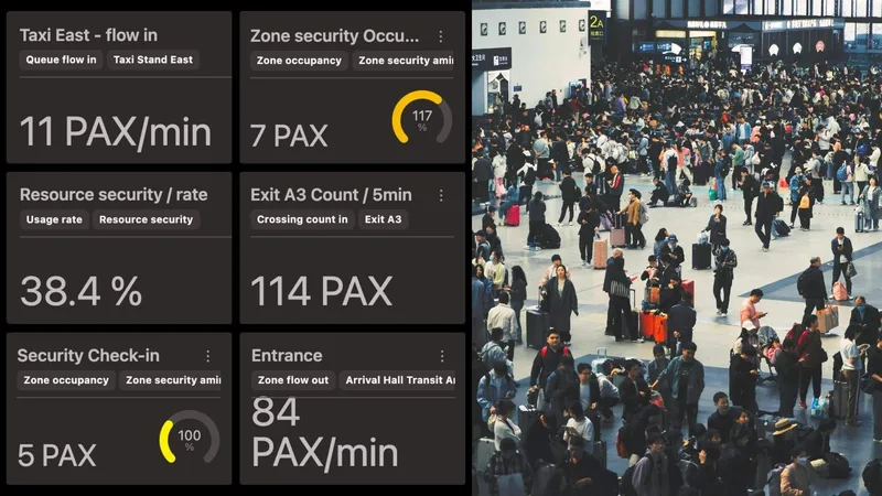
The need to monitor and manage the movement of people and vehicles has always been essential for airports, and for some forward-thinking operators, the vision of a real-time system capable of overseeing, analyzing, and optimizing the entire passenger journey has been a long-standing goal.
Until recently, however, the technology simply wasn’t ready to meet that ambition with the required precision and scale.
Now, thanks to a convergence of technological innovation, market readiness, and societal pressure for privacy, Spatial Intelligence powered by 3D LiDAR is not only possible, it’s scalable and being deployed globally.
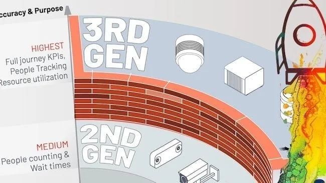
Introducing 3rd Gen People Counting Technology
Mirroring the technological evolution seen across various industries, People Tracking and Counting Technologies have already entered their third generation.
Read article →
So, why now? Here are the 7 key factors making LiDAR-based Spatial Intelligence a reality in airports today.
1. Native 3D Sensors Are Finally Ready
Unlike video or radar, LiDAR is the only sensing technology that provides true, native 3D perception over long distances with high accuracy.
Understanding the basics of 3D LiDAR Technology
Light Detection and Ranging, also known as LiDAR, is a technology for remote sensing that is used to measure distances in an environment.
Read article →

What’s changed? These sensors have matured significantly, and are now affordable, reliable, and robust enough for large-scale deployment. This makes them perfectly suited for complex environments like airports, where depth, distance, and detail matter.
2. Edge Computing Enables Real-Time Performance
Processing massive 3D data used to be a bottleneck. But not anymore.
With next-generation edge computing combined with cloud infrastructure, it’s now possible to process 3D spatial data in real time while accessing unprecedented insights from any browser.
Outsight has been leading this movement for many years:
Outsight Wins 2023 Edge AI and Vision Product Award
We’re thrilled to announce that the 6th generation of our 3D LiDAR processing software, has been awarded the 2023 Edge AI and Vision Product of the Year!
Read article →

This advancement means airports can monitor dynamic flows, such as passenger movement and vehicle traffic, with minimal latency, enabling faster response and better decision-making.
3. Physical AI Turns Data into Actionable Intelligence
LiDAR data alone isn’t enough. The real breakthrough lies in advanced Spatial AI (also known as Physical AI), that requires specific expertise in Spatial Computing.
Gartner® Recognizes Outsight as a Key Player in Spatial Computing
In its latest Emerging Tech Impact Radar: Computer Vision report, Gartner identifies Outsight as a key vendor in Spatial Computing, alongside major technology players such as Nvidia, Meta, Alphabet, and Matterport.
Read article →

Outsight’s software platform converts raw 3D data into precise, anonymous, and actionable insights, enabling airports to optimize everything from queue management and crowd control to safety and space usage.
LiDAR Solutions for Airports
Throughout airport terminals and at all key touchpoints from curb to gate, Outsight’s software leverages the unique value of 3D LiDAR data to anonymously track passengers and monitor queues in real-time. Operators can use accurate data to visualize passenger flow, communicate waiting times and support terminal operations while improving passenger experience.
Read article →
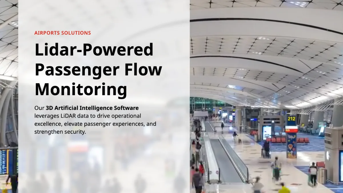
The technology is proven at scale and ready for deployment across diverse infrastructure scenarios.
4. Digital Twins Are Becoming Standard Tools
A 3D-native digital twin is the ideal interface to visualize and manage real-time Spatial Intelligence.
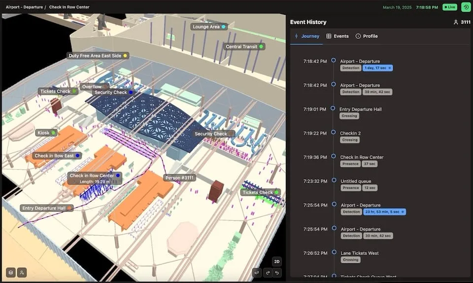
Airport operators now have an unprecedented level of insights about their operations.
Today’s software makes it possible to seamlessly integrate digital twins into web-based applications, allowing airport teams to visualize flows, monitor alerts, and test scenarios, all from an intuitive, interactive dashboard and a simple browser. It’s not just data, it’s live spatial awareness.
Gartner has also recently highlighted Outsight as a key global player in Digital Twins:
Gartner® Highlights Outsight as Digital Twin leader
Recognized for pioneering real-time digitalization of dynamic environments, Outsight sets itself apart by focusing on the live monitoring of people and vehicle flows.
Read article →

5. Privacy Concerns Demand Better Solutions
Public resistance to image-based and wireless surveillance is growing, and rightly so.
LiDAR offers a privacy-first alternative. Since it doesn’t capture personally identifiable information, LiDAR ensures monitoring is anonymous by design, aligning with regulatory requirements and public expectations for ethical, respectful data use in public spaces.
Anonymous vs. Anonymized : Learn the Difference
Understanding Anonymity in Sensor Data: discover the inherent privacy characteristics of each type of Sensor data and the potential risks associated with anonymizing sensitive information
Read article →

6. Global Adoption Validates the Shift
The shift to LiDAR-based Spatial Intelligence is happening now.
Leading airports across the USA, Europe, the Middle East, and Asia are already deploying Spatial Intelligence solutions using Outsight’s technology. Many more are exploring adoption as part of their digital transformation roadmaps.
7. Increasing Air Travel Volume
Today’s travelers and airport stakeholders demand more, greater efficiency, enhanced safety, and a frictionless experience, all while respecting individual privacy.
LiDAR Manages Increased Airport Traffic
See how and why Airports are increasingly using LiDAR-based software solutions to tackle their biggest challenges, leveraging the unique value of Spatial Intelligence.
Read article →

At the same time, operators are under pressure to do more with less, and to adapt to evolving passenger behaviors and traffic patterns.
Despite the COVID-19 pandemic, air travel volume is on the rise and is projected to nearly double to 19.5 billion passengers by 2042, as illustrated in the figure below.
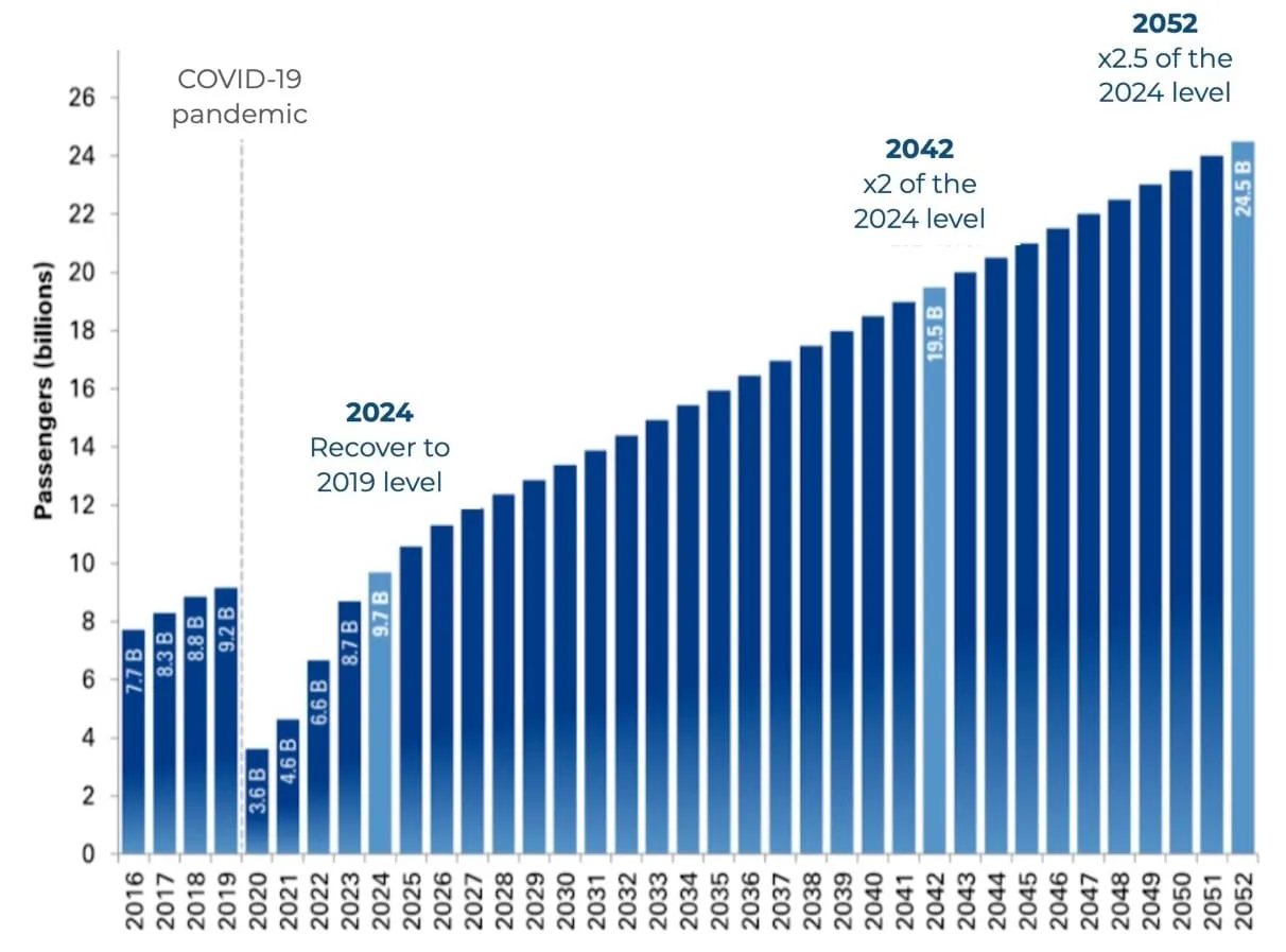
Long-term global passenger traffic forecast (2016-2052) - Source: Airports Council International
This growth presents significant challenges for airport infrastructure. Airport operators must handle the increasing demand while maintaining a high-quality passenger experience and achieving operational efficiency.
With most airports nearing full capacity and new infrastructure unlikely to be built in time to meet growing demand, operators must optimize operations and enhance passenger flow within existing facilities through precise monitoring and actionable insights.
The best way to meet these demands is with real-time, intelligent, and scalable spatial monitoring tools.
Conclusion: The Time for LiDAR-Powered Airport Business Intelligence Is Now
Thanks to the maturity of 3D LiDAR sensors, the rise of Physical AI, and the need for privacy-respecting, real-time intelligence, airports can now realize the full potential of a Spatial Intelligence platform.
At Outsight, we’re proud to be at the forefront of this shift, helping leading airports around the world make smarter, safer, and more efficient decisions every day.
🔗 Explore how our Spatial Intelligence solution is shaping the future of airport operations:
Solutions for Airports