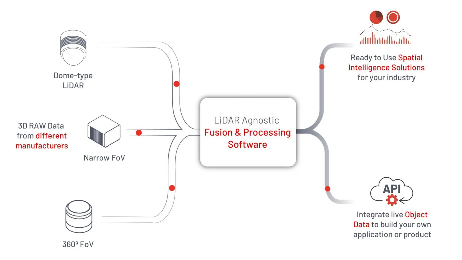
The software from Outsight combines 3D RAW LiDAR data from different sensors, even from different LiDAR manufacturers, and processes these data streams to create a virtual 3D LiDAR sensor in real time.
The virtual sensor output is then converted into actionable KPIs, tailored for each application purpose, in a user-friendly dashboard. The developed solution can also trigger event-based alarms and generate aggregated data analytics.
Lastly, thanks to the API and an open standard data output format, anyone can build their own custom solution, no matter what the hardware input protocol is.
In one way with the dashboard or another with the API, the LiDAR software is the smartest path to the success of any LiDAR project thanks to its fast and easy deployment, advanced tools, and world-class performance.
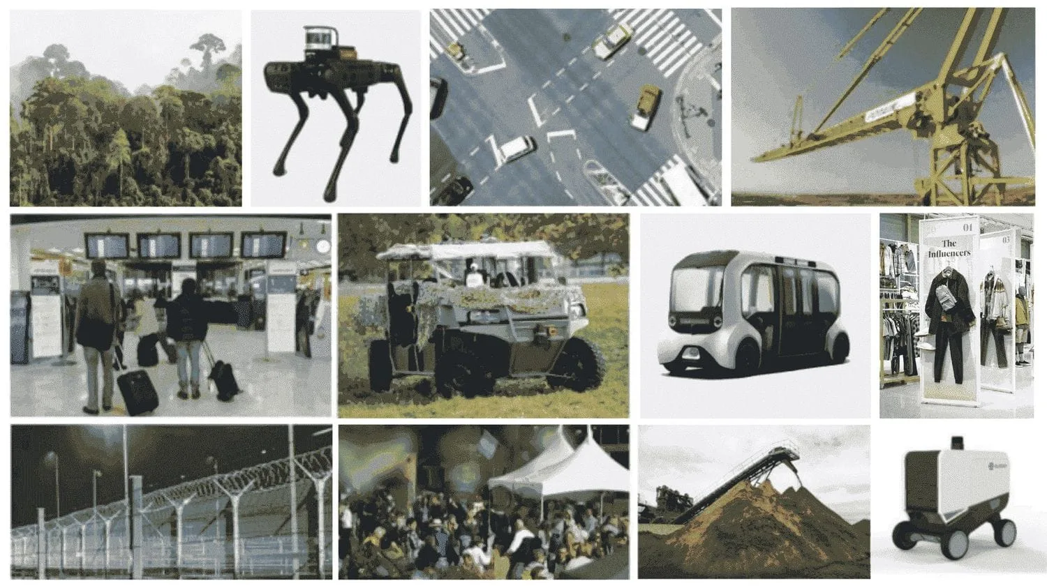
Through different applications, Outsight’s LiDAR software and tools could support many industries, such as smart cities, logistics, automated vehicles, and robotics. Let’s dive in to explore some of the most relevant use cases.
LiDAR Software Use Cases
ITS
LiDAR technology has vast potential in the field of ITS (Intelligent Transportation Systems), including traffic monitoring, smart intersections, detecting VRUs (Vulnerable Road Users), and enhancing road safety for both drivers and pedestrians. However, its widespread adoption has been hindered by the complex data output that arises from using multiple LiDARs with different orientations and positions, particularly in smart traffic solutions.
To overcome this challenge, Outsight’s LiDAR Software offers a comprehensive set of user-friendly features and generates valuable information on object detection, speed, trajectory, and classification, turning raw data into actionable insights.

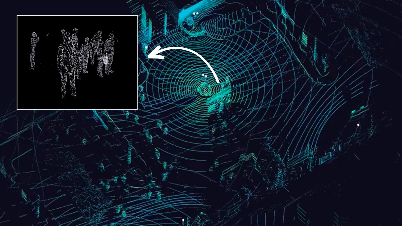
Outsight software can achieve high precision even in large crowded areas
The software’s ability to process huge amounts of 3D raw data at the edge and convert it into narrow-band data, enables low-power wireless communication, making it a must-have solution for ITS applications.
In practice, Outsight’s LiDAR solution can collect traffic data at any intersection and provide total surveillance to get a full traffic view (including pedestrians, vehicles, cyclists, vulnerable users, etc.).
In the city of Bellevue (WA), Outsight’s LiDAR software was used to detect pedestrians and vehicles, get their trajectory and speed, and classify them to create an intersection management tool. The project ultimate goal was to reduce the number of fatal and serious injury traffic collisions to zero.
Outsight software enables the user to follow objects processing in real-time
In a different application example, a European company specializing in providing top-notch products for the Smart Mobility & ITS industries selected Outsight’s LiDAR software to monitor fast-moving objects and calculate the distance between vehicles on highways in order to avoid tailgating.
To know more about ITS applications, read the following article:
LiDAR Software Expands ITS Solutions
With the global rise of 3D sensor demand, LiDAR has never been so accessible and it’s becoming essential for Intelligent Transportation System applications.
Read article →

Smart Airports
For this use case, Outsight developed the Spatial Intelligence Platform (SIP), which is a plug-and-play solution for monitoring airport operations and measuring key performance indicators (KPIs) related to how people move through airports and how well they use their assets.
Outsight’s SIP boasts an unparalleled ability to continuously monitor the journey and interactions of each passenger throughout expansive Terminal areas. This enables both immediate alert generation and comprehensive data analysis
The SIP can be accessed by authorized airport staff through an easy-to-use web dashboard. It can be used in different parts of the terminal, such as check-in, immigration, security, and boarding gates.
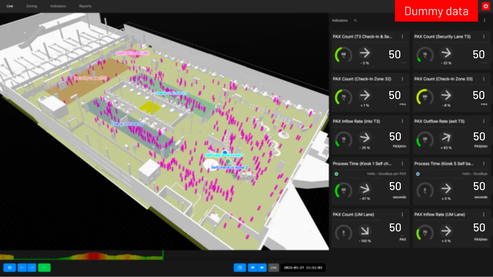
SIP dashboard illustration
With advanced features like automatic detection of passenger queues, the SIP provides valuable insights for real-time decision-making and long-term planning and optimization.
The SIP has already been put to use in major airports, where it has processed more than 4 billion 3D data points. This is a big improvement over the old ways of tracking passenger flow and asset utilization.
Outsight SIP’s hardware agnostic architecture is designed for extreme scalability
Also, Outsight’s SIP puts data privacy and GDPR compliance at the top of its list of priorities, protecting passenger information. Unlike cameras, LiDARs do not collect any personally identifiable information about passengers, and Outsight takes it a step further by processing all data on-premises and providing a private web dashboard.
LiDAR technology and software only generate anonymous data
To know more about Smart Airport applications, read the following article:
LiDAR Manages Increased Airport Traffic
See how and why Airports are increasingly using LiDAR-based software solutions to tackle their biggest challenges, leveraging the unique value of Spatial Intelligence.
Read article →

Industrial Volume Measurement
Accurate volume measurement is a key part of operations optimization because it makes it possible to keep track of inventory and measure material stockpiles. However, it might be hard to measure the volume of large, oddly shaped objects in real time.
With the right software, 3D LiDAR technology can solve problems with measuring volume by doing a thorough scan of the surface of the target material, making a precise 3D point cloud image, and using the surface’s spatial information to figure out the volume of the target material instantaneously.
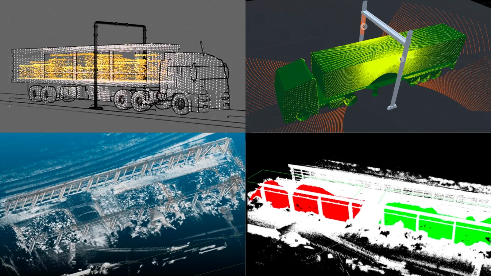
LiDAR software was used to measure volumes from truck loads to large warehouses inventory
In a practical example, a leading research firm in the pulp and paper industry selected Outsight’s software for a 3D LiDAR solution that makes rapid and automated measurements of the volume of large quantities of fiber loads delivered by truck, providing the necessary information to guarantee that the lot is correct.
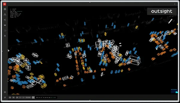
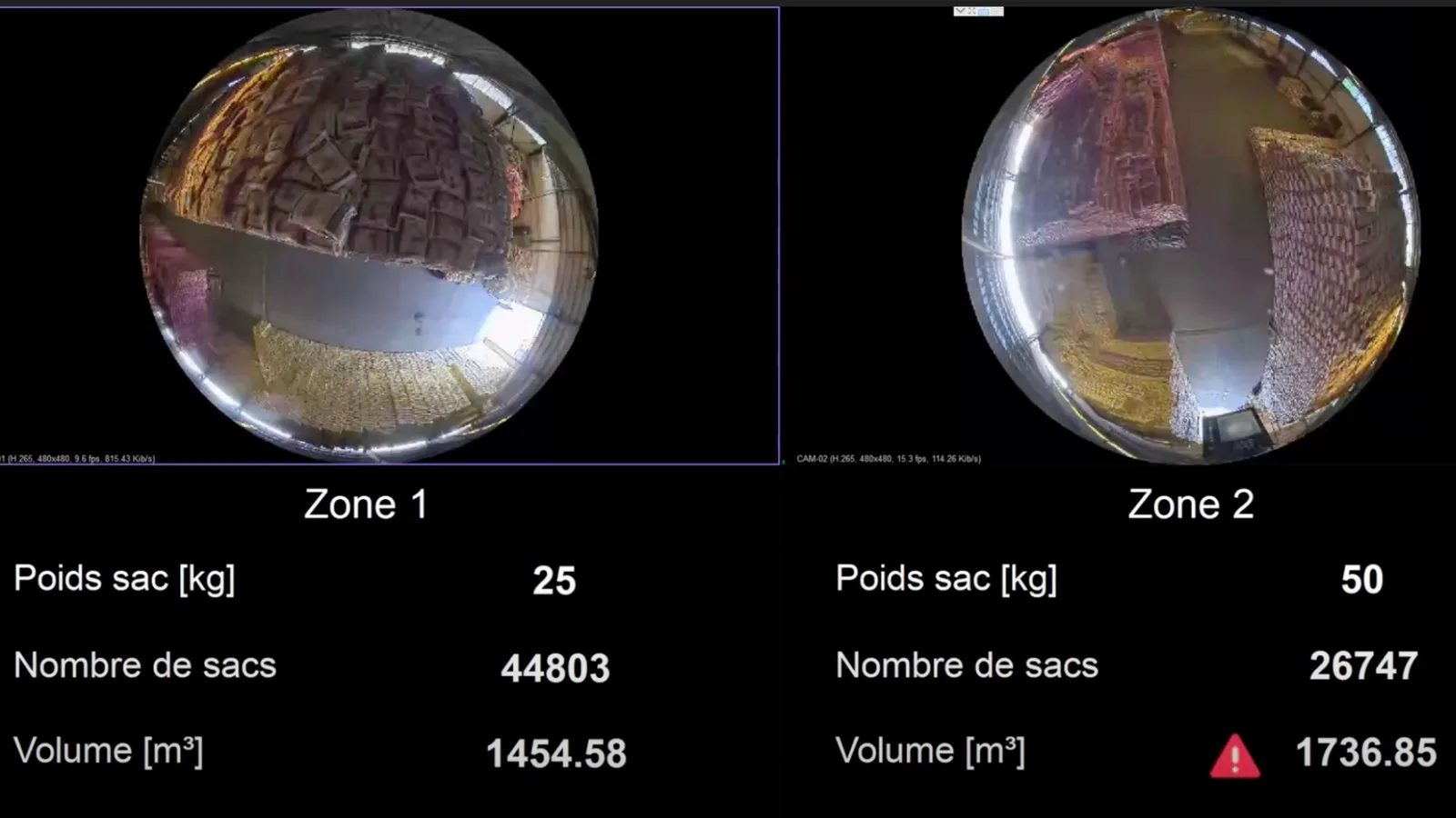
In a different use case, Outsight LiDAR software was chosen to calculate the volume of a warehouse inventory, the number of inventory bags in each heap, and identify people moving around the warehouse. If an abnormal and unexpected volume change occurred, an alarm would be triggered and a video would be provided for alarm verification. The next image shows a screenshot of the solution interface.
Robotics
LiDAR technology is being used more and more to give robots the ability to see, recognize, and avoid obstacles in their surroundings. LiDAR sensors give robots information in real time that lets them do a wide range of tasks by themselves in different fields, such as warehouse logistics, industrial automation, deliveries, security, and research projects.
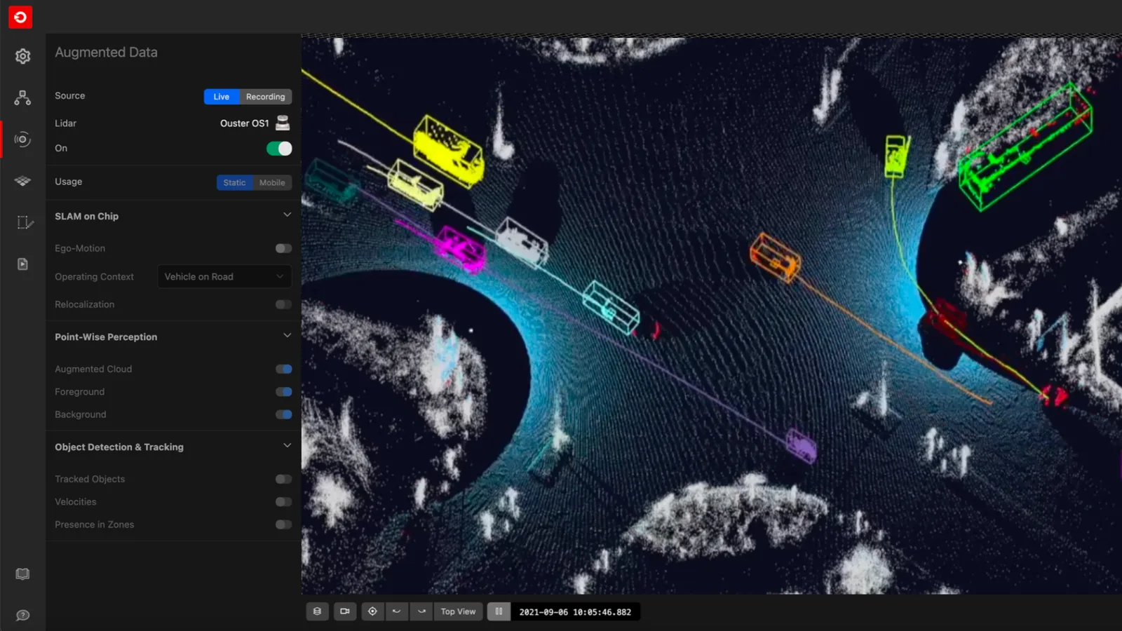
As a use-case example, an offshore navigation robot has used Outsight’s LiDAR software features such as 6 DoF SLAM and re-localization to get accurate and reliable information about its location and to navigate autonomously through different plant floor levels in reference to a pre-established map.
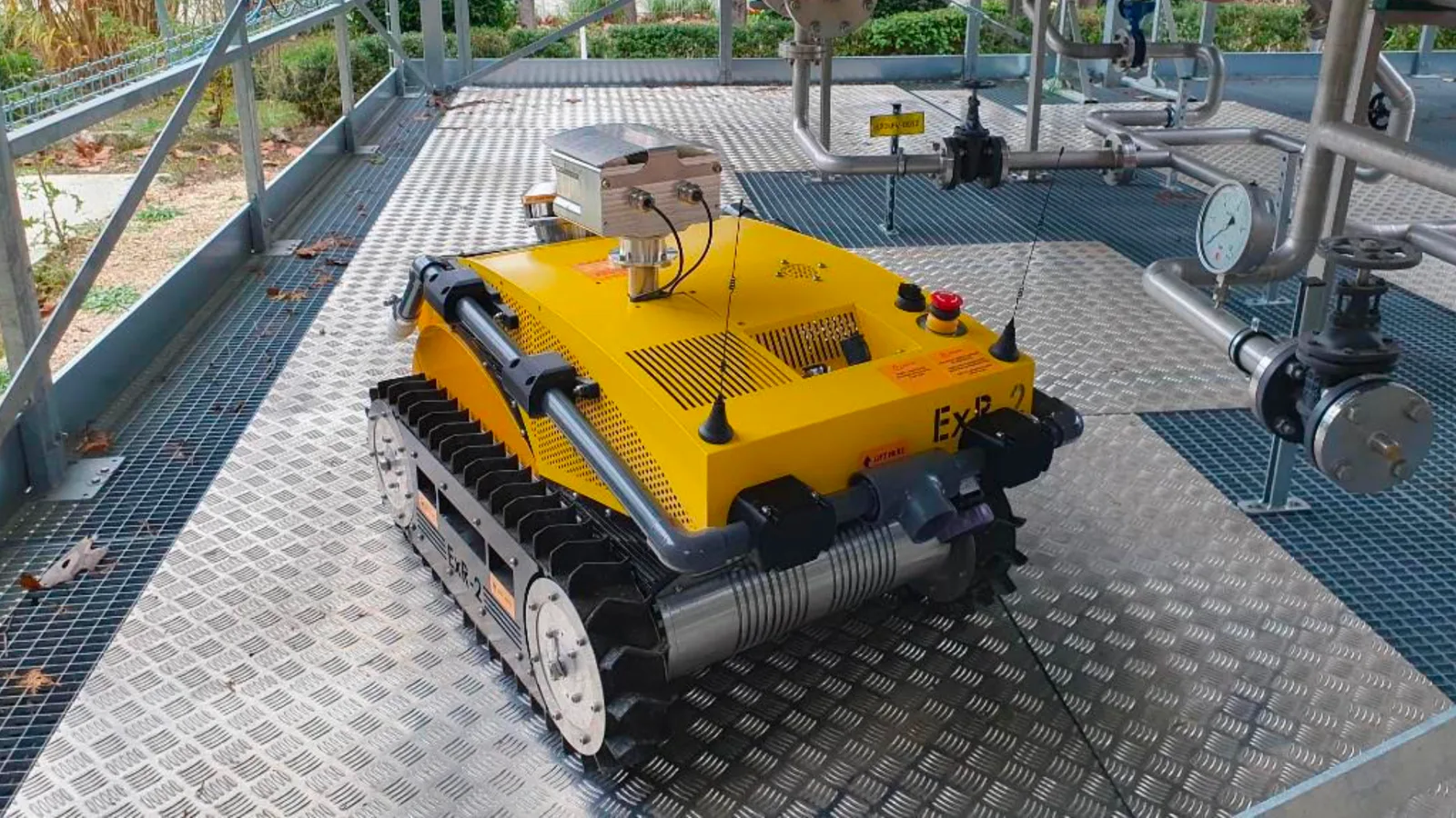
The mobile robot inspects offshore power plants in a multi-level environment using Outsight software
A European defense company, on the other hand, has used LiDAR software to provide processed 3D images and data that will help operators control robots and their arms more precisely, with the ultimate goal of neutralizing a suspicious parcel or package.
Since the robot is controlled by an operator via a wireless connection, in many situations the operator can’t really see the environment around the robot. So, the software feature super-resolution made it possible to make very accurate LiDAR 3D images that helped operators get the precision they needed to keep working.
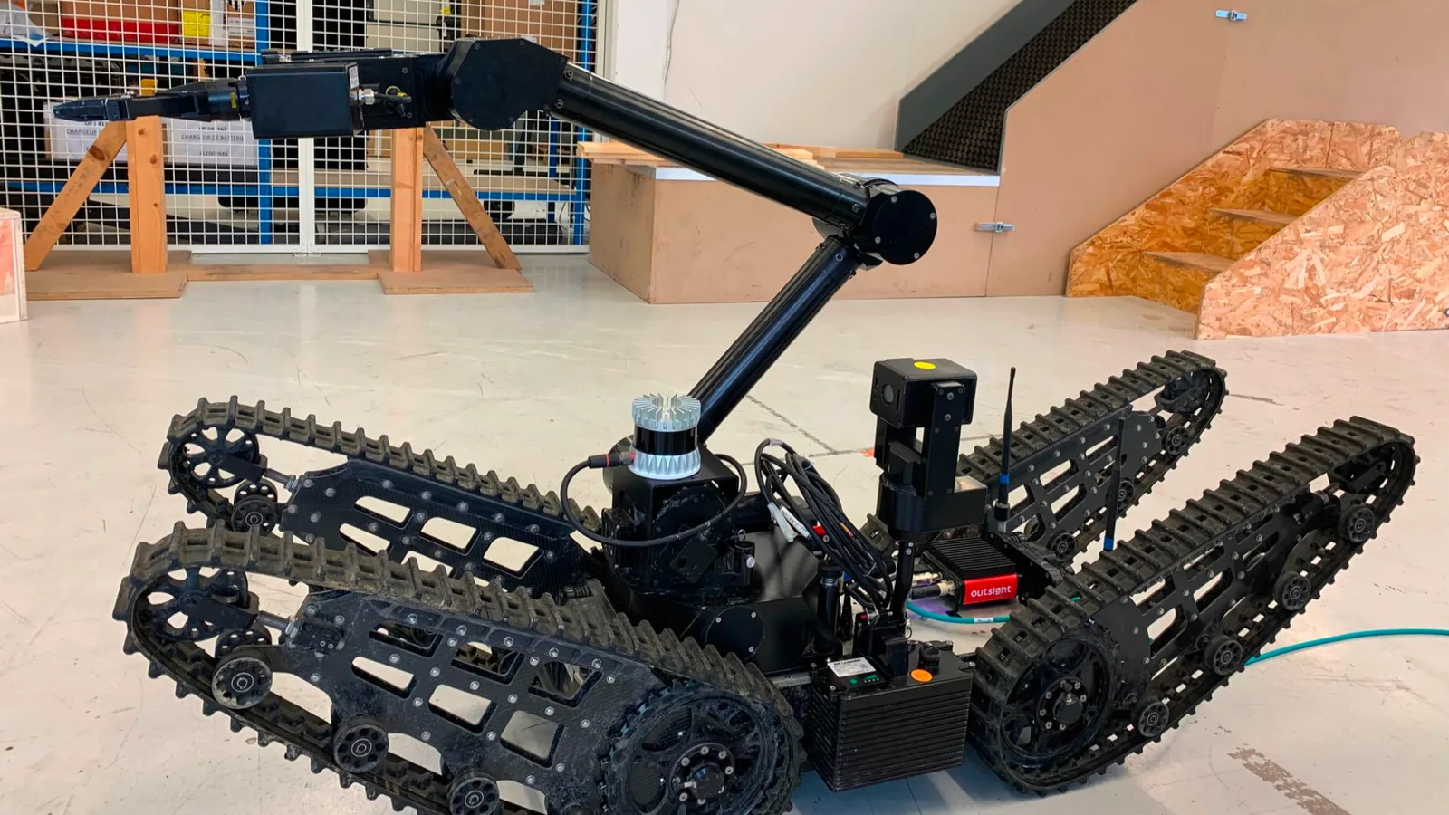
Outsight software capabilities are critical for successfully neutralizing potential threats
Conclusion
LiDAR technology, equipped with Outsight’s software features, has enabled numerous 3D perception applications.
Also, the technology’s inherent qualities, like being able to work during the day and night or not capturing personal information, make it even more appealing to different sectors.
In a nutshell, using LiDAR technology and Outsight’s software would be very helpful for almost any business or industry that needs spatial intelligence or accurate object detection and tracking.
If you want to know more, contact a product specialist.