Skip to content
Insights
Outsight and Innoviz Technologies announce a partnership agreement to accelerate LiDAR adoption, visualized with 3D point cloud imagery.

Innoviz and Outsight announce partnership to accelerate LiDAR's adoption in industries and smart cities

The combination of Outsight and Innoviz's solutions is intended to make 3D LiDAR technology more accessible and faster to use outside of the ADAS market.


Innoviz Technologies, a technology leader of high-performance, solid-state LiDAR sensors and high-performance perception software, today announced its partnership with Outsight.

Outsight’s Spatial Intelligence Software, the company’s unique, real-time edge processing and cloud capability platform, offers a plug-and-play solution for effectively integrating 3D LiDAR data into any infrastructure, industrial, or vehicle application.

The combination of Outsight and Innoviz’s industry-leading products is meant to make it easier and faster for 3D LiDAR technology to be used beyond the advanced driver assistance system (ADAS) market:

  • Infrastructure applications: Intelligent Transportation Systems (ITS), people flow monitoring, and security;
  • Commercial vehicle and robotics: Construction equipment, logistics and service robotics;
  • Industrial uses: Volume measurement, industrial equipment safety, and agriculture.

Innoviz and Outsight partnership

Innoviz’s high-performance LiDAR sensors meet the automotive industry’s strictest performance and safety requirements.

They are purpose-built to be rugged, affordable, reliable, power efficient, lightweight, high-performing, and seamlessly integrable, and are ideally suited to enable a wide range of non-automotive use-cases that require mature solutions.

At the same time, Outsight’s Spatial Intelligence Software makes it easier than ever to use LiDAR technology in any project, whether in real-time (edge processing) or remotely (in the cloud), with features like LiDAR SLAM, object detection and tracking, classification, and segmentation.
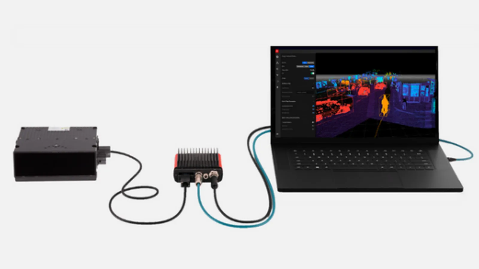
LiDAR solution system for ITS, integrating the InnovizOne with Outsight's Augmented LiDAR Box (ALB)

LiDAR solution system for ITS, integrating the InnovizOne with Outsight’s Augmented LiDAR Box (ALB)

As the recognized pioneer and leader in the LiDAR processing software category and the only specialist software founding member of the LiDAR Coalition, of which Innoviz is also a founding member, Outsight’s solutions have been widely adopted in a number of markets and for dozens of different uses throughout Europe, the United States, Asia, and the Middle East.

“We aren’t in the early days of LiDAR anymore. At that time, demonstration-level sensor prototypes and research-level algorithms were sufficient to ignite the market, giving birth to the current leaders in LiDAR hardware and software. Non-automotive markets that will deploy LiDAR at scale require a whole new level of maturity, with high-performing and reliable hardware like Innoviz’s LiDAR sensors combined with scalable and easy-to-use software solutions like Outsight’s,” said Raul Bravo, President Co-Founder of Outsight. “We’re glad to be working with Innoviz on innovative offerings thanks to the complementary technology and talent of both organizations.”

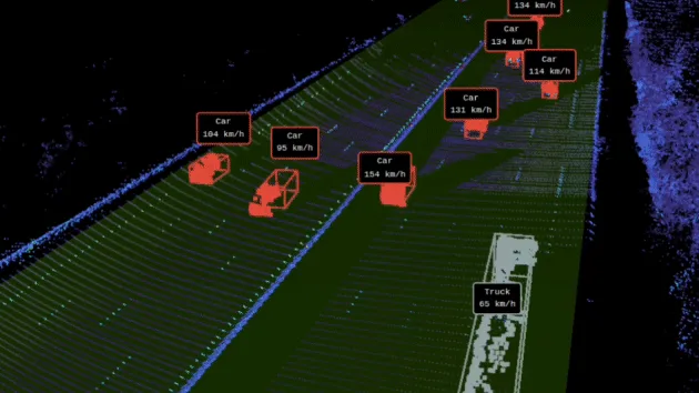
See the real-time LiDAR SLAM software from Outsight using InnovizOne data:

“Our award-winning LiDAR technology is already being used to monitor pedestrian safety in Los Angeles, improve operational efficiency and safety across shipping ports in China, automate crane systems on construction sites in Japan, and more,” said Omer Keilaf, Co-Founder and CEO of Innoviz. “We’re excited to partner with Outsight to continue to accelerate the adoption of our award-winning LiDAR technologies and power use cases across ITS, Smart infrastructure, smart industrial and more.”

Outsight will demonstrate the collaboration with Innoviz LiDAR during CES 2023 at Innoviz’s booth #6553 during the show dates, January 5-8, and will present the use-case with Innoviz LiDAR on Wednesday, January 5, 2pm, at Innoviz’s booth #6553, followed by a Q&A session.

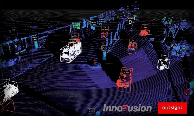
Innoviz and outsight announce partnership  in CES

Related Articles

APPLICATIONS

New Partnership Agreement Between Outsight and Innovusion

The goal of this new partnership is focused on accelerating LiDAR technology in the ITS market.

APPLICATIONS

New Partnership Agreement Between Outsight and Seyond

The aim of this collaboration is to accelerate the advancement of LiDAR technology within the ITS market.

Let's connect

Send us a Message

Drop your email and we'll get back to you as soon as possible.

Frequently Asked Questions

  • What non-automotive markets are adopting LiDAR at scale right now?

    The heaviest adoption outside automotive is in intelligent transportation systems, logistics and port operations, construction automation, and people flow monitoring at airports and transit hubs. Industrial use cases like volume measurement and equipment safety are accelerating. Outsight's deployments illustrate this shift directly: its SHIFT platform is active across major airports such as Dallas Fort Worth and Paris-Charles de Gaulle, SNCF train stations in France, BMW factories, and smart-city intersections in Bellevue. The structural driver is consistent across sectors: LiDAR sensor costs have dropped sharply and processing software has matured enough that a deployment no longer requires a dedicated research team to integrate the data pipeline.

  • Why did LiDAR adoption outside ADAS take longer than the industry expected?

    Early LiDAR sensors were prototype-grade and algorithms were largely research-level, built to generate interest in the technology rather than to run production systems. Non-automotive verticals require hardware that meets automotive-grade reliability and safety standards, paired with software that can be integrated by an operational team without deep LiDAR expertise. Until both conditions were met simultaneously, large-scale industrial and infrastructure deployments remained economically and technically impractical. The Outsight and Innoviz partnership addresses precisely this gap, combining sensor-level hardware maturity with the SHIFT platform's ability to process 3D LiDAR data in real time, making the technology accessible to airport operators, smart-city engineers, and factory managers without requiring specialist perception expertise on-site.

  • What is LiDAR SLAM and why does it matter for infrastructure deployments?

    SLAM stands for Simultaneous Localization and Mapping. In a LiDAR context, it means the software builds a 3D map of a space at the same time as it tracks the positions of moving entities within that space, using only the sensor's point cloud. For infrastructure deployments without a pre-existing BIM or CAD model, SLAM is the mechanism that creates the spatial reference frame the tracking system needs. It removes the dependency on surveying or pre-loaded floor plans, which reduces setup time for new sites. This capability is particularly relevant to infrastructure-based deployments like those enabled by the Outsight SHIFT platform, where LiDAR sensors are fixed in the environment rather than mounted on moving vehicles, and a reliable spatial reference frame is foundational to generating a real-time Motional Digital Twin of the space.

  • What is a solid-state LiDAR and how is it different from a spinning LiDAR?

    A solid-state LiDAR has no rotating mechanical parts; it steers the laser beam electronically or through micro-mirror arrays. Spinning (mechanical) LiDARs use a physically rotating assembly to sweep a 360-degree field. Solid-state units are generally smaller, lighter, and more durable under vibration, which makes them easier to integrate into vehicles, construction equipment, and permanent infrastructure mounts. The trade-off has historically been a narrower field of view, though automotive-grade designs have largely closed that gap for directional monitoring tasks. Outsight's SHIFT platform is built for multi-vendor LiDAR compatibility, supporting both solid-state and spinning sensors from manufacturers including Innoviz, Hesai, RoboSense, and Ouster, so infrastructure deployments can mix sensor types to match coverage requirements at a given site.

  • Can LiDAR sensors designed for automotive ADAS be used in fixed infrastructure installations?

    Yes, and it is increasingly common. Automotive-grade LiDAR sensors are built to survive wide temperature ranges, vibration, shock, dust, and rain, certifications that exceed what most indoor infrastructure environments demand. The main adaptation work is on the software side: automotive perception stacks are optimized for a single moving sensor on a vehicle, while infrastructure deployments fuse data from many fixed sensors into one shared scene. The Outsight and Innoviz partnership was formed specifically to bridge that gap, bringing automotive-grade LiDAR hardware together with Outsight's SHIFT platform, a sensor-agnostic processing layer designed to translate multi-sensor fixed deployments into a unified, real-time 3D scene across airports, stations, factories, and smart-city intersections.

  • How is pedestrian safety monitoring with LiDAR different from camera-based monitoring in public spaces?

    LiDAR measures the 3D position, velocity, and trajectory of each pedestrian directly from geometric data, with no reliance on visible-light conditions. Camera systems infer position and motion from pixel patterns, which degrades at night, in glare, or when pedestrians overlap in the frame. Outsight's infrastructure-based approach extends this further: the SHIFT platform processes LiDAR point clouds in real time, capturing shape and motion while recording no faces or biometric data. That anonymity is structural, not a software filter applied after the fact. Public-space deployments therefore avoid the legal exposure that camera-based behavioral monitoring carries in jurisdictions with strict biometric privacy laws, making LiDAR a practical alternative for operators managing pedestrian safety at scale.