Skip to content
Insights
Outsight's Shift Software Visualisation for Intelligent Transportation Systems

New Partnership Agreement Between Outsight and Seyond

The aim of this collaboration is to accelerate the advancement of LiDAR technology within the ITS market.


Outsight, renowned for its cutting-edge 3D Spatial Intelligence Software Solutions, and Seyond (Formerly known as Innovusion), a key player in advanced, high-performance LiDAR systems, have announced a groundbreaking partnership.

This collaboration is set to revolutionize the ITS market by merging Outsight’s innovative software platform with superior LiDAR products from Seyond.

This strategic alliance is poised to unlock new dimensions in 3D perception technologies, offering ITS operators unparalleled spatial insights.
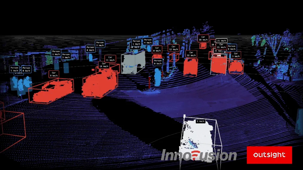
An integration of Outsight's cutting edge software with the best in class sensors from Innovusion (Seyond)

As a frontrunner in high-performance LiDAR systems, crucial for autonomous vehicles and smart transportation, Seyond is integral to Outsight’s ambition to broaden the reach of 3D LiDAR technology.

This partnership aspires to seamlessly blend Outsight’s sophisticated software solutions with Seyond’s extensive product range.

This integration marks a pivotal advancement in deploying sophisticated 3D perception technologies for Intelligent Transportation Systems (ITS) on a grand scale.

Seyond, synonymous with innovation in autonomous driving and mobility safety, brings to the table its exceptional image-grade LiDAR solutions. These top-tier sensors, covering a spectrum from mid to ultra-long ranges, have established Seyond as a leader not just in the automotive realm but also across global smart transportation and industrial automation sectors.

The Role of LiDAR in Intelligent Transportation Systems

Intelligent Transportation Systems (ITS) are crucial for enhancing road safety and efficiency. LiDAR brings these systems to a whole new level.

Read article →
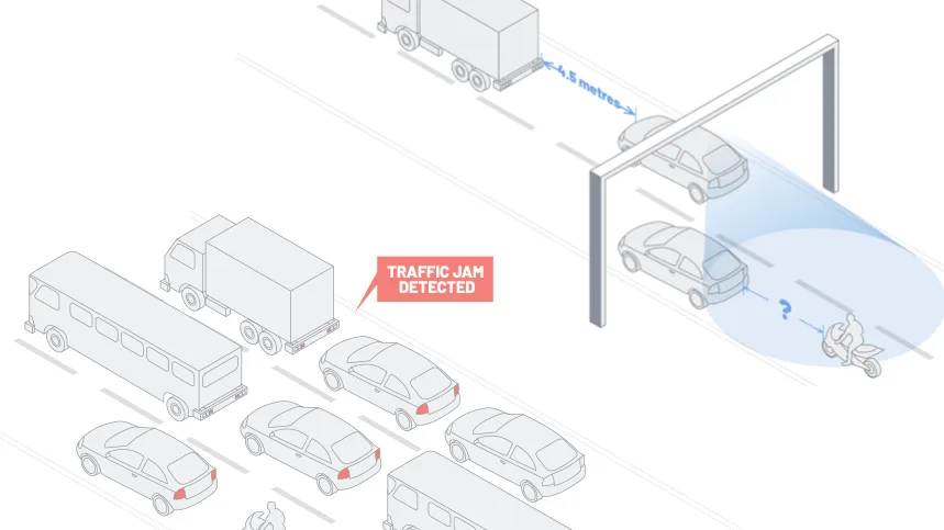
Transforming complex 3D LiDAR data into actionable, real-time insights, Outsight’s software excels in analyzing movements and positions of people, objects, and vehicles anonymously.

Engineered to enhance accessibility and utility of LiDAR technology, Outsight’s software is a game-changer across diverse sectors, fostering improved situational awareness in dynamic environments.

The fusion of Seyond’s cutting-edge LiDAR solutions with Outsight’s powerful software is set to revolutionize 3D perception technologies, elevating design intelligence and modern detection methods in intersections and highways globally.
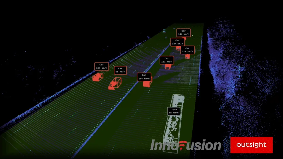
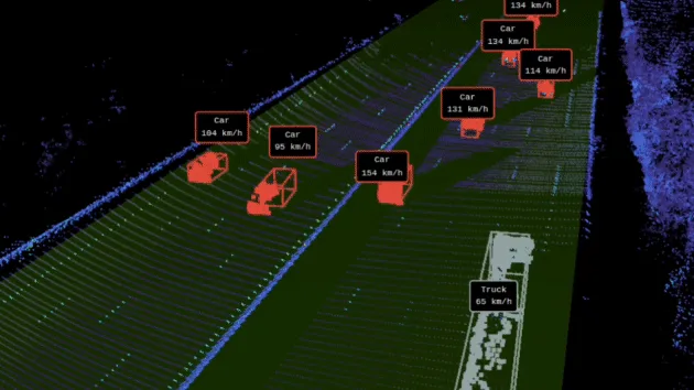
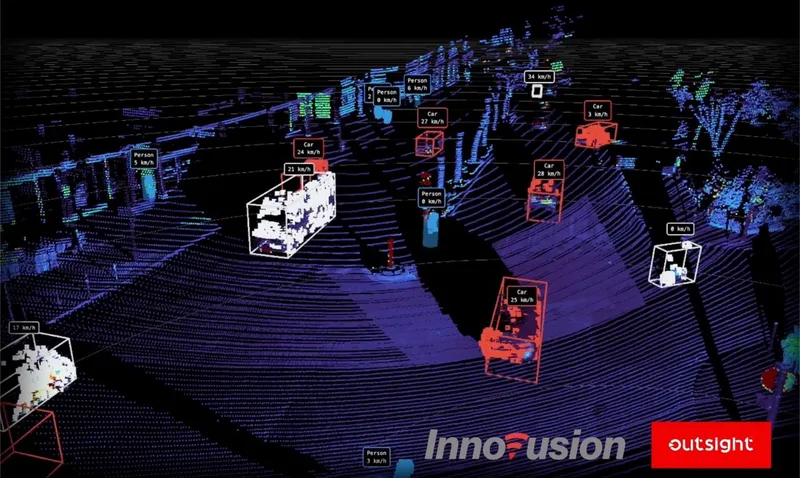
A gif of LiDAR based insights provided by Outsight in collaboration with Innovusion sensors

This unique collaboration brings together Seyond’s hardware prowess and Outsight’s software expertise, creating an ecosystem conducive to innovative ITS solutions.

This partnership is a significant leap toward developing more intelligent, secure, and efficient transportation systems, combining Seyond’s precision in LiDAR technology with Outsight’s prowess in transforming LiDAR data into meaningful insights.

In the joint pursuit of innovation, Seyond and Outsight will work closely to ensure seamless integration of their latest technological advancements.

Raul Bravo, President and Founder of Outsight, expressed excitement about the potential of their collaboration with Seyond, highlighting the promising future of long-range 1550nm LiDAR and its high-resolution data capabilities.
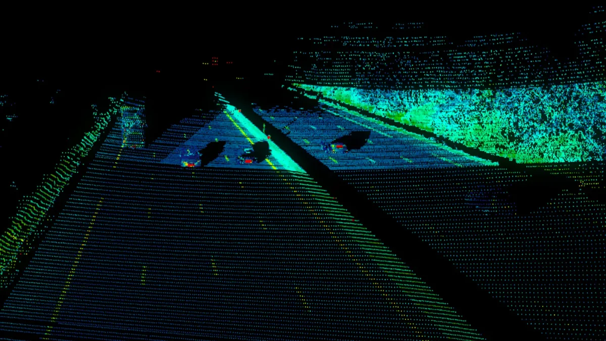
High-resolution data made possible by the integration of Seyond sensors and Outsight's software capabilities

Junwei Bao, CEO and co-founder of Seyond, echoed this sentiment, emphasizing the commitment to advancing innovative perception technologies like LiDAR in the ITS industry. This collaboration is a testament to both companies’ dedication to developing smarter, more efficient global transportation systems.
Related Articles

APPLICATIONS

New Partnership Agreement Between Outsight and Innovusion

The goal of this new partnership is focused on accelerating LiDAR technology in the ITS market.

APPLICATIONS

Innoviz and Outsight announce partnership to accelerate LiDAR's adoption in industries and smart cities

The combination of Outsight and Innoviz's solutions is intended to make 3D LiDAR technology more accessible and faster to use outside of the ADAS market.

Let's connect

Send us a Message

Drop your email and we'll get back to you as soon as possible.

Frequently Asked Questions

  • What is 1550nm LiDAR and why does it matter for highway-speed traffic monitoring?

    1550nm LiDAR uses a longer infrared wavelength than the more common 905nm class. At that wavelength, eye-safety limits allow higher optical power output, which translates directly into longer detection range before the return signal drops below the noise floor. For highway deployments where vehicles must be detected hundreds of meters in advance, this range advantage is meaningful. Outsight's partnership with Seyond, a manufacturer specializing in 1550nm sensors, is aimed at accelerating exactly this kind of ITS application, with the SHIFT platform designed to ingest point-cloud data from multi-vendor hardware including Seyond devices. The tradeoff is that 1550nm sensors are generally more expensive to manufacture, which is why their ITS adoption expanded only as sensor costs fell.

  • What is image-grade LiDAR and how is it different from standard point-cloud LiDAR?

    Image-grade LiDAR produces point clouds dense enough that individual objects, vehicles, pedestrians, and road markings resolve with visual clarity rather than as a sparse cluster of points. That density is achieved by increasing the number of laser channels and scan lines per frame. Standard infrastructure LiDAR typically delivers enough spatial resolution for counting and trajectory tracking; image-grade sensors add object-level detail that aids vehicle classification, lane-level positioning, and incident reconstruction at highways and complex intersections. Outsight, whose SHIFT platform is compatible with Seyond hardware among other multi-vendor LiDAR sources, applies this higher-resolution data within its infrastructure-based perception pipeline to build real-time 3D representations of how vehicles and pedestrians move through a site.

  • How do software and hardware vendors split responsibility in an ITS LiDAR deployment?

    The sensor manufacturer is responsible for the optical and mechanical design: wavelength, range, angular resolution, and weatherproofing. The software vendor takes over from the raw point cloud, handling perception (detecting and classifying objects), tracking (assigning each entity a persistent trajectory across multiple sensors), and analytics (producing KPIs like speed, queue length, near-miss counts, and occupancy). In practice, these responsibilities are cleanly separable, which is why hardware-agnostic software platforms can run on sensors from multiple manufacturers without modification to the analytics layer. Outsight's SHIFT platform illustrates this division directly, maintaining LiDAR-native perception and a sub-50ms processing pipeline while supporting hardware from vendors including Seyond, Hesai, RoboSense, Ouster, and Velodyne across ITS and infrastructure deployments.

  • Can a single LiDAR sensor cover a full highway intersection, or do deployments need multiple units?

    A single long-range LiDAR sensor can cover one approach lane at useful detection distances, but a full intersection typically needs multiple units mounted on gantries or poles at each approach to eliminate occlusion blind zones between large vehicles. Software fuses the individual sensor fields into one shared scene, so a truck that blocks one sensor's view of a cyclist is still tracked by a neighboring sensor. Outsight's infrastructure-based approach, compatible with Seyond hardware among other multi-vendor options, applies exactly this fusion logic through the SHIFT platform, combining per-sensor point clouds into a single real-time scene with sub-50ms end-to-end latency. The exact unit count depends on intersection geometry, lane count, and required detection range.

  • What vehicle classes can LiDAR distinguish in a traffic monitoring deployment?

    3D point-cloud analysis classifies vehicles by bounding-box dimensions, shape profile, and motion characteristics. Typical classes in ITS deployments include passenger cars, vans, trucks and articulated lorries, buses, motorcycles, and cyclists, with pedestrians tracked as a separate entity class. Finer distinctions, such as separating a delivery van from a pickup, depend on sensor resolution and the classification model in use. Outsight's SHIFT platform applies this classification logic in real time across infrastructure-mounted LiDAR sensors, including hardware from Seyond, enabling anonymous vehicle and pedestrian tracking without capturing faces or license plates. LiDAR-based classification also operates in any lighting condition, unlike camera-based systems that degrade at night or in glare.

  • Does a hardware-agnostic LiDAR software platform lose performance when sensors from different vendors are mixed on the same site?

    Not in principle, though integration work is required. Each LiDAR model outputs a point cloud in its own native format and at its own scan rate and angular resolution. A hardware-agnostic platform normalizes those differences at ingestion, so the perception and tracking layers see a unified stream regardless of sensor origin. Outsight's SHIFT platform supports over 210 compatible LiDAR sensor models, including hardware from Hesai, RoboSense, Ouster, Velodyne, and Seyond, and mixed-vendor deployments are common in large sites where one sensor type is optimized for long-range coverage and another for dense near-field detection. The Seyond partnership extends that compatibility further, targeting ITS applications where varied infrastructure conditions often demand exactly this kind of multi-vendor flexibility.