Skip to content
Insights
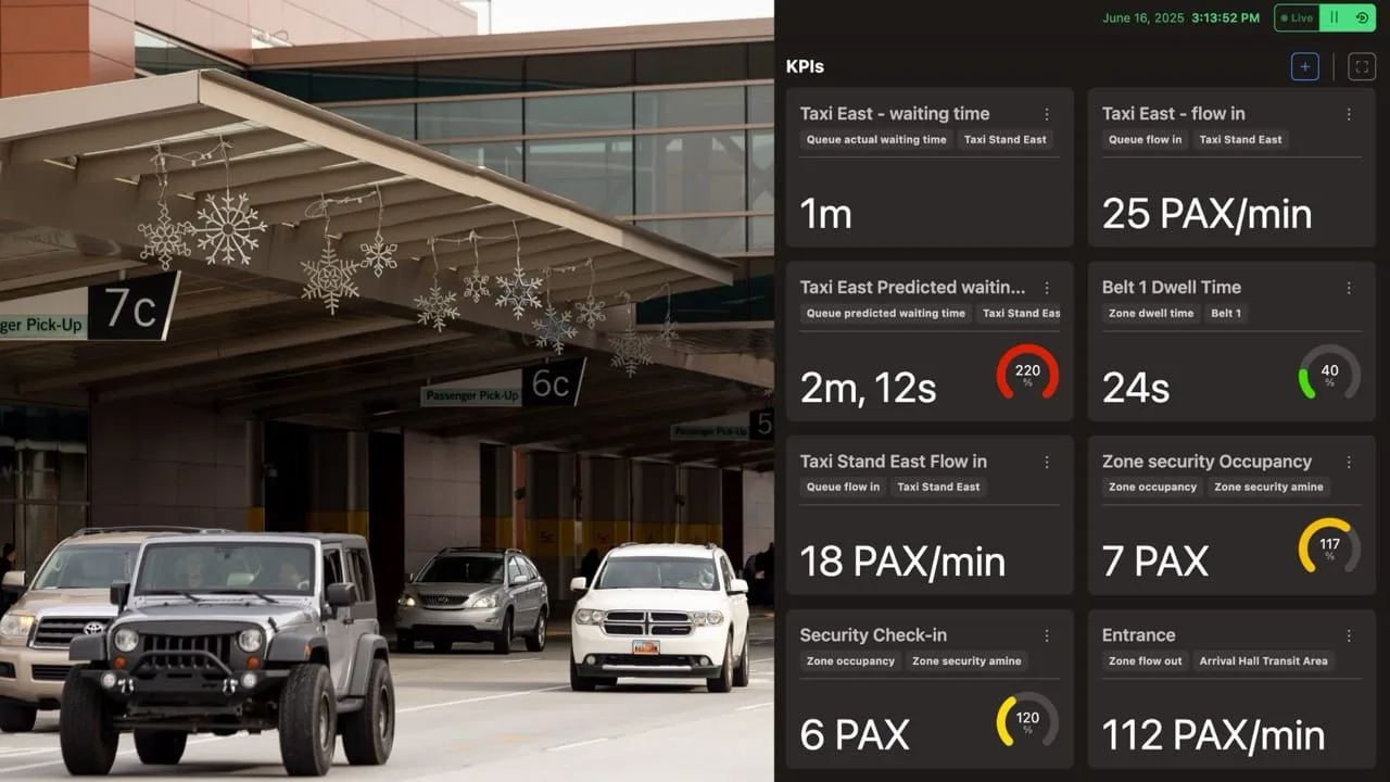
Car traffic at the airport curbside.

Solving the Airport Curbside Congestion Challenge with 3D LiDAR Technology

Curbside congestion challenges airports worldwide. Outsight’s Shift Perception Platform uses 3D LiDAR to deliver real-time, privacy-compliant insights.


Curbside congestion is a growing issue for airport operators around the world. As passenger volumes increase, the curbside becomes a critical pressure point. Limited visibility and unpredictable behavior create safety risks and operational inefficiencies.

The airport curbside is one of the first physical point of interaction between travelers and the airport.

As global air travel continues to rebound and grow, airports are experiencing record volumes of passenger traffic. With global air travel rebounding, airports are handling record levels of passenger traffic.

How LiDAR Enhances Passengers’ Experience at Airports

According to the New York Times, the cumulative wait time in airport queues is 37 billion hours. LiDAR Software can help.

Read article →

According to the Airports Council International (ACI), global passenger traffic is forecast to exceed 12 billion by 2030. As a result, pressure on infrastructure, especially curbside zones, is intensifying.
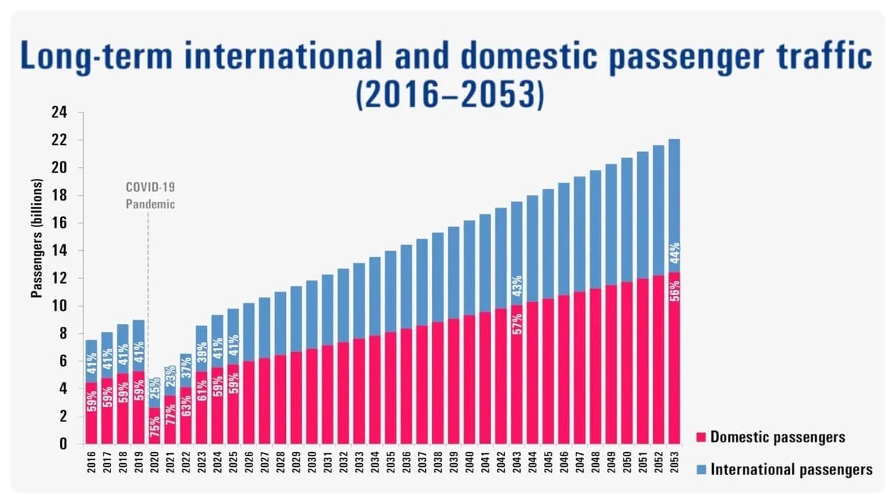
Long term international and domestic passenger traffic- Source: ACI International

Long term international and domestic passenger traffic

Curbside traffic has become a major cause of delays and inefficiencies at many major international airports.

For example, according to Los Angeles World Airports (LAWA), at LAX during peak hours, curbside demand exceeds available capacity by approximately 60% on the upper level and nearly 50% on the lower level. This sustained capacity shortfall frequently disrupts curbside operations, creating ripple effects across the entire passenger journey.

These bottlenecks frustrate travellers, raise emissions, hinder ground operations, and create potential security risks, ultimately undermining the airport’s ability to ensure a seamless flow from arrival to check-in.

Traditional solutions rely on manual supervision and basic sensors like cameras. Some airports implement traffic marshals or redesign curbside zones with physical barriers. Others use time-based vehicle restrictions or enforce drop-off time limits.
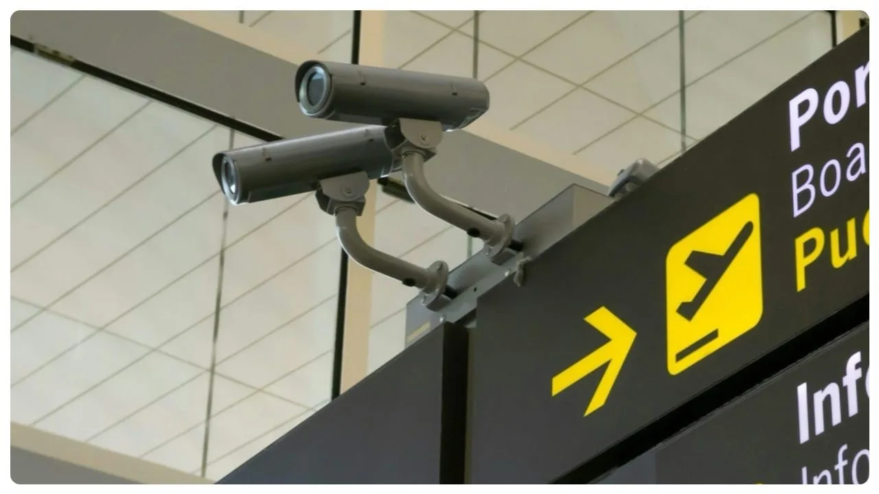
CCTV cameras at an airport.

CCTV cameras at an airport.

While these methods provide temporary relief, they lack scalability, precision, and real-time adaptability.

Most conventional technologies fail to deliver the real-time, detailed, and anonymous data that modern airports need.

LiDAR Tech for Improving Airport Touchpoint Operations

LiDAR-based Spatial Intelligence significantly enhances airport operations, improving passenger flow and reducing wait times at key touchpoints.

Read article →
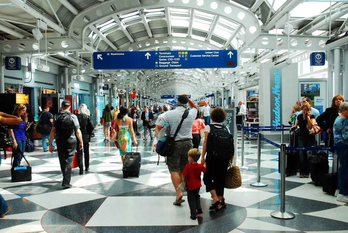
LiDAR (Light Detection and Ranging) is a remote sensing method that uses laser pulses to measure distances and generate highly accurate 3D representations of an environment.

LiDAR technology gives airports a clear, real-time 3D view of what’s happening at the curbside. It works in all lighting and weather conditions, and it doesn’t collect personal information, which makes it safe and ethical to use in public places.
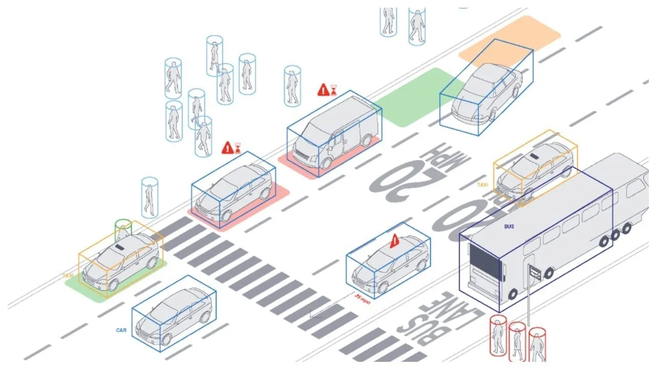
LiDAR technology gives airports 3D view of what’s happening at the curbside.

LiDAR technology gives airports 3D view of what’s happening at the curbside.

Outsight’s Shift Spatial Intelligence Platform is a key component of a complete real-time Physical AI software solution that turns raw 3D LiDAR data into actionable insights through advanced Physical AI.

LiDAR Manages Increased Airport Traffic

See how and why Airports are increasingly using LiDAR-based software solutions to tackle their biggest challenges, leveraging the unique value of Spatial Intelligence.

Read article →

  • Real-time monitoring of both pedestrian and vehicle flows
  • Dwell time measurement to detect parking overstays
  • Congestion alerts before bottlenecks develop
  • Anonymous tracking that respects privacy regulations

Outsight’s software solution turns curbside activity into clear, digital data.

This helps airport staff spot problems early and make smart decisions before disruptions occur. It leads to safer operations, less traffic congestion, and a smoother experience for passengers as soon as they arrive.
Related Articles

AIRPORTS

Passenger Flow, Experience, and Wait Times: Improving the Airport Journey

In today's fast-paced world, airport efficiency and passenger experience are vital. Outsight's Spatial AI software is transforming airport passenger flow and wait time management.

AIRPORTS

Optimizing Airport Operations with LiDAR-Based Passenger Tracking

Rising passenger volumes are pushing airports to operate with greater precision and efficiency. LiDAR-based Spatial Intelligence provides real-time visibility, enhancing flow, safety, and overall passenger experience.

Let's connect

Send us a Message

Drop your email and we'll get back to you as soon as possible.

Frequently Asked Questions

  • Why is airport curbside congestion harder to fix than terminal congestion?

    The curbside is an open, mixed-use zone where pedestrians, private vehicles, taxis, ride-hail cars, and buses compete for space simultaneously. Unlike a terminal corridor or security lane, it has no natural choke point that funnels everyone through a single path, so conventional counting sensors miss entire movement streams. The outdoor environment also complicates camera-based approaches: glare, rain, darkness, and vehicle headlights all degrade image quality in ways that do not affect a LiDAR-based active sensor. Outsight's SHIFT platform addresses this directly by deploying 3D LiDAR in the infrastructure itself, producing a real-time Motional Digital Twin that tracks every pedestrian and vehicle across the full curbside zone, regardless of lighting or weather conditions, without capturing any facial or biometric data.

  • At what point does curbside vehicle dwell time cross from normal into a congestion trigger?

    Dwell-time thresholds vary by airport policy and zone type: short-term drop-off lanes at major hubs typically enforce limits of 1 to 3 minutes, while staged holding areas allow longer waits. The Outsight SHIFT platform assigns a unique anonymous ID to each vehicle the moment it enters a monitored curbside zone and timestamps continuously, so operators receive an alert the instant a configurable threshold is crossed rather than discovering an overstay after it has already created a cascade. Because the system is LiDAR-based, it captures shape and motion without recording faces, license plates, or any biometric data, keeping compliance straightforward for airport operations teams.

  • Can a LiDAR curbside system tell the difference between a private car, a rideshare, and a taxi?

    3D LiDAR classifies vehicles by shape and size: sedan, SUV, van, bus, and two-wheeler are standard output classes. Distinguishing a private car from a rideshare vehicle of the same model requires an additional data source, typically an API feed from the ground-transportation management system that logs permitted operators or a license-plate reader for identity-bound workflows. The LiDAR layer handles position, occupancy, and dwell time; vehicle category beyond shape class needs a fused data input. Outsight's SHIFT platform is designed for exactly this kind of fusion, pairing its anonymous 3D LiDAR pipeline with open integrations so that external operator-identity feeds can be combined with real-time position and dwell data at the curbside, without capturing biometric or plate information in the LiDAR stream itself.

  • Does LiDAR curbside monitoring work on elevated multi-level drop-off structures?

    Yes. Sensors mount on overhead gantries, canopy structures, or ceiling fixtures at each level independently, and the platform fuses all sensor feeds into one shared spatial model. Tracking continuity is maintained across levels when a person or vehicle transitions between them, which is relevant for airports where upper-level departures and lower-level arrivals run as separate but interconnected curbside zones. Outsight's SHIFT platform is designed precisely for this type of multi-zone infrastructure deployment, building a unified Motional Digital Twin across all sensor feeds so that operators see a single, coherent picture of curbside flow regardless of how many vertical levels or structural segments the drop-off area spans.

  • How does a 3D spatial intelligence system help reduce vehicle emissions at the curbside?

    Curbside idling is a direct function of dwell time and circulation inefficiency: vehicles that cannot find a space quickly, or that wait longer than needed, run engines longer. Congestion alerts that redirect incoming ground vehicles to holding areas before they reach the curb reduce the density of idling vehicles in the drop-off zone. Outsight's SHIFT platform applies this logic in practice, using infrastructure-based 3D LiDAR to detect vehicle occupancy and dwell time in real time, enabling operators to trigger holding-area guidance before congestion builds at the curb. Several airports have cited idle-reduction goals as a secondary benefit of such flow management programs, alongside the primary safety and throughput objectives.

  • What is the minimum sensor coverage needed to monitor a typical airport curbside lane?

    Coverage depends on ceiling or mounting height, lane width, and the density of obstructions such as canopy pillars. Because LiDAR's 3D field of view extends far wider than a 2D camera at equivalent height, fewer units are typically required per linear meter of curbside. The optimal configuration is determined through simulation before physical installation. Outsight's SHIFT platform includes a multi-vendor LiDAR simulator that evaluates different sensor models and placements against the specific site geometry, finding the configuration that meets coverage and accuracy targets at the lowest hardware count. This approach has been validated across airport deployments including Dallas Fort Worth, the world's largest 3D LiDAR airport deployment, and Bordeaux Airport, where site-specific geometry varies considerably between curbside zones.

  • How much is global air passenger traffic expected to grow by 2030, and why does that strain airport curbsides?

    According to Airports Council International (ACI), global passenger traffic is forecast to exceed 12 billion by 2030. As air travel rebounds and grows, airports are already handling record levels of passenger traffic. The curbside is one of the first physical points of interaction between travelers and the airport, so every additional passenger adds pressure there. This makes curbside zones a critical pressure point, where limited visibility and unpredictable behavior create safety risks and operational inefficiencies.

  • How far can curbside demand exceed capacity at a busy US airport during peak hours?

    At one of the busiest US airports, figures from the airport's operator show that during peak hours curbside demand exceeds available capacity by approximately 60% on the upper level and nearly 50% on the lower level. This sustained capacity shortfall frequently disrupts curbside operations and creates ripple effects across the entire passenger journey. It illustrates why curbside traffic has become a major cause of delays and inefficiencies at many major international airports.

  • What methods do airports traditionally use to manage curbside congestion, and where do they fall short?

    Traditional approaches rely on manual supervision and basic sensors such as cameras. Some airports deploy traffic marshals or redesign curbside zones with physical barriers, while others use time-based vehicle restrictions or enforce drop-off time limits. These methods provide temporary relief, yet they lack scalability, precision and real-time adaptability. Modern airports need real-time, detailed and anonymous data, which most conventional technologies struggle to deliver.

  • What problems does airport curbside congestion cause besides passenger delays?

    Curbside bottlenecks frustrate travelers, raise emissions, hinder ground operations and create potential security risks. Limited visibility and unpredictable behavior of vehicles and pedestrians also create safety risks. Together, these effects undermine the airport's ability to ensure a seamless flow from arrival to check-in, and because the curbside is where the journey starts, disruptions there ripple through the rest of the passenger experience.

  • What does the Shift Spatial Intelligence Platform do at the airport curbside?

    Outsight's Shift Spatial Intelligence Platform is a key component of a complete real-time software solution that turns raw 3D LiDAR data into actionable insights through advanced Physical AI. At the curbside, Shift Perception enables real-time monitoring of both pedestrian and vehicle flows, dwell time measurement to detect parking overstays, congestion alerts before bottlenecks develop, and anonymous tracking that respects privacy regulations. The software turns curbside activity into clear, digital data that staff can act on.

  • How can airport staff get congestion alerts before a curbside bottleneck forms?

    At the curbside, Outsight's Shift Perception provides real-time monitoring of pedestrian and vehicle flows, dwell time measurement to detect parking overstays and congestion alerts before bottlenecks develop. Because the software turns curbside activity into clear, digital data, airport staff can spot problems early and make smart decisions before disruptions occur. According to Outsight, this leads to safer operations, less traffic congestion and a smoother experience for passengers as soon as they arrive.

  • Is LiDAR curbside monitoring at airports compliant with privacy regulations?

    LiDAR is a remote sensing method that uses laser pulses to measure distances and generate highly accurate 3D representations of an environment. It does not collect personal information, which makes it safe and ethical to use in public places such as airport curbsides. At the curb, Outsight's Shift Perception provides anonymous tracking that respects privacy regulations, alongside real-time monitoring of pedestrian and vehicle flows. Airports therefore get real-time, detailed and anonymous data about curbside activity.

  • Why is the curbside such a critical pressure point for airport operators?

    The curbside is one of the first physical points of interaction between travelers and the airport. As passenger volumes increase, it becomes a critical pressure point where limited visibility and unpredictable behavior create safety risks and operational inefficiencies. Curbside bottlenecks frustrate travelers, raise emissions, hinder ground operations and undermine a seamless flow from arrival to check-in. With global passenger traffic forecast by ACI to exceed 12 billion by 2030, pressure on curbside zones is intensifying.

  • How does LiDAR give airports a real-time 3D view of curbside activity?

    LiDAR (Light Detection and Ranging) is a remote sensing method that uses laser pulses to measure distances and generate highly accurate 3D representations of an environment. At the airport curbside, it gives operators a clear, real-time 3D view of pedestrians and vehicles. It works in all lighting and weather conditions and collects no personal information. Outsight's Physical AI software then turns this 3D data into flows, dwell times and alerts.

  • Why are CCTV cameras alone not enough to manage airport curbside congestion?

    CCTV cameras and manual supervision are the basis of many traditional curbside solutions, and they offer only temporary relief. They lack scalability, precision and real-time adaptability, and most conventional technologies struggle to deliver the real-time, detailed and anonymous data modern airports need. LiDAR-based Spatial Intelligence fills this gap by working in all lighting and weather conditions, tracking people and vehicles anonymously and generating alerts automatically.

  • How can airports reduce congestion at the curbside drop-off area?

    Curbside congestion comes from vehicles overstaying, parking in the wrong zones and peaks of arrivals that exceed capacity. Monitoring every vehicle and pedestrian in real time lets curbside teams see dwell times per vehicle, receive overstay and wrong-zone alerts, track speeds and understand congestion by zone, level and time. Outsight's Spatial Intelligence Platform delivers this with 3D LiDAR, and one of the busiest US airports uses it for the world's largest curbside deployment, covering both departures and arrivals levels.