Skip to content
Insights
GIF of 3D point cloud lidar scan from partnership between Outsight and PreAct technologies

Outsight and PreAct Technologies Partner to Break New Ground in People Flow Monitoring

New affordable high-resolution technology for smart infrastructure applications set to disrupt LiDAR market


Outsight, the leading innovator in 3D Spatial AI Software Solutions, has joined forces with PreAct Technologies, a trailblazer in near-field flash LiDAR technology, to revolutionize the fields of Smart Infrastructure and People Flow Monitoring.

PreAct’s unique approach has reduced LiDAR system costs by up to tenfold compared to existing solutions, without compromising on resolution.

This groundbreaking partnership heralds a new era in the industry, where high-resolution LiDAR technology becomes accessible at unprecedentedly affordable prices.

Understanding How Lidar Works

3D LiDAR is a complex technology that enables unprecedented Spatial Intelligence. Many engineering choices are possible when building a new device.

Read article →

Combined with Outsight’s cutting-edge Spatial AI Software Platform, this powerful technology can now be deployed on a large scale across various industries.

The partnership is a game-changer, particularly for applications requiring detailed spatial analysis and monitoring, such as smart city infrastructure, retail, transportation hubs, and in any other context requiring efficient people flow management in high-density areas.

Image of PreAct's High-Resolution 3D Data capturing lidar

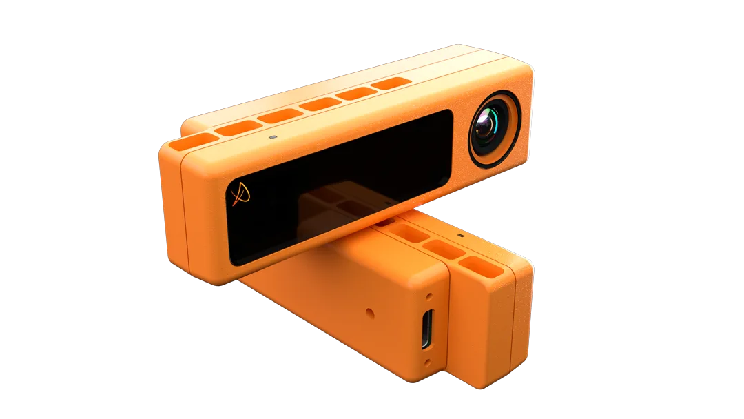
_The PreActs’ Mojave Sensor Revolutionizes High-Resolution 3D Data Collection at One-Tenth the Cost of Traditional LiDARs

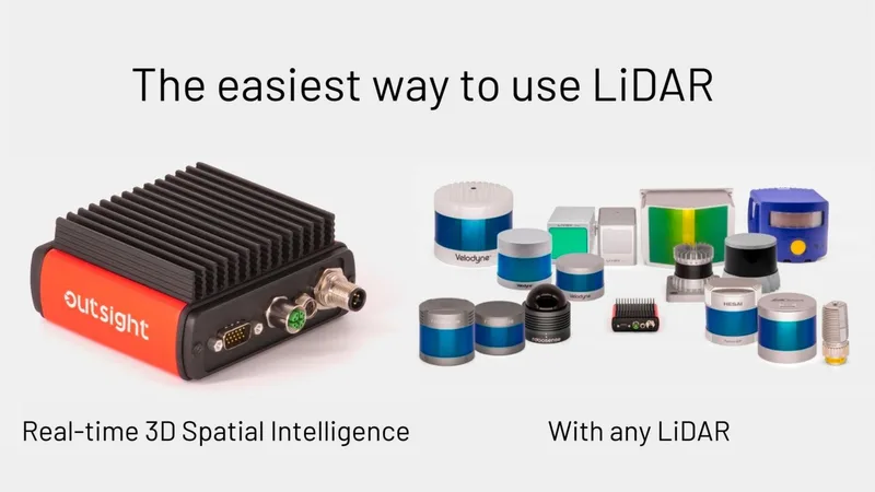
Seamless Integration for Groundbreaking Solutions

Outsight’s expertise in transforming raw 3D LiDAR data into actionable insights complements PreAct’s affordable, high-resolution LiDAR technology.

Together, they provide an integrated solution that enables operators of transportation hubs, retailers, and industrial sites to tap into a new dimension of Spatial Intelligence.

This collaboration ensures the delivery of smarter, safer, and more sustainable environments.

Image of Outsight's lidar software dashboard paired with PreAct's sensors

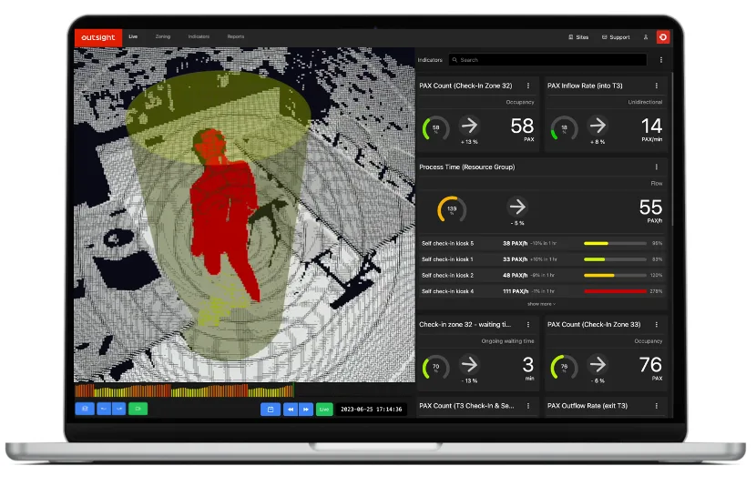
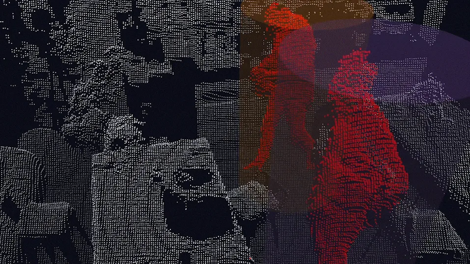
_The output 3D Point-Cloud data from PreAct is processed in real-time thanks to Outsight’s Software and generates a comprehensive set of Spatial Analytics insights

Innovation Showcased at CES 2024

Outsight and PreAct Technologies demonstrated the capabilities of this partnership at the latest CES 2024.

Attendees experienced firsthand the potential of these integrated solutions in the at Outsight’s and PreAct’s booths.

Did you missed the opportunity but want to know more? just contact us.


Related Articles

APPLICATIONS

Innoviz and Outsight announce partnership to accelerate LiDAR's adoption in industries and smart cities

The combination of Outsight and Innoviz's solutions is intended to make 3D LiDAR technology more accessible and faster to use outside of the ADAS market.

TECHNOLOGY

Outsight Introduces the First LiDAR Pre-processing Software Engine

Outsight announced today the launch of a game-changing product: the Augmented LiDAR Box (ALB), the first real-time LiDAR Software Engine.

Let's connect

Send us a Message

Drop your email and we'll get back to you as soon as possible.

Frequently Asked Questions

  • What is flash LiDAR and how does it differ from scanning LiDAR?

    Flash LiDAR illuminates the entire scene simultaneously with a single pulse, the way a camera flash works, rather than sweeping a laser beam point by point across the field of view. This produces a full depth frame in one shot, with no moving parts and a much simpler mechanical design. The tradeoff is that flash LiDAR typically covers shorter ranges and smaller fields of view than spinning or scanning systems, making it well suited to near-field applications like entrance monitoring, checkout lanes, and doorway flow counting rather than wide-area outdoor coverage. Outsight's multi-vendor LiDAR compatibility across the SHIFT platform means both flash and scanning sensor types can feed the same Motional Digital Twin pipeline, allowing operators to mix sensor modalities based on the specific geometry and range requirements of each location.

  • Why has the cost of LiDAR sensors been a barrier to large-scale smart-infrastructure deployments?

    Traditional mechanical spinning LiDAR sensors were originally engineered for automotive prototypes at low volumes, which kept unit costs high. A single sensor that was acceptable on a test vehicle at tens of thousands of dollars is impractical when a busy transport hub or retail chain needs dozens or hundreds of units. Cost-per-sensor directly determines whether a deployment can cover every entrance, checkout lane, or corridor, or whether operators must settle for coarser coverage with blind zones. This economic constraint is precisely why Outsight's partnership with PreAct Technologies targets more affordable high-resolution hardware: the SHIFT platform is designed to scale across large, multi-sensor infrastructure deployments, such as those already running at Dallas Fort Worth Airport and SNCF train stations in France, where blanket coverage is essential to generating a reliable Motional Digital Twin.

  • Can a single spatial analytics software platform ingest point clouds from fundamentally different LiDAR sensor architectures?

    Yes. Processing software that is hardware-agnostic normalizes the raw point-cloud stream regardless of whether the sensor is a spinning multi-beam unit, a solid-state unit, or a flash unit. Differences in scan pattern, beam density, and frame rate are abstracted at the preprocessing layer. The SHIFT platform supports 210+ compatible LiDAR sensor models across these architectures, with verified compatibility spanning hardware from Hesai, RoboSense, Ouster, Velodyne, and Seyond. That multi-vendor normalization layer is the practical reason a partnership with a flash-LiDAR vendor like PreAct Technologies integrates cleanly into an existing deployment rather than requiring a separate software stack for each sensor architecture.

  • What people-flow use cases specifically benefit from high-resolution near-field LiDAR rather than longer-range sensors?

    Near-field, high-resolution sensors are best suited to use cases where precise body-pose detail or close-proximity counting matters more than long range. Retail checkout-lane queue detection, narrow corridor occupancy at transportation security checkpoints, entrance counting in high-density venues, and fall detection in healthcare or assisted-living facilities all benefit from dense point clouds at short distances. Outsight's infrastructure-based approach, used across deployments at airports such as Dallas Fort Worth and Paris-Charles de Gaulle, pairs this kind of granular 3D perception with the SHIFT platform to deliver accurate people-flow analytics without capturing any biometric data. Longer-range sensors remain better suited for wide terminal floors, curbside vehicle tracking, or multi-lane roadway monitoring.

  • How does reducing LiDAR sensor cost affect the total cost of ownership of a people-flow deployment?

    Sensor cost is one component of total cost of ownership alongside cabling, edge compute, installation labor, and software licensing. When sensor unit cost drops significantly, two things shift: first, operators can afford denser coverage, reducing or eliminating blind zones that previously required workaround logic in software. Second, the relative weight of software, support, and integration in the overall budget increases, which tends to raise the bar on software quality and vendor support rather than lowering total spend. Outsight's SHIFT platform is designed with this balance in mind, supporting multi-vendor LiDAR hardware so that operators can take advantage of lower-cost sensors without being locked into a single hardware supplier, keeping the full deployment economics flexible as the sensor market evolves.

  • Is CES a meaningful venue for industrial and smart-infrastructure technology, or is it mainly consumer electronics?

    CES has expanded well beyond consumer electronics. The Smart Cities and Vehicle Tech tracks now regularly feature B2B infrastructure, mobility, and industrial automation exhibitors, drawing transportation authorities, real-estate operators, and systems integrators alongside press. For spatial sensing companies, it serves as a credible demonstration venue for technology aimed at airports, transit hubs, and urban intersections. Outsight received the CES Best of Innovation award in the Smart Cities category, which reflects how the show's evaluation criteria extend to infrastructure-grade technology. That recognition, tied to Outsight's work on the Motional Digital Twin and SHIFT platform for people-flow monitoring, confirms that CES juries assess real operational impact, not consumer appeal alone.