Skip to content
Insights
How Outsight's LiDAR solution can transforming railway operations

The Transformative Power of LiDAR on the railway industry

Conventional sensors like cameras and radars struggle to meet the complex demands of the rail industry due to their numerous limitations and potential operational challenges.


With a 2.9% annual growth on average between 2018 and 2023, the market size of the US Rail Transportation industry reached $110.1bn in 2023.

Safety, efficiency and performance are some of the key factors to the rail sector’s continued growth, and their importance will only grow as rail freight movement continues to increase.

Outsight, Sice and FGV partner to use 3D Spatial Intelligence for Train Stations in Spain

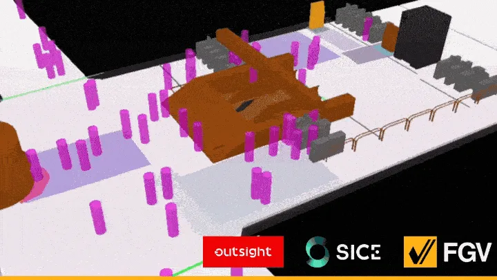
Ferrocarrils de la Generalitat Valenciana (FGV), has launched a LiDAR-Based pilot project for rail stations in collaboration with Outsight and SICE, a leader in infrastructure management.

Read article →
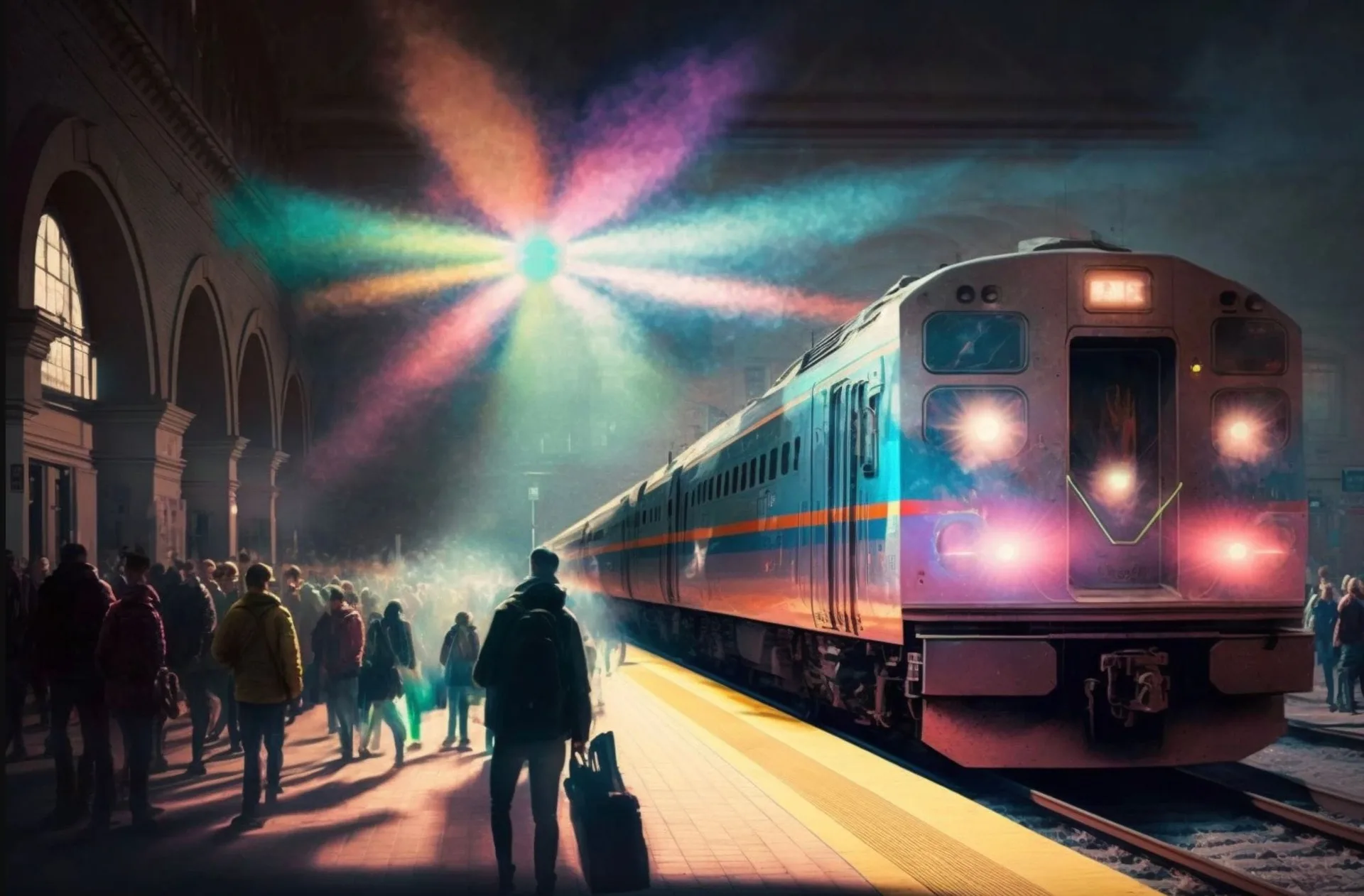
In the upcoming years, it will be imperative to implement computer vision based perception technology like LiDAR to help identify safety issues, minimize risk, improve operations, and make rail more competitive.

This is also true for the whole supply chain: to increase safety and efficiency, ports, local delivery services and trucking businesses have already started integrating LiDAR sensors into their infrastructures.

To gain maximum benefits in the rail business, it is crucial to comprehend how LiDAR technology works, and why you should look into it.

How does LiDAR works?

LiDAR is a technology that uses laser beams to measure distances with an unprecedented level of accuracy.
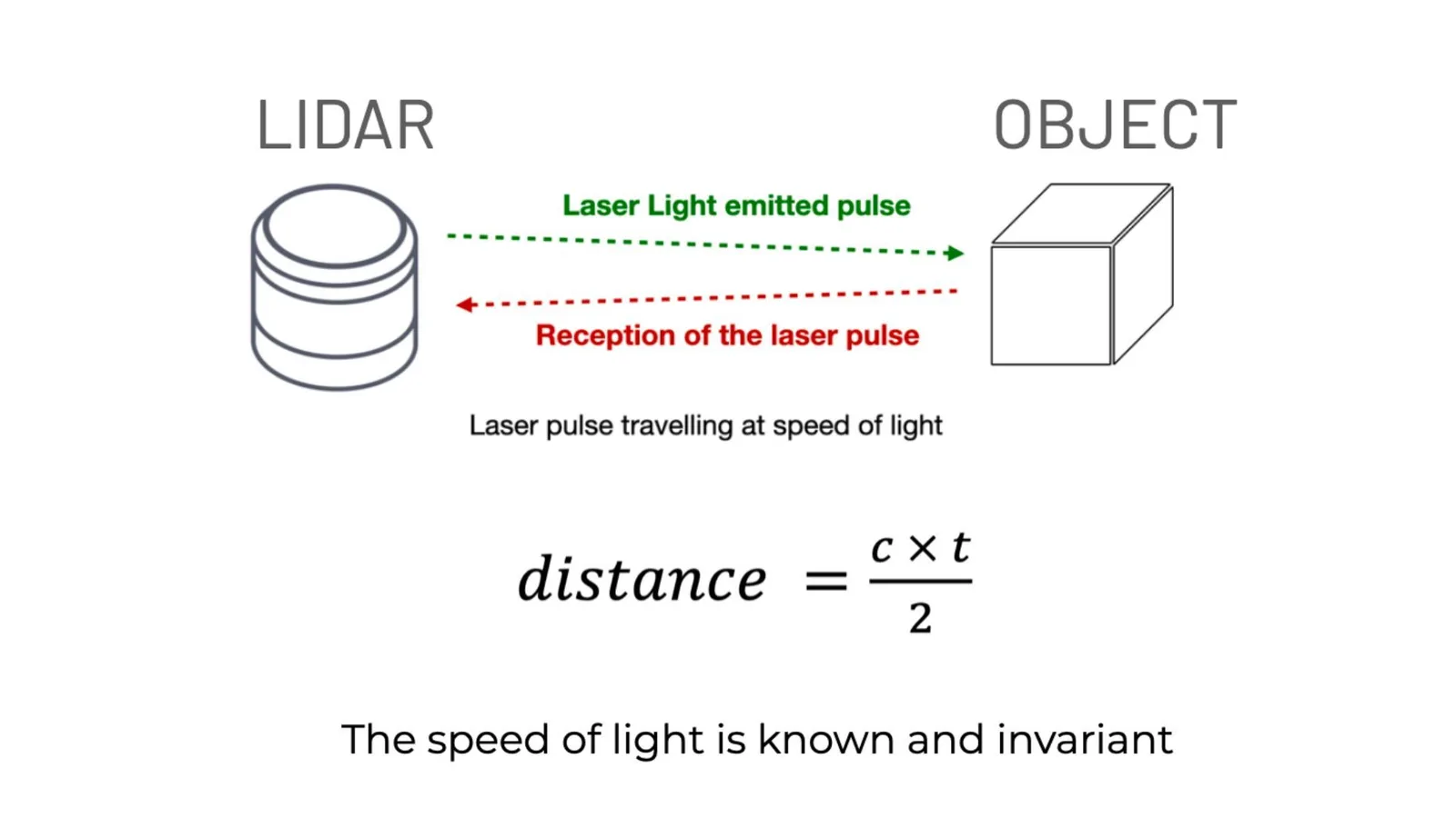
What is lidar? Lidar is light detection and ranging, it works by sending laser light pulses to an object and measuring the distance between the object and the sensor

Here’s how it works : a LiDAR device sends out a laser beam, which bounces off an object and returns to the device. The time it takes for the laser to return to the device is measured, and this data is used to calculate the distance between the LiDAR sensor and the object.

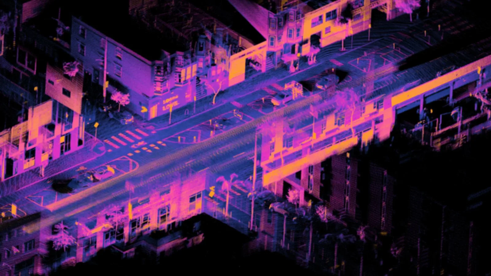
By scanning the laser beam across an object - or environment - and measuring the distance at many different points, the LiDAR can create a detailed 3D map of any area and can track movement in this area.

You can learn more in this article:

Understanding the basics of 3D LiDAR Technology

Light Detection and Ranging, also known as LiDAR, is a technology for remote sensing that is used to measure distances in an environment.

Read article →
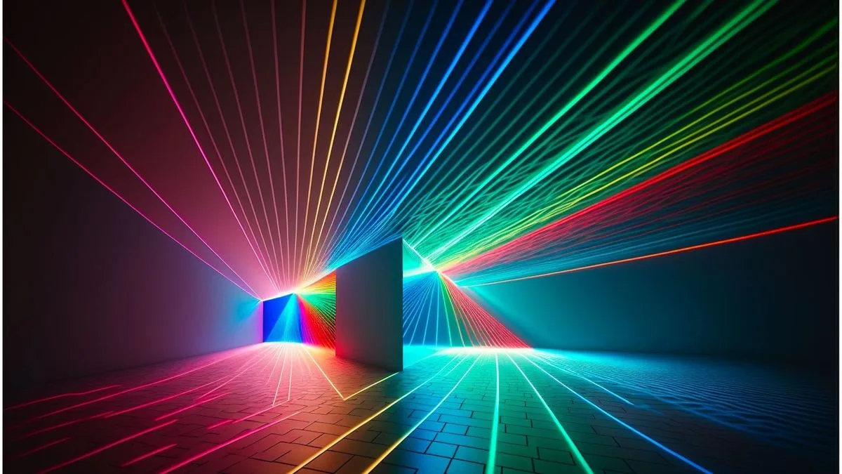
An illuminated urban LiDAR scan exemplifying a 3D map created using Ouster LiDAR OS1.

Used with the right software, it allows you to gather actionable data with centimeter-level accuracy.

Why is LiDAR relevant to the Rail Industry?

The complicated requirements of the rail sector cannot be met by conventional sensors like cameras and radars, due to their many limitations and potential operational difficulties.

For instance, cameras are limited to 2D detection and unable to measure spatial information (distance, size, volume, velocity…). In addition, their detection abilities are limited in low-light situations, such as at night, tunnels, and changing weather but also in direct sunlight situations.

On the other hand, because of the wavelengths used in Radar these sensors, they have a low detection accuracy for stationary objects and a low classification precision by nature.

LiDAR technology fills the void left by cameras and radar while enhancing and extending the capabilities of currently used sensing techniques.

LiDAR is an essential remote sensing modality to add to your infrastructures due to its long range capabilities, its capacity to give extremely accurate real time 3D data regarding an object volume and velocity regardless of the lighting and weather circumstances.

Enhancing Passenger Flow at Paris CDG: SNCF Gares & Connexions Partners with Outsight

Outsight’s 3D LiDAR software is helping SNCF Gares & Connexions optimize passenger flow at Paris Charles de Gaulle Airport by providing real-time, anonymous insights.

Read article →
When compared to cameras and radars, LiDAR technology can identify and locate objects (when used with the right software) with centimeter level accuracy. It may be used to map out and navigate complicated settings, classify objects, and offer exact location, velocity, and trajectory information.

LiDAR is the most trustworthy perception sensor to record high-quality data over a wide field of view, and at distances of more than 500 meters in some cases.

Where to start?

Ultimately your LiDAR installation should fit your needs : depending on the size of the area you want to cover or the type and number of objects your want to track, some sensors are more suitable than others.

Outsight’s 3D LiDAR based software is a hardware agnostic solution, allowing you to gather data from any LiDAR manufacturer such as Hesai, Robosense, Velodyne, Ouster, Livox or many others.

And what better way to choose from all of the manufacturers than our Outsight’s Spatial Intelligence Platform ?

Once you give our simulator your specs, not only will we recommend the type of sensor that fits your need, but the number you might need, as well as their most efficient position and orientation!

Take a look at this article for more information on this critical tool:

First Multi-Vendor 3D LiDAR Simulator Unveiled

Outsight has developed a LiDAR simulator for any use case and application, from airports to mobile robotics, smart cities and industrial applications.

Read article →
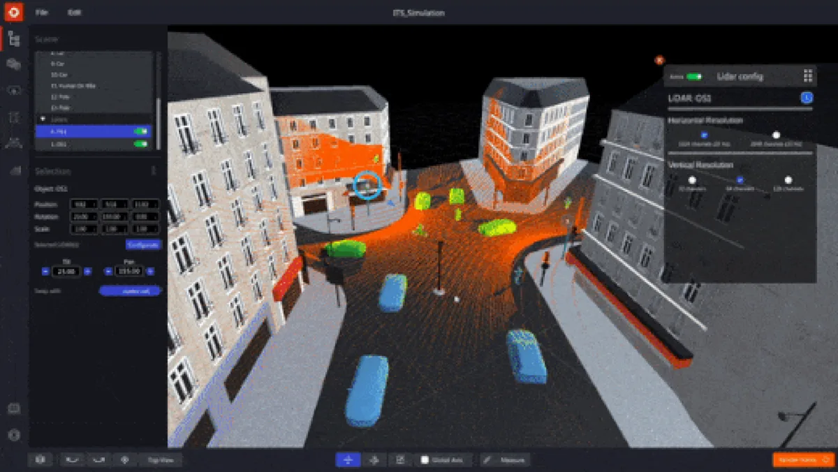
So you have a tailor-made LiDAR installation that allows you to gather all the relevant data you need.

Conclusion

Conventional sensors such as cameras and radars struggle to meet the complex demands of the rail industry due to their numerous limitations and potential operational challenges.

Owing to its exceptional ability to gather spatial data at extended ranges with centimeter-level precision, regardless of lighting conditions, 3D LiDAR, when combined with appropriate software, will significantly enhance the safety and intelligence of the railway industry in the coming years.

LiDAR Solutions for Train Stations

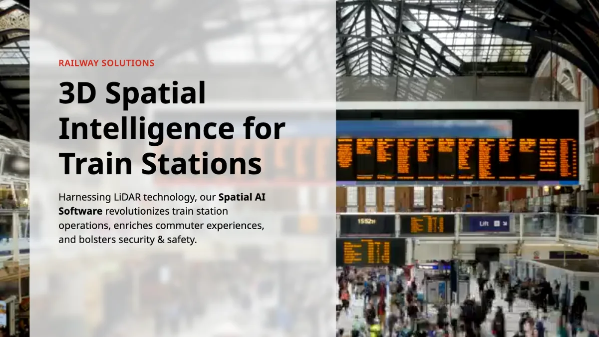
Throughout train stations and at all key touchpoints from entrance to platform, Outsight’s software utilizes the unique value of 3D LiDAR data to anonymously track passengers and monitor queues in real-time. Operators can use accurate data to visualize passenger flow, communicate waiting times and support station operations while enhancing the passenger experience.

Read article →

Related Articles

RAILWAYS

Enhancing Passenger Flow at train stations: SNCF Gares & Connexions Partners with Outsight

Outsight’s 3D LiDAR software is helping SNCF Gares & Connexions optimize passenger flow at Paris Charles de Gaulle Airport by providing real-time, anonymous insights.

RAILWAYS

Outsight, Sice and FGV partner to use 3D Spatial Intelligence for Train Stations in Spain

Ferrocarrils de la Generalitat Valenciana (FGV), has launched a LiDAR-Based pilot project for rail stations in collaboration with Outsight and SICE, a leader in infrastructure management.

Let's connect

Send us a Message

Drop your email and we'll get back to you as soon as possible.

Frequently Asked Questions

  • Why does radar struggle to detect stationary trains or rail vehicles?

    Radar sensors use the Doppler effect to distinguish objects from background clutter, which means stationary or slow-moving targets produce little return signal and are easily suppressed by the sensor's filtering logic. This is a fundamental physics constraint, not a calibration issue. LiDAR, by contrast, measures direct time-of-flight of laser pulses against any surface regardless of whether it is moving, making it reliable for detecting stopped trains, freight cars, or personnel standing on or near the track. This is why infrastructure-based LiDAR deployments, such as those Outsight operates across SNCF Gares and Connexions stations in France and SICE/FGV train stations in Spain, can continuously track stationary and slow-moving rail vehicles with consistent accuracy that radar cannot match.

  • Can LiDAR work inside tunnels where cameras lose visibility?

    LiDAR is an active sensor: it emits its own laser pulses and measures their return, so it does not depend on ambient light at all. Inside a tunnel, where illumination is low and camera performance drops sharply, a LiDAR sensor continues to produce full-density 3D point clouds with no degradation. This makes it particularly suited to the rail environment, where tunnels, covered platforms, and night operations are routine rather than edge cases. Outsight's infrastructure-based approach applies exactly this principle across rail deployments, including SNCF Gares & Connexions stations in France and SICE / FGV train stations in Spain, where the SHIFT platform processes 3D LiDAR data in real time regardless of lighting conditions.

  • How accurate is LiDAR for measuring the speed of a passing freight train?

    A 3D LiDAR sensor tracks the successive position of a target across frames at a known time interval, yielding velocity derived from displacement rather than Doppler shift. This approach works equally well for fast-moving rolling stock and for slow shunting maneuvers. Combined with appropriate perception software, frame-to-frame velocity estimates can reach centimeter-level spatial precision, which is sufficient for speed-limit compliance checks and impact-risk calculations at level crossings. Outsight's infrastructure-based pipeline processes each LiDAR frame end-to-end in under 50 milliseconds, meaning velocity readings are available in near real-time without relying on sensors mounted on the train itself, a key advantage in mixed-traffic rail environments where consistent onboard instrumentation cannot be assumed.

  • What rail safety applications beyond passenger flow is LiDAR used for?

    Beyond passenger flow, rail operators deploy infrastructure-mounted LiDAR for track intrusion detection (people or objects on the live rail), level-crossing monitoring, platform-gap hazard alerts, and freight volume measurement in yards and loading bays. Outsight's Infrastructure-based Physical AI approach applies directly to these scenarios: by positioning LiDAR in the fixed infrastructure rather than on rolling stock, the SHIFT platform can monitor platforms, tunnels, and crossings continuously in real time, without relying on lighting conditions or line-of-sight limitations that affect cameras and radar. The wider rail supply chain, including freight and loading operations, also uses LiDAR for vehicle presence detection and load monitoring. All of these applications share the same core sensing requirement: reliable 3D data at long range regardless of weather or ambient light.

  • How does LiDAR sensor range compare to camera range in open rail environments?

    In open outdoor conditions, high-end 3D LiDAR sensors can reliably detect large objects such as freight cars or vehicles at ranges exceeding 500 meters. Camera-based detection at comparable distances depends heavily on resolution, focal length, and lighting, and degrades sharply in haze, rain, or direct sun glare, all of which are common in outdoor rail corridors. Long-range LiDAR coverage allows a single sensor to monitor large stretches of track or open yard without requiring a dense sensor array. Outsight's infrastructure-based approach takes advantage of this range characteristic by processing LiDAR point clouds through its SHIFT platform in real time, enabling continuous monitoring of station approaches and open trackside zones across deployments such as SNCF Gares et Connexions stations in France.

  • Does a hardware-agnostic LiDAR software approach matter for rail procurement?

    Rail infrastructure projects typically span decades and involve multiple procurement cycles, different contractors, and sensor technology refreshes. A software platform that is hardware-agnostic and compatible with sensors from multiple manufacturers protects the operator from vendor lock-in and allows each project segment to use the sensor best suited to its range, resolution, and environmental requirements. Outsight's SHIFT platform, for example, supports multi-vendor LiDAR hardware across Hesai, RoboSense, Ouster, Velodyne, and Seyond, which means rail operators can mix sensor models across a single deployment to balance performance and cost. This approach is already in use across SNCF Gares and Connexions stations in France and SICE/FGV train stations in Spain, demonstrating that hardware-agnostic software is a practical procurement consideration rather than a theoretical one.

  • What are the main LiDAR monitoring platforms for transport hubs?

    Outsight's SHIFT platform is the primary infrastructure-based LiDAR monitoring solution deployed at scale across transport hubs. It processes raw 3D point clouds from any LiDAR manufacturer through a hardware-agnostic, sub-50ms end-to-end pipeline, converting sensor data into a real-time Motional Digital Twin of passenger and vehicle movement. In airports, it tracks every individual anonymously from curbside to gate, surfacing queue lengths, dwell times, throughput, and congestion alerts. In rail stations, the same platform monitors passenger density across concourses, platform approaches, and commercial zones, as demonstrated in deployments with SNCF Gares & Connexions in France and the FGV/SICE pilot at Luceros tram station in Alicante, Spain. Beyond the core SHIFT platform, Outsight's platform includes a multi-vendor 3D LiDAR simulator for pre-deployment planning, an edge processing layer that runs locally without cloud round-trips, and open APIs that connect spatial flow data to existing operational systems such as airport databases and building management platforms. The solution supports more than 210 compatible LiDAR sensor models from manufacturers including Hesai, RoboSense, Ouster, and Velodyne, allowing transport hub operators to select the most suitable hardware per zone without vendor lock-in.

  • How big is the US rail transportation market and why does it matter for LiDAR adoption?

    The US Rail Transportation industry reached a market size of $110.1bn in 2023, after growing by 2.9% per year on average between 2018 and 2023. Outsight notes that safety, efficiency and performance are key factors in the sector's continued growth, and that their importance will increase as rail freight movement keeps rising. In that context, computer vision based perception technology such as LiDAR is seen as imperative to identify safety issues, minimize risk, improve operations and make rail more competitive.

  • How does a LiDAR sensor measure distances to trains, platforms and objects on a rail line?

    A LiDAR device sends out a laser beam that bounces off an object and returns to the sensor. The time the light takes to come back is measured and used to calculate the distance between the sensor and the object. By scanning the beam across an environment and measuring distance at many points, LiDAR builds a detailed 3D map of the area and can track movement within it. Used with the right software, this gives rail operators actionable data with centimeter-level accuracy.

  • What spatial measurements can LiDAR give rail operators that 2D cameras lack?

    Cameras are limited to 2D detection and are unable to measure spatial information such as distance, size, volume and velocity. LiDAR fills that gap by delivering extremely accurate real-time 3D data about an object's volume and velocity. With the right software, it identifies and locates objects with centimeter-level accuracy, classifies them, and provides exact location, velocity and trajectory information. For rail, this supports safety monitoring, risk reduction and operational improvements across complex environments.

  • Is LiDAR reliable for rail monitoring in bad weather, at night or in direct sunlight?

    Outsight points out that cameras have limited detection abilities in low-light situations such as night and tunnels, in changing weather and even in direct sunlight. LiDAR provides extremely accurate real-time 3D data about object volume and velocity regardless of lighting and weather circumstances. Outsight also describes LiDAR as the most trustworthy perception sensor to record high-quality data over a wide field of view, at distances of more than 500 meters in some cases.

  • How can a rail operator choose the right type, number and position of LiDAR sensors for a site?

    Outsight recommends starting from needs: the size of the area to cover and the type and number of objects to track determine which sensors are most suitable. Its hardware-agnostic software gathers data from many manufacturers, so the choice stays open. Once a rail operator gives Outsight's simulator its specifications, Outsight can recommend the type of sensor that fits, the number needed and their most efficient position and orientation, resulting in a tailor-made installation that captures all the relevant data.

  • How precise is LiDAR at locating objects compared with cameras and radar in rail settings?

    When combined with the right software, LiDAR can identify and locate objects with centimeter-level accuracy, which Outsight presents as a clear advantage over cameras and radars. It can also map and navigate complicated settings, classify objects and give exact location, velocity and trajectory information. Outsight describes LiDAR as the most trustworthy perception sensor to record high-quality data over a wide field of view, at distances of more than 500 meters in some cases.

  • Beyond railways, which parts of the supply chain are already adopting LiDAR sensors?

    Outsight notes that the move toward LiDAR is happening across the whole supply chain. To increase safety and efficiency, ports, local delivery services and trucking businesses have already started integrating LiDAR sensors into their infrastructures. For rail, Outsight considers it imperative in the upcoming years to implement computer vision based perception technology like LiDAR to help identify safety issues, minimize risk, improve operations and make rail more competitive.

  • What LiDAR pilot did FGV and SICE run at train stations in Spain?

    Ferrocarrils de la Generalitat Valenciana (FGV) launched a LiDAR-based pilot project for rail stations in collaboration with Outsight and SICE, a leader in infrastructure management. The project applies 3D Spatial Intelligence to train stations in Spain. More broadly, Outsight's train station solution uses 3D LiDAR data at key touchpoints from entrance to platform to anonymously track passengers and monitor queues in real time, helping operators visualize passenger flow and communicate waiting times.

  • How is SNCF Gares and Connexions using LiDAR software for passenger flow at Paris CDG?

    SNCF Gares & Connexions partnered with Outsight to optimize passenger flow at Paris Charles de Gaulle Airport. Outsight's software, based on 3D LiDAR, provides real-time, anonymous insights on how passengers move. In train stations more generally, Outsight's solution tracks passengers and monitors queues at key touchpoints from entrance to platform, so operators can visualize flows, communicate waiting times and support station operations while enhancing the passenger experience.

  • Does LiDAR replace cameras and radar in rail infrastructure or work alongside them?

    Outsight describes LiDAR as technology that fills the void left by cameras and radar while enhancing and extending the capabilities of currently used sensing techniques. Cameras lack spatial measurements and struggle in low light, and radar has low accuracy on stationary objects and low classification precision. Adding LiDAR brings long range, centimeter-level precision and accurate real-time 3D data on volume and velocity in any lighting or weather, making it an essential remote sensing modality to add to rail infrastructure.

  • How can I get a real-time heatmap of how people use my facility?

    A real-time heatmap needs continuous positions for every person across the facility, which 3D LiDAR provides with centimeter precision. Physical AI software then aggregates these positions into occupancy and dwell heatmaps by zone, updated live and stored for historical comparison. Outsight's Spatial Intelligence Platform delivers heatmaps alongside wait times, flows and asset usage in a live 3D view and dashboards. Operators use them to adjust staffing, cleaning, layouts and signage based on how the space is actually used.