Skip to content
Insights
Partnership between Outsight and Velodyne.

Outsight and Velodyne LiDAR strengthen their collaboration

Outsight and Velodyne Lidar, Inc. announced they have strengthened their collaboration by developing technologies key to infrastructure operators.


PARIS, FRANCE–(EINPresswire.com)–Outsight, specialist in 3D Spatial Intelligence, and Velodyne Lidar, Inc. (Nasdaq: VLDR, VLDRW), provider of intelligent LiDAR solutions, today announced they have strengthened their collaboration by developing technologies key for smart cities, transport hubs and public safety.

This initiative builds on the companies’ partnership, announced in June 2020, to improve the analysis and management of people flow and assets in large crowded environments.

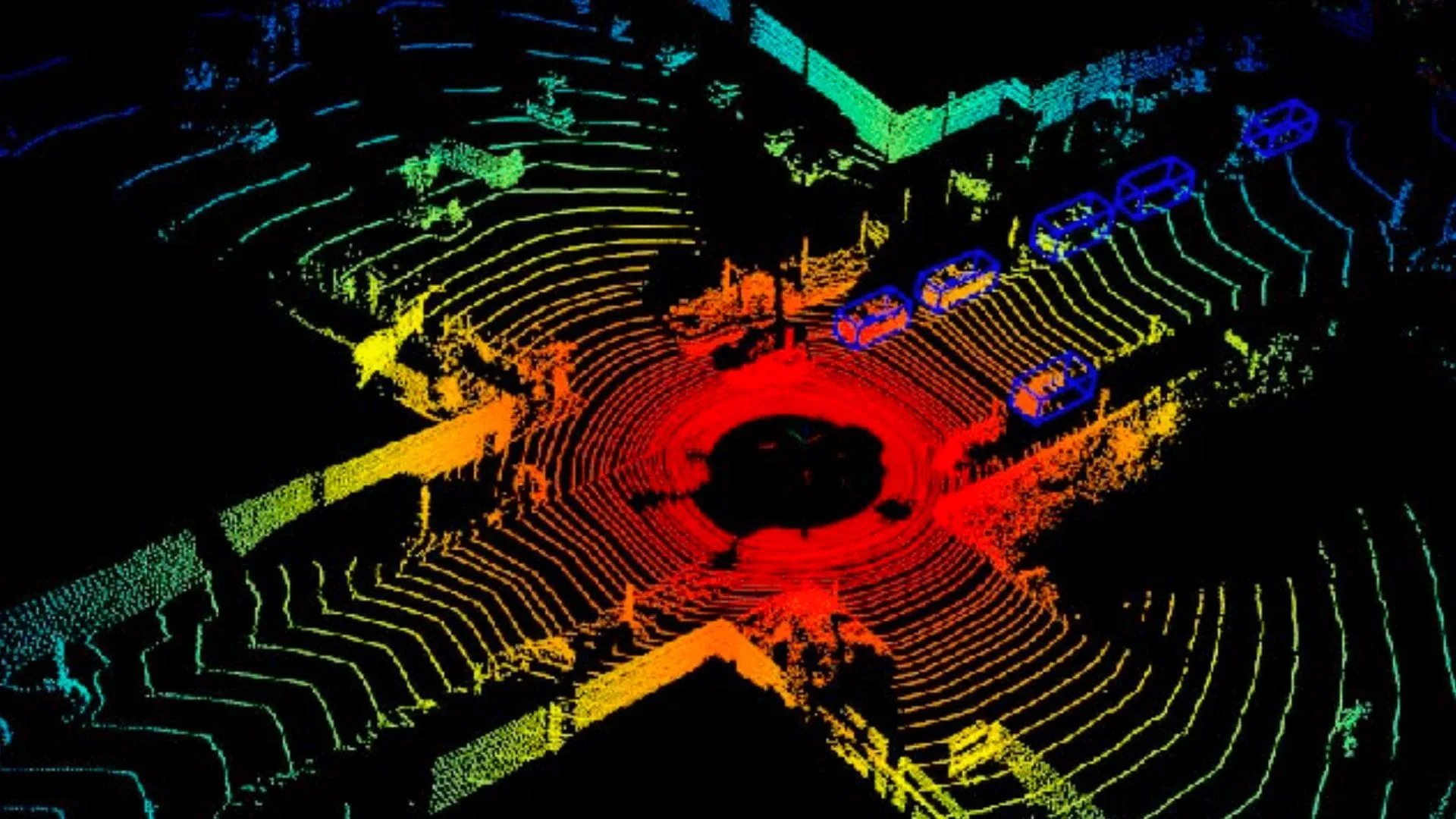
In just a few months, Outsight has grown rapidly by integrating new features into its Velodyne lidar-based processing solutions that enable systems to perceive, understand and interact with their surroundings in real time.

To facilitate user adoption of these solutions, Outsight and Velodyne have strengthened their collaboration. With a new generation of LiDAR data processing software, connected to Velodyne’s sensors, Outsight offers a unique level of simplicity, cost, efficiency and versatility.

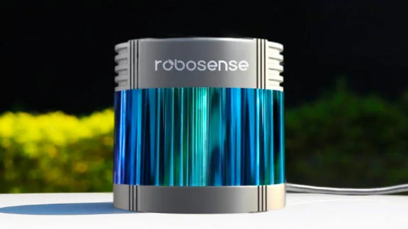
Outsight has developed its drivers and interfaces with Velodyne’s LiDAR sensors for their combination of high-resolution 3D Perception, long range and broad vertical field of view. Outsight is using Velodyne’s surround-view portfolio, including Alpha Prime™, Ultra Puck™, Puck™ and HDL-32E, which allow machines to operate autonomously and safely in diverse environments, without human intervention.

Outsight’s 3D Spatial Intelligence technology with Velodyne LiDAR sensors can be used in several fields including logistics, transport hubs, public safety and more.

The strengthened partnership between the companies follows the successful deployment of Outsight’s technology at Paris Charles de Gaulle airport of the ADP group to provide accurate real-time monitoring of people flow while preserving private data.

According to Raul Bravo, President and co-founder of Outsight, “Our partnership with Velodyne has enabled us to step up and expand our application of lidar technology. The combination of Velodyne’s LiDAR technology with our unique point-cloud data processing software engine makes building applications for 3D lidar easier than ever. Our common customers, integrators and solution providers, can then accelerate time to market while decreasing product development costs.”


Related Articles

AIRPORTS

Aeroporti di Roma to deploy Outsight's Physical AI solution at scale across Rome Fiumicino Airport

Aeroporti di Roma (ADR) is expanding its collaboration with Outsight to a large-scale deployment across almost all Schengen common-use areas at Rome Fiumicino Airport.

CORPORATE

Intel and Outsight Announce Strategic Collaboration to Bring Physical AI–Powered Spatial Intelligence to the Enterprise Edge

Outsight’s Shift platform integrated into Google Distributed Cloud Edge powered by Intel Xeon 6 SoC – Live demonstration at Google Cloud Next 2026

Let's connect

Send us a Message

Drop your email and we'll get back to you as soon as possible.

Frequently Asked Questions

  • What is the difference between a LiDAR hardware vendor and a LiDAR software processing vendor?

    A LiDAR hardware vendor designs and manufactures the physical sensor: the laser emitter, receiver optics, and spinning or solid-state mechanism that generates raw 3D point clouds. A LiDAR software processing vendor builds the algorithms that consume those raw point clouds and turn them into tracked entities, behavioral classifications, and operational analytics. The two roles are complementary: the sensor captures geometry, and the processing layer extracts meaning from it. Outsight sits firmly in the software processing layer, offering multi-vendor LiDAR compatibility across hardware from Velodyne, Hesai, RoboSense, Ouster, and others through its SHIFT platform. Most infrastructure deployments require both layers, sourced separately and integrated at the site level.

  • How does sensor-agnostic LiDAR software reduce time to market for solution integrators?

    When a software processing layer ships pre-built drivers and tested interfaces for a given sensor portfolio, integrators skip the low-level calibration and packet-parsing work that would otherwise consume months of engineering effort. They begin directly at the application layer, configuring zones, thresholds, and analytics outputs. The SHIFT platform from Outsight follows this model, offering native compatibility across multiple LiDAR vendors including Velodyne, Hesai, RoboSense, Ouster, and others, so integrators can swap hardware for cost or availability reasons without rewriting perception code. That hardware flexibility shortens project cycles, lowers development risk, and allows solution providers to deploy across diverse customer environments without maintaining separate software branches for each sensor brand.

  • What LiDAR sensor specifications matter most for people-flow tracking in busy transport hubs?

    Three specifications dominate for people-flow tracking in busy transport hubs: vertical field of view, range, and point density. A wide vertical field of view lets a ceiling-mounted or pole-mounted sensor cover tall spaces and resolve people close to the floor without dead zones. Sufficient range allows fewer sensors to cover large concourse areas. High point density resolves individuals in dense crowds where people occlude each other. Surround-view sensors, which spin 360 degrees, are favored in open terminal environments because a single unit covers all directions without blind sectors. Outsight's infrastructure-based deployments, including the world's largest 3D LiDAR airport installation at Dallas Fort Worth, draw on these same criteria when selecting hardware across its multi-vendor compatible SHIFT platform, which supports sensors from Velodyne alongside other manufacturers.

  • Why do smart-city and transport-hub LiDAR deployments require real-time processing rather than batch processing?

    Operational decisions in transport hubs and smart cities are time-sensitive. Opening an extra security lane, dispatching staff to a forming queue, or triggering a safety alert at a crowded intersection must happen within seconds of the triggering condition. Batch processing aggregates data and analyzes it after the fact, producing accurate historical reports but lacking the ability to feed live decision loops those environments require. The end-to-end pipeline from raw sensor pulse to actionable event must run in sub-50ms to support live alerting and coordination. Outsight's SHIFT platform is built around exactly that constraint, delivering a sub-50ms end-to-end pipeline that powers real-time situational awareness across deployments such as Dallas Fort Worth Airport and SNCF train stations in France.

  • How does a LiDAR partnership between a sensor manufacturer and a software vendor benefit end customers?

    When sensor and software vendors co-develop drivers and test interfaces together, the end customer inherits validated performance rather than discovering integration gaps in production. The collaboration between Velodyne and Outsight follows this model: joint testing across the sensor's full operating envelope, covering varying ranges, point densities, and mounting angles, surfaces edge cases that neither party would catch independently. Customers deploying the SHIFT platform can therefore rely on a pre-validated hardware-software pairing rather than absorbing integration risk themselves. That validation also carries commercial benefits: a vetted combination typically allows system integrators to commit to shorter project timelines and firmer performance guarantees, lowering the overall cost and complexity of bringing a LiDAR-based infrastructure deployment into operation.

  • Can the same LiDAR processing software handle both indoor people tracking and outdoor vehicle or city applications?

    Yes, provided the software is designed around sensor-agnostic point-cloud processing rather than scene-specific models. Indoor people tracking and outdoor vehicle or intersection monitoring differ in scale, point-cloud density, and entity classification requirements, but both reduce to the same pipeline: segment the point cloud into objects, classify each object by shape and motion, assign persistent IDs, and emit behavioral events. The Outsight SHIFT platform follows exactly this architecture, handling logistics sites, transport hubs, BMW factory floors, and smart-city intersections like those deployed for the City of Bellevue, all from the same processing stack. Configuration rather than code changes drives the difference between environments, making a single platform viable across indoor and outdoor use cases at scale.