Skip to content
Insights
Super-LiDAR Resolution with Software

Super-LiDAR Resolution with Software

Learn how to increase the resolution of your LiDAR output without adding additional processing time by making use of the Outsight preprocessor software.


3D Lidar is not “Image + Depth”

In comparison to a single photograph, a video film (a rapid succession of pictures at a specific frame rate) allows for a better interpretation of the situation:
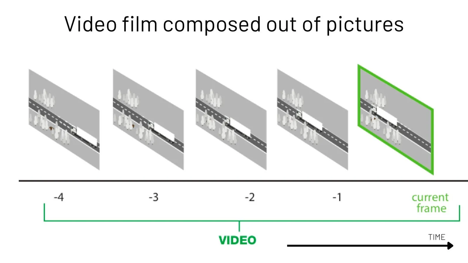
Video processing pipeline

This is partially because the human brain will interpolate information and use movement to add sense to the perception.

However, the typical pipeline for processing Video streams from Cameras, especially when using Machine Learning approaches, is based on analysing successive individual Images.
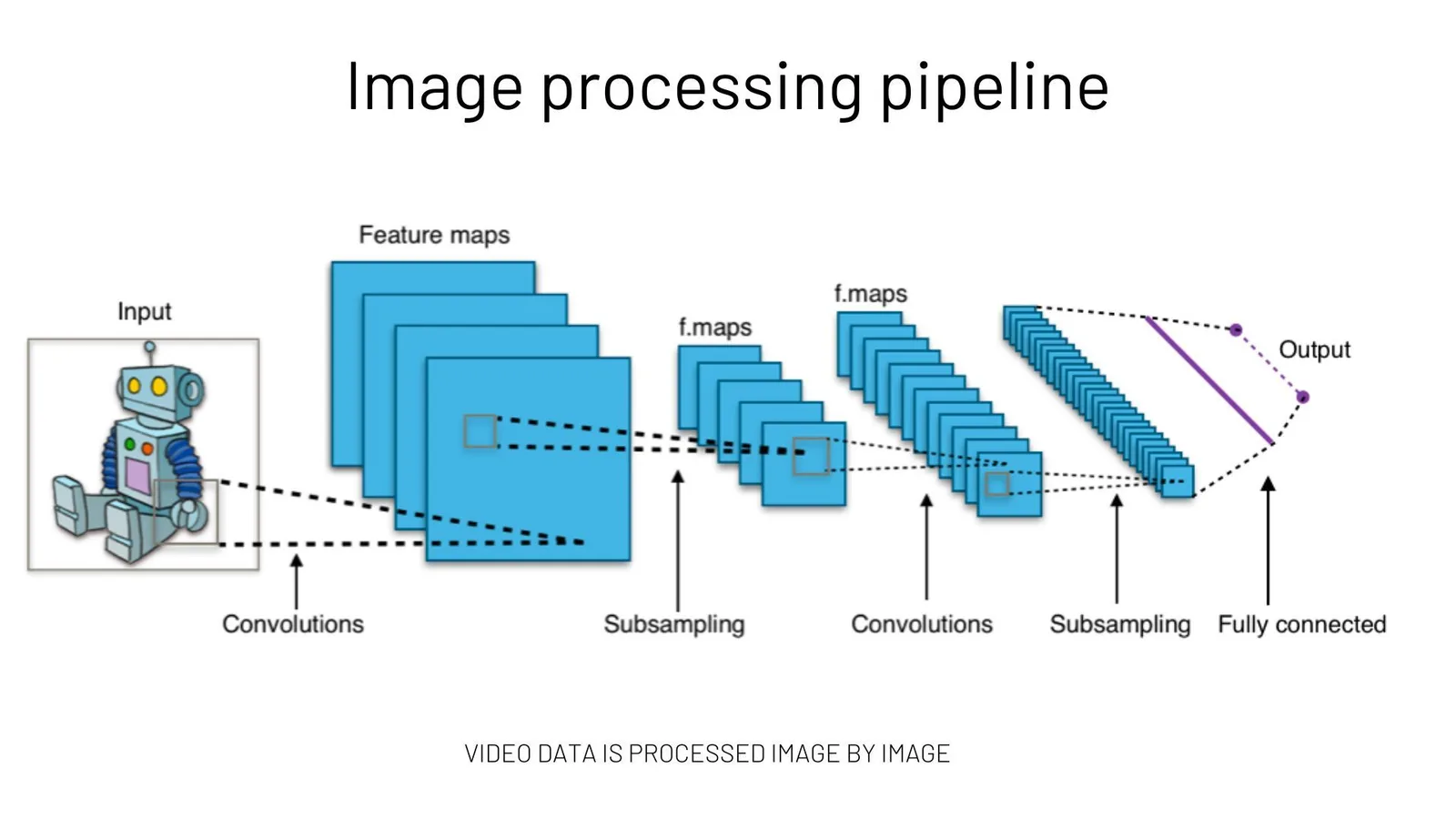
Processing pipeline with ai

When 3D LiDAR first appeared, a natural first approach was to apply the same image processing techniques to this new type of data, for example treating depth as an additional colour (RGB-D with D = Depth).

This method delivers poor results (and requires significant processing resources) as it does not take advantage of the unique properties of 3D LiDAR data and the Spatial Information that it natively contains.

Worse than Red Fish memory

When analysing the instantaneous perception of the environment around the sensor, processing LiDAR frames (the 3D equivalent of Images) one by one is equivalent to forgetting the past: your sensor discovers the world as if it first magically appeared in the current frame.

You’ll give away information as quick as you’ll add it (or even faster).
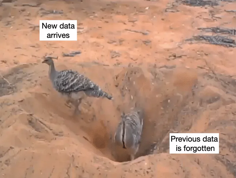
New data complexity

Even Red Fishes don’t forget so quickly! (and by the way, they’re smarter than you think)

Of course there is information on each 3D frame, but

  • there is also rich information in the relationship between the current frame and the previous ones (context and association).
  • more importantly, remembering how the world was before the current frame arrived reveals a meaningful part of reality (signal) that can only be distinguished from noise when time is taken into account (multiple frames).

Keep reading if you want to see some specific examples below.

Increasing resolution and processing power is not a magic wand

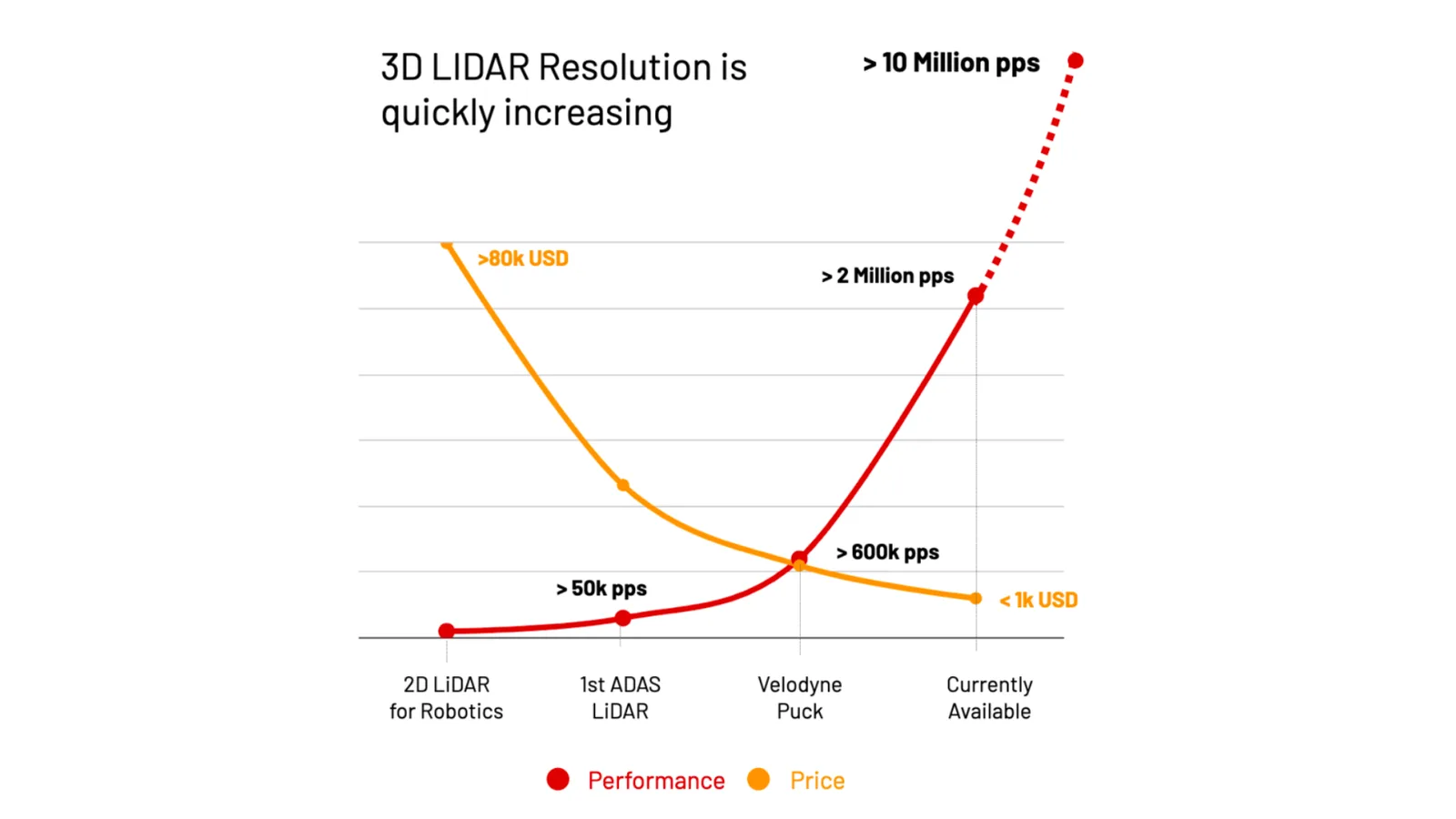
As we mentioned in a previous article, 3D LiDAR is on an incredible trend, with prices dropping while performance rises.

This will become even more interesting as the expected improvement of performance, measured in points per second, will soon show a five-fold enhancement and reach double digit millions:
Lidar becoming affordable

This presents a number of challenges, including how to process such a large amount of data in real time (hint: using 3D pre-processing software), but it doesn’t solve the problem of instantaneous memory loss.

Smaller objects will be detected, but not smaller changes.

Super-Resolution based on high-performance SLAM

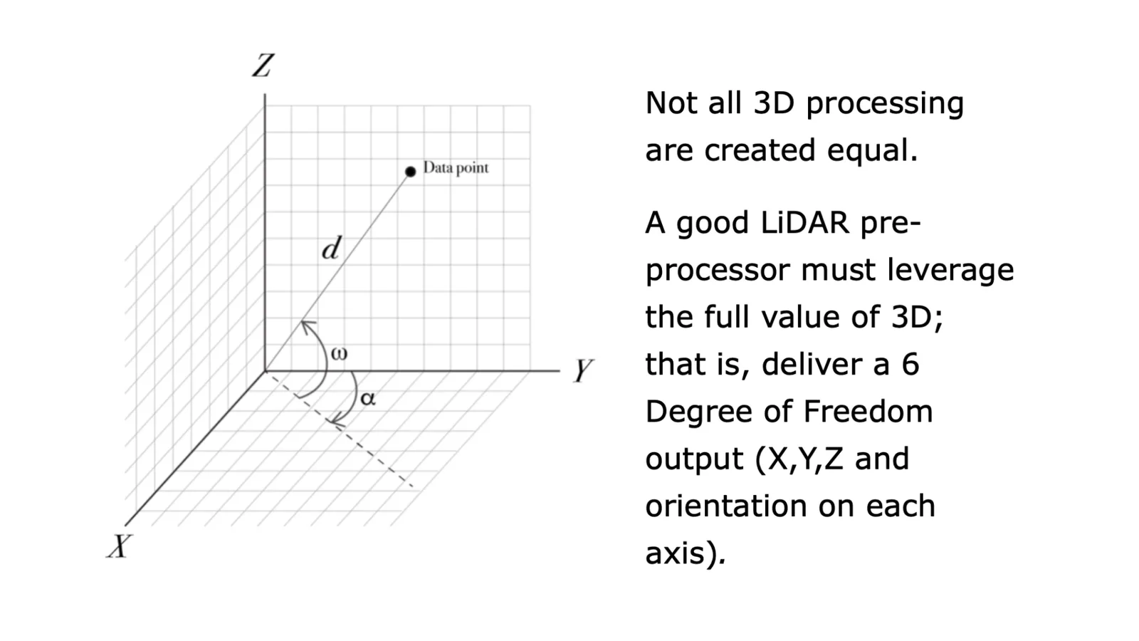
Simultaneous Localisation and Mapping (SLAM) refers to the ability of a sensor, in this case 3D LiDAR, to know its own position and orientation in a map as it is being built.

It’s one of the basic features that performs a 3D Software pre-processor such as Outsight’s.
Super lidar resolution with software

Six DoF output value depends on LiDAR preprocessor

The output of the SLAM feature is typically used for Localisation purposes, including understanding the precise movement and velocity of the Sensor itself (Ego-Motion).

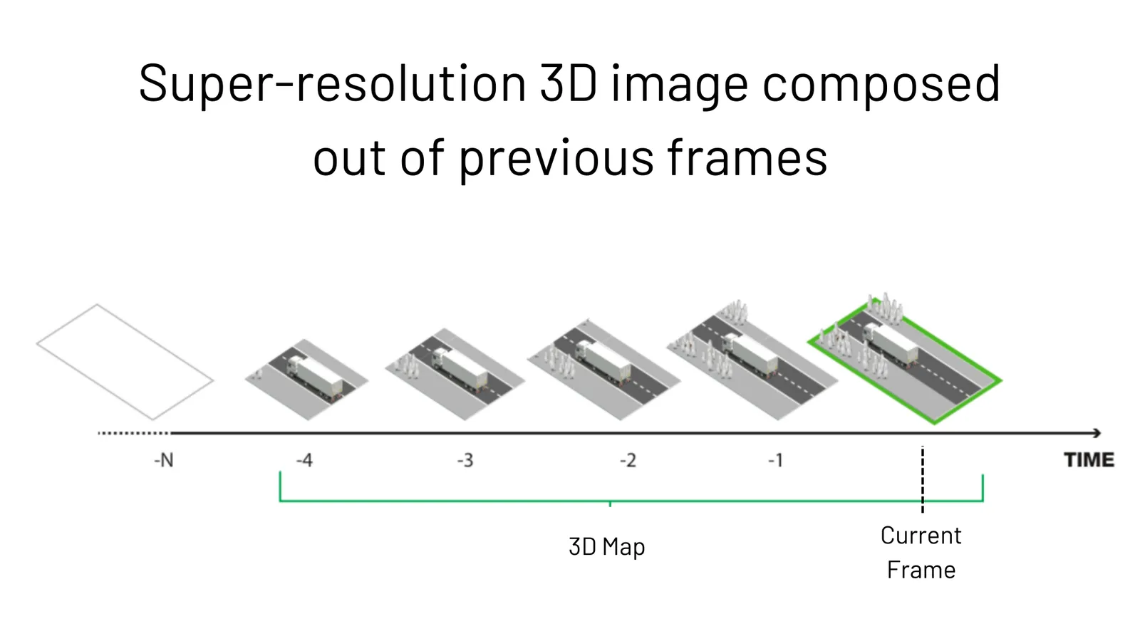
However, because the Ego-Motion output provides the precise relationship between successive frames (the relative position and orientation), it also allows generating a Super-resolution 3D image (a Map) in real-time, the equivalent of what a Video stream is to an Image:
Mapping with Lidar and SLAM

In this case, the goal isn’t to use the 3D map for cartography, but to increase the resolution as the sensor (or the objects around it) moves.

What it usually took days, it’s now possible with Outsight’s pre-processing software in less than 30 seconds:

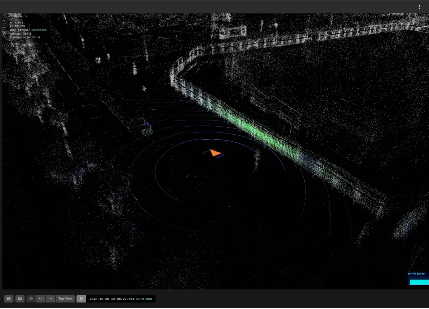
Consider this example. The image below is what you would get with a currently-available 3D LiDAR of significant resolution, in one frame:
Lidar frame

Now consider what happens when a customer of Outsight uses the Super-Resolution slider in the real-time web interface:
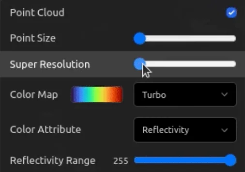
Slider for lidar data

The same situation becomes much clearer - if it’s true for you, it’s true for any computer vision system that uses this integrated real-time signal instead of the instantaneous frame:

3D LiDAR with Outsight processor output super resolution

This is not only relevant for LiDARs using repetitive scanning patterns, software real-time super-resolution adds value also in non-repetitive approaches:

Super resolution demonstration in real-time

Let’s take a look at what this means in practice, with a real-world example.

Detecting invisible road debris and obstacles

In a typical driving situation you want to detect debris such as a tire.

Because it’s a light-absorbing black surface and relatively small in size, the number of Laser hits impacting the object will be very low and even less those getting back to the receiver, even with the highest resolution LiDAR.

Applying Super-Resolution to Obstacle Perception

In this practical experience we used a well-known mechanical 360ºFoV LiDAR, the number of points belonging to the object and getting back to the sensor are shown in the chart below, for each frame:
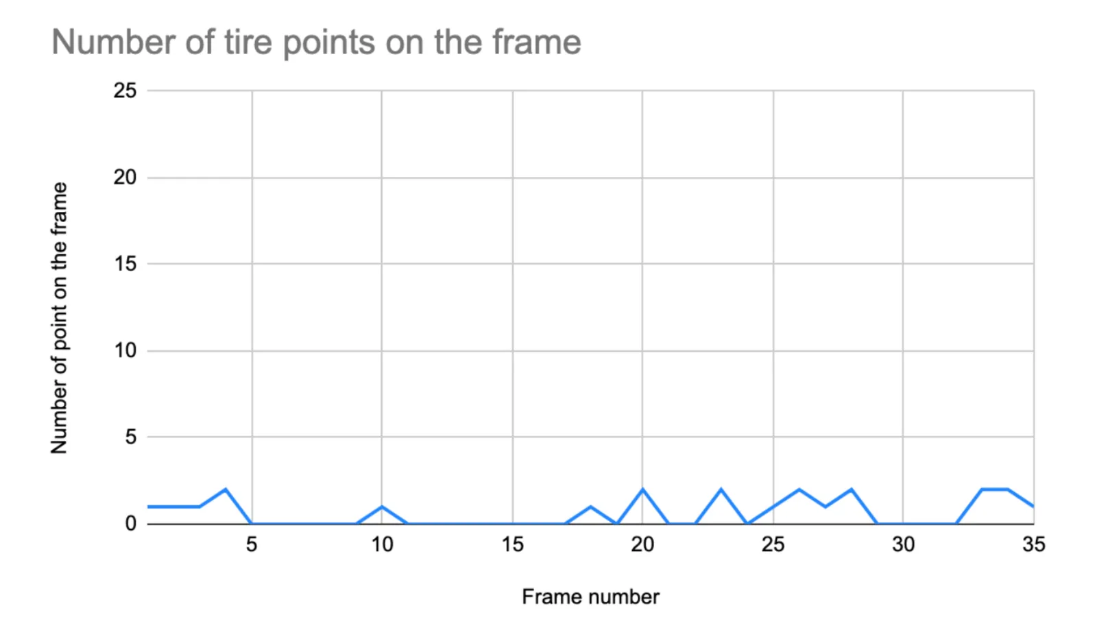
ADAS Lidar data

As you can see, not a single frame delivers more than 3 points on the object (signal).

This is challenging even for the best Object Detection algorithms, especially if you take into account that irregularities on the road (noise) and the side walk edge (more noise).

Look at how close the points of the tire look like vs. the environment:
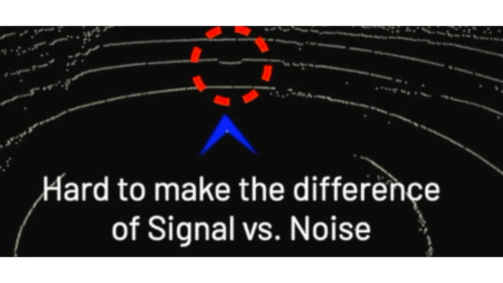
Super lidar resolution with software and lidar

In fact, the image above is even a favourable case: if you look closely at the chart you’ll see that in some frames the object does not appear at all - it becomes invisible!
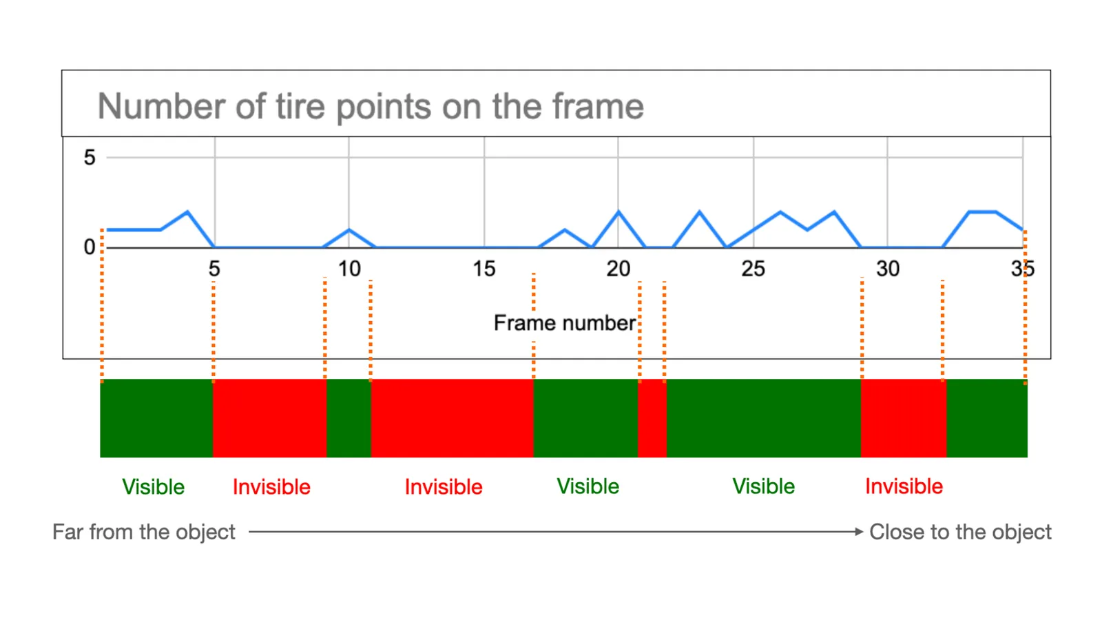
Super lidar resolution with software outsight

That means that the challenge, for any object detection algorithm using this data as an input, is even harder - these few points appearing and disappearing will very likely filtered out as being noise.

To be fair, the fact that even close to the object there are some frames with no points is in this case related to the repetitive scanning method of the LiDAR that was used and won’t be the case with other kind of LiDARs, but this doesn’t change the fact that a single frame is by definition limited by the number of points per frame.

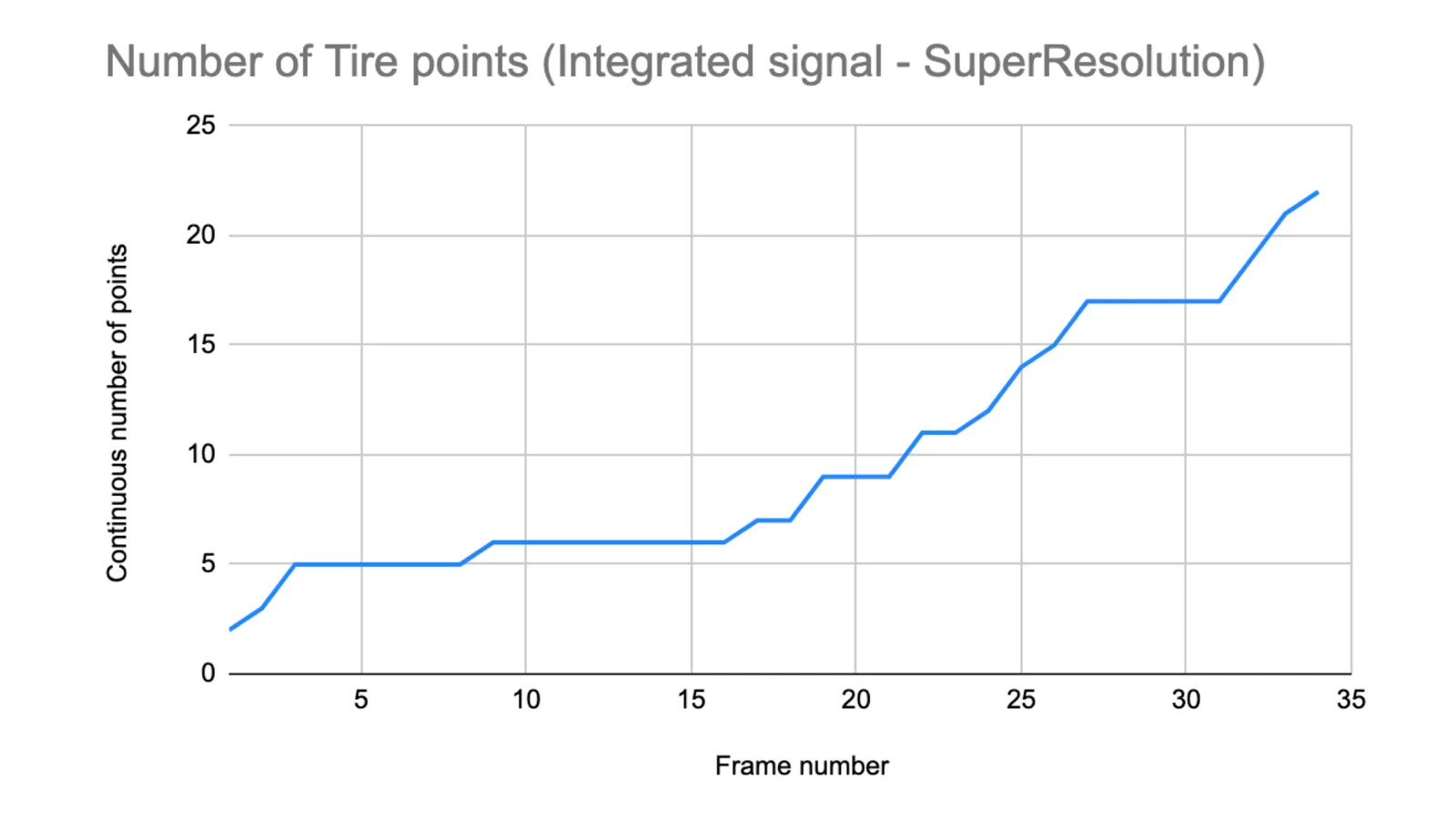
Now, let’s cumulate frames over time (aka Integrating the signal).

Thanks to the SLAM algorithm, we can understand how each frame is positioned and oriented in relation to the previous ones, so we can build a live (real-time) 3D map that increases the actual resolution (ie. how many points of the object are detected).

In the same situation, same recording and sensor, the available data increases with the past observations:
Super lidar resolution with software graph

This is no magic (and no interpolation: all the information is actual laser hits), it’s just simply applying a memory of past points that help understanding the present perception:

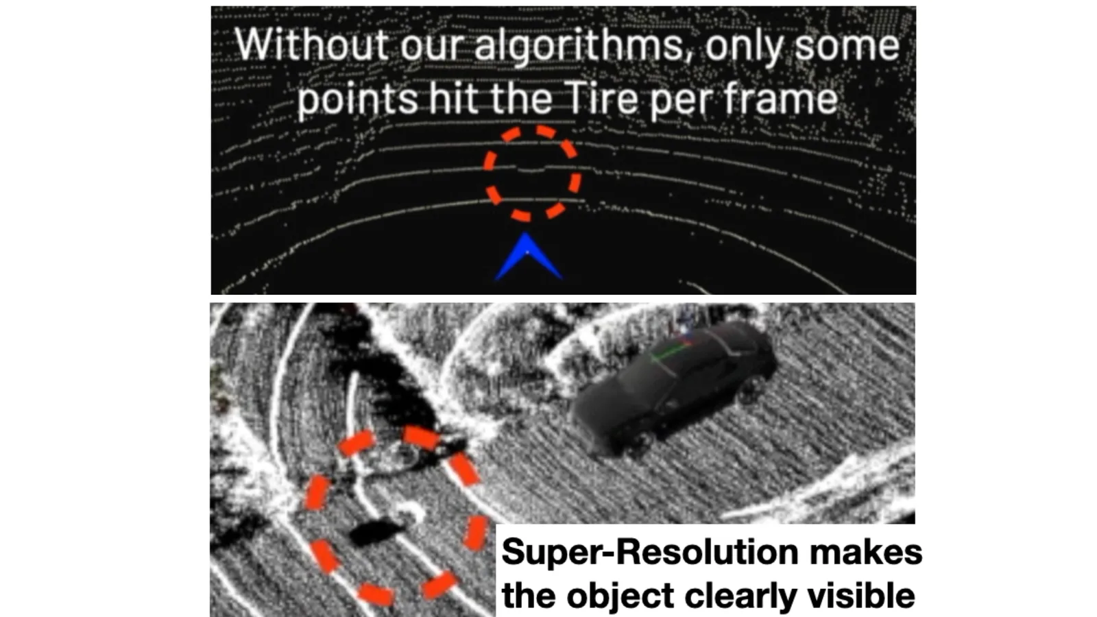
Increasing Resolution with Outsight’s Software

Objects that were previously invisible become visible:
Point-cloud super-resolution

How it works

The basic algorithm enabling Super-resolution is SLAM, but there are many different approaches, most of them requiring high-end computing power and are fragile in challenging dynamic environments.

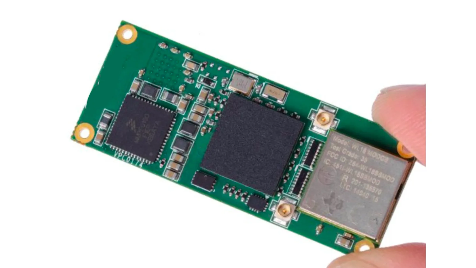
As pioneers of LiDAR SLAM with more than 70 patent filings, our team at Outsight has validated our unique approach in dozens of different contexts and situations, using low processing power (ARM-based SoC CPU).
Lidar Slam on Chip

This is possible thanks to, among other things, a one-of-its-kind algorithm, that we will describe in another article.

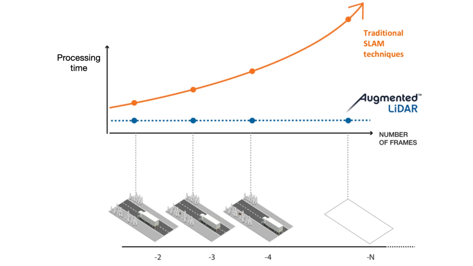
One of the key points is that its processing time is de-correlated with the number of past frames being used to compute the position and orientation:
Super lidar resolution with software and outsight lidar solutions

Outsight’s processor time is not correlated with the number of frames

This is no magic neither, those of you that were following the company Dibotics, now called Outsight, have probably attended one of our many presentations in international conferences or read one of these articles published many years ago:

The hardware and software flywheel

With LiDAR becoming an affordable piece of hardware, any company can start using it, without needing to become a LiDAR expert, thanks to the appropriate real-time pre-processing software.

3D Super-Resolution is an excellent example of how software can sublimate hardware capabilities, resulting in even better data for software to process.

If you want to know more, contact a Product Specialist to guide you with your application.

Related Articles

TECHNOLOGY

What is a 3D LiDAR Preprocessor?

If LiDAR is such a desirable technology, why isn't it employed more often? The core issues preventing a wider adoption are solved by Software pre-processing.

APPLICATIONS

The Top 101 Applications of LiDAR

LiDAR can make anything that moves, observes other moving things, or needs to measure volumes smarter and safer. That makes for many applications!

Let's connect

Send us a Message

Drop your email and we'll get back to you as soon as possible.

Frequently Asked Questions

  • What is LiDAR super-resolution and how is it different from just buying a higher-resolution sensor?

    Super-resolution in a LiDAR context means accumulating laser returns across multiple frames over time, using SLAM to align each frame precisely, so the effective point density on an object grows without any change to the sensor hardware. A higher-resolution sensor increases points per frame, but still discards all spatial memory the moment the next frame arrives. Super-resolution retains that memory, meaning a small object that appears on only two or three points per frame can accumulate dozens of confirmed laser hits across seconds of observation, turning a near-invisible detection into a reliable one. Outsight applies this principle in its preprocessor software component, allowing operators to achieve significantly denser point clouds from existing infrastructure-mounted sensors before the data ever reaches the SHIFT platform's perception and analytics layers.

  • Does SLAM super-resolution work on LiDAR sensors with non-repetitive scanning patterns, or only on spinning mechanicals?

    Both scanning architectures benefit. Repetitive mechanical scanners revisit the same angular positions each rotation, so gaps between scan lines are predictable and accumulation fills them systematically. Non-repetitive scanners (such as solid-state sensors that randomize beam direction each frame) produce different point distributions per frame, meaning each accumulated frame adds genuinely new spatial samples rather than reinforcing existing scan-line positions. The SLAM alignment step is sensor-agnostic; it works from the geometric consistency of the environment rather than from any assumption about scan pattern. Outsight's preprocessor is designed with this sensor-agnostic principle in mind, and the broader SHIFT platform supports multi-vendor LiDAR hardware spanning both mechanical and solid-state form factors across its infrastructure deployments.

  • How does processing time scale as more past frames are accumulated for super-resolution?

    In the approach described in the article, processing time does not scale with the number of past frames used. The SLAM algorithm computes the relative position and orientation of each incoming frame without re-processing the entire accumulated history, so the computational cost stays roughly constant regardless of how many seconds of data are being integrated. This design is central to how Outsight's preprocessor software achieves super-resolution within a sub-50ms end-to-end pipeline, keeping latency flat even as the depth of the accumulated point cloud grows. The result is a technique capable of running on low-power ARM-based system-on-chip hardware, which matters for edge deployments where high-end GPU servers are impractical or too expensive.

  • What is ego-motion estimation in a LiDAR preprocessor and why does it matter for perception beyond navigation?

    Ego-motion estimation is the SLAM output that describes the precise change in a sensor's position and orientation between consecutive frames, expressed as a six-degree-of-freedom transform. Navigation and mapping applications use it to localize a moving platform, but perception pipelines benefit separately. Once the relative transform between frames is known, point clouds from different moments can be registered into a common coordinate frame. That registration is what makes super-resolution possible, and it also enables motion compensation, separating points that moved because the sensor moved from points that moved because an object in the scene moved. The Outsight preprocessor applies this principle within a sub-50ms end-to-end pipeline, using ego-motion estimates to stack and align successive scans so that effective spatial resolution increases without any additional sensor hardware or processing delay.

  • Why do small dark objects like tyre debris disappear from single LiDAR frames?

    A black tyre on the road absorbs light and is relatively small, so very few laser pulses hit it and even fewer return to the receiver, even on a high-resolution sensor. In a test with a mechanical 360° LiDAR, no single frame returned more than 3 points on the tyre, and in some frames the object did not appear at all. Detection algorithms tend to filter out such sparse, flickering points as noise. Accumulating frames over time with SLAM super-resolution gathers enough real laser hits for the object to become visible.

  • Why does treating LiDAR depth as an extra image channel (RGB-D) give poor results?

    When 3D LiDAR first appeared, a natural approach was to reuse image processing techniques and treat depth as an additional colour, known as RGB-D. According to Outsight, this method delivers poor results and requires significant processing resources. It fails to exploit the unique properties of 3D LiDAR data and the spatial information it natively contains. Outsight's pre-processing software works directly with this 3D structure, including its SLAM-based super-resolution.

  • What does it mean that frame-by-frame LiDAR processing forgets the past?

    Processing LiDAR frames one by one means the sensor discovers the world as if it first appeared in the current frame. Outsight compares this to a memory worse than a red fish, where information is lost as fast as it is added. Each frame holds information, yet there is also rich information in the relationship between the current frame and previous ones. Remembering past frames reveals signal that can only be distinguished from noise when time is taken into account.

  • How long does it take to build a super-resolution LiDAR map with pre-processing software?

    Building a super-resolution 3D map from LiDAR data used to take days. With Outsight's pre-processing software it is possible in less than 30 seconds. The software uses its SLAM feature to determine the relative position and orientation of successive frames and accumulates them into a live 3D map. Customers can control this through a Super-Resolution slider in Outsight's real-time web interface. All the added detail comes from actual laser hits, with no interpolation, so small objects become visible in real time.

  • What processor does LiDAR SLAM for super-resolution run on?

    Outsight's LiDAR SLAM runs on low processing power, specifically ARM-based SoC CPUs. Most SLAM approaches require high-end computing power and are fragile in challenging dynamic environments. Outsight has validated its approach in dozens of different contexts and situations, drawing on more than 70 patent filings as a pioneer of LiDAR SLAM. A one-of-its-kind algorithm keeps processing time de-correlated from the number of past frames used to compute position and orientation.

  • Does a higher points-per-second LiDAR remove the need for super-resolution software?

    LiDAR performance, measured in points per second, is expected to improve five-fold and reach double-digit millions while prices keep falling. Higher resolution lets a sensor detect smaller objects. Detecting smaller changes in the scene requires memory across frames, which is what super-resolution software provides. More points per second also raise the challenge of processing so much data in real time, which Outsight addresses with 3D pre-processing software.

  • What is the Super-Resolution slider in the real-time LiDAR web interface?

    The Super-Resolution slider is a control in Outsight's real-time web interface. When a customer uses it, a scene that looks sparse in a single LiDAR frame becomes much clearer. Super-resolution works by accumulating frames over time, positioned and oriented relative to each other using SLAM, into a live 3D map. Any computer vision system that uses this integrated real-time signal benefits in the same way as a human viewer. It adds value with repetitive and non-repetitive scanning LiDARs alike.

  • Why can LiDAR signal only be separated from noise when multiple frames are combined?

    In a single LiDAR frame, a few points on a small object such as a tire can look very close to road irregularities or a sidewalk edge. Detection algorithms will very likely filter these sparse points, which appear and disappear between frames, out as noise. Outsight notes that remembering how the world was before the current frame reveals a meaningful part of reality that can only be distinguished from noise when time is taken into account. Accumulating frames with SLAM increases the number of actual laser hits on the object.

  • How are 3D LiDAR prices and performance expected to change in the coming years?

    Outsight describes 3D LiDAR as being on an incredible trend, with prices dropping while performance rises. Performance measured in points per second is expected to show a five-fold enhancement and reach double-digit millions. This creates the challenge of processing large volumes of data in real time, which Outsight handles with 3D pre-processing software. Higher resolution alone detects smaller objects, while super-resolution software also reveals smaller changes.

  • How much LiDAR SLAM experience and patent activity underlies this super-resolution approach?

    Outsight presents itself as a pioneer of LiDAR SLAM with more than 70 patent filings. Its team has validated its SLAM approach in dozens of different contexts and situations using low processing power. The company was previously known as Dibotics and presented this work at many international conferences. Super-resolution is one of the capabilities built on this SLAM foundation within Outsight's pre-processing software. Its algorithm keeps processing time independent of the number of past frames used.

  • Can companies use LiDAR super-resolution without being LiDAR experts?

    Yes. With LiDAR becoming an affordable piece of hardware, any company can start using it without needing to become a LiDAR expert, thanks to the appropriate real-time pre-processing software. Outsight calls this the hardware and software flywheel. 3D super-resolution is its example of how software can sublimate hardware capabilities, resulting in even better data for software to process. Super-resolution is available through Outsight's pre-processing software and its real-time web interface.