Many people first learned about the value of real-time LiDAR data (that focus on movement) thanks to the Self-Driving Car application, which will be widely deployed at scale sooner or (more likely) later.
That accounts for one long-term use case. Let’s look for a hundred more.
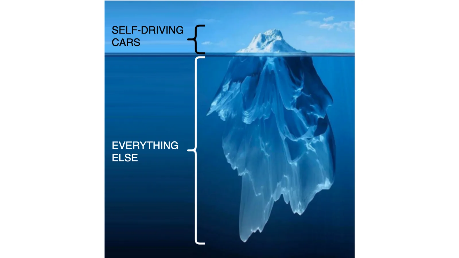
There is an iceberg of applications with LiDAR less known than self-driving cars
When we talk about Real-Time LiDAR data, we’re not referring to traditional and decades-old LiDAR uses like mapping, which mostly don’t require instantaneous or fast processing (and are mainly interested in the static part of the world).
Indeed, much more than a hundred other use cases taking advantage of the uniqueness of 3D Spatial Intelligence are currently being deployed or will be in the near future in a variety of markets.
The deployment of LiDAR is being fuelled by five mega-trends, take a look at our latest article on this if you want to learn more:
Top 5 Mega-Trends in LiDAR
Five long-term factors are driving the development of 3D perception technology and will therefore change a diverse set of industries all around the world.
Read article →

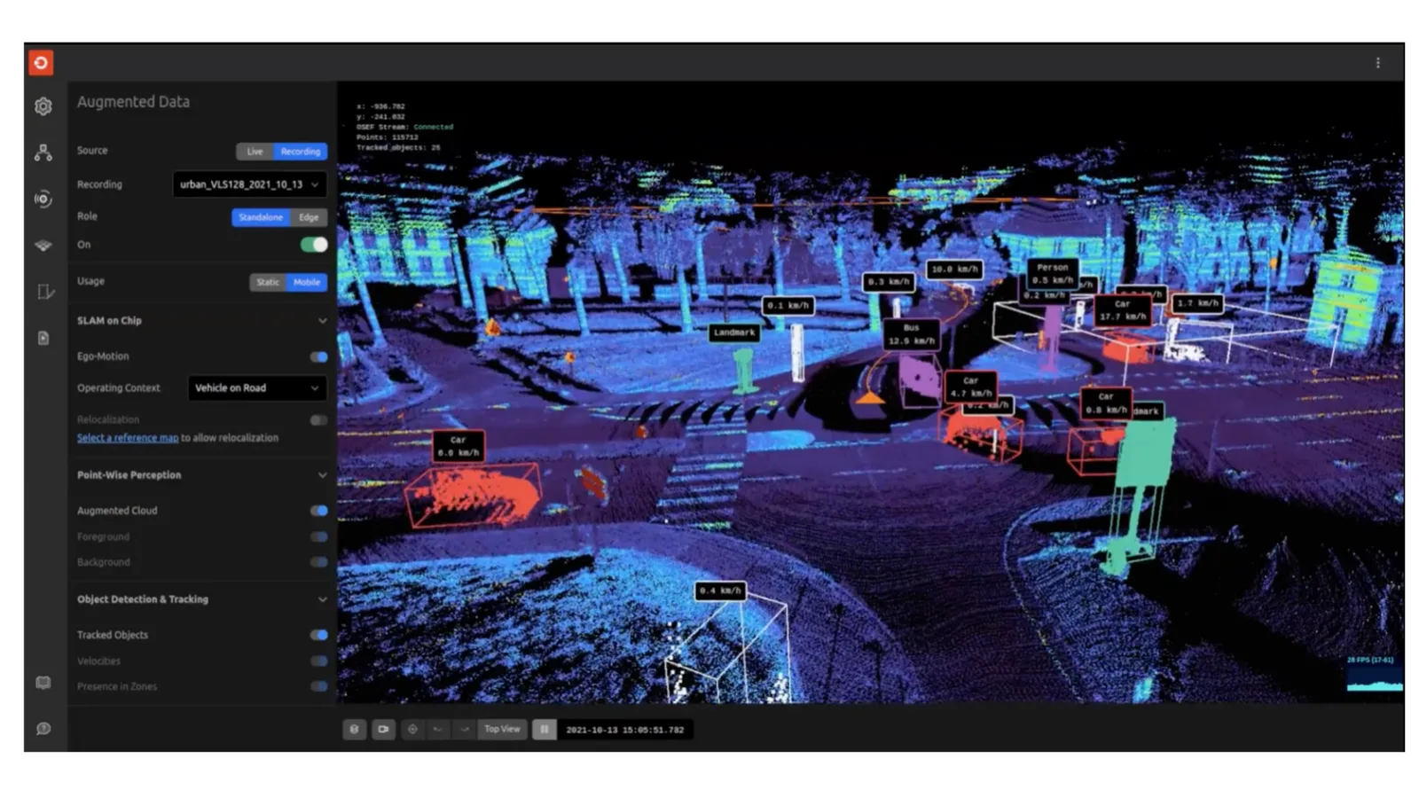
At Outsight we classify these applications in three main market segments:
- Smart Vehicles & Robots: moving machines (not limited to fully automated ones), that can make use of 3D data to enable full Situation Awareness.
- Smarter Infrastructure: Fixed-position 3D sensors such as LiDAR enable many use cases such as Smart Cities.
- Industrial: increasing Safety and Productivity thanks to 3D real-time insights.
Smarter and Safer Vehicles & Robots thanks to LiDAR
The first application in automotive will be assisting the human driver in a safer journey long before fully autonomous cars hit the road at scale.
This is already a reality, for example key companies like Valeo have for many years successfully mass-produced the Scala sensor for ADAS.
Ground Truth for ADAS
While LiDAR sensors are still expensive for automotive mass-production, they are being used (with the right software like Outsight’s) extensively for creating reference data useful for benchmarking the performance of traditional sensors such as Radar and Camera.
Let us know if you also want Outsight to help you on this !
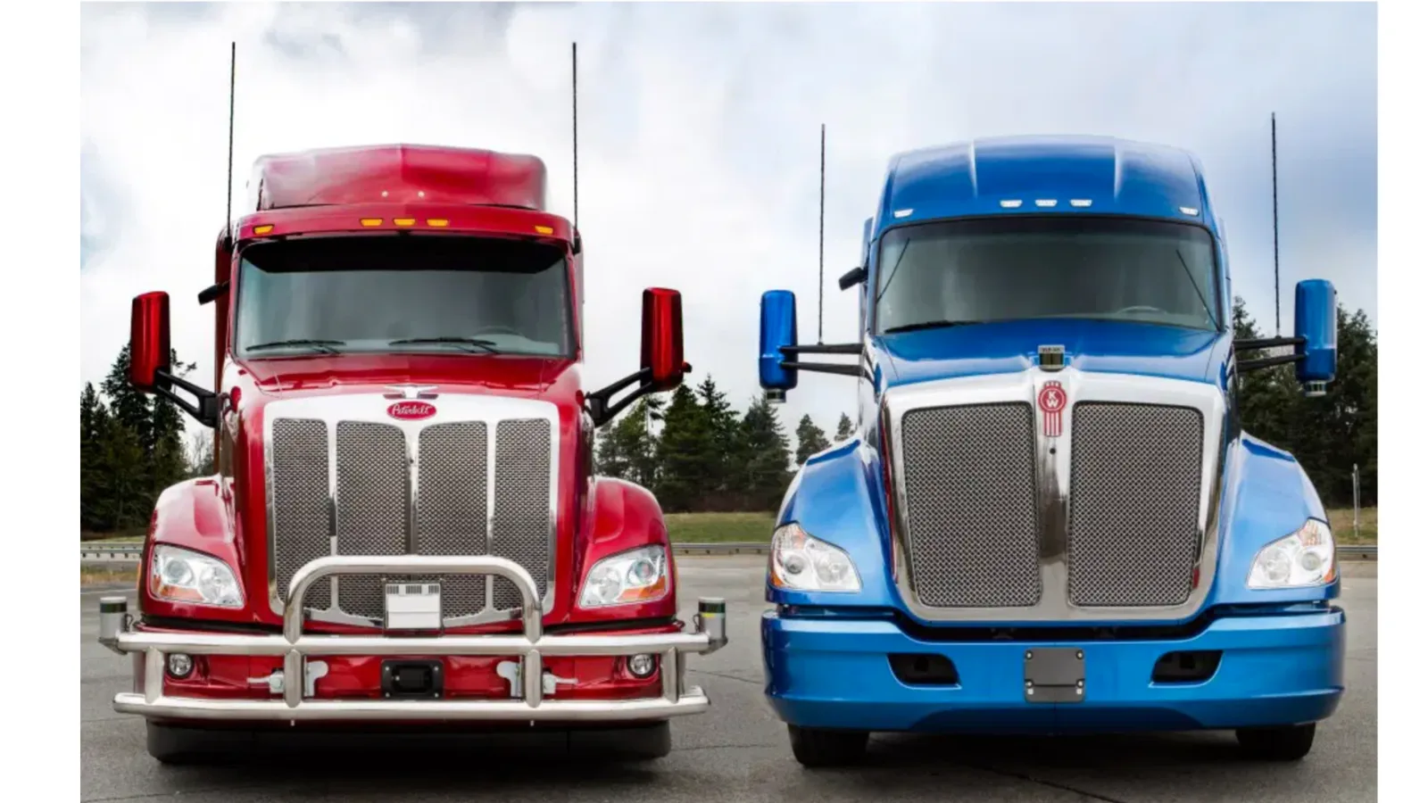
Commercial Vehicles
The novelty is that many other vehicles are leveraging the technology, including Trucking Safety using LiDAR hardware from prominent companies such as Velodyne and Ouster:
Trucks will use LiDAR in many situations, take a look at how Outsight’s software is used for Autonomous Truck Convoy - beyond line of sight:
Autonomous truck convoy with LiDAR
Ultimately any commercial vehicle working on either goods or people transportation will be equipped with advanced 3D sensing capabilities.
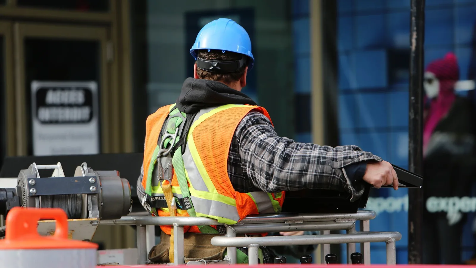
One of the key use cases in many different markets and contexts is ensuring the safety of people working alongside Industrial Vehicles __(i.e. in Construction Sites, Mines, Factories, Agriculture…)_, as LiDAR provides a 360º 3D Perception Shield preventing accidents.
In this article we dive deeper into the Construction Site applications:
LiDAR Enhances Construction Site Safety
Gain an understanding of the role that 3D LiDAR technology plays in contributing to a significant increase in the level of safety on construction sites.
Read article →
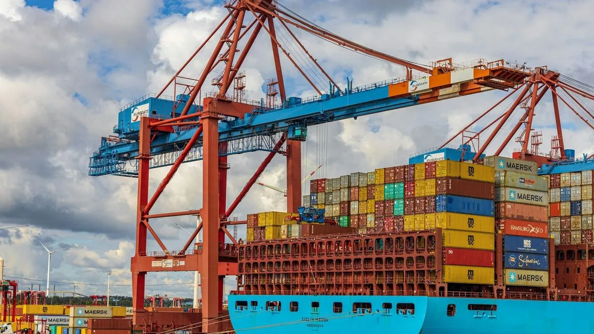
Logistics automation using LiDAR
Beyond improved manned versions, the mobile robotics’ market in the logistics space is poised to grow exponentially, both in outdoor/public roads an inside warehouses.
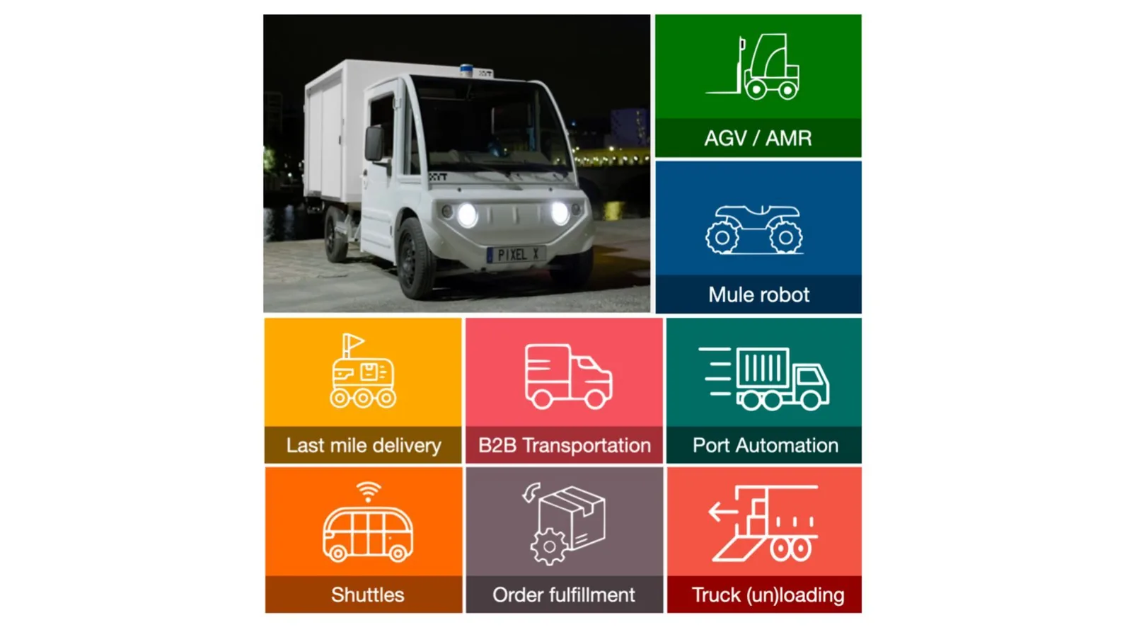
Hereafter an example of Port Automation using LiDAR and Outsight’s pre-processing software:
Port automation with LiDAR
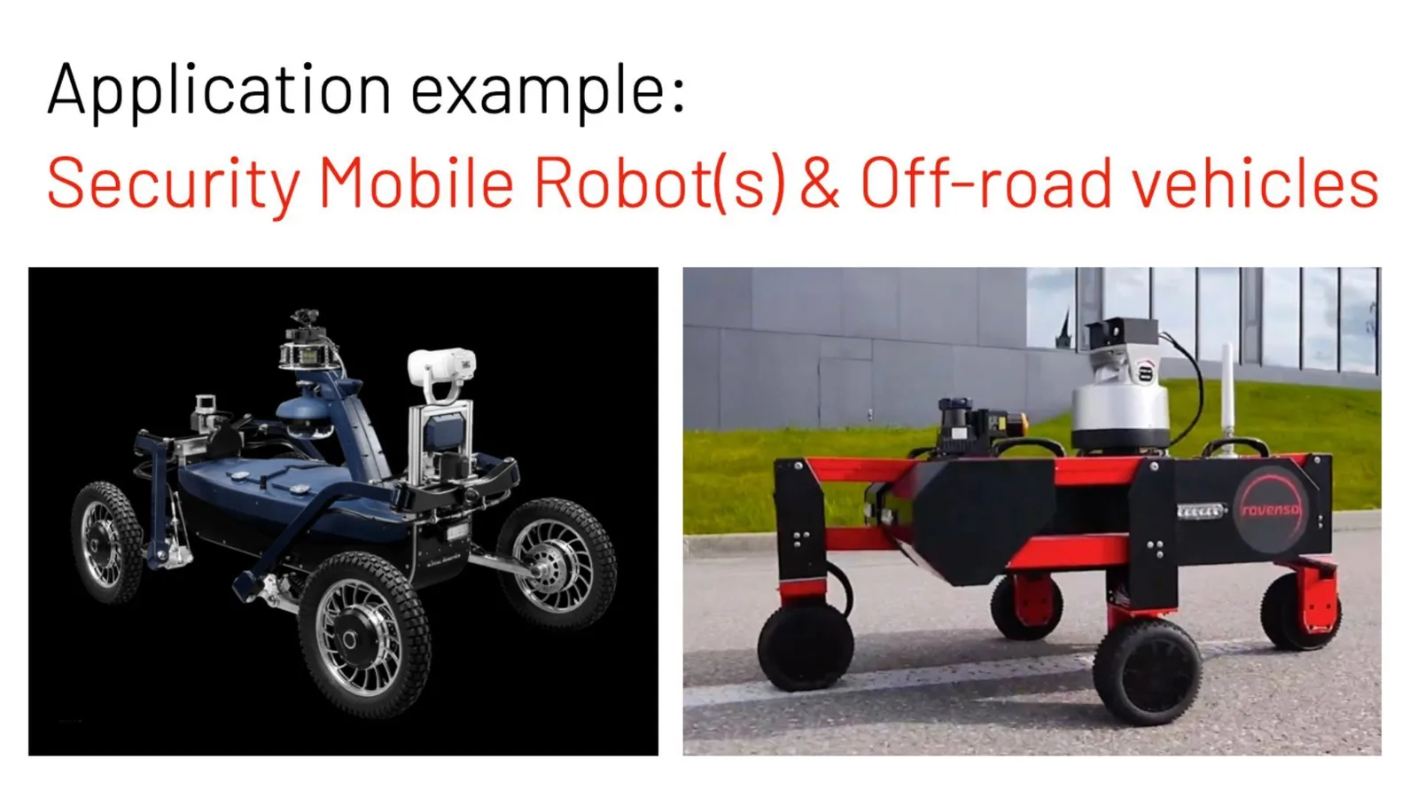
The rise of the (mobile) robots
As we mentioned in a previous article outlining the Macro-trends driving LiDAR growth, the exponential deployment of mobile robotics in many applications is a key driver of LiDAR market expansion.
Security and off-road surveillance robots are a rising star in the space.
Typically these applications require the ability to create a map and relocalize the LiDAR within the reference of this map, in real-time, one of the key features offered by Outsight’s LiDAR software.
If you are interested, contact a Product Specialist today!
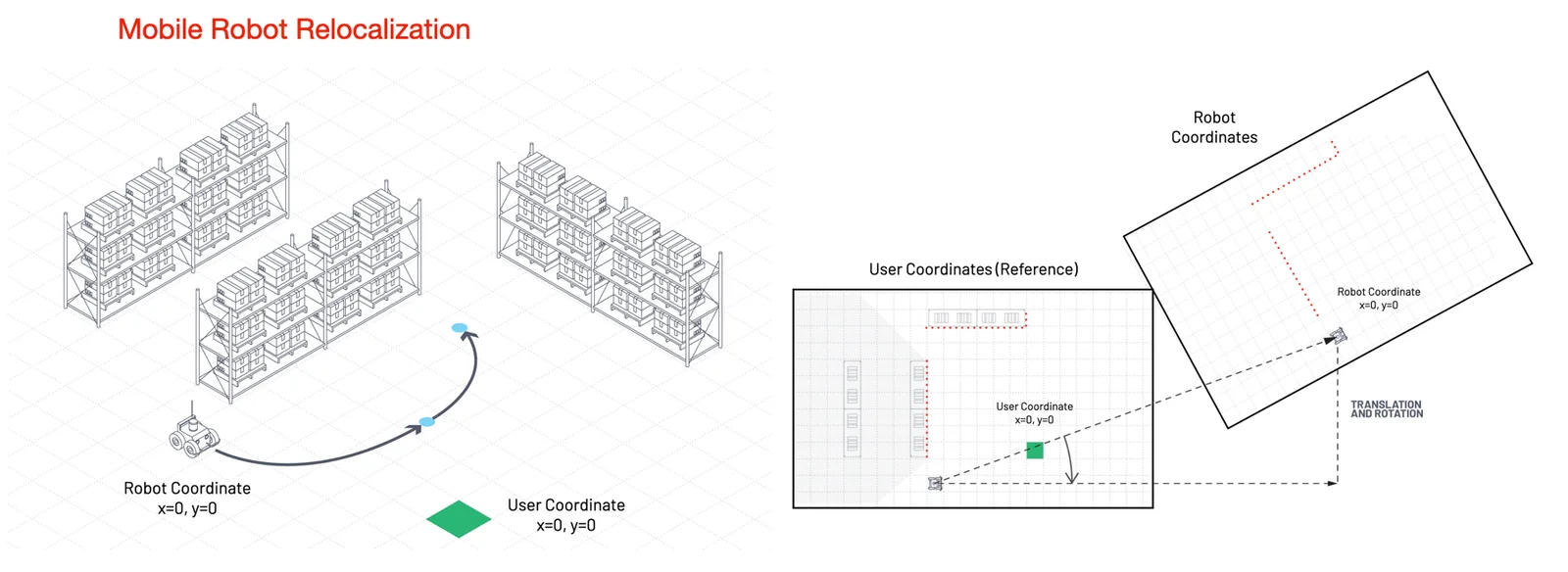
Mobile robot relocalization using LiDAR, processed by Outsight’s software
We’re seeing many other applications arising in mobile robotics, in addition to Security and Logistics:
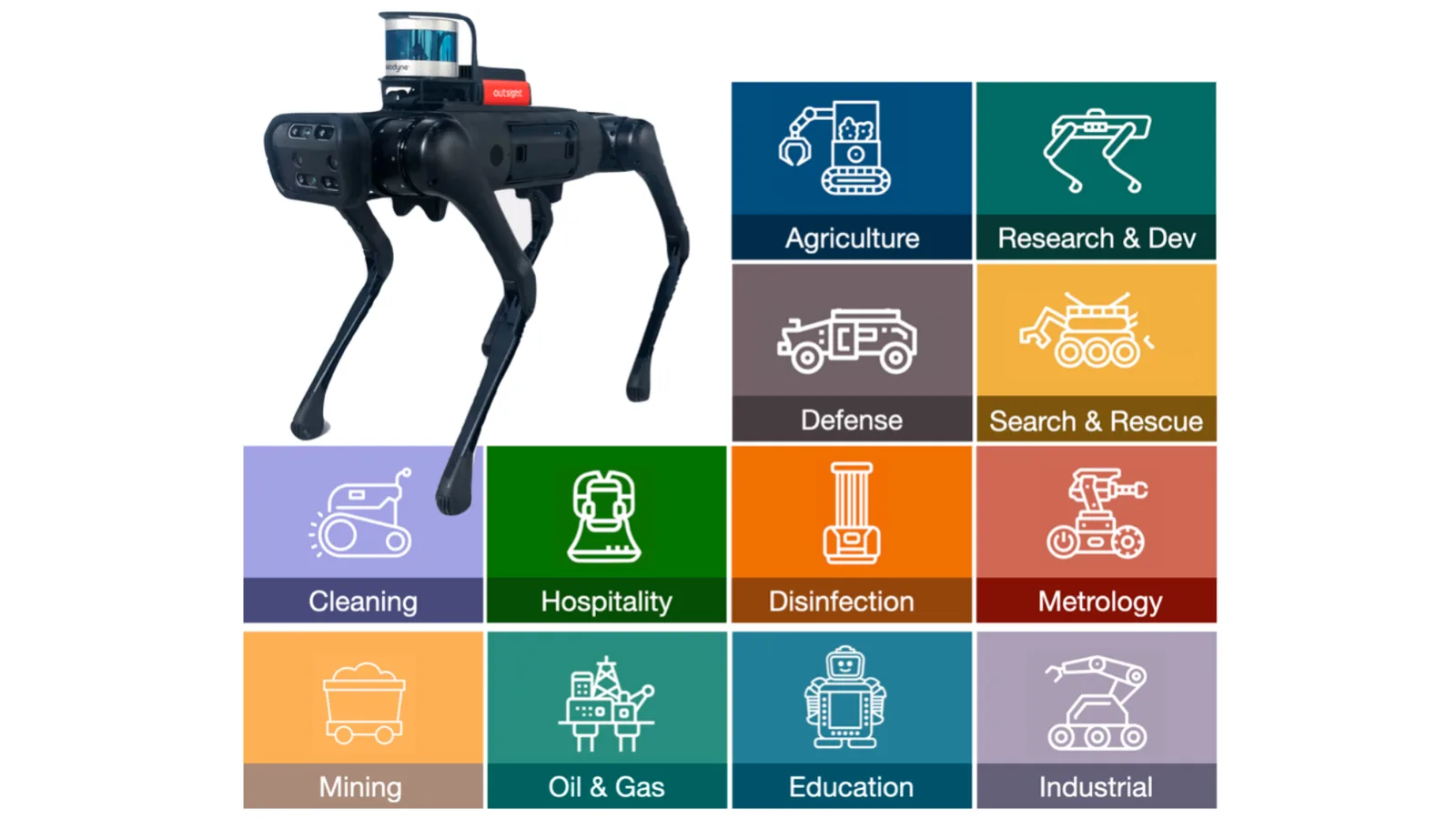
LiDAR applications in mobile robotics (example with Velodyne LiDAR)
All of these robots have one thing in common: they are all in contact with the ground. What about the Sea and the Air? there are many applications both for flying drones and Maritime contexts.
Flying drones can be used in a variety of situations, including the majority of the ones we’ve discussed for mobile robots, where 3D real-time Situation Awareness adds a unique value and becomes a key enabling capability in many of them.
Flying Drones with LiDAR
An advanced application of LiDAR real-time Software is the instantaneous detection of power-lines from Helicopters, preventing one of the main causes of accidents. We initially validated this using a Drone, before starting a successful collaboration with a major Helicopter manufacturer:
Real-time Power-lines segmentation from a drone
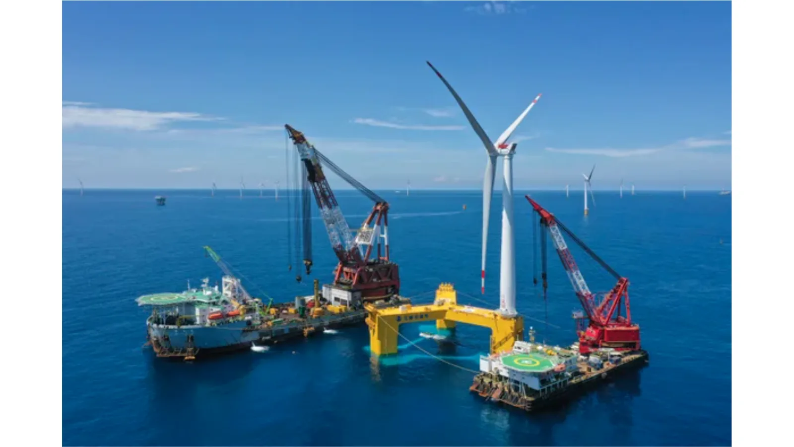
Similar to flying drones, much can be said about applications that are based on the sea, with some specific additional use cases beyond fully autonomous vessels, such as ensuring the Security of Bridges in waterways, and others that you may perhaps not suspect, like assisting in offshore wind farms’ building and avoiding collisions in low-visibility situations.
This article enters into more details on the Maritime-related applications:
LiDAR Solutions for the Shipping Industry
The need for higher safety, decreased costs, and improved utilization of human resources is the primary factor driving this change in the maritime industry.
Read article →
Even Localising vessels in GPS-denied environments such as tunnels, is an interesting case because IMU-based odometry quickly drifts significantly.
Vessel localising in a tunnel with LiDAR
Another possible application is harbour surveillance and observation, thanks to advanced SLAM algorithms, providing a full panoramic view during day or night.
If you’re exploring using LiDAR in this field, you’re just a click away from a Product Specialist thanks to Outsight’s software and experience.
Harbour surveillance with LiDAR
Heavy equipment Third-person Teleoperation
An interesting growing trend is the approach of incremental pathways to full autonomy that companies like Teleo are following in the construction and mining industries, retrofitting existing fleets with distant supervision and operation.
LiDAR provides a unique capability at it allows remote operation to happen in a third-person point of view: with software solutions such as Outsight’s, you can create a super-resolution live map in real-time and short latency and displace the position of the virtual camera, so the operator can follow the scene as he was flying around:
SLAM on a orchard
Smarter and Safer Trains
Railway related applications require in many cases long-range LiDAR detection, that is only possible with few LiDAR models, but there are already several applications in this space that work with medium range ones, such a GPS-denied precise Localisation (i.e. Tunnels), long-distance Relocation in maps and surrounding vegetation monitoring among others.
Long-distance train localisation with LiDAR
Urban tramways also have a number of 3D Situational Awareness requirements that can be met without waiting for long-range LiDAR to become affordable due to their lower speed.
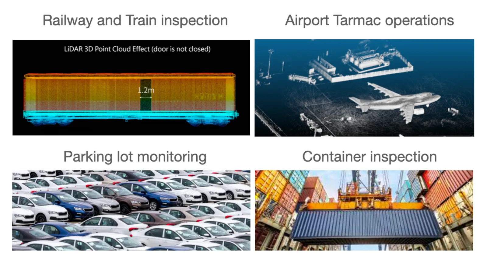
Top use cases of LiDAR in Industrial markets
The word “Industrial” covers here many different situations, the number of applications are almost endless, so consider this as a quick overview of the most important ones:
Volume measurement of truck loads
A similar use case is the unique capability of LiDAR to assess Heap volume in real-time, as well as warehouse stock.
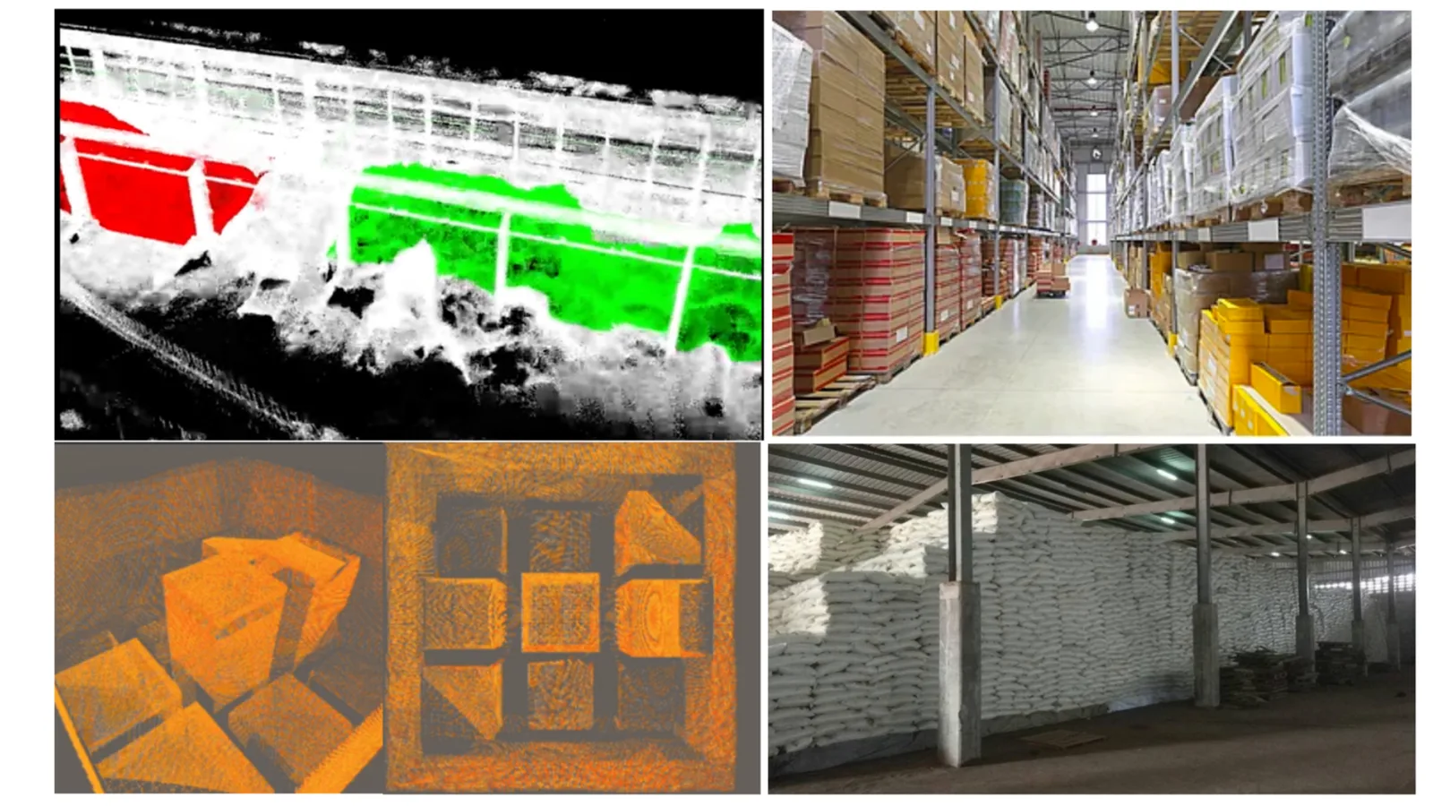
Volume assessment in real time with LiDAR, processed by Outsight’s software
Construction site safety
Construction sites concentrate in fact many cases that can be also found in factories and other contexts, including ensuring workers’ safety around machines.
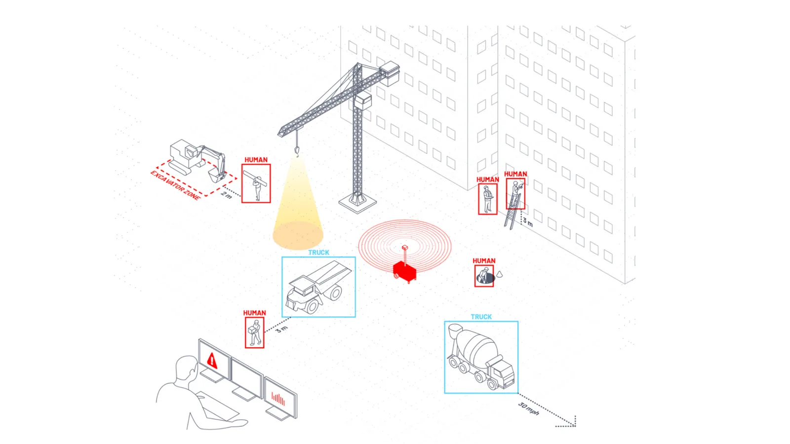
Construction site safety with LiDAR, processed by Outsight’s software
Crane & Factory Equipment safety
An interesting example is how we used the unique value of 3D sensing of LiDAR to provide a standard factory crane with 3D safety capabilities:
Load tracking with ALB (Augmented LiDAR Box) + LiDAR
Forestry management
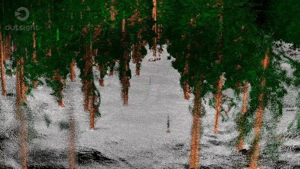
Forestry administration with ALB (Augmented LiDAR Box) + LiDAR
Smart Infrastructure: an endless list of LiDAR applications
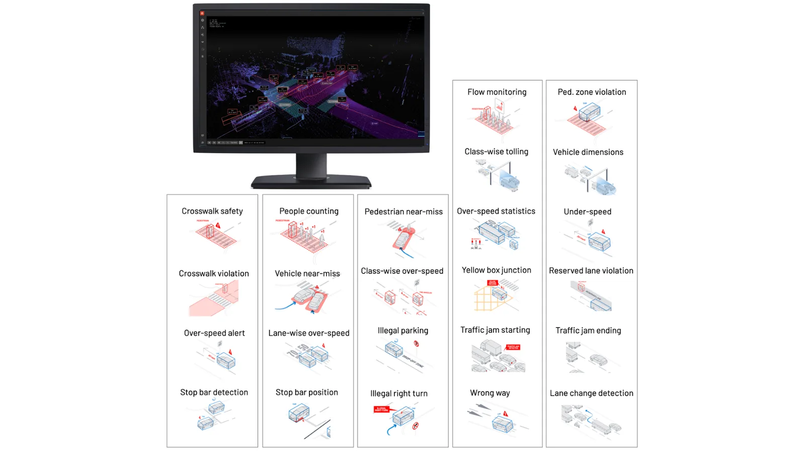
One of the key areas of rapid development for infrastructure-based LIDAR is Smart Cities and related fields (i.e. Intelligent Transportation Systems, aka ITS), where we are seeing dozens of different Use Cases happening now.
Airport Operational Excellence and Security
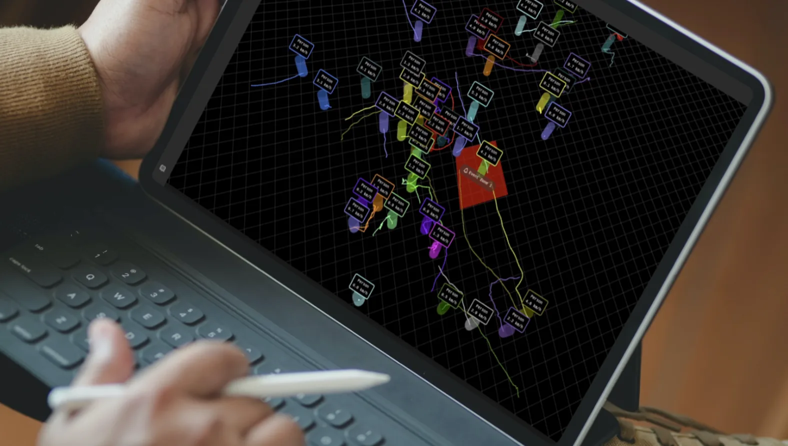
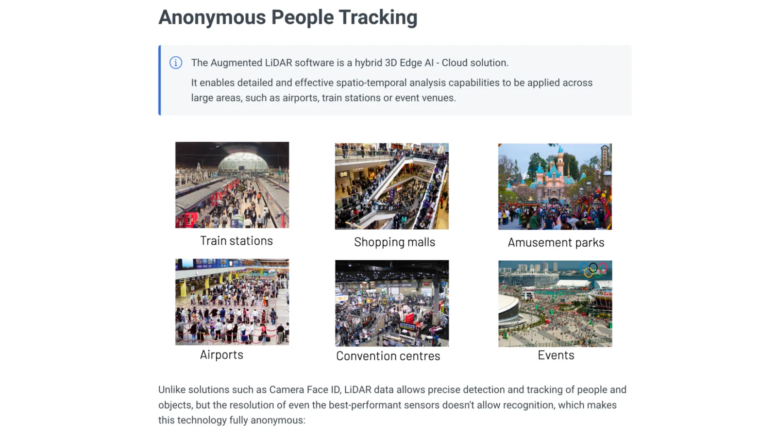
If you have been following Outsight, you’re certainly aware we’ve deployed unique solutions in Airports, being able to anonymously track thousands of people and objects in real-time, deal with massive amounts of 3D data from dozens of fused LiDARs in real-time.
Crowd monitoring in an airport terminal
Many use cases are enabled by the capability of individually tracking everyone, everywhere, all the time.
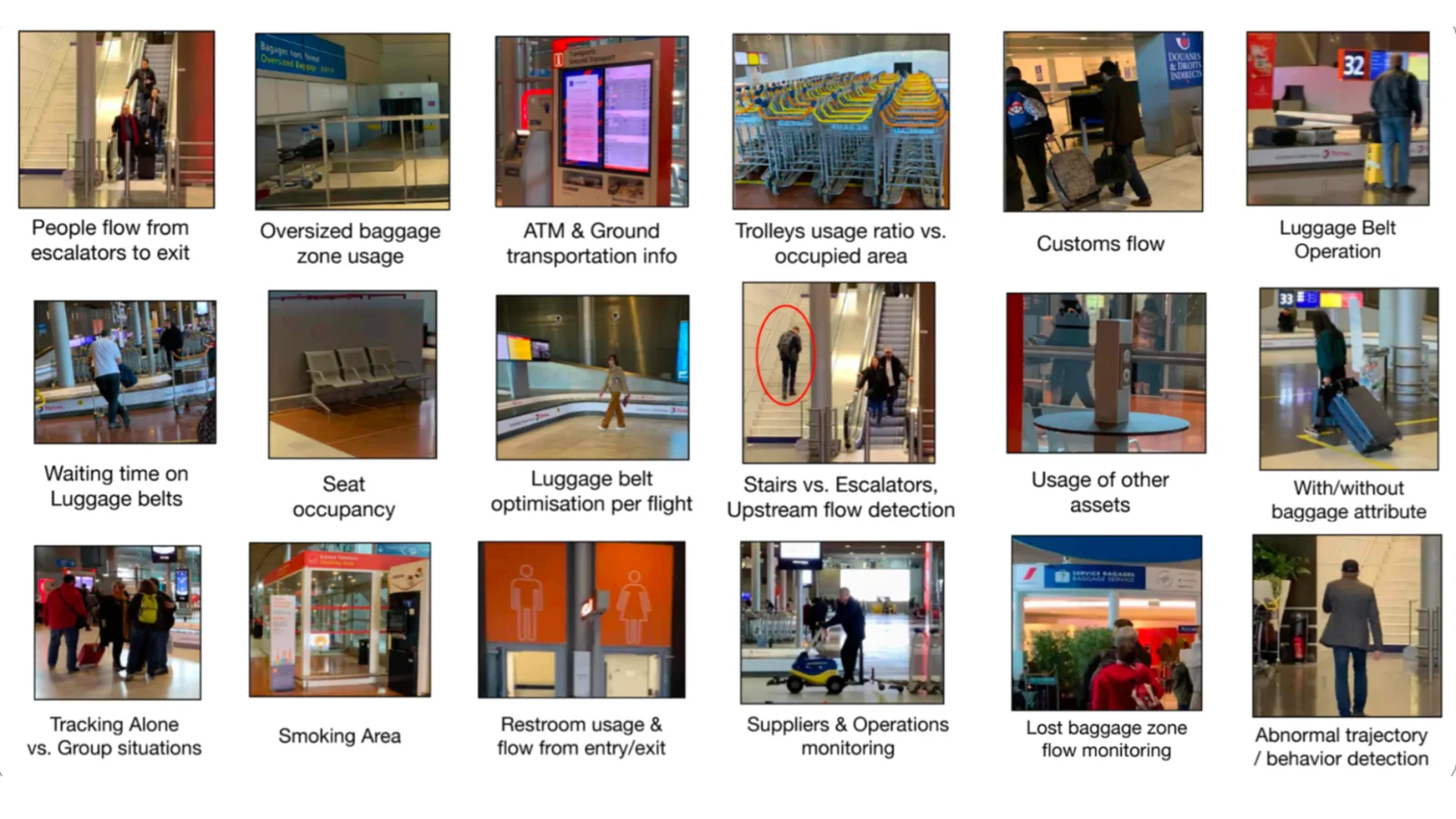
Of course an airport is nowadays a small city, and the same technology is relevant to other contexts such as Retail, Train Stations, Amusement parks …
Other interesting use cases related to people safety
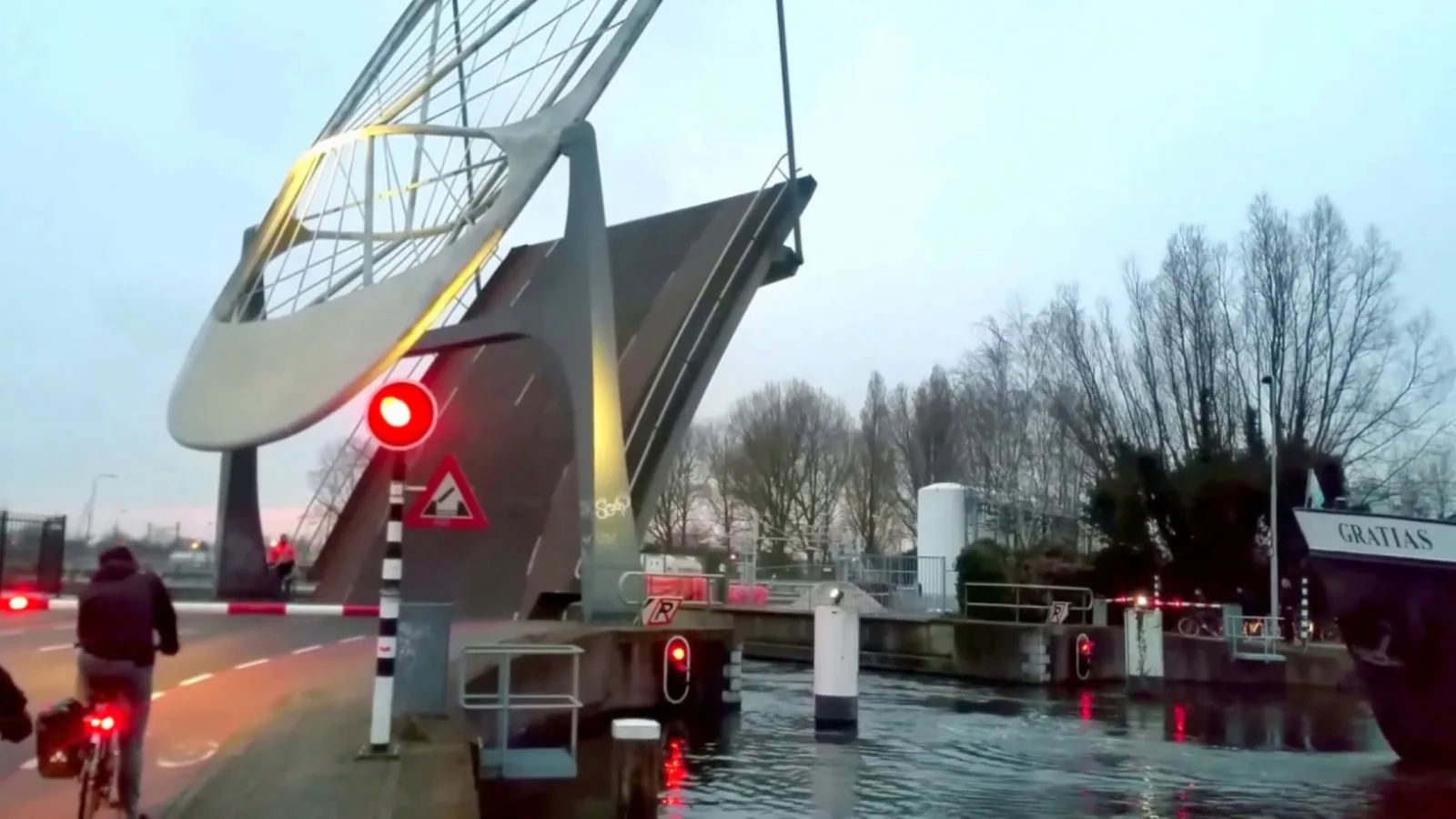
Bridge safety:
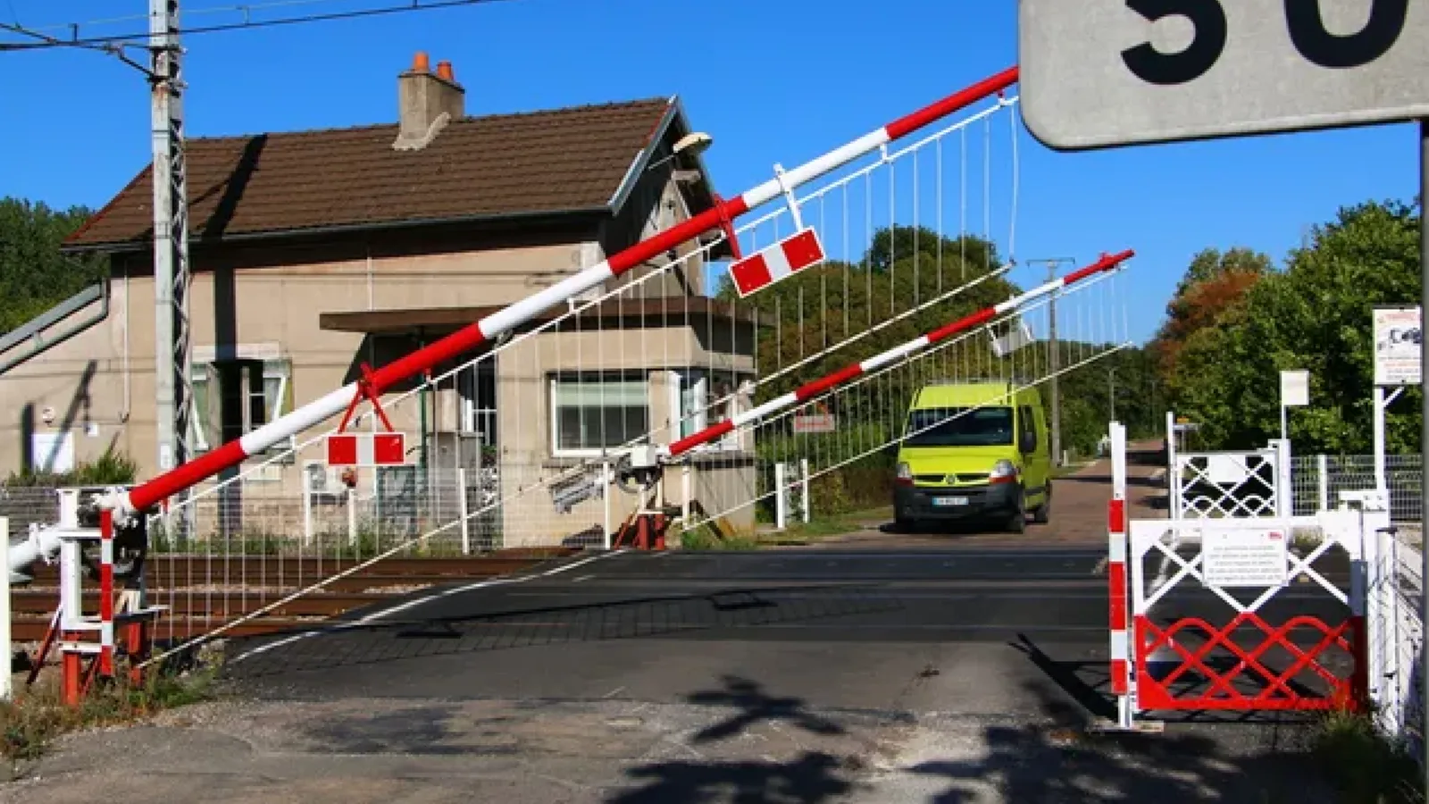
Railway crossing alert:
And of course many inspection and Situation Awareness uses in many industries:
Security
Unlike traditional intrusion detection systems, which typically detect intrusions at perimeter fences, LiDAR, when used with the right software, can identify and track intruders across an entire sensitive site by fusing multiple LiDAR sensors strategically positioned within the site.
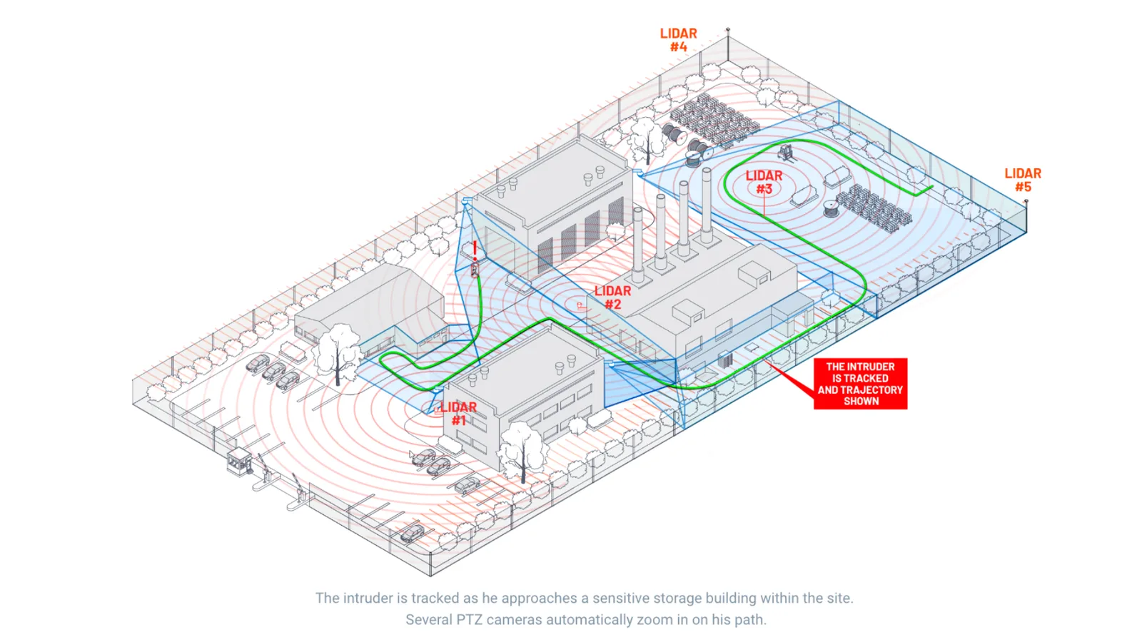
Security monitoring with LiDAR, processed by Outsight’s software
Using Outsight solutions, integrated with the main VMS vendors such as Milestone, the intruder, detected and tracked, can be identified with a PTZ camera, driven by the software:
Conclusion
We could go on and on about applications, but you’ve probably figured it out by now: the list of LiDAR’s applications is endless.
Anything that moves, monitors moving objects or requires measuring volumes can become more intelligent, efficient, and safe.
Outsight’s mission is to enable a new generation of 3D-based solutions to emerge, thanks to our real-time pre processing software.
Explaining 3D LiDAR Preprocessors
The software behind this promising 3D technology
Read article →