Skip to content
Insights
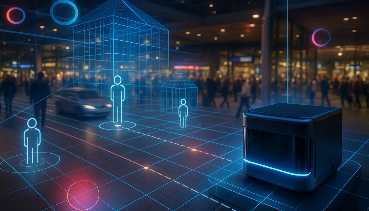
Busy airport terminal with passengers walking, queuing, and interacting under bright natural light.

Digitizing Movement: The next generation of Digital Twins

Integrating people flow monitoring into Digital Twins with LiDAR and Spatial Intelligence delivers real-time insights, optimizing safety and efficiency.


Introduction

Complex infrastructure environments, from airports to industrial facilities, face a persistent challenge: the lack of real-time, actionable data about how people and vehicles move through physical spaces.

Motional Digital Twins (MDTs), powered by Spatial Intelligence and 3D native sensors like LiDAR, are transforming this landscape by providing continuous, precise visibility into dynamic flows.

MDTs enable operators to move from reactive management to proactive decision-making by digitizing movement patterns in real time.

This article explores how integrating people flow monitoring into Digital Twins addresses critical operational problems, improves efficiency, and supports privacy, all while leveraging the unique strengths of LiDAR and Spatial Intelligence.

Bridging Data Gaps: Achieving Visibility into Physical Flows

Traditional infrastructure management often suffers from a fundamental blind spot: operators cannot see or quantify the real-time movement of people and vehicles. This data gap leads to inefficiencies, unresolved customer pain points, and unaddressed safety risks.

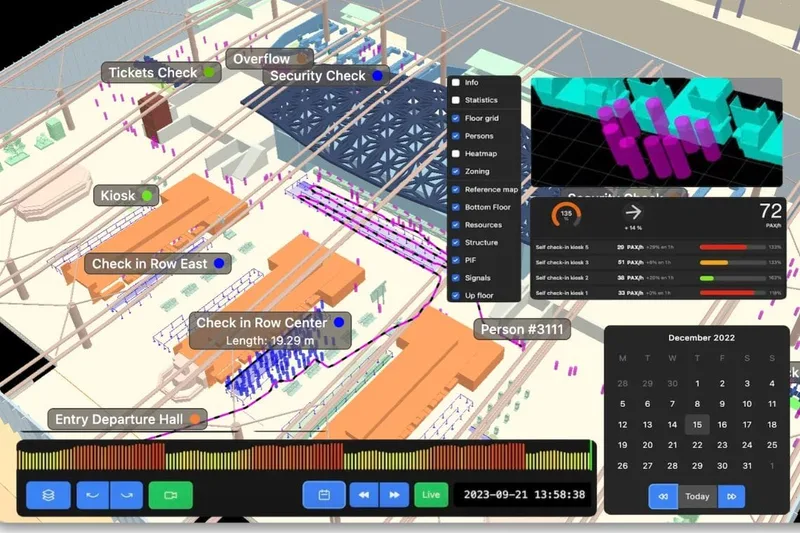
MDTs solve this by acting as real-time digital replicas that continuously track and analyze movement throughout a facility. By transforming invisible flows into actionable insights, MDTs empower operators with the Spatial Intelligence needed to make informed decisions.

LiDAR, when combined with Spatial AI (also known as Physical AI), enables continuous individual tracking across entire premises with centimeter-level precision. The result is a structured, contextualized understanding of movement, not just aggregate counts.

LiDAR-based MDTs can track thousands of individuals simultaneously, providing granular data on movement patterns that were previously invisible to operators.

Optimizing Capacity and Managing Complexity

As infrastructure usage grows, organizations must maximize the capacity of existing facilities without the luxury of immediate expansion. Airports, for example, often operate near or at full capacity, making efficient flow management essential.

LiDAR Manages Increased Airport Traffic

See how and why Airports are increasingly using LiDAR-based software solutions to tackle their biggest challenges, leveraging the unique value of Spatial Intelligence.

Read article →

MDTs provide the Spatial Intelligence foundation for optimizing operations within current constraints. By delivering real-time and predictive insights, such as actual and forecasted wait times or resource utilization, operators can make timely adjustments to staffing and facility usage.

These insights are not generic; they are specific, actionable, and tailored to the dynamic realities of each environment. For instance, knowing the precise occupancy of a waiting area or the actual queue length at security enables targeted interventions.

Real-time queue monitoring with MDTs has helped major transport hubs reduce average wait times by up to 20% during peak hours.

Overcoming the Limits of Legacy Technologies

Legacy Digital Twins and static data sources, such as Building Information Modelling (BIM), focus primarily on assets rather than dynamic flows. Camera-based systems, meanwhile, struggle with lighting changes and cannot deliver continuous, high-precision tracking across large areas.

MDTs overcome these limitations by digitizing movement as a core capability. Real-time awareness is built into both data acquisition and processing, allowing for immediate operational impact.
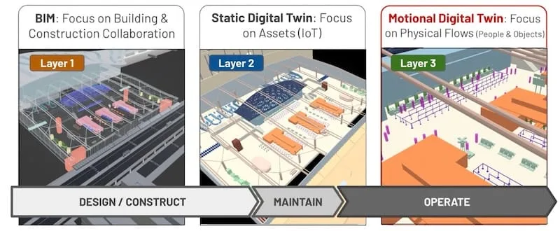
Motional Digital Twins represent the third generation of DT solutions

LiDAR stands out as the most advanced and capable technology for this purpose. It perceives in 3D over long distances, emits its own light, and operates reliably in complete darkness or variable lighting. This ensures uninterrupted, premises-wide tracking that is both accurate and robust.

Understanding the basics of 3D LiDAR Technology

Light Detection and Ranging, also known as LiDAR, is a technology for remote sensing that is used to measure distances in an environment.

Read article →

LiDAR sensors maintain consistent performance regardless of weather or lighting, making them uniquely suited for continuous monitoring in complex environments.

Ensuring Privacy in People Flow Monitoring

Public resistance to image-based and wireless surveillance is growing, driven by legitimate privacy concerns. MDTs address this by enabling anonymous tracking that respects individual privacy.

Anonymous vs. Anonymized : Learn the Difference

Understanding Anonymity in Sensor Data: discover the inherent privacy characteristics of each type of Sensor data and the potential risks associated with anonymizing sensitive information

Read article →

LiDAR offers a key advantage: it does not capture any personally identifiable information.

People are represented only as symbols within the system, and no images are recorded or displayed. This native privacy preservation is reinforced by the MDT platform, which ensures that all tracking remains completely anonymous.

With LiDAR-based MDTs, privacy is preserved by design, no images, facial or identifying data is ever collected, eliminating the risk of personal identification.

Real-World Applications: Solving Operational Challenges

MDTs are not limited to a single industry or use case.

What Happens in Airports… Happens Everywhere

Airports combine all the complexities of modern infrastructure, making them the ideal launchpad for solutions that will soon scale to cities, industries, and beyond.

Read article →

Their precise, continuous tracking and situational awareness capabilities address a range of operational problems across different sectors. Here are several examples:

Organizations benefit from these capabilities in diverse ways:

  • Transportation Hubs: MDTs accurately count people and vehicles, measure dwell times, monitor queues, and provide real-time alerts for overstays, spacing, and speed. This enhances both efficiency and safety at curbside areas.
  • Railway Platforms: Continuous monitoring of passenger trajectories helps anticipate risky behaviors in crowded situations, enabling proactive incident prevention.
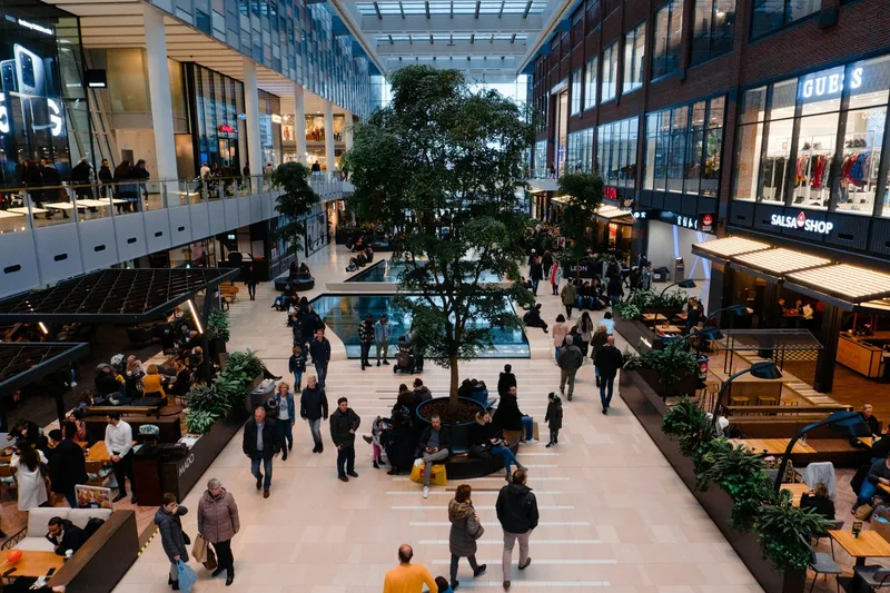
  • Retail and Tourism: MDTs support accurate staff scheduling by adapting workforce deployment to actual demand, using precise flow and interaction data.
  • Smart Cities & Roads: By focusing on vulnerable road user (VRU) safety, MDTs provide the accurate perception needed for accident reduction initiatives like Vision Zero.
  • Industrial & Logistics: Anonymous monitoring of workers and industrial vehicles enhances workforce safety and delivers comprehensive situational awareness, reducing false positives.

Conclusion: The Future of Digital Twins with Spatial Intelligence

Integrating people flow monitoring into Digital Twins represents a significant advancement for infrastructure operators seeking to address the challenges of visibility, capacity, and privacy.

MDTs, powered by LiDAR and Spatial Intelligence, provide the actionable insights needed to optimize operations, enhance safety, and respect privacy across a wide range of environments.

As leaders in this field, we at Outsight are committed to delivering robust, privacy-preserving solutions that help organizations achieve measurable improvements in efficiency and safety. Our technology is trusted by operators worldwide to provide the real-time, 3D spatial awareness that modern infrastructure demands.

The adoption of MDTs with LiDAR and Spatial Intelligence is setting a new standard for operational excellence, enabling organizations to address challenges that were once considered unsolvable.
Related Articles

TECHNOLOGY

What's a Motional Digital Twin?

How the third generation of Digital Twin technology is transforming the way infrastructure operators understand and optimize the movement of people and vehicles.

SECURITY

Making Spaces Truly Smart with LiDAR based People Counting

Enhance efficiency, optimize costs, and ensure security in smart spaces, from retail outlets and offices to large venues and public areas.

Let's connect

Send us a Message

Drop your email and we'll get back to you as soon as possible.

Frequently Asked Questions

  • What is the difference between a static digital twin and a Motional Digital Twin?

    A static digital twin, such as a BIM model, captures the geometry of a building and the status of fixed assets. A Motional Digital Twin adds the layer neither BIM nor IoT-sensor twins address: the continuous, individually resolved trajectories of every person, vehicle, and robot moving through that space. Outsight pioneered this third generation of digital twins, building the Motional Digital Twin concept around infrastructure-mounted LiDAR sensors that feed a real-time, anonymous 3D replica of how occupants and assets actually move. The two approaches are complementary rather than competing. Operators typically layer a Motional Digital Twin on top of an existing BIM, gaining the dynamic dimension without discarding the spatial context already built.

  • Why does LiDAR outperform camera-based analytics for large-area continuous tracking?

    Camera-based analytics are 2D and lighting-dependent: they lose accuracy in shadows, glare, and crowds where people occlude each other. LiDAR emits its own laser pulses and measures surfaces in 3D regardless of ambient light, fog, or darkness. Because it captures depth natively, it can assign a unique spatial identity to each individual across a wide area without any image ever being formed. Outsight's infrastructure-based approach builds on exactly this principle, using LiDAR to feed a real-time Motional Digital Twin that tracks every person and vehicle anonymously by shape and motion rather than by face or biometric data. This structural difference makes cameras and LiDAR complementary technologies rather than direct substitutes: LiDAR provides the spatial backbone, while cameras contribute attribute data where needed.

  • How does a Motional Digital Twin help when a facility cannot expand its physical footprint?

    When new construction is not feasible, the only lever for handling growth is improving utilization of existing space. Outsight's Motional Digital Twin surfaces precise occupancy, queue depth, and throughput figures in real time, allowing operators to shift staffing to bottlenecks before queues form rather than after. Predictive forecasting, derived from historical trajectory patterns, allows resource deployment changes to be made preemptively rather than reactively. This approach has been applied at constrained airport terminals such as Bordeaux Airport and Paris-Charles de Gaulle, where physical expansion is limited but passenger volumes continue to grow. The result is that facilities extract more throughput from a fixed square footage without adding a single square meter.

  • What does 'anonymous by design' mean in practice for a LiDAR deployment?

    LiDAR pulses measure the geometry and position of surfaces. No pixel, no face, and no license plate is ever produced at the sensor level. An entity in the system is represented as a 3D bounding box with a classification and a trajectory, not as an image. This is precisely what Outsight describes as "anonymous by definition": because LiDAR captures shape and motion rather than visual detail, there is nothing to anonymize after the fact, since no personally identifiable information enters the pipeline in the first place. In deployments such as Dallas Fort Worth Airport and SNCF train stations in France, this structural property means GDPR compliance is an outcome of the hardware choice itself, not a data-processing configuration applied downstream.

  • Can the same Motional Digital Twin deployment cover both indoor terminals and outdoor curbside areas?

    Yes. LiDAR sensors operate reliably in full sunlight, complete darkness, rain, and fog because they generate their own illumination and measure returned laser pulses rather than relying on ambient light. A single shared 3D point cloud can fuse sensors mounted indoors on ceilings with sensors mounted on outdoor gantries and poles. The Outsight Motional Digital Twin is built around exactly this topology: infrastructure-mounted sensors feed a unified real-time model where a tracked entity retains its anonymous unique ID as it crosses between indoor and outdoor coverage zones. At airports such as Dallas Fort Worth and Paris-Charles de Gaulle, this gives operators a continuous, uninterrupted view of the journey from curbside drop-off through check-in to gate, without any camera-based biometric exposure.

  • How does Motional Digital Twin data connect to robot or autonomous vehicle workflows on an industrial site?

    Infrastructure-based sensing means the sensors are fixed in the building rather than aboard each machine. Every autonomous mobile robot or vehicle operating in the facility receives a beyond-line-of-sight picture of the entire site from a shared Motional Digital Twin feed, without needing its own onboard perception stack for situational awareness. Outsight pioneered this approach, deploying it in industrial environments such as BMW factories, where a single infrastructure layer serves all machines simultaneously. This model is the inverse of the traditional autonomous-vehicle design: one shared infrastructure layer replaces duplicated onboard sensors on every individual machine, lowering per-robot hardware cost and eliminating the blind spots each robot would otherwise have.

  • Why are Motional Digital Twins considered the third generation of digital twin solutions?

    Outsight positions Motional Digital Twins (MDTs) as the third generation of digital twins because they make digitizing movement a core capability. Legacy digital twins and static sources such as Building Information Modelling (BIM) focus primarily on assets. MDTs add continuous, real-time tracking of how people and vehicles move through a facility, with real-time awareness built into both data acquisition and processing, so the twin can have an immediate operational impact.

  • How many people can a LiDAR-based Motional Digital Twin track at the same time, and how precisely?

    A Motional Digital Twin built on Spatial Intelligence and 3D LiDAR can track thousands of individuals simultaneously across an entire site. Tracking is continuous and reaches centimeter-level precision, which gives operators a structured, contextualized understanding of movement at the level of individual trajectories. This granular data reveals movement patterns that were previously invisible to operators, going well beyond aggregate counts of how many people entered a space.

  • How much can Motional Digital Twin queue monitoring cut wait times at major transport hubs?

    According to Outsight, real-time queue monitoring with Motional Digital Twins has helped major transport hubs reduce average wait times by up to 20% during peak hours. The gain comes from real-time and predictive insights such as actual and forecasted wait times, resource utilization, the precise occupancy of waiting areas and the actual queue length at security. With this information, operators can make timely, targeted adjustments to staffing and facility usage within the constraints of their existing facilities.

  • What predictive insights does a Motional Digital Twin give airport operators working at full capacity?

    Airports often operate near or at full capacity, so they must get more out of existing facilities. A Motional Digital Twin provides real-time and predictive insights such as actual and forecasted wait times and resource utilization. It also reports specific values such as the precise occupancy of a waiting area or the actual queue length at security. Operators use these insights to make timely, targeted adjustments to staffing and facility usage.

  • What alerts can a Motional Digital Twin trigger at airport curbsides and transportation hubs?

    At transportation hubs, Motional Digital Twins accurately count people and vehicles, measure dwell times and monitor queues. They also provide real-time alerts for overstays, spacing and speed. Outsight states that these capabilities enhance both efficiency and safety at curbside areas. The alerts rely on continuous Spatial Intelligence tracking based on 3D LiDAR, which perceives in 3D over long distances, emits its own light and keeps working reliably in complete darkness or variable lighting.

  • How do Motional Digital Twins help railway operators prevent incidents on crowded platforms?

    On railway platforms, Motional Digital Twins continuously monitor passenger trajectories. By following how people move in crowded situations, the system helps operators anticipate risky behaviors, which enables proactive incident prevention. The monitoring relies on Spatial Intelligence built on 3D LiDAR and is anonymous, since people are represented only as symbols in the system and no images are recorded or displayed. This lets operators act on precise movement data while preserving passenger privacy by design.

  • How can a Motional Digital Twin support Vision Zero road safety programs in smart cities?

    For smart cities and roads, Motional Digital Twins focus on the safety of vulnerable road users (VRUs). They provide the accurate perception that accident reduction initiatives like Vision Zero need. This perception comes from continuous 3D tracking based on LiDAR and Spatial Intelligence, which maintains consistent performance regardless of weather or lighting. Tracking is also anonymous: people are represented only as symbols, and no images, facial or identifying data are collected.

  • How do retailers and tourism sites use Motional Digital Twins to schedule staff?

    In retail and tourism, Motional Digital Twins support accurate staff scheduling by adapting workforce deployment to actual demand. The twin supplies precise flow and interaction data captured through continuous, anonymous tracking with Spatial Intelligence built on 3D LiDAR. Managers can use this data to align staffing with real demand. Privacy is preserved by design, as the system records no images, faces or other identifying data, and people are represented only as symbols within the platform.

  • How do Motional Digital Twins improve worker safety in industrial and logistics sites?

    In industrial and logistics environments, Motional Digital Twins anonymously monitor both workers and industrial vehicles. This enhances workforce safety and delivers comprehensive situational awareness across the site. Outsight states that this approach also reduces false positives. Since people are represented only as symbols and no images are captured, the monitoring respects worker privacy while still providing precise, continuous tracking based on 3D LiDAR and Spatial Intelligence.

  • What data blind spot do Motional Digital Twins solve for airports and industrial facilities?

    Traditional infrastructure management often cannot see or quantify the real-time movement of people and vehicles. Outsight explains that this data gap leads to inefficiencies, unresolved customer pain points and unaddressed safety risks. Motional Digital Twins close the gap by acting as real-time digital replicas that continuously track and analyze movement throughout a facility, turning invisible flows into actionable insights so operators can move from reactive management to proactive decision-making.

  • What are the different generations of digital twins?

    The first generation of digital twins were static models of buildings and assets, such as BIM, used for design and facility management. The second generation added live asset data from IoT sensors, for example equipment status or energy use. The third generation, which Outsight calls the Motional Digital Twin, adds the continuous movement of people, vehicles and robots through the space, revealing how the site actually operates. It is built on 3D LiDAR and Physical AI and can be layered on top of an existing BIM model.