Skip to content
Insights
LiDAR: a new Era for flow monitoring in Airports

LiDAR: a new Era for flow monitoring in Airports

LiDAR is a game changer technology enabling a whole new level of situation awareness in many airport contexts, from security to operational excellence.


3D People Flow Monitoring Solutions are bringing a New Era to Airports thanks to LiDAR.

This enabling technology offers 3D measurements with great precision and operates in any lighting condition, unlike older technologies like cameras.

Moreover, LiDARs can cover much larger areas and protect privacy by design.

Outsight’s Software allows Airport operators to leverage this amazing technology for different needs and a diversity of stakeholders.
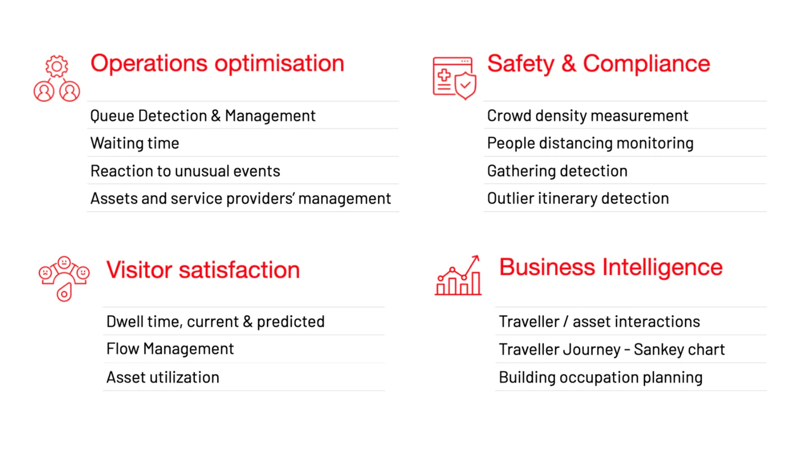
Key benefits of lidar in airports

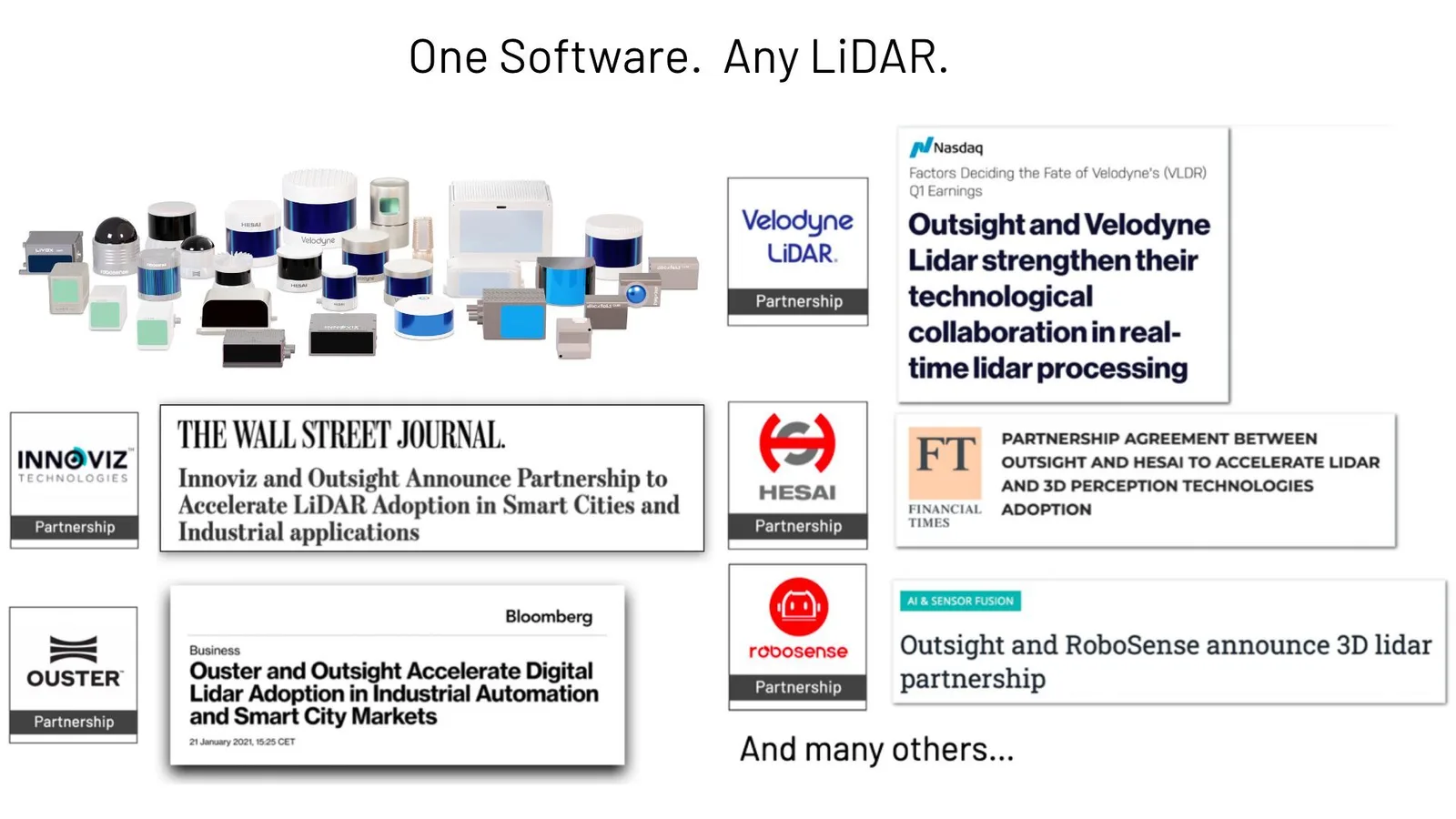
Our solution works with a large number of LiDAR manufacturers and turns raw data into Actionable Insight.
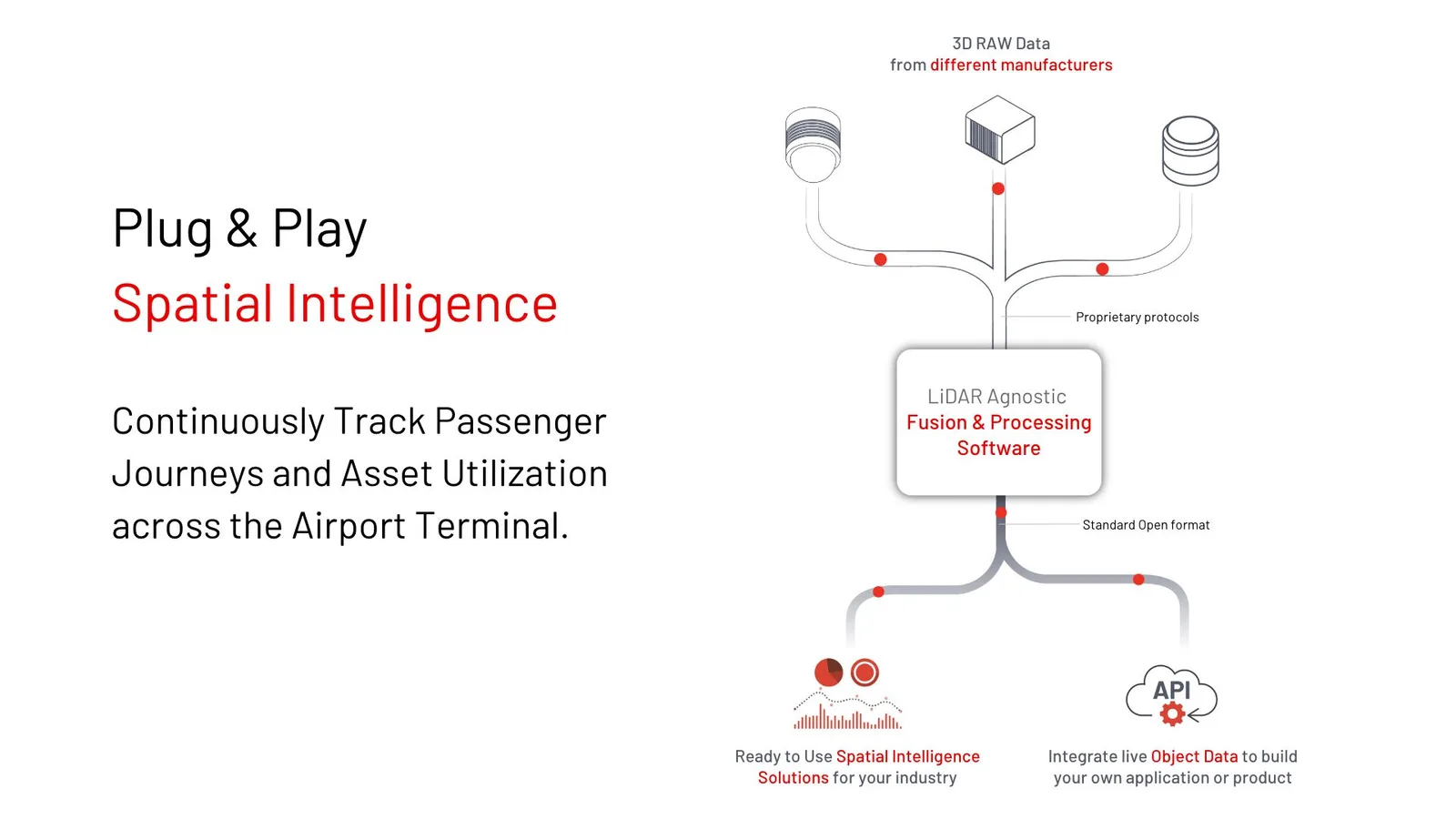
Outsight activity for airports in a nutshell, Plug and Play Spatial Intelligence

Thanks to our hardware-agnostic solution and strategic partnerships with most hardware manufacturers, you can use the best sensor or combination of them:
Compatible with all lidars 1

Among other capabilities you can for example continuously track passenger journeys and monitor asset utilization.

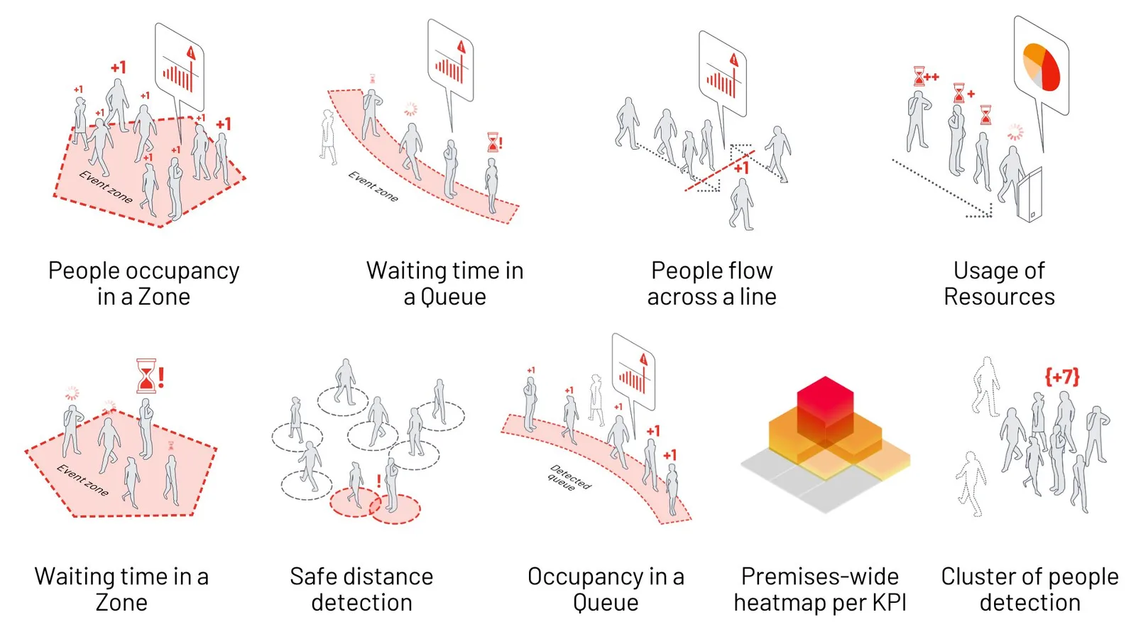
The user-friendly web dashboard allows you to monitor dozens of key performance indicators and receive instant alerts.
Airport kpis

The Advanced Analytics performed by the solution, such as the automatic detection of overflowing passenger queues, provide you valuable insights for both real-time decision making as well as long-term planning.

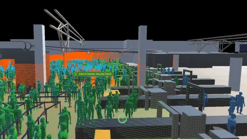
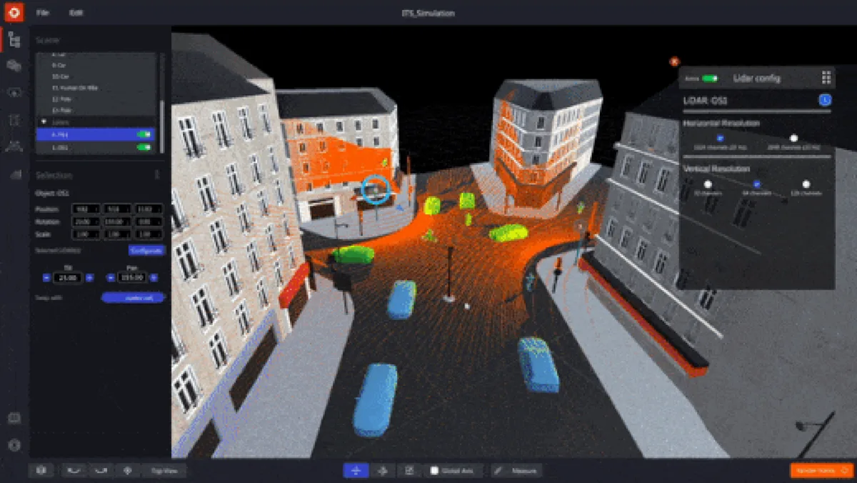
Deploying the solution is super easy: we provide full support on each stage of the process, starting from 3D Simulator Tool for planning and optimizing LiDAR placement and Installation.

First Multi-Vendor 3D LiDAR Simulator Unveiled

Outsight has developed a LiDAR simulator for any use case and application, from airports to mobile robotics, smart cities and industrial applications.

Read article →
Large scale deployments at major airports such as Paris Charles de Gaulle and Orly have led to unparalleled transformation.

With its scalability and advanced software algorithms, the Outsight Spatial Intelligence Platform is leading the way in the use of 3D LiDAR data in dozens of use cases.

Achieve Operational Excellence. Improve Security, Safety and Travellers’ satisfaction.

All this can be accomplished thanks to Outsight’s Spatial Intelligence Plaftorm and the power of LiDAR.

Learn more:

LiDAR Manages Increased Airport Traffic

See how and why Airports are increasingly using LiDAR-based software solutions to tackle their biggest challenges, leveraging the unique value of Spatial Intelligence.

Read article →


Related Articles

AIRPORTS

The Seven reasons why 3D LiDAR is Transforming Airports

Thanks to its accuracy and spatial perception, anonymous tracking capabilities and wide detection range, 3D LiDAR technology is transforming airports.

AIRPORTS

LiDAR Software Helps Airports to Manage Increased Traffic

See how and why Airports are increasingly using LiDAR-based software solutions to tackle their biggest challenges, leveraging the unique value of Spatial Intelligence.

Let's connect

Send us a Message

Drop your email and we'll get back to you as soon as possible.

Frequently Asked Questions

  • What is the difference between 2D and 3D LiDAR for airport passenger tracking?

    2D LiDAR scans a single horizontal plane, producing a cross-section of the scene. It can count objects crossing a line but loses accuracy in multi-level crowds or when people overlap vertically. 3D LiDAR scans a full volumetric field, capturing height, depth, and shape simultaneously. This allows the system to distinguish a person pushing a trolley from a lone pedestrian, separate overlapping individuals in dense queues, and track posture changes (sitting, crouching, falling) that 2D sensors miss entirely. Outsight's infrastructure-based approach relies exclusively on 3D LiDAR for this reason, and deployments at airports such as Dallas Fort Worth and Paris-Charles de Gaulle demonstrate how volumetric sensing translates into reliable, anonymous passenger flow monitoring at scale.

  • How far in advance can a LiDAR-based queue system predict a security bottleneck?

    Queue-depth trends measured in real time can feed short-horizon forecasting models that project lane saturation 15 to 30 minutes ahead, giving supervisors enough lead time to open additional lanes or redirect passengers before a bottleneck forms. The prediction relies on combining the current queue growth rate with historical demand patterns for the same time-of-day and day-of-week. In deployments such as Dallas Fort Worth, Outsight's SHIFT platform runs this analytics layer continuously through a sub-50ms pipeline, tracking shape and motion across the terminal without capturing any biometric data. The result is a system that surfaces actionable alerts without requiring manual operator input at every step.

  • Does a LiDAR flow monitoring system require internet connectivity to function?

    Core perception and tracking run at the edge, on local processing hardware co-located with the sensors. Outsight's SHIFT platform follows this architecture: the pipeline from raw point cloud to tracked entity and live KPI dashboard operates entirely on-premise, so a WAN or internet outage does not interrupt real-time alerting or tracking. Cloud connectivity, when present, is used for remote monitoring, firmware updates, and offloading historical data to long-term storage rather than for the live detection loop. This on-premise-first design is particularly relevant in airport environments, where network reliability and data sovereignty are critical operational requirements.

  • How does a LiDAR simulator help airports plan sensor deployments before installation?

    A multi-vendor 3D LiDAR simulator lets planners import a floor plan or BIM model, position virtual sensors, and run synthetic point-cloud traces to evaluate coverage, blind spots, and sensor overlap before a single device is mounted. The output is a validated sensor layout with documented coverage guarantees per zone. Outsight introduced the first multi-vendor LiDAR simulator of this kind, built directly into the SHIFT platform, to make pre-installation planning systematic rather than empirical. By resolving coverage gaps in simulation, airport operators reduce the risk of costly re-cabling or sensor additions after go-live, a step that has proven especially valuable in large-terminal deployments such as Dallas Fort Worth, the world's largest 3D LiDAR airport deployment.

  • Can LiDAR flow data be used to measure airport staff performance against contracted SLAs?

    Yes. Because the system tracks every entity continuously, it can measure objective dwell times at each service point, queue wait times per lane, and the elapsed time between a queue threshold breach and the opening of a new lane. Outsight's Motional Digital Twin captures exactly this kind of operational data in real time, anonymously, across the full terminal floor, which means airports like Dallas Fort Worth or Paris-Charles de Gaulle can compare measured figures against SLA commitments written for security operators, ground handlers, or cleaning contractors. The result replaces manual observation with a continuous, timestamped record that both the airport and the service provider can audit without any privacy concerns attached to the underlying data.

  • What happens to LiDAR tracking accuracy when an airport terminal is under renovation and the floor plan changes?

    LiDAR perception operates on live point clouds, not on a stored floor map, so temporary walls, scaffolding, and blocked corridors appear as new geometry in real time. The sensor network adapts automatically to the changed physical environment. The analytics layer, however, which references zone boundaries drawn on the digital twin, does require an operator to update zone definitions when a corridor is closed or a new checkpoint opens. In Outsight's Motional Digital Twin approach, deployed at airports such as Dallas Fort Worth and Paris-Charles de Gaulle, zone boundaries are managed through the SHIFT platform, meaning operators can redraw affected areas without interrupting the broader tracking pipeline. Without such an update, KPIs for the affected zone will reflect the old geometry rather than the new operational reality.