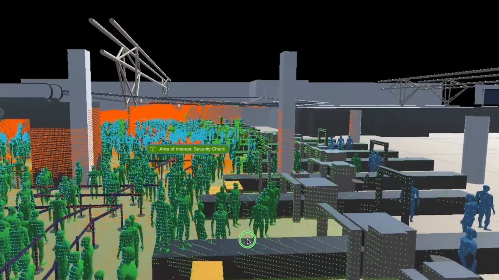
Airports, with their complex environments and heavy, continuous flows of people, have unique challenges that can be effectively addressed with 3D LiDAR sensing solutions and that can’t be solved with legacy systems such as cameras.
Whether it’s the superb accuracy of LiDAR’s laser light pulses and wide detection range, which can be used to efficiently monitor all areas of a large airport facility, or the anonymous nature of LiDAR technology, which keeps passengers’ identities private, there are a lot of attractive features that make it an ideal sensor technology for airports.
Learn more about specific LiDAR airport solutions, such as Outsight’s Spatial Intelligence Platform by checking this article
Keep reading to learn about seven key reasons why LiDAR (Light Detection and Ranging) solutions are a game-changer for airports.
3D LiDAR Technology for Airport Use – 7 Key Benefits
With a loosening of COVID-19 restrictions and an influx of travelers, airports faced increased congestion.
A high volume of people in airports, combined with staffing shortages, means that airports need to be increasingly efficient at handling many passengers while maintaining security and safety.
With the rising level of complaints leveled against airports and airlines by disgruntled passengers, efficient airport operations became essential for a profitable business.
Here are the most important benefits of LiDAR technology that airports can leverage to improve daily operations, enhance security and safety, and boost customer satisfaction.
1. High Precision Accuracy
Advanced 3D LiDAR technology uses laser pulses of light that are transmitted, reflected off the person or object, and then detected by the receiver.
Due to this design, the system is extremely precise.
In an airport terminal, this high level of accuracy stays the same no matter how far away the LiDAR transmitter is from the target.
This means that accuracy can be as low as a few centimeters. In real-life airport operations, this level of precision lets managers accurately track the movements of travellers, vehicles, and planes around large, complex airport facilities.
2. Uninterrupted Tracking Technology
The 3D LiDAR solution system provides continuous 24/7 tracking throughout the entire airport facility, inside the terminal, and outside on the tarmac.
Airport staff can monitor customer traffic from arrival to departure as they move through the airport, and individual-level detail can be seen at every location.
This can include the tracking of airport parking garages and outside lots, curbside arrivals, check-in counters, terminal lounges, dining areas, retail stores, TSA security checkpoints, and departure gates, at all hours and in real-time.
3. Anonymous Tracking by Definition
Privacy is a serious concern when it comes to sensor data. Unlike older camera sensors, LiDAR sensors are unable to identify specific individuals or capture biometric data such as skin tone or facial features.
LiDAR tracking is fully anonymous, and therefore, it passes an important test for widespread public trust and acceptance.
While people and objects in the terminal and on the airport grounds can be reliably detected, counted, and classified with paths traced and data collected from a distance, individual privacy is protected since no personal data can ever be obtained.
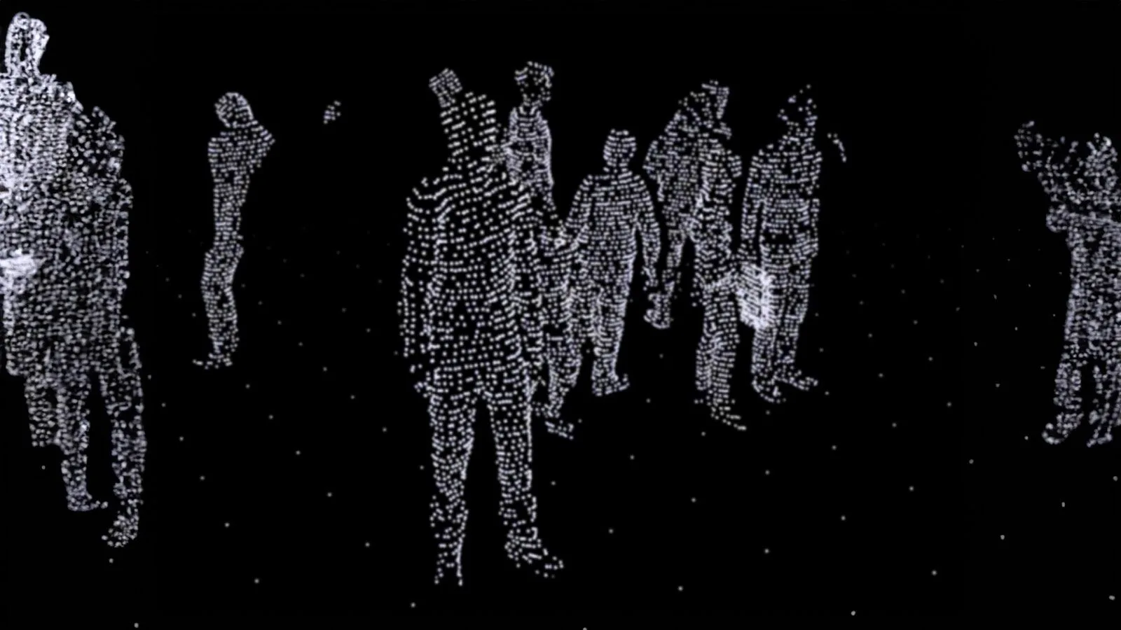
LiDAR technology completely guarantees privacy in an airport terminal
Note that Anonymous is not the same as Anonymized, learn the difference here:
Anonymous vs. Anonymized : Learn the Difference
Understanding Anonymity in Sensor Data: discover the inherent privacy characteristics of each type of Sensor data and the potential risks associated with anonymizing sensitive information
Read article →

Since the light-emitting LiDAR device is an active sensor [that means that it generates its own light], versus a camera’s passive sensor, it can operate in total darkness and is not affected by variable lighting conditions.
This feature is critical for airport sensor applications that need to be fully operational at all hours for passengers and planes that leave and arrive throughout the day and night.
The capability of working both indoors and outdoors contributes to enabling a continuous tracking from curbside to tarmac.
This is important as the same technology can be for example applied to Curbside / Taxi Stand monitoring and optimization, while keeping an uninterrupted track of travelers when entering the terminal.
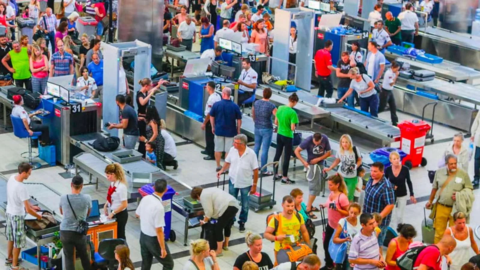
Staff and travelers security inside the terminal must be guaranteed even in suboptimal lightning conditions
5. Large Detection Ranges
LiDAR technology has a detection range approaching almost 1,000 feet.
This makes LiDAR solution systems more efficient and cost-effective than cameras: a large terminal can be fully covered by a few devices when using LiDAR software, and this amounts to reduced costs for equipment and installation.
The enhanced long-range detection capabilities of these sensors mean that significantly fewer units are required to cover the same area compared to camera and stereovision solutions. Specifically, between 3 to 10 times fewer sensors are needed, resulting in substantial cost savings in terms of setup, wiring, networking, and maintenance.
In addition to the wide range, LiDAR devices can be used anywhere and in any type of weather or environmental condition, including rain, snow, lightning, and powerful winds.
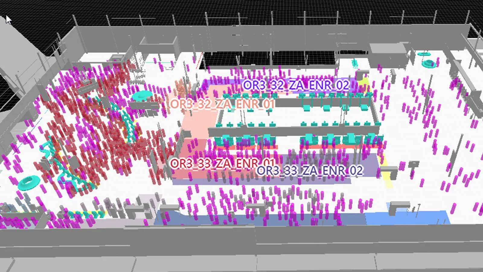
LiDAR solution provides highly-accurate information even in large environments such as an airport terminal or a big train station
6. Spatial Perception
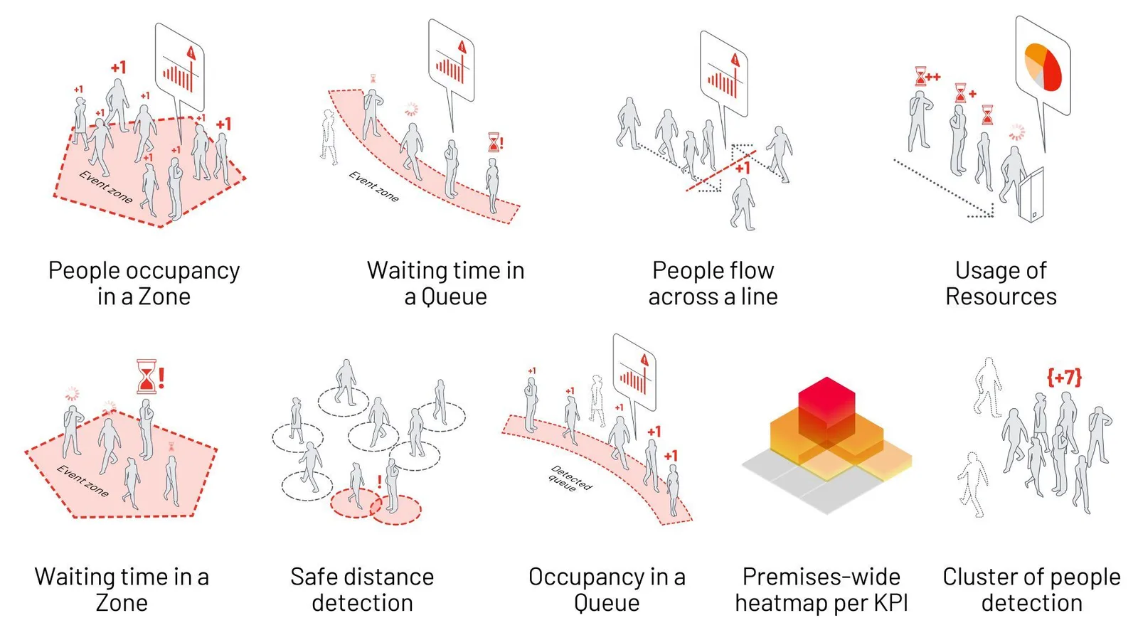
With 3D LiDAR-processed data, which is made by the LiDAR software, as an airport operator you can gather a wide range of information that can be used for Spatial Intelligence, get operational insights, and help making decisions in the moment.
The information gathered through LiDAR solutions helps optimizing operations, such as waiting times and queue management, reactions to unexpected events, and the management of service providers.
It can help increase customer satisfaction by smoothing the flow of people and providing accurate information throughout their trip.
Thanks to Outsight’s Spatial Intelligence software, a complete set of KPIs are available:
You can learn more about our solutions for Airports.
7. Multi-Purpose Use
While airports use LiDAR systems to track passengers, the same technology and infrastructure can be used for many other purposes.
One can watch and manage all apron operations, such as moving aircraft, loading and unloading, boarding, and refueling, as well as moving vehicles and planes that are parked.
Parking lots and garages can also be monitored in addition to runways.
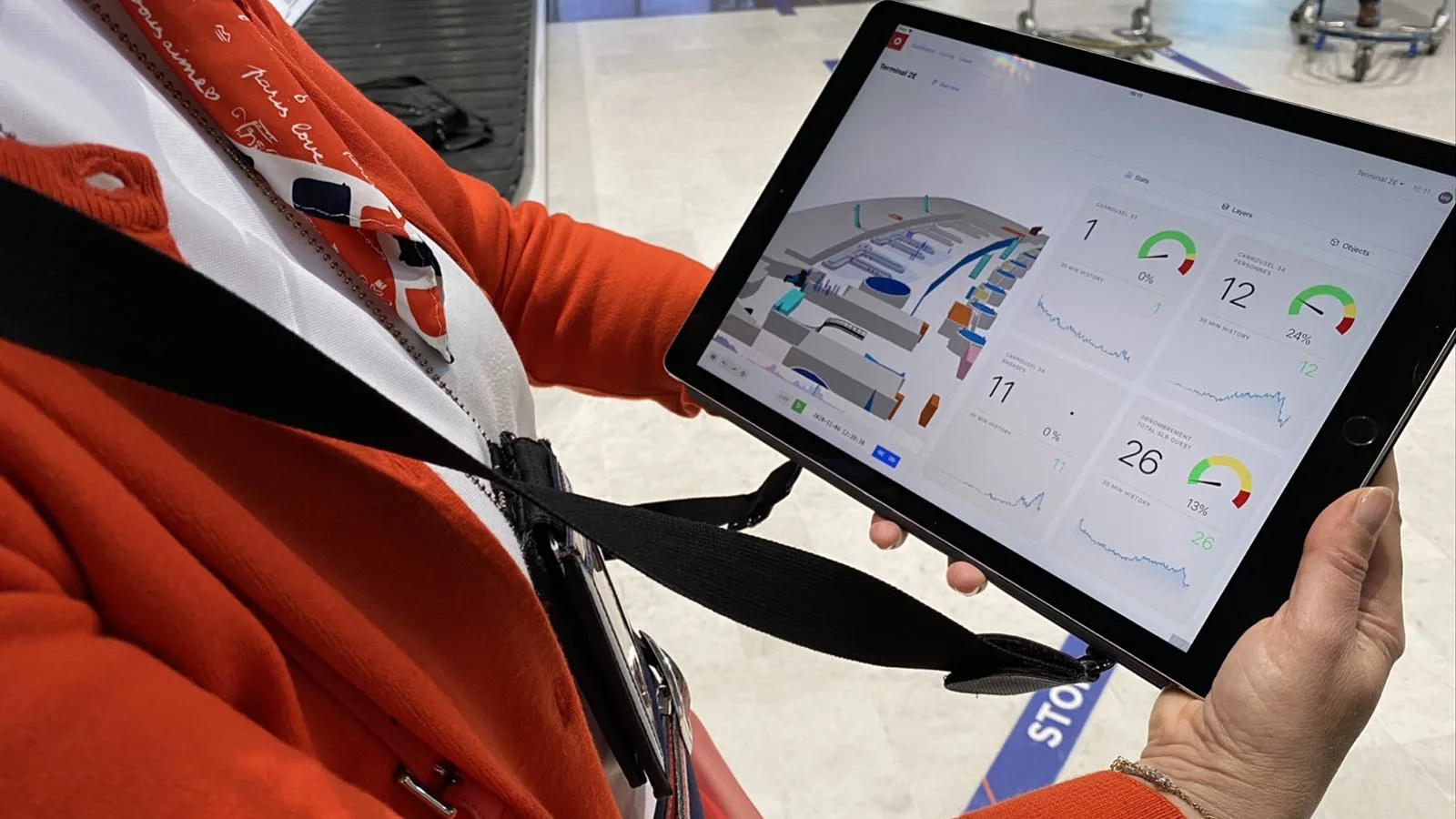
Terminal operators can oversee and manage all apron operations in one single accessible dashboard
Outsight Helps Airports Use LiDAR Effectively
With all these benefits that LiDAR offers to airport operations, you may wonder why the technology has not been more widely adopted.
The primary reason why LiDAR isn’t used by every facility is not its performance or cost but its complexity.
The raw data that LiDAR hardware collects is unprocessed and not of any practical daily use. Furthermore, there are currently no standards that maintain consistency in the network and output format among different manufacturers and the 2D image processing techniques used by the Computer Vision industry cannot be used for LiDAR’s 3D data.
Other reasons for slow adoption include the difficulty of processing huge amounts of data and the need to use multiple sensors and combine this data.
However, there is a solution that will help airports easily use this valuable technology.
Outsight’s 3D LiDAR software converts raw sensor data into manageable and actionable information in a usable format that can then be brought into various applications.
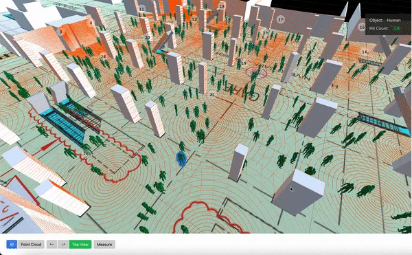
Many different and actionable KPIs can be obtained from Outsight’s Spatial Intelligence solution
Using the software accelerates and simplifies LiDAR-driven projects, and it works with any LiDAR sensor device.