With decades of experience working with various LiDAR vendors and the compatibility of Outsight’s Spatial Intelligence Platform with all relevant ones, we often get asked: which is the best LiDAR sensor?
The reality is that, unlike cameras, which are technically similar and use the same technology principles, devices using LiDAR technology can be made in many different ways. Therefore, the best solution can only be determined for a specific context.
This article aims to clarify these different design choices and help you understand why most of our customers use an average of three different hardware vendors on the same premises.
Recommended Readings
First, it’s highly recommended to read these two key articles to understand what is LiDAR and how Lidar works:
Understanding the basics of 3D LiDAR Technology
Light Detection and Ranging, also known as LiDAR, is a technology for remote sensing that is used to measure distances in an environment.
Read article →
Why Do You Need LiDAR Sensor Freedom?
Choosing a LiDAR-based solution for your operations, whether in an airport, a train station, a logistics center, or a city infrastructure, means more than selecting a sensor.
Read article →
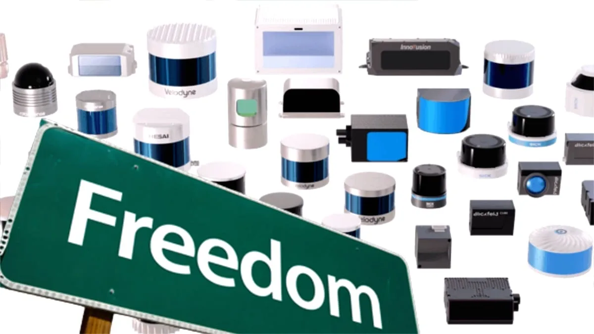
The differences between LiDARs
The following are some of the variables a manufacturer must choose to build their device:
| Variable | Most popular | Other Options |
|---|---|---|
| Device type | Rotating | Dome-like, Narrow Field of View |
| Illumination technique | Scanning | Flash, Hybrid |
| Detection method | Direct Time of Flight | FMCW, Others |
| Laser technology | Diode | Fiber Laser, Others |
| Peak power (Range) | Kilowatts | Tens of Watts |
| Laser Wavelength | 905nm | 1550nm, 1064nm, 840nm |
| Receiver technology | Silicon | InGaaS, Others |
| Horizontal Field of View | 360º | From 20º to 360º |
| Vertical Field of View | 30º | From 20º to 360º |
| Angular Resolution | Tenth of degrees | Degrees |
| Frame-rate | 20fps | 10fps, Up to 1000fps |
| Points per second | Millions | Hundreds or Tens of Thousands |
| Range | Tens of Meters | Hundreds of Meters |
| Pattern | Repetitive | Random, Others |
| Reflectivity data | Yes | No, Yes with additional data |
| Laser Hits per azimuth | Single | Double, Multiple |
| Network Protocol | UCP | TCP, Proprietary |
Each of these choices can be combined, theoretically resulting in over 15 million possible lidar sensor designs!
In reality, not all variables are independent (e.g., resolution depends on others like FoV, points per second, and frame rate), but there are still many different possibilities.
A key question is: is there any value for the end user in creating different sensor configurations?
Let’s use just one of these variables to see how this concretely translates into advantages and disadvantages for the user.
Choosing the right Field of View
As a reminder, the Field of View (FoV) is the portion of the scene illuminated by the lasers, defined as Horizontal FoV (hFoV) and Vertical FoV (vFoV).
Different vendors propose multiple lidar sensors configurations.
For instance the lidar scanner Hesai XT-32 has a Horizontal Field of View of 360º and 31º vertically and Ouster OS-0 some 90º in vFoV (both Rotating LiDARs).
Robosense’s Bpearl illuminates the scene in similar FoV but using a Dome-like pattern, while Seyond Falcon K LiDAR focus its laser energy in a 120º x 25º FoV.
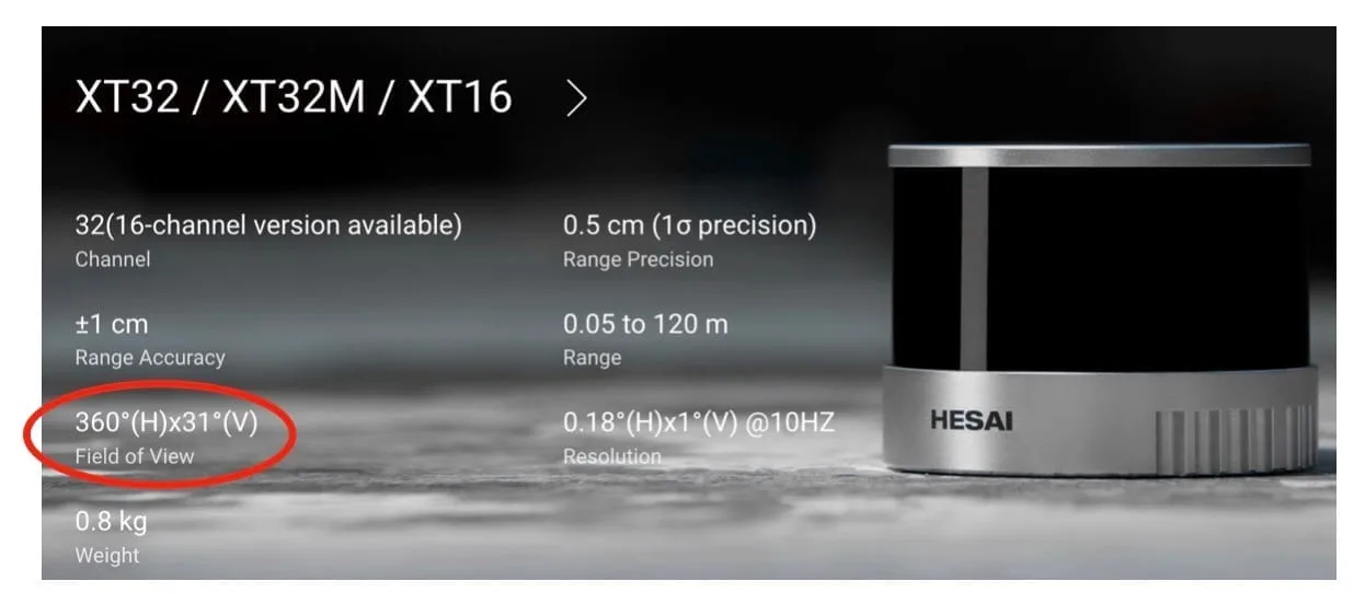
From Hesai website’s, Field of View of XT32 LiDAR
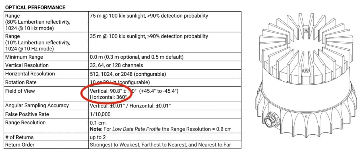
Ouster LiDAR OS-0
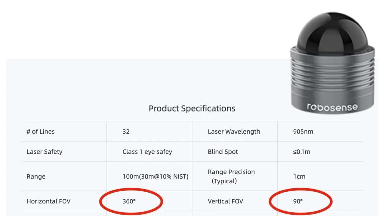
Robosense B-Pearl specifications
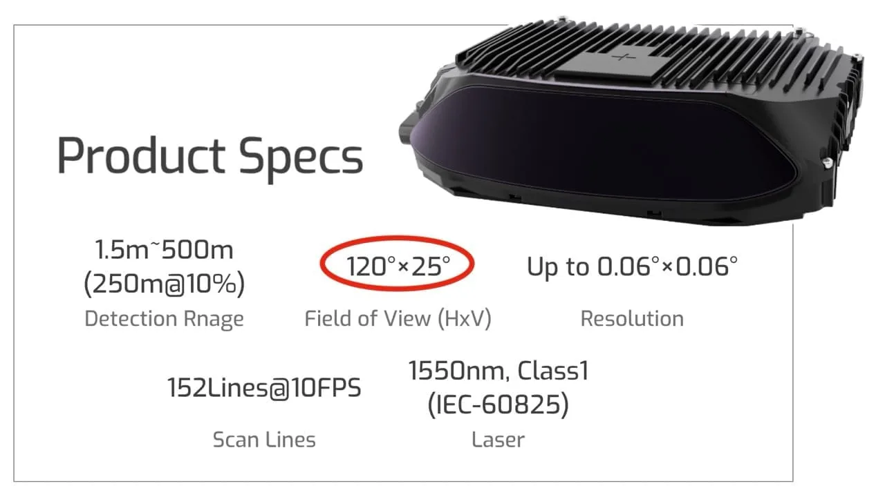
Seyond Falcon K LiDAR
For a given total energy budget, illuminating a wider field of view comes with drawbacks like lower Detection range and/or Resolution.
The figure below illustrates the consequences in detecting persons depending on the chosen trade-offs:
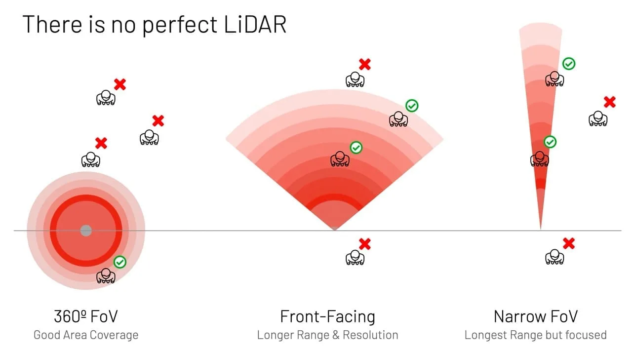
Some persons will be detected or missed depending on the lidar configuration
In reality, this drawing is too simplistic. It depicts the detection zone as a continuous field, while in fact, the laser pulses are fired at specific angles, creating blind zones that can be large enough to cause missed detections:
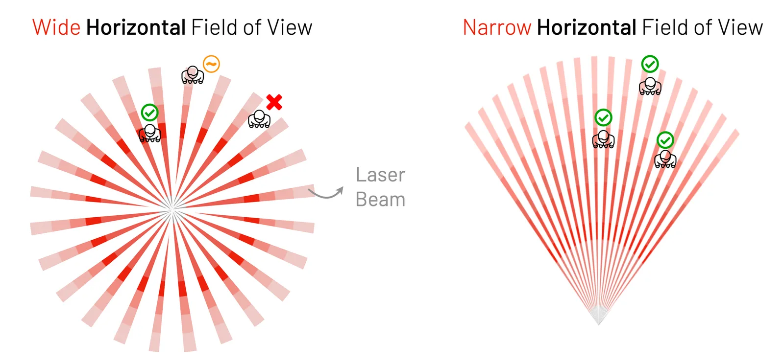
On the left, due to angular resolution (or the density of LiDAR beams per meter), some individuals are missed even if they are within the detection range. Others (in yellow) may be detected but with only a few points, which may not be enough to distinguish them from noise.
To make things even more interesting, don’t forget the Vertical Field of View and Vertical Angular Resolution, which can vary greatly between sensors:
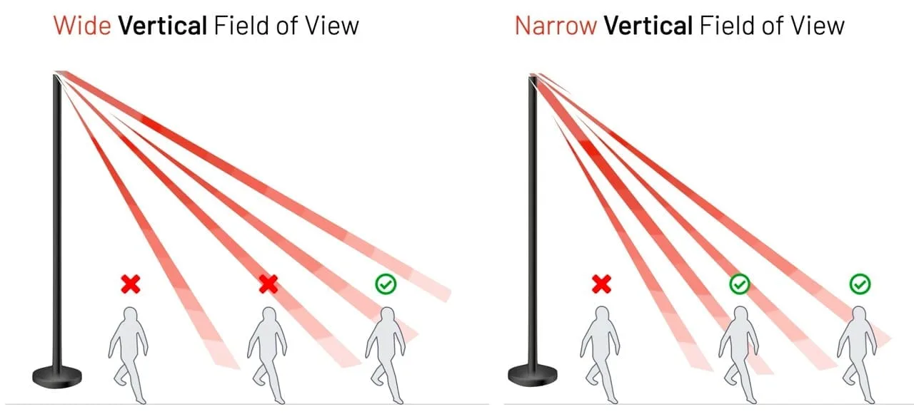
Because of their Vertical Angular Resolution, some Laser Beams will not detect some persons
What about sensor cost?
If your application can’t accept these missed detections, a quick and easy solution is to add higher-resolution and wider field-of-view sensors, but this comes with a cost.
Each sensor design choice relies on very different underlying technologies:
A manufacturer using a fiber laser solution with an InGaAs detector will achieve much longer ranges [see our article on the Details of LiDAR for more information], but the bill of materials and manufacturing costs will be much higher than using CMOS-based Diode LiDAR.
It may surprise external observers that the pricing range of different models and manufacturers can go from a few hundred dollars to more than $20,000!
This huge difference creates tremendous room for optimization, or overpaying if the wrong hardware is used. In many cases, a combination of cheaper sensors may deliver better results and lower total cost of ownership (including setup, networking, and processing costs) than using high-cost ones.
Welcome to Hardware Freedom
Operators of infrastructure and high-dwell spaces, such as airports, rail stations, quick-service restaurants, and tourism sites, don’t have homogeneous facilities or needs.
On the same premises, they need to simultaneously monitor narrow, long aisles indoors with low-height ceilings, large halls with high ceilings, as well as track vehicles outdoors over wide open parking areas.
This requires using the right combination of sensors and manufacturers for the right context, in order to optimize performance and cost.
Outsight’s Spatial Intelligence software platform offers a comprehensive set of capabilities that leverage the unique value of 3D data to deliver actionable insights, which includes abstracting this hardware complexity.
In this context, two key capabilities of Outsight’s software address the complexity of choosing and using the right combination of LiDAR manufacturers and models: a multi-vendor simulation tool during the design phase and a LiDAR-agnostic processing module during the operations phase.
First Multi-Vendor 3D LiDAR Simulator Unveiled
Outsight has developed a LiDAR simulator for any use case and application, from airports to mobile robotics, smart cities and industrial applications.
Read article →
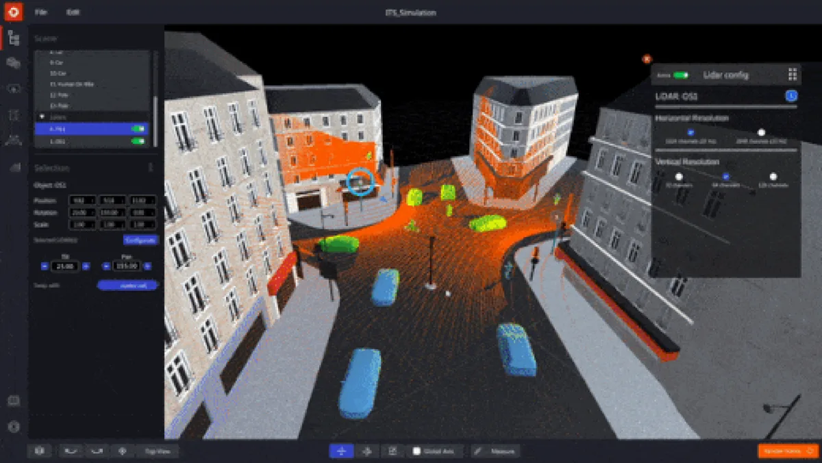
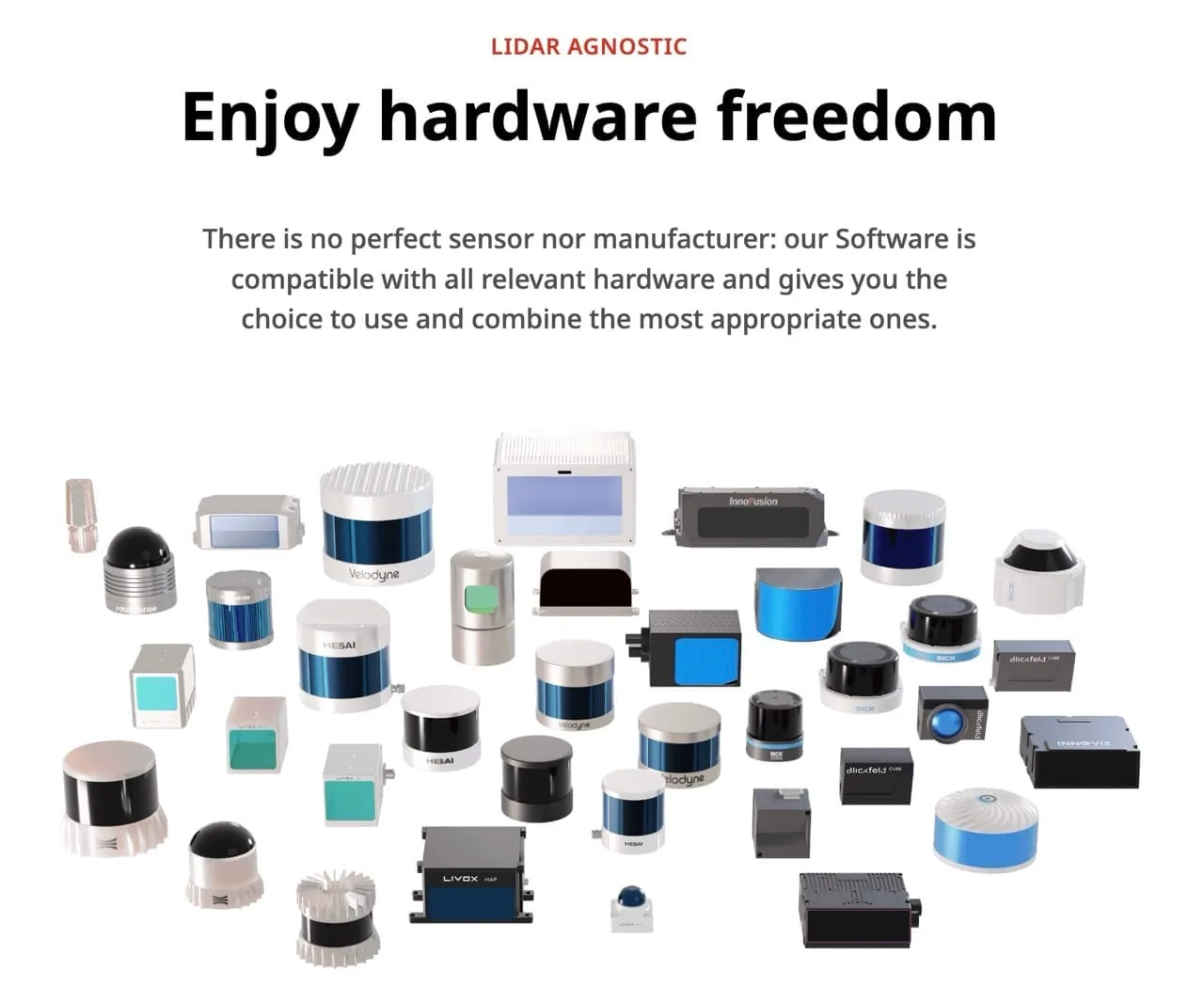
Our real-time processing software module is compatible with all relevant hardware
To learn more, don’t miss our latest whitepapers and webinars, or contact a Product Specialist.
Don’t miss the LiDAR Directory for a comprehensive list of all relevant hardware companies in the LiDAR market.