Skip to content
Insights
Visual of LiDAR point clouds enhancing operational efficiency across industrial environments.

LiDAR in Public Spaces: Top 6 Key Advantages for Improved Operations and Maintenance

Discover the benefits of LiDAR technology in public spaces: people counting, anonymity, public safety, easy installation, and error-free data.


As processes and machines become increasingly automated and sophisticated, the use of LiDAR technology has emerged as a significant breakthrough in extracting data sources that can be leveraged to enhance them.

This cutting-edge technology is proving to be also a game-changer in Public Spaces, offering a wealth of data that can be easily applied to optimize performance and efficiency but also increase safety and security.

Once the LiDAR sensors capture the spatial data, LiDAR software is used to actually process this information and create real-time KPIs and alerts that can be easily reconfigured for various use cases with only a few clicks of the mouse.

The software also allows for adjusting parameters like the field of vision, resolution, or points of interest, which are then translated into various mounting options.

Operations within public spaces, like airports, stadiums, or train stations, are just one example of the many fields that can benefit from smart sensing solutions such as 3D LiDAR hardware and software.

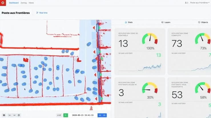
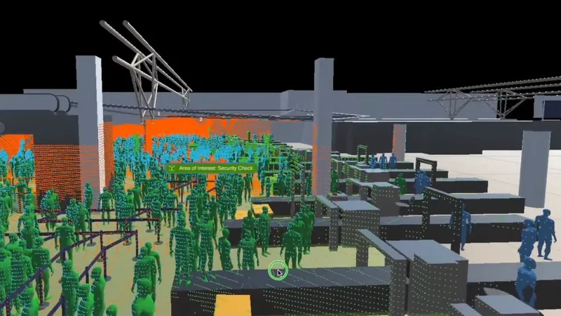
Outsight’s Spatial Intelligence Platform is helping airports, like Paris Charles-de-Gaulle Airport, to enhance their passport control management

LiDAR Solutions Key Advantages for Public Spaces

1. People Counting and Crowd Management with High Precision

People counting and crowd management technology has never been more crucial to public health than it is now, when communities worldwide are still on the road to recovery from the COVID-19 epidemic and restrictions are being lifted.

Here is where LiDAR technology comes in, with its ability to deliver precise, real-time data: it can accurately identify, count, classify, and track the movement of people and items (such as trolleys, passengers, and other objects) in a given area.

This can help public space operators to optimize traffic flow and prevent overcrowding in high-traffic areas.

Additionally, LiDAR technology can aid in the planning and design of public spaces, providing valuable insights into how people use and interact with the environment.

In the upcoming years, it will be imperative to implement computer vision based perception technology - like LiDAR - to help identify safety issues, minimize risk, improve operations, and make rail more competitive.

2. Anonymity Thanks to LiDAR Technology

Moreover, anonymity is crucial in public spaces. Compared to other sensor technologies, such as cameras, which can record people’s biometrics characteristics, LiDAR technology has a significant advantage since it can’t gather any private information.

This personal information is not required to perform crucial use cases such asverifying the number of people getting in a certain stadium zone or checking the general flow of passengers at any given moment around a train station.

Outsight software allows for individual and aggregated people tracking in a queue without requiring personal identification

3. Ensuring Crowd Safety Now and in the Future

After the data and reports are accumulated, they can be accessed, processed, and used for managing crowds public safety now and in the future through predictions.

Moreover, Outsight’s software can be used to track passengers full trajectory as they move across the whole facilities or to assess occupancy by counting and tracking the direction of people over a specific area.

People flow monitoring is critical to ensure safety and security.

Outsight’s software allows for detecting and tracking people anonymously, including precise trajectory and speed

4. Accurate Detection of Intrusions

While it may seem simple to anticipate where large crowds would congregate in these public areas, gaining access to this information in real time about certain individuals might be difficult.

This can be answered with LiDAR solutions, like the one from Outsight, which can improve the efficacy of perimeter intrusion detection systems (PIDS) for elevated-security zones, allowing for far more accurate detection of incursions, anomaly detection or unauthorised groups into critical sections inside these places.

More than detecting and tracking, Outsight’s LiDAR Software can also be integrated with a PTZ camera that would autonomously move to a target based on the movements detected

5. Easy Installation and Customization

The time of flight LiDAR sensors are straightforward to set up. Unlike similar sensor technology, which is often set up to point straight down, LiDAR sensors provide versatile sensor mounting choices to monitor and track regions from almost any vantage point.

This makes the system easy to install and tailor since the counting zones can be defined with a few clicks in the perception software.
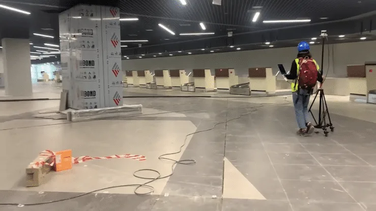
Passenger tracking and counting lidar solutions can be easily installed

A full people flow monitoring solution can be easily installed in only a few days

6. Cost-efficiency Solution

Saving money on labor is a persuasive argument in favour of LiDAR technology. Because the field of vision and detection range can be so high (up to 300m), fewer sensors are required to monitor a large region.

Due to the fact that it is capable of performing multi-point scanning, LiDAR solutions are also well suited for use in busy and crowded spaces.

Finally, LiDAR solutions can equally function in the dark; thus, they can give uninterrupted and real-time measurements even at night, enabling round-the-clock surveillance of the whole airport.
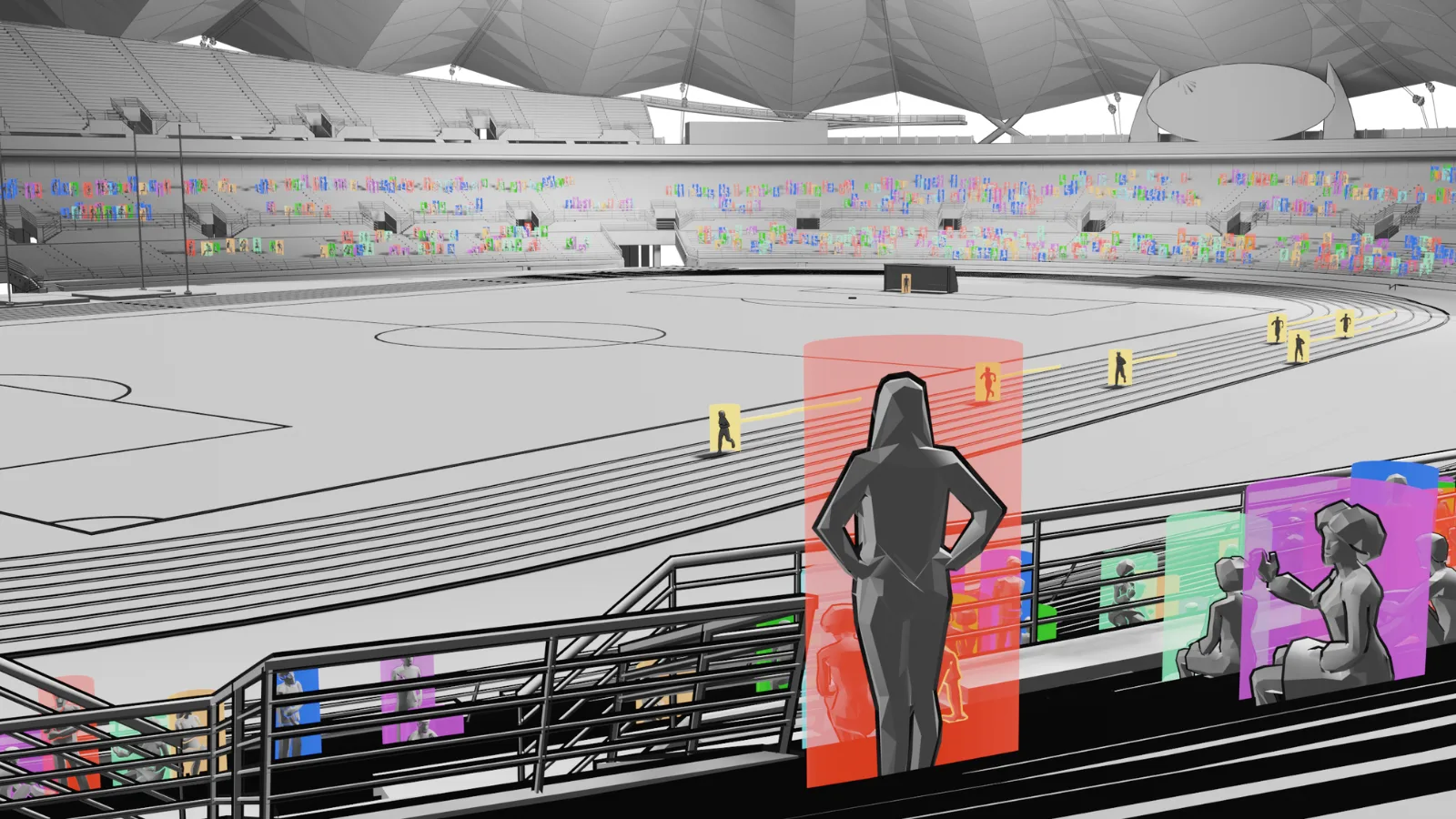
Lidar technology is the perfect solution for people counting no matter the size of the venue. It excels with crowd management with accurate 3D data

LiDAR solution provides highly-accurate information using an optimal number of sensors even in large environments such as an full stadium, an airport terminal or a big train station

What’s Next?

3D Perception Software Solutions have become an invaluable tool for public space operators worldwide, offering many benefits that improve safety, efficiency, and sustainability, and tend to play an increasingly important role in the future.

Schedule a meeting with a Product Specialist to start improving your venue operations efficiency and safety from today.
Related Articles

SECURITY

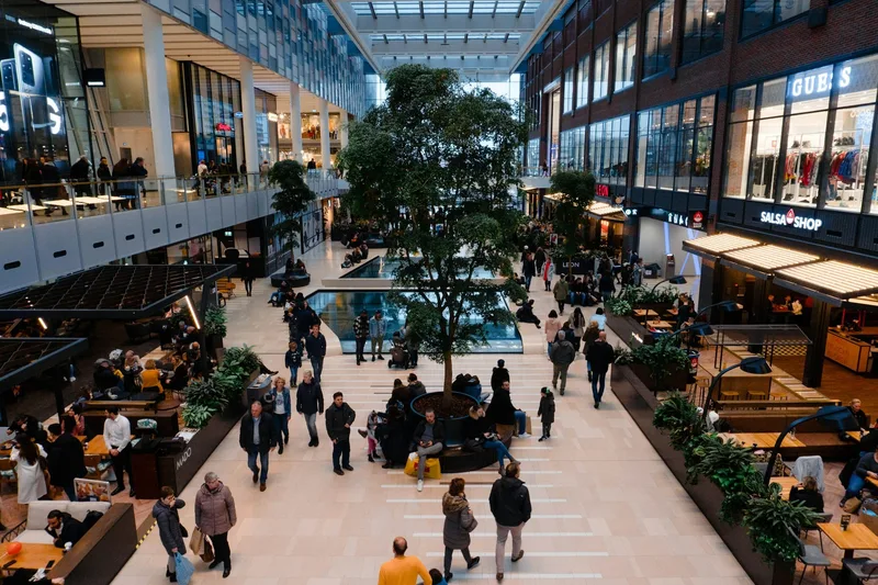
Making Spaces Truly Smart with LiDAR based People Counting

Enhance efficiency, optimize costs, and ensure security in smart spaces, from retail outlets and offices to large venues and public areas.

AIRPORTS

The Seven reasons why 3D LiDAR is Transforming Airports

Thanks to its accuracy and spatial perception, anonymous tracking capabilities and wide detection range, 3D LiDAR technology is transforming airports.

Let's connect

Send us a Message

Drop your email and we'll get back to you as soon as possible.

Frequently Asked Questions

  • How does LiDAR compare to turnstile counters for measuring footfall in public spaces?

    Turnstiles count entries at a single chokepoint but cannot track where people go once inside, how long they dwell, or whether congestion forms downstream. LiDAR sensors mounted in the infrastructure track each person as a unique anonymous entity from entry to exit, capturing full trajectories, dwell times, and queue formation in real time. This is precisely how Outsight's Motional Digital Twin operates at large-scale transit and public venues, including SNCF Gares & Connexions stations in France, where infrastructure-based LiDAR builds a continuous spatial picture of entire concourses rather than a single count at one boundary. The difference between the two approaches is the difference between a snapshot at a door and a live, anonymous model of how a space actually flows.

  • Can LiDAR sensors still track people accurately in complete darkness?

    Yes. LiDAR is an active sensor: it emits its own laser pulses and measures their return, independent of ambient light. Darkness, direct sunlight, and dim artificial lighting all produce identical results. This makes round-the-clock monitoring of public spaces possible without supplemental lighting, which cameras require for reliable nighttime analytics. Outsight's infrastructure-based deployments, including transit stations operated with SNCF Gares and Connexions in France, rely on this light-independence to deliver continuous 3D tracking through a sub-50ms pipeline regardless of time of day or lighting conditions on site.

  • What is perimeter intrusion detection and how does LiDAR improve it over traditional systems?

    Perimeter intrusion detection systems (PIDS) alert operators when a person or vehicle enters a restricted zone. Traditional PIDS use infrared beams or pressure sensors that trigger a binary alert with no spatial context. A LiDAR-based PIDS classifies the intruding entity (person, vehicle, or group), tracks its trajectory in 3D, and can automatically cue a PTZ camera to follow the target, reducing false alarms and giving security teams actionable location data rather than just an alarm event. Outsight applies this capability at infrastructure scale through its SHIFT platform, which processes LiDAR point clouds with sub-50ms latency and generates anonymous 3D object tracks across secured facilities including datacenters, giving operators real-time situational awareness without capturing faces or biometric data.

  • How quickly can a LiDAR people-flow system be installed in an existing public venue?

    LiDAR sensors mount on standard poles, ceilings, or gantries from almost any angle, unlike many optical counters that require straight-down placement, so physical installation in an existing public venue is typically completed in days rather than weeks. Counting zones and regions of interest are then defined in software without physical reconfiguration of the sensors, keeping commissioning time short when operators need to adjust coverage after initial deployment. The Outsight SHIFT platform follows this same approach: zones, flow paths, and regions of interest are configured at the software layer, meaning that a venue can adapt its monitoring coverage without touching the physical infrastructure at all.

  • What is the difference between people counting and crowd management, and does one technology handle both?

    People counting produces a scalar: how many individuals are in a zone at a given moment. Crowd management requires a dynamic picture, covering where those individuals are moving, whether density is building toward a dangerous threshold, and where flow is blocked. A 3D LiDAR system handles both within the same sensor network, outputting per-entity trajectories for crowd management logic on top of the aggregate counts used for basic occupancy reporting. Outsight's Motional Digital Twin applies exactly this layered approach in large public venues, tracking individual trajectories and zone densities in real time across deployments such as SNCF Gares and Connexions stations in France, where both occupancy metrics and dynamic flow analysis run from a single infrastructure-based sensor network.

  • Does a LiDAR spatial intelligence system need to be rebuilt from scratch when a public venue is reconfigured?

    Not in general. Zone definitions, counting lines, and regions of interest are configured in software and can be redrawn in the platform interface without moving hardware. Outsight's SHIFT platform follows this principle: when a public venue is reconfigured, operators update zone boundaries digitally rather than redeploying sensors. If structural changes shift walls or columns significantly, a rescan of the affected area updates the underlying 3D site map. Historical data collected under the old layout remains accessible for before-and-after operational comparisons, allowing venue managers to measure the impact of physical changes on pedestrian flow without losing continuity in their records.

  • What is the best LiDAR monitoring solution for shopping malls?

    Outsight's Spatial Intelligence Platform is designed for exactly this kind of high-footfall retail environment. It uses infrastructure-mounted 3D LiDAR sensors to anonymously track every shopper from entry to exit, producing real-time data on foot traffic patterns, dwell times, zone occupancy, and queue formation across the full mall floor. Key advantages over traditional tools like cameras, Wi-Fi sniffers, or beam counters include centimeter-level positional accuracy that holds up in dense crowds, all-weather and all-lighting operation (including fully enclosed or low-light environments), and privacy by design: no images, faces, or biometric data are ever recorded. Fewer sensors are needed per square meter compared to camera-based systems, typically 3 to 10 times fewer, which reduces installation, cabling, and maintenance costs significantly. Operators use the platform to optimize store layouts, identify high- and low-traffic zones, adjust staffing in real time based on live occupancy, and track queue lengths at checkouts or service counters. All outputs are available via dashboards, configurable KPIs, instant alerts, and open APIs that connect into existing building management or retail analytics systems.