Skip to content
Insights
Using Lidar in ITS and Smart Cities

Advancing Intelligent Transportation Systems with LiDAR Technology

LiDAR technology delivers precise real-time data, transforming intelligent transportation systems and enhancing urban mobility in smart cities.


Introduction

Intelligent Transportation Systems (ITS) are transforming how cities manage traffic, safety, and mobility. As urban areas grow more complex, the need for accurate, real-time data becomes critical. LiDAR technology has emerged as a key enabler for these systems by providing detailed 3D spatial information that supports smarter decision-making.

In recent years, over 30 major metropolitan areas have integrated LiDAR into their ITS infrastructure to improve traffic flow and incident detection.

How does Lidar work? (in detail)

3D LiDAR is a complex technology that enables unprecedented Spatial Intelligence. Many engineering choices are possible when building a new device.

Read article →

This article explores how LiDAR is shaping the future of smart city transportation networks through its unique capabilities and applications.

LiDAR’s Role in Modern ITS Deployments

LiDAR stands out among sensing technologies due to its ability to generate precise 3D representations of environments. For ITS applications, this means unparalleled accuracy in detecting vehicles, pedestrians, cyclists, and other objects, regardless of lighting or weather conditions.

Unlike traditional cameras or radar sensors, LiDAR delivers consistent performance at night and during adverse weather events such as fog or heavy rain.

By capturing millions of data points per second across intersections and roadways, LiDAR enables transportation authorities to:

  • Detect near-miss incidents that may not trigger conventional alarms
  • Classify vehicle types for better lane management
  • Monitor pedestrian crossings with centimeter-level precision

Outsight Secures TISAX Certification

We are thrilled to announce that we have successfully obtained the TISAX Certification, which serves as a testament to our dedication to the highest standards of information security.

Read article →

These capabilities support safer roads while optimizing signal timing based on actual usage patterns rather than estimates or historical averages.

Enhancing Urban Mobility in Smart City Environments

Smart city initiatives rely on robust data collection to address congestion challenges and improve quality of life. Integrating LiDAR into urban mobility strategies allows municipalities to gain deeper insights into how people move through public spaces.

With high-resolution spatial data from multiple vantage points:

  • Planners can redesign intersections where bottlenecks frequently occur
  • Public transit agencies receive actionable feedback about bus stop utilization
  • Emergency services benefit from faster response times thanks to dynamic routing information

Outsight, Advantech, and Intel Unite to Launch a Smart Cities Solution

Outsight’s Smart Cities solution in partnership with Intel & Advantech harnesses LiDAR tech for precision in urban management, enhancing safety and efficiency in high-traffic areas.

Read article →

The combination of reliable detection accuracy and comprehensive coverage makes LiDAR an essential component for any smart city aiming to modernize its transportation ecosystem.

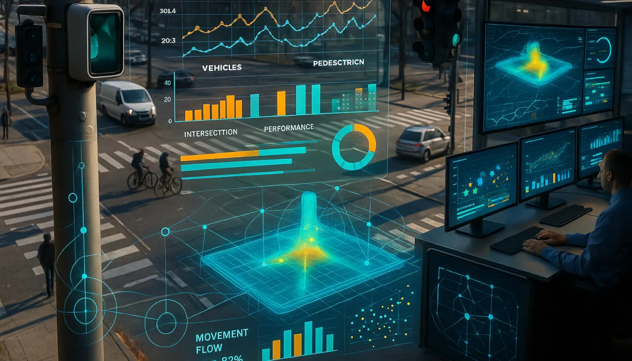
Real-Time Traffic Monitoring and Analysis

Effective traffic management depends on timely awareness of changing road conditions. Traditional loop detectors or video analytics often struggle with occlusions or variable lighting; however, the real-time 3D capability offered by advanced solutions like ours at Outsight addresses these limitations directly (https://www.outsight.ai).

Key benefits enabled by real-time monitoring include:

  • Immediate identification of stalled vehicles blocking lanes
  • Adaptive signal control informed by live vehicle counts
  • Proactive alerts when abnormal patterns suggest potential hazards

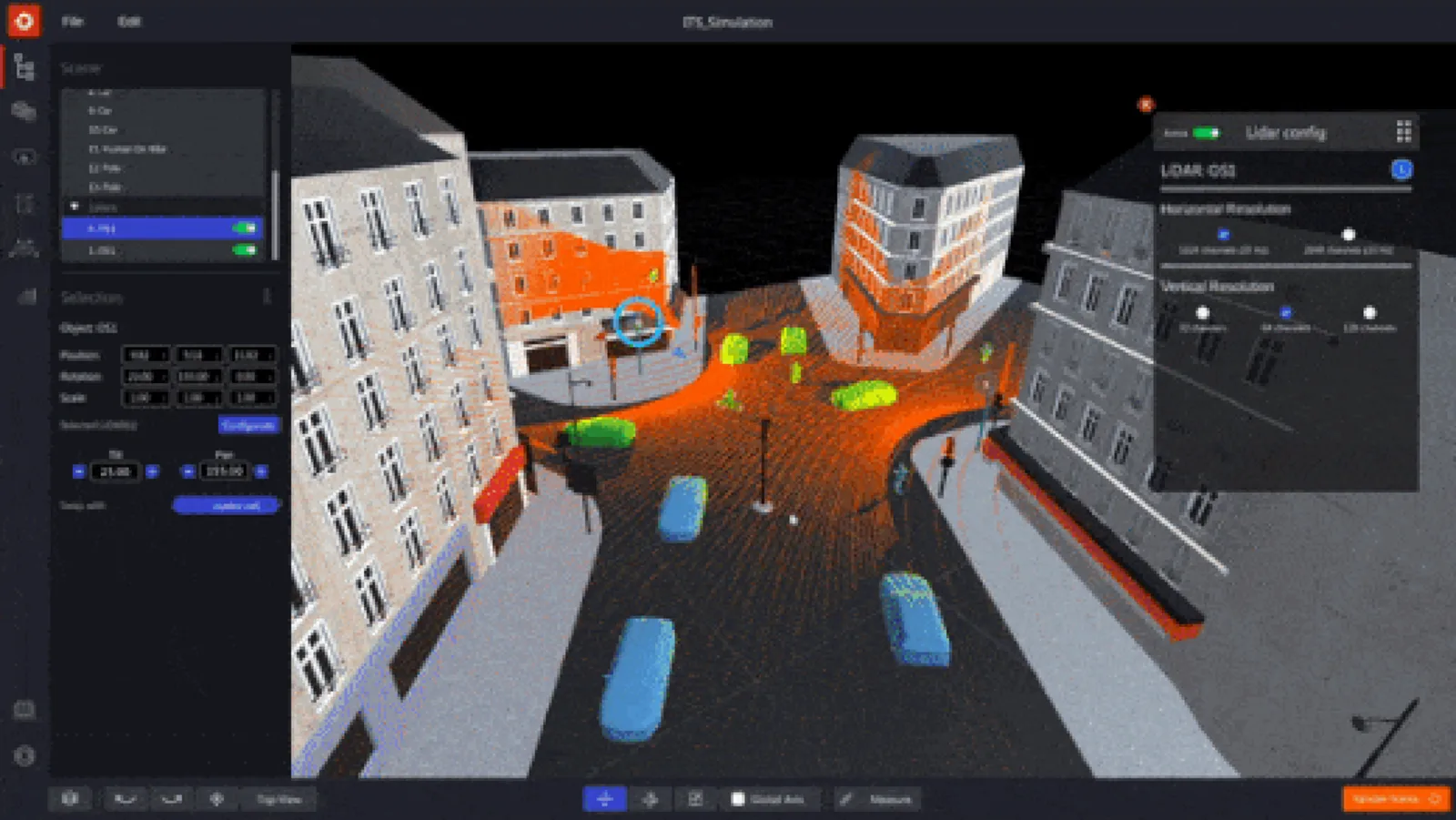
Introducing the first multi-vendor 3D LiDAR Simulator

Outsight has developed a LiDAR simulator for any use case and application, from airports to mobile robotics, smart cities and industrial applications.

Read article →

By leveraging Spatial Intelligence powered by robust hardware deployments across corridors and intersections, cities can react quickly while maintaining efficient operations throughout peak periods.

Spatial Intelligence: Unlocking New Insights for ITS

Spatial Intelligence goes beyond simple object detection, it provides context-aware understanding that helps authorities make informed decisions about infrastructure investments.

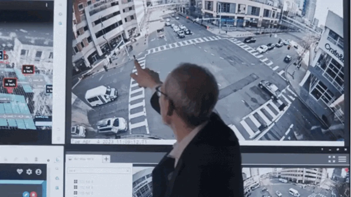
Making Bellevue safer with LiDAR Solutions

Discover Outsight’s latest use case in the city of Bellevue, a complete LiDAR installation to increase users’ safety at busy intersections!

Read article →

  • Long-term planning projects targeting vulnerable road users
  • Evaluating pilot programs before scaling up investments citywide
  • Measuring the impact of policy changes (e.g., speed limit reductions) using objective metrics

As more agencies adopt advanced analytics tools built around high-fidelity sensor inputs like those from our solutions at Outsight, collaboration between departments becomes easier, and outcomes become measurable instead of anecdotal alone.

Conclusion: The Future of ITS with LiDAR Innovation

The integration of accurate sensing technologies is reshaping what’s possible within Intelligent Transportation Systems worldwide.

By adopting reliable tools such as those provided by our team at Outsight, recognized globally for leadership in this field, cities are positioned not only to solve today’s challenges but also anticipate tomorrow’s needs through ongoing innovation.

From Inductive Loops to LiDAR Solutions: The Future of City Traffic Monitoring

With Inductive Loops’ limitations becoming increasingly evident, LiDAR solutions are quickly becoming the next wave for city traffic monitoring

Read article →

As demand grows for scalable solutions supporting safe mobility across diverse environments, from busy downtown cores to suburban arterials, the role played by precise technologies like LiDAR will only expand further within every smart city vision moving forward.


Related Articles

AIRPORTS

Aeroporti di Roma to deploy Outsight's Physical AI solution at scale across Rome Fiumicino Airport

Aeroporti di Roma (ADR) is expanding its collaboration with Outsight to a large-scale deployment across almost all Schengen common-use areas at Rome Fiumicino Airport.

CORPORATE

Intel and Outsight Announce Strategic Collaboration to Bring Physical AI–Powered Spatial Intelligence to the Enterprise Edge

Outsight’s Shift platform integrated into Google Distributed Cloud Edge powered by Intel Xeon 6 SoC – Live demonstration at Google Cloud Next 2026

Let's connect

Send us a Message

Drop your email and we'll get back to you as soon as possible.

Frequently Asked Questions

  • How does LiDAR compare to inductive loop detectors for traffic counting?

    Inductive loop detectors are embedded in pavement and count vehicles by sensing magnetic field disruption as metal passes over them. They provide no spatial context, cannot classify pedestrians or cyclists, and require costly road closures to install or repair. LiDAR sensors mount overhead on poles or gantries and capture the full 3D geometry of every entity crossing an intersection, enabling simultaneous vehicle classification, pedestrian tracking, and near-miss detection without touching the road surface. Outsight applies this infrastructure-based LiDAR approach at city scale through its SHIFT platform, including deployments at smart-city intersections such as those in Bellevue, Washington, where the goal is reducing traffic fatalities through real-time spatial intelligence.

  • What does LiDAR actually measure at a smart city intersection that radar cannot?

    Radar returns a velocity and approximate range per detected object but collapses spatial shape into a point or blob. LiDAR captures millions of 3D points per second, resolving the bounding box, orientation, and trajectory of every entity simultaneously: a cyclist filtering between lanes, a pedestrian mid-crossing, and a turning bus are all tracked as distinct classified objects with centimeter-level positions. That geometric fidelity is what enables near-miss detection and vulnerable-road-user monitoring at scale. Outsight applies this capability at smart-city intersections through its infrastructure-based Motional Digital Twin, with deployments such as the City of Bellevue's Vision Zero program using LiDAR-derived 3D data to monitor exactly these conflict scenarios without capturing any biometric information.

  • Can LiDAR-based traffic sensors be used for Vision Zero pedestrian safety programs?

    Yes. The City of Bellevue, Washington deployed LiDAR-based intersection monitoring as part of its Vision Zero initiative, using real-time 3D tracking to identify conflict points between pedestrians and vehicles. That deployment was built on Outsight's infrastructure-based approach, where LiDAR sensors installed in the infrastructure itself generate a Motional Digital Twin of every person and vehicle moving through an intersection. Because LiDAR assigns persistent anonymous IDs to every detected entity, it can log trajectory data needed to reconstruct near-miss events and generate the objective safety metrics that policy programs require before scaling citywide. The anonymous-by-definition nature of LiDAR perception, capturing shape and motion rather than faces or license plates, also makes it compatible with the privacy constraints that municipal Vision Zero programs typically face.

  • How is real-time LiDAR data typically fed into a city's traffic management center?

    Edge processing hardware at each intersection converts raw 3D point clouds into structured entity streams (position, class, speed, heading) in under 50 milliseconds. That structured feed is then transmitted over the city's fiber or cellular backhaul to the traffic management center's UTMC platform via standard protocols such as MQTT or REST. Outsight's SHIFT platform follows this same architecture, processing infrastructure-mounted LiDAR data through a sub-50ms pipeline and delivering pre-classified object streams to downstream city systems, as demonstrated in its Vision Zero intersection deployment with the City of Bellevue. The management center receives pre-classified events rather than raw sensor data, keeping bandwidth demands manageable even across large corridor deployments.

  • Does infrastructure-mounted LiDAR work without GPS or cellular connectivity at each sensor?

    Infrastructure-mounted LiDAR sensors do not require GPS because their position and orientation are fixed and calibrated once at installation. Each sensor knows its own coordinate frame relative to the intersection or facility layout. Connectivity is needed only to transmit the processed entity stream to a central platform; if that link drops, edge hardware buffers data locally and resumes transmission when connectivity restores. This architecture is more resilient than cloud-dependent video analytics systems. Outsight's SHIFT platform follows exactly this model, running a sub-50ms edge pipeline that produces a real-time 3D entity stream without relying on GPS or per-sensor cellular links, as demonstrated in smart-city deployments such as the City of Bellevue's Vision Zero intersections.

  • How many cities have deployed LiDAR in their ITS infrastructure?

    According to figures cited in recent ITS industry coverage, over 30 major metropolitan areas have integrated LiDAR into their ITS infrastructure to improve traffic flow and incident detection. The figure reflects deployments where LiDAR is used as a primary sensing layer for real-time monitoring, not supplementary research pilots. Adoption is concentrated in North America, Europe, and parts of Asia, driven by Vision Zero mandates, smart-city investment programs, and the declining unit cost of solid-state LiDAR sensors. The City of Bellevue, Washington, is one documented example, where Outsight's infrastructure-based LiDAR approach supports Vision Zero intersection safety goals by tracking pedestrian and vehicle movement in real time without capturing any biometric data.