Skip to content
Insights
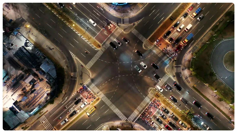
Busy traffic intersection ready for Lidar technology

Making City of Bellevue's Roads Safer: How Outsight's Software Changed the Game

Discover Outsight's latest use case in the city of Bellevue, a complete LiDAR installation to increase users' safety at busy intersections!


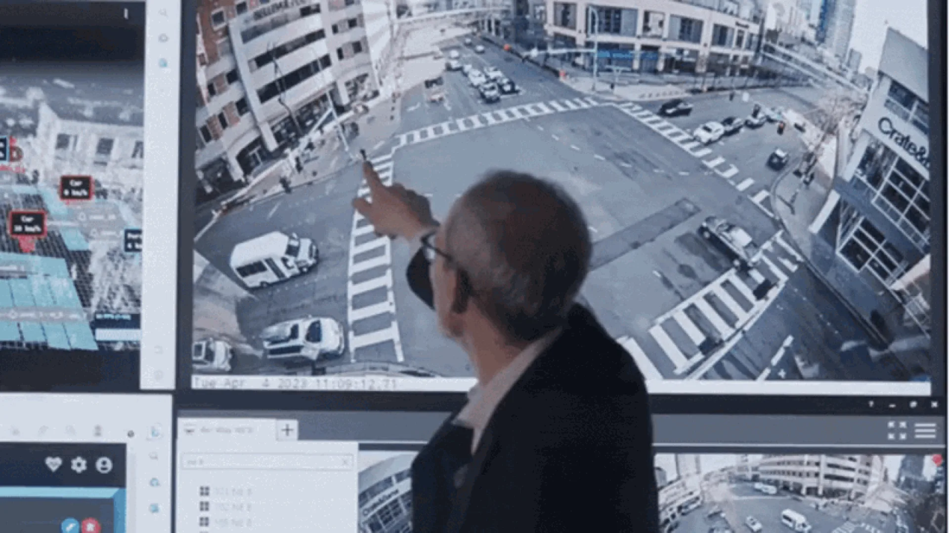
Discover Franz Loewenherz’s testimonial on Outsight Deployment in the City of Bellevue

Bellevue, WA is a beautiful city in the Eastside region of King County. As part of the Vision Zero Community, the city has a clear goal of eliminating traffic fatalities and severe injuries by 2030.

For Franz Loewenherz, Mobility Planning and Solutions Manager at the City of Bellevue, WA, the number one priority is addressing vulnerable road users’ (VRUs) safety.

According to the data collected, people walking and bicycling represent just 5% of all crashes, however, they account for 55% of all fatal and serious crashes. 41% of all pedestrian fatalities and serious injuries are attributable to failure to yield
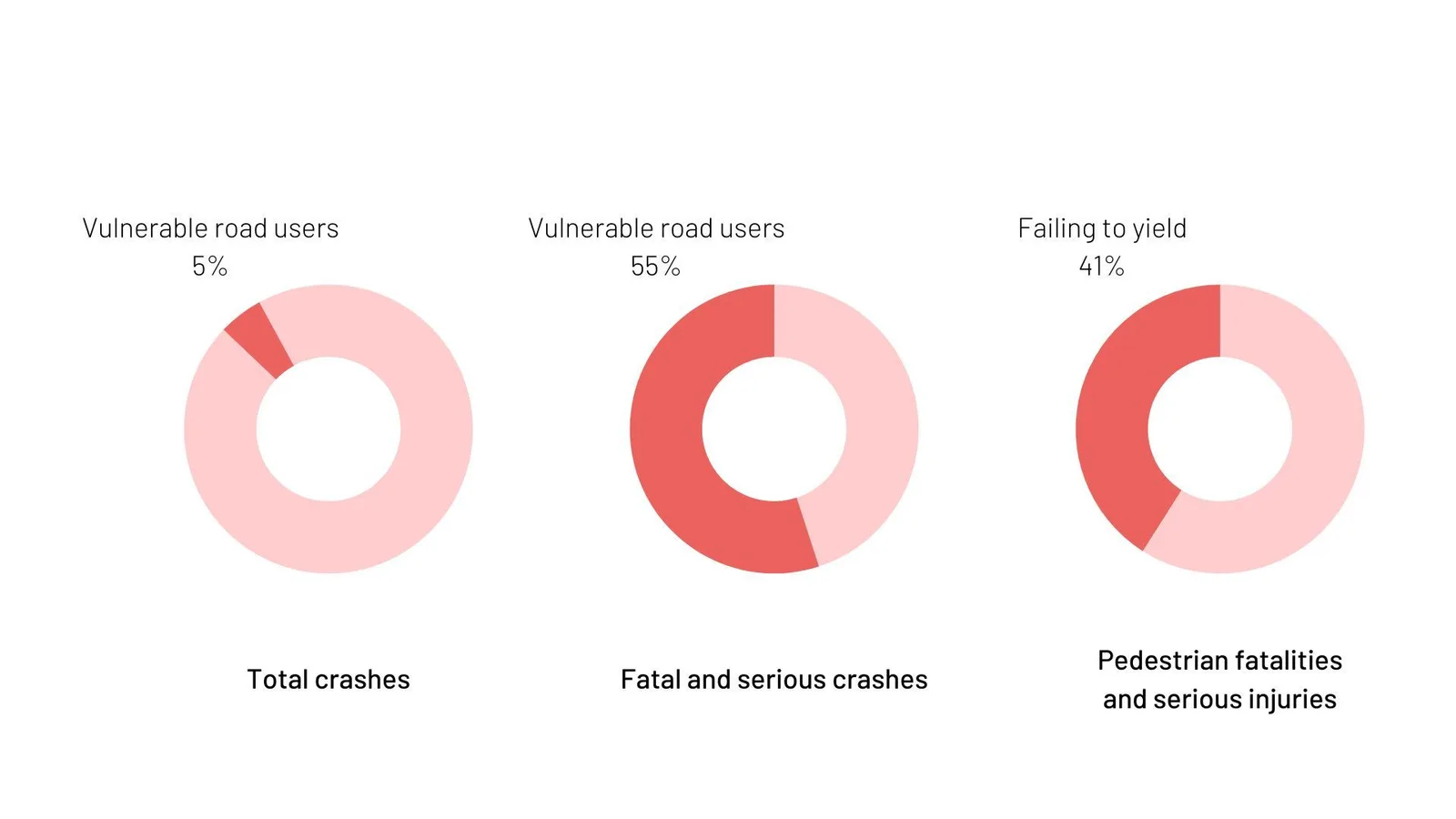
Doughnut chart of crashes

To achieve this goal, the city is equipping itself with physical and digital solutions to maximize pedestrian safety. But the installation of these equipments requires precise insights to ensure that resources are correctly allocated.

Why choose Outsight as a LiDAR Partner?

As part of its ongoing safety initiatives over the past 7 years, the city of Bellevue turned to LiDAR for a high-performance analysis technology to complement its existing safety infrastructure.

The objective encompassed not only the detection and classification of various road users - from pedestrians to vehicles - at all times of the day, including evenings, but also the identification of potential conflict situations as well as measuring the effectiveness of deploying physical solutions such as high visibility crosswalks.

Originally developed for the Automotive Market, its unrivaled precision and ability to work under any lighting or weather condition make LiDAR a technology perfectly adapted to address the challenges of Smart Cities.

Thanks to its ability to extract raw data from any LiDAR, and transform it into real time actionable insights, Outsight’s processing software was the ideal solution for deploying their installation.

To learn more about Outsight, here’s a 60 sec video:

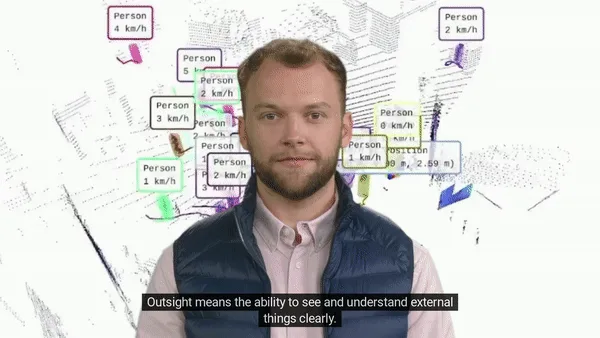
Overview of Outsight

Outsight means the ability to see and understand things clearly: we transform Raw 3D data from different manufacturers into actionable information.

Read article →
The results

After implementing Outsight’s solution with LiDAR, Bellevue used evaluated the reduction in conflicts between vehicles and other road users (vulnerable road users as well as other vehicles).

The results are astonishing !
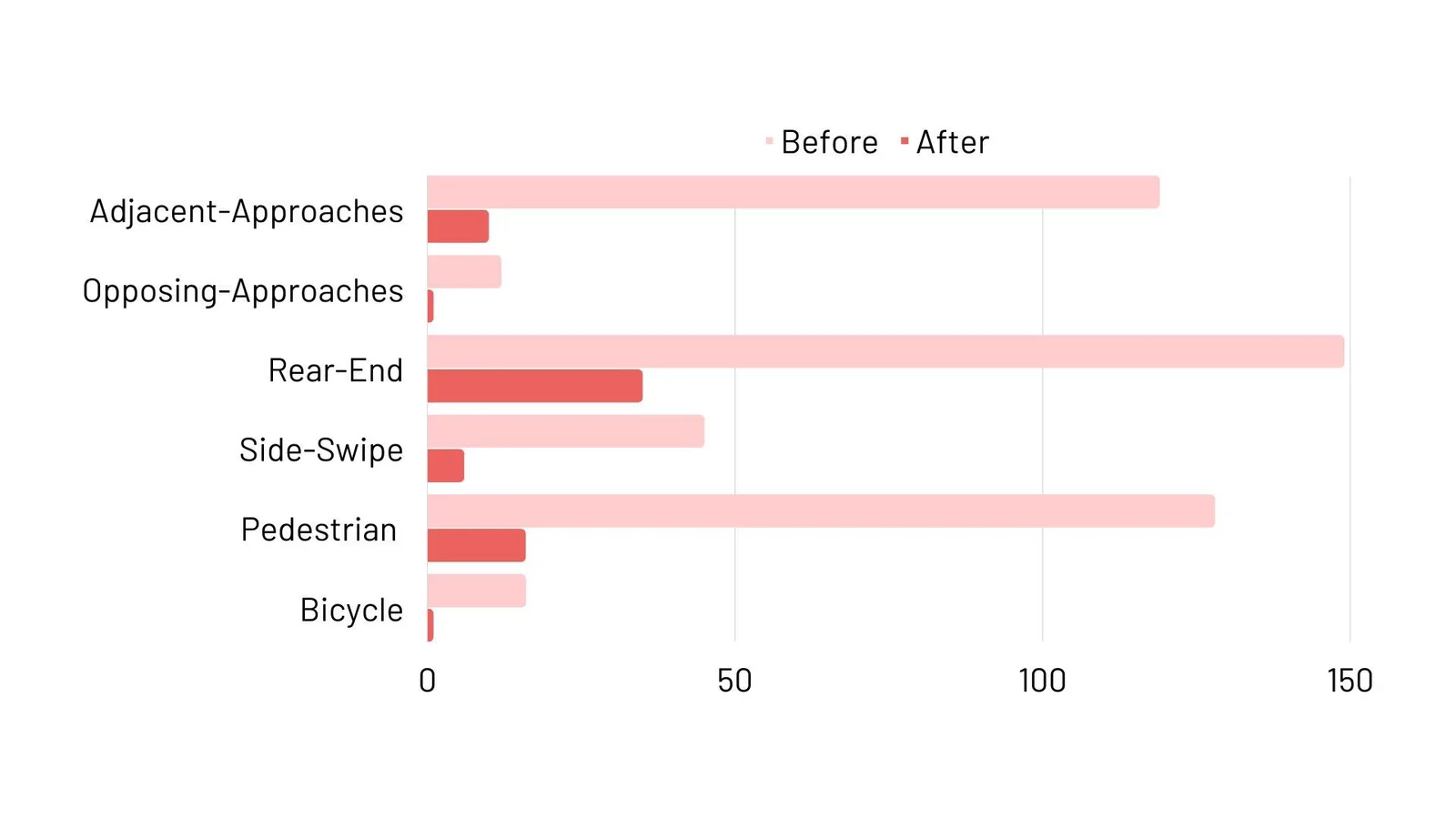
Informatics after Outsight's LiDAR Software Solutions

These results perfectly illustrate the relevance of LiDAR technology and its software for the Smart City market.
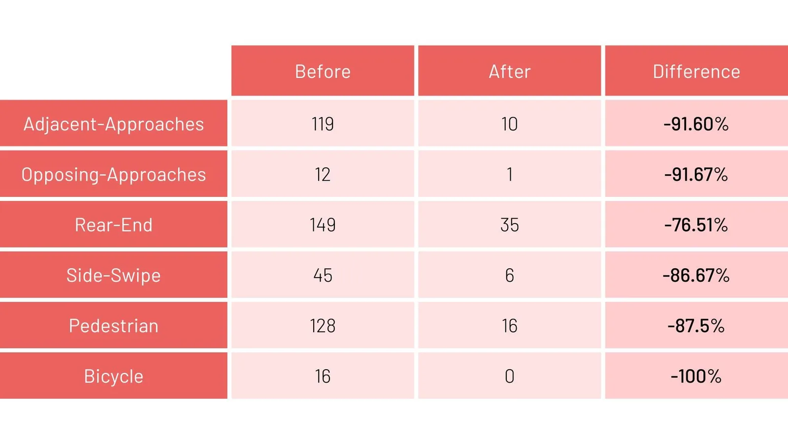
Before and after of conflict count

Conflict count - Before and After Outsight’s Solution deployment

On one hand, real-time analysis enables operators to make immediate decisions in response to unforeseen events, while on the other, the study of data acquired over the long term enables safety measures to be deployed in a relevant manner.

The development of the LiDAR market has led to the emergence of dozens of different manufacturers. This boom has accelerated the technology’s maturity, enabling exponential performance gains and drastic cost reductions.

But in the absence of standards for data processing - each manufacturer having its own proprietary data formats - the technology remains difficult to deploy optimally.

Outsight’s software solutions overcome this problem, extracting and transforming raw LiDAR data from any sensor to real-time, actionable insights.

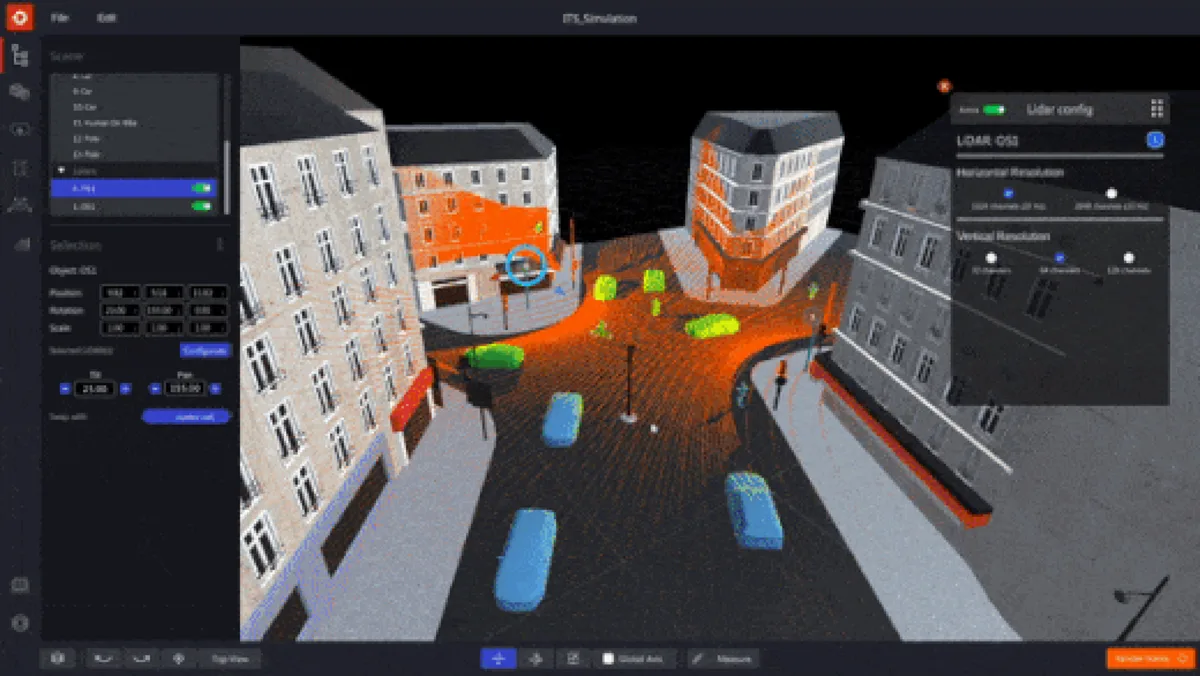
Operators can then choose the type of equipment most relevant to their use cases, and can even combine several types of sensor for optimum results, using tools like a multi-vendor LiDAR Simulator:

First Multi-Vendor 3D LiDAR Simulator Unveiled

Outsight has developed a LiDAR simulator for any use case and application, from airports to mobile robotics, smart cities and industrial applications.

Read article →

Related Articles

APPLICATIONS

End to end ITS application by Outsight

Outsight provides the easiest and most comprehensive way to use LiDAR in ITS: from Simulation to Deployment and Analytics' Dashboard.

APPLICATIONS

How LiDAR and Edge Computing Are Powering Vision Zero

Edge Computing + LiDAR enable real-time road safety. Outsight’s software solution ensures seamless integration, making Vision Zero a reality.

Let's connect

Send us a Message

Drop your email and we'll get back to you as soon as possible.

Frequently Asked Questions

  • What percentage of pedestrian fatalities at intersections are caused by failure to yield?

    In Bellevue, WA, 41% of all pedestrian fatalities and serious injuries are attributable to failure-to-yield incidents. That single conflict type outweighs all other pedestrian crash causes combined, which is why the city's Vision Zero program specifically targets it. Infrastructure-mounted LiDAR is well-suited to detecting near-miss yield failures in real time because it classifies both the vehicle trajectory and the pedestrian path simultaneously, without relying on ambient light. Outsight's deployment at City of Bellevue intersections applies exactly this approach: sensors mounted in the infrastructure feed a real-time 3D perception pipeline that identifies dangerous vehicle-pedestrian interactions as they develop, giving operators the data needed to prioritize the highest-risk crossing points.

  • How does a city measure whether a new crosswalk or signal phase actually reduced conflicts?

    The standard method is surrogate safety analysis: counting vehicle-pedestrian conflict events before and after a physical change, rather than waiting years for enough crashes to reach statistical significance. LiDAR provides the continuous, classified trajectory data needed for this approach, tracking every road user at all hours without gaps from lighting or weather conditions. In Bellevue, Outsight's infrastructure-based LiDAR deployment applies exactly this logic, generating anonymous 3D trajectory records at busy intersections so the city can compare conflict frequencies across signal phases and crosswalk configurations. The before-and-after conflict count becomes the evaluation metric, allowing cities to rank interventions by measured impact and prioritize the next round of capital investment.

  • Can intersection LiDAR sensors detect cyclists and e-scooters, or only pedestrians and cars?

    Infrastructure-mounted LiDAR classifies entities by 3D shape and motion, not by category presets. A standard deployment can distinguish pedestrians, cyclists, two-wheelers (including e-scooters), personal light electric vehicles, and multiple vehicle classes such as cars, trucks, and buses. Each entity receives a bounding box, a classification label, and a continuous trajectory. At the City of Bellevue's Vision Zero intersections, Outsight applies this same classification approach to support safer mixed-traffic environments in real time. Detection accuracy depends on sensor placement and the size of the object's point-cloud return, but compact devices like e-scooters with a rider are large enough to be tracked reliably at typical mounting heights.

  • Why do smart city LiDAR deployments need software that handles multiple sensor manufacturers?

    Each LiDAR manufacturer ships a proprietary binary data format, so raw point clouds from a Hesai unit cannot be directly ingested by software written for a RoboSense unit. A city that mixes brands to optimize coverage and budget would otherwise need separate processing stacks per vendor. Sensor-agnostic middleware normalizes all incoming point clouds into a common tracked-entity stream, which means the city can select hardware on performance and cost grounds alone rather than being constrained to a single vendor's ecosystem. Outsight's SHIFT platform is built on exactly this principle, with native compatibility across Hesai, RoboSense, Ouster, Velodyne, and Seyond hardware, an approach validated in the City of Bellevue's Vision Zero intersection deployment where mixed sensor coverage was a practical requirement.

  • What is the Vision Zero program and which US cities are part of it?

    Vision Zero is a road safety framework originating in Sweden that sets an explicit target of zero traffic fatalities and serious injuries. Cities adopting it treat fatal crashes as preventable infrastructure failures rather than inevitable accidents. In the United States, cities including San Francisco, New York, Seattle, and Bellevue have formally joined the Vision Zero Network, committing to data-driven safety plans with measurable interim targets. Bellevue's program targets complete elimination of traffic fatalities and severe injuries by 2030. To support that goal, the City of Bellevue deployed Outsight's infrastructure-based LiDAR software at busy intersections, using anonymous 3D perception to analyze pedestrian and vehicle movement patterns without capturing any biometric data.

  • How does a LiDAR-based conflict detection system handle nighttime and adverse weather at intersections?

    LiDAR is an active sensor that emits its own laser pulses and measures the return time, so ambient light level has no effect on detection quality. Darkness, streetlight glare, and overcast conditions produce the same point-cloud accuracy as daylight. Rain and fog attenuate the return signal at longer ranges, but at intersection-scale distances (typically under 60 meters) the degradation is marginal for pedestrian and vehicle detection. This all-condition reliability is a primary reason infrastructure operators choose LiDAR over camera-only analytics for safety-critical intersection monitoring. Outsight applied exactly this principle in its Vision Zero deployment for the City of Bellevue, where infrastructure-mounted LiDAR sensors feed the SHIFT platform to detect conflicts and near-miss events around the clock, regardless of weather or lighting conditions.