Skip to content
Insights
LiDAR and Spatial Intelligence transform airport checkpoints.

Fixing Friction: How LiDAR and Spatial Intelligence Are Transforming Airport Checkpoints

Long lines at check-in and security cost airports millions. LiDAR-powered Spatial Intelligence offers a smarter, privacy-first way to improve flow and recover lost revenue.


At airports, long queues and unpredictable wait times at check-in and security checkpoints are among the top sources of frustration for travelers. Recent analyses of over 20,000 passenger reviews show significant friction at two critical checkpoints: check-in and security.

These pain points aren’t just inconvenient, they have a measurable financial impact.

Delays at security are linked to a 30% drop in retail spending. Across major U.S. airports, poor passenger experiences could threaten nearly $695 million in annual revenue.

Over 55% of travellers say they would choose a different airport if it meant avoiding long check-in and security queues, according to a recent industry report.

When passenger expectations are not met, trust erodes, and both satisfaction and spending decline.
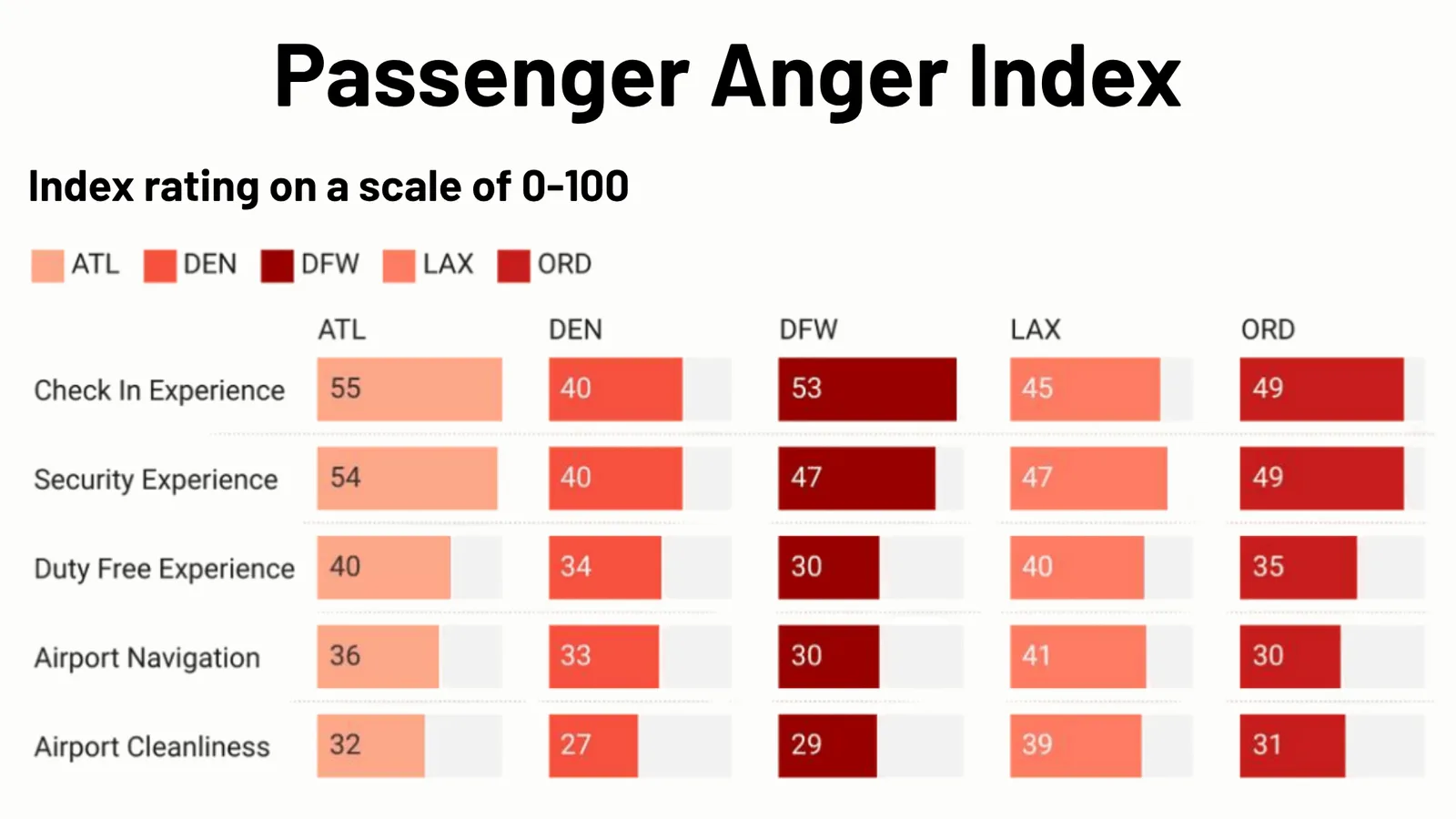
Passenger Anger Index - Source: Adoreboard

To address these issues, many airports rely on traditional tools such as manual observation, camera-based video analytics, radar sensors, and Wi-Fi tracking. Some more advanced solutions use AI layered onto camera systems to estimate crowd density and movement patterns.

While these systems offer some insights, they often aren’t accurate in real time, don’t show detailed movement, or raise privacy concerns.

Why Now? The 7 Key Drivers Accelerating LiDAR Adoption in Airports

Discover the 7 key drivers making LiDAR-based Spatial Intelligence a reality in airports, real-time, anonymous, and ready for global deployment.

Read article →
These tools also have problems. For example, showing how people move through different parts of the airport, especially in crowded places. In large-scale operations, they often give incomplete or delayed information. Which makes them less useful in fast-moving areas like security and check-in.

Improving flow and reducing friction in these high impact areas requires a more advanced approach.
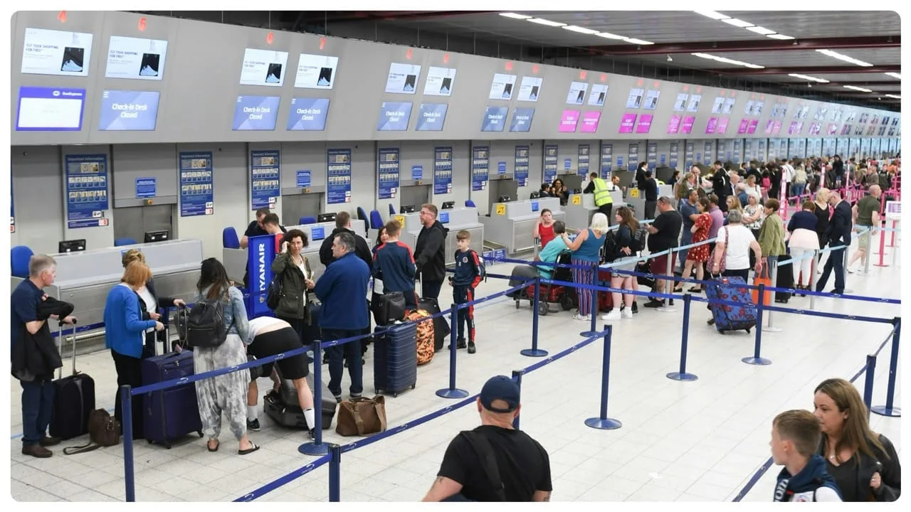
Long queue and unpredictable wait times at check-in is one of the top sources of frustration for travelers.

Airports need precise, real-time, and fully anonymous data about how people move. Especially in areas where delays cause the most frustration and revenue loss. This is where 3D Spatial Intelligence powered by LiDAR technology becomes transformative.

LiDAR (Light Detection and Ranging) uses laser pulses to scan the area and measure how long it takes for the light to bounce back from objects.

This creates a detailed 3D map of the space and shows how people move. Without using cameras or collecting personal information.

Understanding How Lidar Works

3D LiDAR is a complex technology that enables unprecedented Spatial Intelligence. Many engineering choices are possible when building a new device.

Read article →

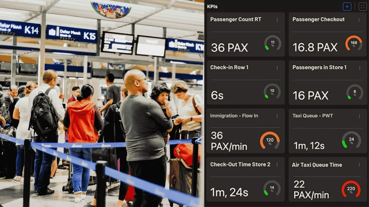
Outsight’s software uses LiDAR to track how people and vehicles move in large places like airport terminals. Unlike video cameras, LiDAR doesn’t record personal details, it only measures movement. This helps airport teams spot crowded areas, like at check-in and security. They can then make fast decisions, such as sending more staff or opening more lanes.

This leads to smoother passenger flow, better use of resources, and keeps everyone’s privacy safe.

When airports fix the biggest pain points, like check-in and security, they can win back passenger trust and avoid losing money. These two areas are the main causes of frustration.

By reducing delays at these checkpoints, airports could gain back part of the $188.7 million in revenue that’s at risk because of long wait times and unhappy travelers. Smoother flow means happier passengers, more time to shop, and a better airport experience overall.

As travelers expect more, airports face tough competition, making the journey smooth and easy is now more important than ever. Using 3D Spatial Intelligence with LiDAR is a smart way to rebuild trust, fix daily problems faster, and find new ways to earn revenue.

Outsight’s software uses LiDAR to track how people move in airport terminals.

With real-time and accurate data from a platform like Outsight’s Shift, airport teams can track how people move, make quicker decisions. And do it all without slowing things down or risking anyone’s privacy.

Now is the time for airports to improve flow and boost revenue potential by turning real-time data into faster, smarter decisions.
Related Articles

AIRPORTS

Passenger Flow, Experience, and Wait Times: Improving the Airport Journey

In today's fast-paced world, airport efficiency and passenger experience are vital. Outsight's Spatial AI software is transforming airport passenger flow and wait time management.

AIRPORTS

End to end Passenger Journey Tracking with LiDAR Technology

LiDAR-based Spatial AI significantly enhances airport operations, improving passenger flow and reducing wait times at key touchpoints.

Let's connect

Send us a Message

Drop your email and we'll get back to you as soon as possible.

Frequently Asked Questions

  • How much revenue do long security queues actually cost airports?

    Passenger friction at check-in and security is directly linked to spending behavior: delays at security checkpoints correlate with a 30% drop in airside retail spending. Across major U.S. airports, poor checkpoint experiences put roughly $695 million in annual revenue at risk. The mechanism is straightforward: a passenger who clears security late has less dwell time in retail, arrives at the gate stressed, and is less likely to make discretionary purchases. Measuring and reducing that friction is precisely where infrastructure-based LiDAR systems apply, and deployments like Outsight's Motional Digital Twin at Dallas Fort Worth, the world's largest 3D LiDAR airport deployment, show how real-time queue analytics can give operators the visibility needed to intervene before delays compound into lost revenue.

  • Why does camera-based AI fall short at airport security checkpoints?

    Camera-based crowd analytics estimate density from 2D image data, which degrades in crowded conditions because bodies occlude one another. They also carry persistent privacy exposure: even where facial recognition is disabled, video frames contain identifiable data that must be managed under GDPR and similar regulations. LiDAR captures shape and motion in 3D point cloud form, with no pixel-level image ever recorded, so occlusion in dense queues is resolved by sensor fusion rather than image inference, and privacy compliance is structural rather than a configuration choice. This is the approach Outsight deploys at airports such as Dallas Fort Worth and Paris-Charles de Gaulle, where the SHIFT platform tracks passenger flow anonymously by definition, because LiDAR geometry never captures faces, license plates, or biometric data in the first place.

  • What is the difference between Wi-Fi tracking and LiDAR tracking for airport queue measurement?

    Wi-Fi tracking samples the signal strength of passenger devices at intervals, producing position estimates typically accurate to several meters and updated every few seconds at best. It also misses passengers whose devices have Wi-Fi disabled or randomized MAC addresses. LiDAR tracks every person in the scene continuously, many times per second, at centimeter-level precision, with no dependency on carried devices. Outsight's infrastructure-based approach, used in airport deployments such as Dallas Fort Worth and Paris-Charles de Gaulle, relies on LiDAR as the primary measurement layer precisely because it captures shape and motion anonymously, regardless of what a passenger carries. The two technologies are complementary: Wi-Fi data can be fused onto a LiDAR backbone as an additional attribute, but it cannot serve as the primary measurement source for a real-time queue-management loop.

  • How does 3D LiDAR distinguish a queue from general crowd density at a check-in hall?

    A 3D LiDAR system tracks each person as an individually labeled entity with a persistent anonymous ID and a continuous trajectory. Queue detection is therefore behavioral, not statistical: entities that are stationary or moving at very low speed in a defined zone for more than a configurable dwell threshold are classified as queuing. Outsight's Motional Digital Twin applies exactly this per-entity behavioral classification in live airport deployments, including at Dallas Fort Worth and Paris-Charles de Gaulle, enabling operators to measure queue length, wait time, and throughput simultaneously rather than reporting a single density estimate averaged across a zone. Because LiDAR captures shape and motion rather than faces or biometric data, the classification is anonymous by definition.

  • Can airports use real-time flow data to predict security bottlenecks before they form?

    Real-time spatial data feeds predictive models that project queue length and wait time several minutes ahead, drawing on current arrival rates, lane throughput, and historical patterns for a given time-of-day and day-of-week. This forward-looking window is what enables proactive staffing decisions, such as opening an additional lane or redeploying an agent before a queue reaches the threshold that triggers passenger frustration, rather than reacting after a backlog has already formed. Outsight's Motional Digital Twin delivers exactly this capability at airport scale, anonymously tracking the position and flow of every person in the checkpoint zone through infrastructure-mounted LiDAR sensors, with a sub-50ms end-to-end pipeline that keeps predictive models fed with current ground truth. Deployments at airports including Dallas Fort Worth and Rome Fiumicino illustrate how this approach translates live spatial data into operational foresight.

  • Do over half of passengers really switch airports to avoid long queues?

    According to a recent industry report, more than 55% of travelers say they would choose a different airport if it meant avoiding long check-in and security queues. That figure positions checkpoint performance as a direct competitive variable for airports operating in multi-airport metro markets, where a neighboring facility is a realistic substitute for a meaningful share of origin traffic. Outsight draws on this statistic in its analysis of airport checkpoint friction, arguing that queue reduction is not merely an operational concern but a revenue-retention issue, one that real-time 3D flow measurement through the SHIFT platform can help airports quantify and address before passengers vote with their feet.