Skip to content
Insights
Lidar, thanks to 3D data, provides the information for Outsight Platform to optimize queues in Retail and Airports

LiDAR queue optimization for airports and retail

How privacy by design LiDAR people counting turns passenger and shopper flow into real time queue optimization across airports and shopping centers.


Queues are where operations and experience break at the same time

In an airport or a shopping center, the queue is the moment that decides everything. A long line at security makes a passenger miss a flight. A clogged checkout sends a shopper home with a half empty basket. The same congestion that frustrates people also strains staff, throughput, and revenue.

LiDAR people counting changes that equation. It measures movement in three dimensions, anonymously, in real time, so airports and shopping centers can see queues forming and act before they become a problem.

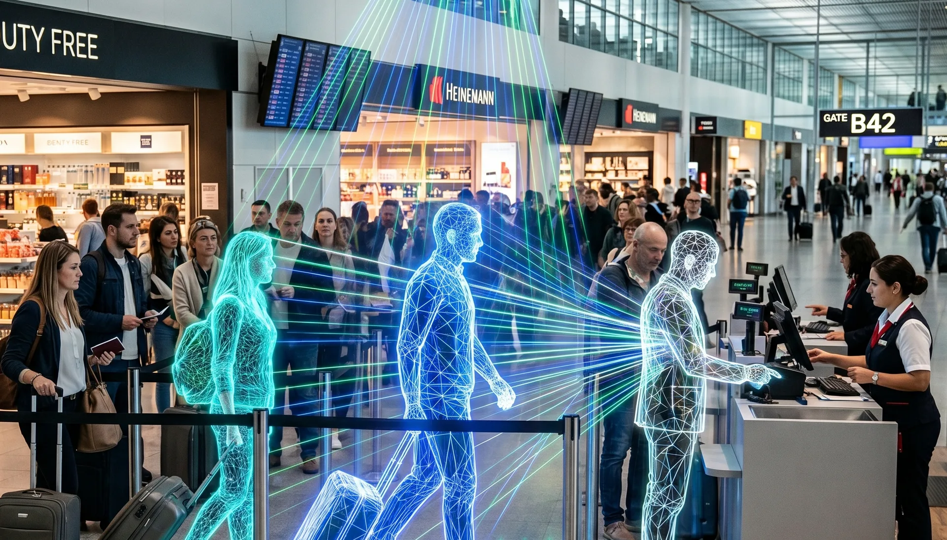
Optimizing Airport Operations with LiDAR-Based Passenger Tracking

Rising passenger volumes are pushing airports to operate with greater precision and efficiency. LiDAR-based Spatial Intelligence provides real-time visibility, enhancing flow, safety, and overall passenger experience.

Read article →
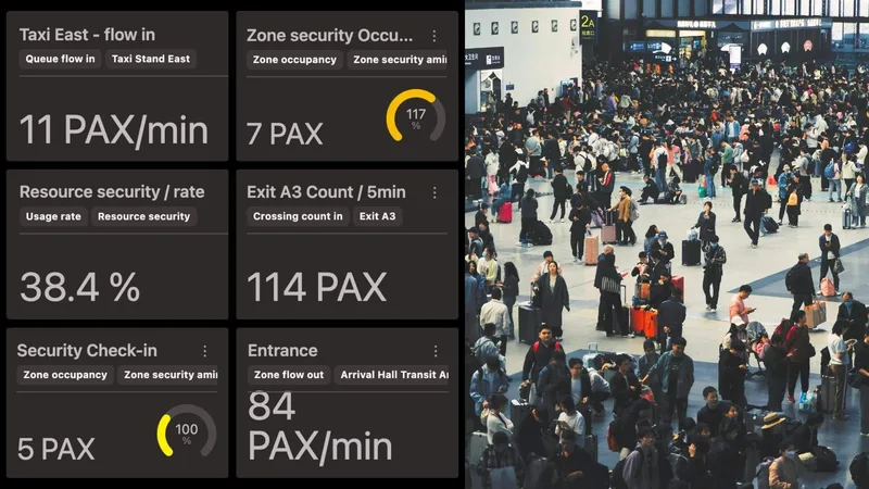
Why traditional counting falls short

Most people counting today relies on cameras, infrared beams, or Wi-Fi and Bluetooth probes.

The common failure modes show up everywhere from a terminal checkpoint to a mall atrium:

  • Cameras lose accuracy in low light, glare, and tightly packed groups, and they capture identifiable images that trigger privacy review.
  • Infrared and beam counters miss people walking side by side and cannot tell direction or dwell time.
  • Wi-Fi and Bluetooth sampling only sees devices that happen to be discoverable, so counts drift and queue length is a guess.
  • Most systems report after the fact, which is useful for a monthly report but useless for opening a second lane right now.

The result is traffic analytics that look precise on a dashboard but are wrong at the curb, the gate, or the till. Operators end up staffing on instinct rather than evidence.

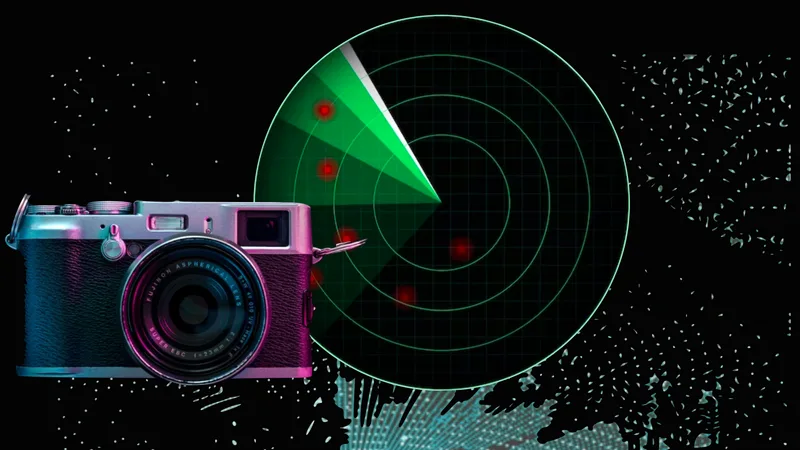
An in-depth comparison of LiDAR, Cameras, and Radars’ technology

This article explores the capabilities and limitations of each type of sensor, to provide a clear understanding of why LiDAR has emerged as a strong contender in computer vision tech race.

Read article →
How LiDAR people counting closes the gap

LiDAR sensors map a space with pulses of laser light and measure the precise position of everything that moves through it. Outsight’s Spatial Intelligence Platform turns that raw 3D data into operational metrics: how many people are present, how they flow, where they slow down, and how long they wait.

Each person is assigned an anonymous ID at the moment they enter the space and tracked with centimeter level precision until they leave.

That continuity is what makes accurate queue measurement possible. The platform knows the real length of a line, the real wait time, and whether it is growing or shrinking, not an estimate.

When a checkpoint or checkout approaches its limit, the system flags it while there is still time to open a lane, redirect flow, or move staff. Passenger flow monitoring becomes an operational control, not a post mortem.

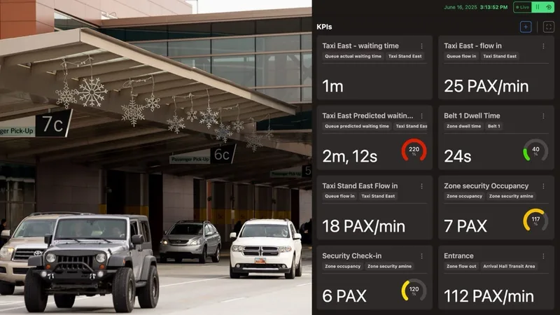
Solving the Airport Curbside Congestion Challenge with 3D LiDAR Technology

Curbside congestion challenges airports worldwide. Outsight’s Shift Perception Platform uses 3D LiDAR to deliver real-time, privacy-compliant insights.

Read article →
LiDAR also holds up in the conditions that defeat other sensors. It works in full darkness and bright sun alike, covers large open areas with fewer blind spots, and maintains accuracy in dense crowds where cameras and beams lose the count.

Privacy by design, not privacy by patch

The distinction that matters most to operators is how privacy is handled.

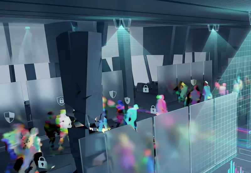
This is privacy by design rather than privacy by patch. The sensor produces operational metrics with no personal data attached, which makes compliance a property of the technology itself instead of a process bolted on afterward.

For airport security leaders and retail operators working under GDPR and similar regimes, that removes a recurring source of risk and review.

Anonymous vs. Anonymized: learn the difference

Understanding Anonymity in Sensor Data: discover the inherent privacy characteristics of each type of Sensor data and the potential risks associated with anonymizing sensitive information

Read article →

The same platform across airports and shopping centers

The economics of flow are different in a terminal and a mall, but the underlying need is the same: count people accurately, watch how they move, and act on it in real time.

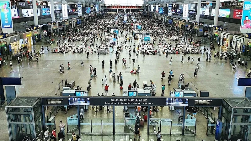
In airport operations, the platform tracks passengers from curb to gate across every key touchpoint. It measures queues at check in, security, and boarding, surfaces bottlenecks and dwell times, and feeds predictions that help teams balance throughput against security and staffing.

Dallas Fort Worth Airport Selects Outsight for the World’s Largest 3D LiDAR Deployment

Dallas Fort Worth (DFW), a major US Airport, selects Outsight for the largest 3D LiDAR deployment to enhance safety, operations, and passenger flow with Spatial Intelligence.

Read article →

In shopping center monitoring, the same capability measures footfall, dwell time, and queue length across entrances, concourses, and checkout areas. Operators see which zones draw traffic, where shoppers stall, and when to open another lane, turning traffic analytics into decisions about staffing, layout, and tenant performance.

Enhancing Retail Insights: Leveraging Physical AI and LiDAR for Advanced Shopper Analytics

LiDAR and Physical AI provide retailers with real-time shopper analytics, enabling smarter layouts and improved customer experiences in physical stores.

Read article →
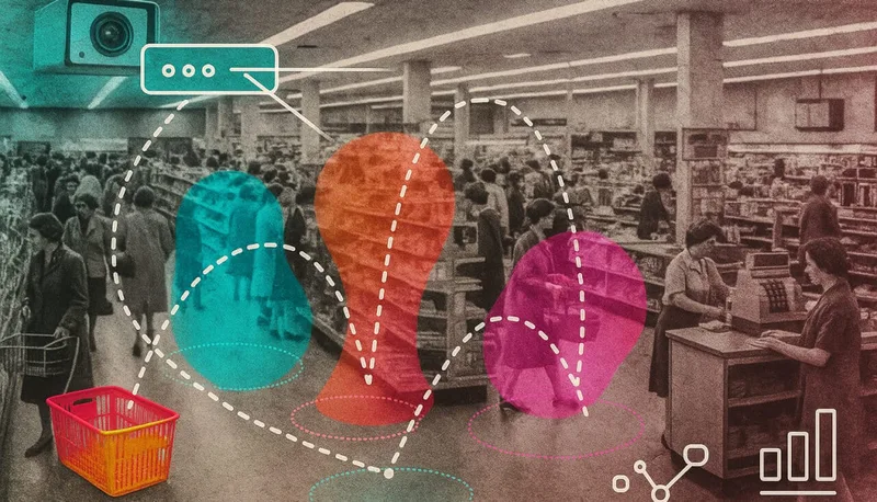
One platform, one privacy model, two environments where queues decide the outcome.

What this means for operators

Queue optimization is no longer a trade off between accuracy and privacy. LiDAR people counting delivers both: precise, real time measurement of how people move, with no personal data collected in the first place.

If you are responsible for passenger flow or shopper experience and want to see what privacy by design queue optimization looks like in your space, contact the Outsight team to talk through your use case.
Related Articles

APPLICATIONS

How to analyze real-time passenger flow in airports

The barriers that stall real-time passenger flow analysis in airports, and how privacy-safe 3D LiDAR spatial intelligence restores visibility and speeds response.

AIRPORTS

Achieving Complete Synchronization in Airports with Spatial AI Technology

LiDAR technology helps achieve synchronized operations across all areas of an airport. Outsight’s Spatial Intelligence platform provides real-time tracking, efficient resource allocation, and ensures privacy.

Let's connect

Send us a Message

Drop your email and we'll get back to you as soon as possible.

Frequently Asked Questions

  • What is the minimum queue length that LiDAR can reliably detect?

    LiDAR tracks each person as a discrete entity with centimeter-level spatial precision, so queue measurement is not threshold-dependent the way beam-counter or Wi-Fi sampling is. A queue of two people registers as clearly as a queue of two hundred. The practical floor is determined by sensor mounting height and field of view rather than by algorithmic sensitivity, making it well-suited to short queues at low-traffic periods as well as peak-hour congestion.

  • Can the same queue monitoring sensors also track dwell time and footfall in retail zones?

    Yes. Because each person carries a persistent anonymous ID from the moment they enter a sensor's coverage area until they exit, the same infrastructure that measures queue length simultaneously records how long each individual stays in any defined zone. Zone boundaries are set in software, not by hardware placement, so a single sensor covering a checkout area can report queue length, dwell time, and total footfall with no additional hardware.

  • How does real-time queue data actually trigger a staff action?

    The platform exposes threshold-based alerts via API and push notification. An operator defines a rule: when measured queue length exceeds a set value, or when predicted wait time crosses a target, an alert fires to a duty manager's device or to the workforce-management system. At airports this can trigger automatic signage updates or gate reassignments through the AODB integration layer. The alert fires while the queue is still forming, not after it has peaked.

  • How does LiDAR queue analytics compare to video analytics with AI-based crowd counting?

    AI-based video crowd counting estimates crowd density from 2D image pixels and degrades when people overlap or lighting changes. LiDAR assigns a separate tracked 3D bounding box to each person, so it reports a count of individuals rather than an estimated density. This distinction matters most in dense queues: at high occupancy, camera-based counting error compounds while LiDAR precision is largely unaffected by crowd density. Video analytics also require a privacy-compliance workflow; LiDAR does not, because no image is ever produced.

  • What hardware infrastructure is needed to add LiDAR queue monitoring to an existing shopping center?

    LiDAR sensors mount on ceilings, poles, or wall brackets within the infrastructure of the site, with no changes to the floor or to the people moving through it. Each sensor connects to an edge processing unit that can run on standard rack or compact form-factor hardware. Sensor placement is evaluated through a simulation step that models coverage against the site's floor plan and ceiling height before any hardware is installed, which constrains the number of units needed and reduces deployment risk.

  • What is the best LiDAR solution for optimizing queues?

    Infrastructure-based 3D LiDAR, paired with the right spatial intelligence software, is the most effective approach for real-time queue optimization. Unlike cameras (which lose accuracy in low light and dense crowds), infrared beam counters (which miss people walking side by side), or Wi-Fi probes (which only detect discoverable devices), LiDAR tracks every person in a scene continuously at centimeter-level precision, regardless of lighting or crowd density. Each person is assigned a persistent anonymous ID from entry to exit, so the system measures actual queue length, wait time, and whether the queue is growing or shrinking in real time rather than producing an estimate after the fact. Outsight's SHIFT platform applies this principle across airports and retail environments. When a checkpoint or checkout lane approaches its throughput limit, the system flags it while there is still time to open a lane or redirect flow. Because LiDAR captures geometry and motion rather than images, no faces or biometric data are ever recorded, making privacy compliance a structural property of the sensor rather than a post-processing step. The same platform and sensor infrastructure serve both airport terminals (curb to gate) and shopping centers, with operator-defined zones and thresholds configured in software. Large-scale deployments such as Dallas Fort Worth Airport demonstrate how this infrastructure-based approach delivers queue optimization at production scale.

  • Why do infrared beam counters struggle to measure queues at airports and shopping centers?

    Infrared and beam counters miss people walking side by side, and they cannot tell the direction of movement or dwell time. Like other traditional counting methods, they break down in the conditions that matter most for queues: dense crowds, changing light and large open spaces. Most such systems also report after the fact, which is too late to open a second lane. LiDAR people counting measures movement in three dimensions, anonymously and in real time, so operators see queues forming and can act.

  • Why are Wi-Fi and Bluetooth probe counts unreliable for measuring queue length?

    Wi-Fi and Bluetooth sampling only detects devices that happen to be discoverable, so it sees a varying fraction of the people actually present. As a result, counts drift over time and the reported queue length is essentially an estimate. Like many traditional systems, these probes also tend to report after the fact, which suits monthly reporting better than operational decisions. Outsight's Spatial Intelligence Platform, built on 3D LiDAR, counts every person in the space and tracks them in real time.

  • How does anonymous ID tracking let LiDAR measure real wait times in a queue?

    In Outsight's Spatial Intelligence Platform, each person receives an anonymous ID the moment they enter the monitored space and is tracked with centimeter-level precision until they leave. Because the platform follows each individual continuously, it knows when every person joined the line and when they exited it. That continuity gives the real length of the queue, the real wait time and whether the line is growing or shrinking. The ID carries no identity, since LiDAR captures only geometry and motion.

  • Does LiDAR queue monitoring record faces, license plates or biometric data?

    LiDAR captures geometry and motion only. It records no faces, license plates or biometric identifiers, so there is no personal data to anonymize afterwards. Outsight's Spatial Intelligence Platform turns this 3D data into operational metrics such as people counts, flow, dwell time and wait time. Each person is tracked under an anonymous ID from entry to exit, which is enough to measure queues accurately. This is why Outsight describes the approach as privacy by design.

  • What does privacy by design mean for LiDAR people counting under GDPR?

    Privacy by design means the technology produces operational metrics with no personal data attached from the start, so compliance is a property of the sensor itself. LiDAR captures shapes and movement, which lets Outsight's Spatial Intelligence Platform measure queues without collecting identifiable information. The opposite approach, privacy by patch, collects identifiable images and then tries to anonymize or restrict them through added processes. For airport security leaders and retail operators working under GDPR and similar regimes, privacy by design removes a recurring source of risk and review.

  • Which airport touchpoints can LiDAR-based Spatial Intelligence measure queues at?

    Outsight's Spatial Intelligence Platform tracks passengers from curb to gate across every key touchpoint of the terminal. It measures queues at check-in, security and boarding, and surfaces bottlenecks and dwell times along the way. These measurements feed predictions that help airport teams balance throughput against security and staffing needs. The same infrastructure-based approach is already running at major airports, including a major US hub described as the world's largest 3D LiDAR airport installation.

  • Does LiDAR people counting stay accurate in darkness, bright sun and dense crowds?

    Yes. LiDAR works in full darkness and in bright sunlight alike, since it measures positions with its own pulses of laser light. It covers large open areas with fewer blind spots and keeps its accuracy in dense crowds, where cameras and beam counters tend to lose the count. Cameras, in comparison, lose accuracy in low light, glare and tightly packed groups. For queue measurement at security checkpoints or busy checkouts, this robustness is what keeps the numbers reliable during peak periods.

  • How precise is LiDAR people tracking in airport and shopping center queues?

    Outsight's Spatial Intelligence Platform tracks each person with centimeter-level precision, from the moment they enter a monitored space until they leave. LiDAR sensors map the space with pulses of laser light and measure the exact position of everything that moves through it. The platform converts this raw 3D data into metrics such as how many people are present, how they flow, where they slow down and how long they wait. This precision is what allows real queue length and real wait time to be measured directly.

  • What is the difference between real-time queue optimization and retrospective queue reporting?

    Retrospective reporting tells operators after the fact how queues behaved, which is useful for a monthly report. Real-time queue optimization acts while the queue is forming. With Outsight's Spatial Intelligence Platform, live 3D data shows when a checkpoint or checkout is approaching its limit, while there is still time to open a lane, redirect flow or move staff. Passenger flow monitoring thus becomes an operational control, and staffing decisions rely on evidence gathered in the moment.

  • Is the same LiDAR queue platform used for both airports and shopping centers?

    Yes. Outsight uses one Spatial Intelligence Platform, with one privacy model, in both environments. In airports it measures queues at check-in, security and boarding and helps balance throughput, security and staffing. In shopping centers it measures footfall, dwell time and queue length across entrances, concourses and checkout areas, informing decisions on staffing, layout and tenant performance. In both a terminal and a mall, the core need is to count people accurately, observe how they move and act in real time.

  • How do you measure queue wait times automatically?

    Automatic wait-time measurement requires tracking each person from the moment they join a queue until they leave it at the service point. With 3D sensors such as LiDAR, the software detects queue entry and exit for every individual and computes actual wait times, queue length and throughput continuously. It can also predict upcoming wait times so staff can open lanes or counters before a queue builds. Outsight's Spatial Intelligence Platform delivers these metrics live at airport checkpoints, check-in counters, immigration desks and retail tills, and can publish them to passenger-facing displays.