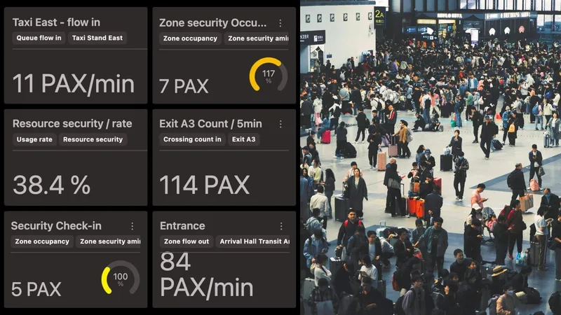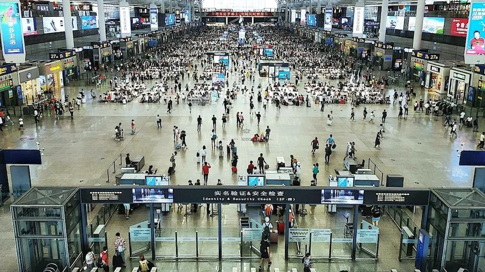
As global passenger volumes rise, airports face the challenge of maintaining safety, efficiency, and passenger satisfaction across complex environments. Every part of the airport must operate in perfect synchronization to ensure a seamless travel experience.
This requires more than just visibility, it demands a connected ecosystem where multiple systems work together to deliver a unified view of movement.
Traditional technologies like WiFi tracking or camera-based systems often create blind spots. That’s where LiDAR-based Spatial Intelligence changes the game.
The Evolution of Passenger Tracking Technology in Airports
The Evolution of People Counting Technology.
1st Generation: Wi-Fi-Based Technology
Wi-Fi tracking was one of the first methods used to track passengers in airports. It was inexpensive and widely accessible, relying on the signals of passengers’ smartphones to determine their location.
However, Wi-Fi can’t provide precise tracking or real-time insights, and it’s also dependent on passengers having Wi-Fi enabled, making it unreliable.
2nd Generation: Image-Based Technology
As airports needed more accurate data, image-based technologies like cameras came into play.
These technologies could offer clearer insights into passenger behavior, but they still have limitations, privacy concerns, high data processing requirements, and an inability to operate efficiently in low-light environments.
3rd Generation: LiDAR-Based Technology
LiDAR represents the third generation of passenger tracking technology, offering high precision, real-time insights, and privacy by design.
Understanding How Lidar Works
3D LiDAR is a complex technology that enables unprecedented Spatial Intelligence. Many engineering choices are possible when building a new device.
Read article →

Outsight’s LiDAR-based Spatial Intelligence platform takes this technology a step further by integrating 3D mapping, real-time tracking, and actionable data into a single platform.
LiDAR allows for seamless integration into airport systems, offering a precise, GDPR-compliant solution for tracking passengers, vehicles, and luggage across various airport environments, from terminals to outdoor areas.

LiDAR vs Image-Based People Flow Monitoring
LiDAR: Delivering Complete Coverage and Precision Across Every Part of the Airport
In airports every space contributes to the overall passenger journey, and gaps in visibility can quickly translate into congestion, inefficiency, and safety risks.
This is why airports need a perception technology that offers continuous, accurate, and reliable monitoring, one that doesn’t depend on lighting conditions, weather, or connectivity.
LiDAR technology provides this holistic visibility with unmatched precision, capturing every movement of people and vehicles in real time and with centimeter-level accuracy.
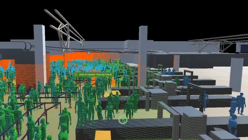
Real-time passenger flow monitoring at security checkpoints.
Unlike traditional sensing systems, LiDAR enables the creation of a dynamic 3D Digital twin of its environment, enabling operators to understand both flow and behavior rather than just presence.
Its adaptability means it can be deployed in virtually any area of the airport, from train station platforms and parking zones to security checkpoints, boarding areas, and baggage claim halls.
Key Advantages of LiDAR for Airports
LiDAR technology and Software is shaping a new wave of operational excellence, passenger experience and safety for airports of all sizes.
Read article →

Because it operates reliably in bright light, darkness, fog, or rain, LiDAR ensures continuous situational awareness in all conditions.
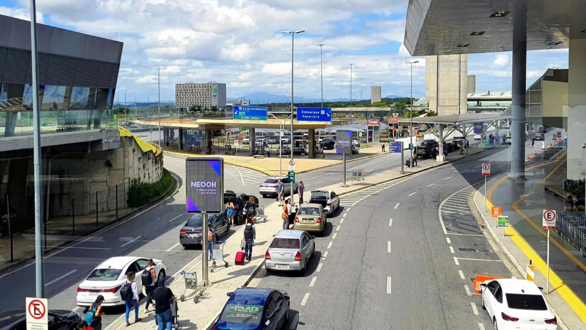
Optimize airport curbside with LiDAR for smooth pick-up/drop-off.
Here are some of the key ways LiDAR technology is being applied across different areas of the airport, delivering precise insights and enhancing efficiency at every stage of the passenger journey:
- Curbside & Parking Areas: Real-time detection of vehicles and passenger movements helps prevent congestion, improve pick-up coordination, and optimize drop-off flows for taxis, shuttles, and private cars.
- Entrances & Check-in Halls: Continuous flow monitoring enables airports to predict demand surges, reduce queue times, and dynamically deploy staff where needed most.
- Security Checkpoints: LiDAR supports efficient screening by detecting bottlenecks early, automating queue management, and helping balance throughput and safety.

Enhance airport retail with LiDAR for better passenger engagement.
- Retail & Duty-Free Zones: By analyzing dwell times, passenger paths, and engagement levels, airports can enhance the retail experience, improve store layouts, and increase conversion rates.
- Boarding Gates: Real-time occupancy and movement data assist operators in coordinating boarding, avoiding overcrowding, and maintaining on-time performance.
- Baggage Claim & Arrivals: Tracking passenger density and flow helps minimize waiting times and congestion at baggage carousels, improving passenger comfort and operational control.
- Transit & Intermodal Areas: LiDAR enables seamless monitoring between transport hubs such as train platforms and terminals, ensuring passengers transition smoothly through connected infrastructure.
Each of these applications contributes to a complete, data-driven understanding of airport activity, helping operators make proactive decisions that improve safety, efficiency, and the overall passenger experience.
Beyond its spatial awareness, LiDAR is private by design, it captures no images or personal data, ensuring full compliance with privacy regulations like the GDPR.
Anonymous vs. Anonymized : Learn the Difference
Understanding Anonymity in Sensor Data: discover the inherent privacy characteristics of each type of Sensor data and the potential risks associated with anonymizing sensitive information
Read article →

Moreover, the same LiDAR infrastructure can support multiple operational goals simultaneously, from security and operations to retail analytics and traffic management, creating a unified perception layer for the entire airport ecosystem.
In short, LiDAR enables airports to see, understand, and act on what’s happening across every zone.
Leverage the value of Lidar
Outsight’s Shift Perception Software transforms raw 3D LiDAR data from any hardware manufacturer into actionable Spatial Intelligence.
Not All LiDAR Sensors Are Equal: Key Differences Explained
This article explores LiDAR differences and why customers use multiple vendors to meet their needs.
Read article →

There is no perfect sensor nor manufacturer, and that’s why our platform is hardware-agnostic, allowing airports to combine and integrate the most appropriate sensors for every zone.
Explore various LiDAR types for airport monitoring.
With Outsight’s Platform you get:
- Seamless Integration: Connects effortlessly with existing airport systems and BI dashboards through open, standard data formats, ensuring smooth interoperability.
- Scalable Architecture: Edge and Cloud deployment options minimize processing and setup costs while enabling easy expansion from pilot to full-terminal coverage.
- Data-Driven Optimization: Offers ready-to-use and customizable KPIs plus historical analytics for smarter planning, trend analysis, and investment decisions.
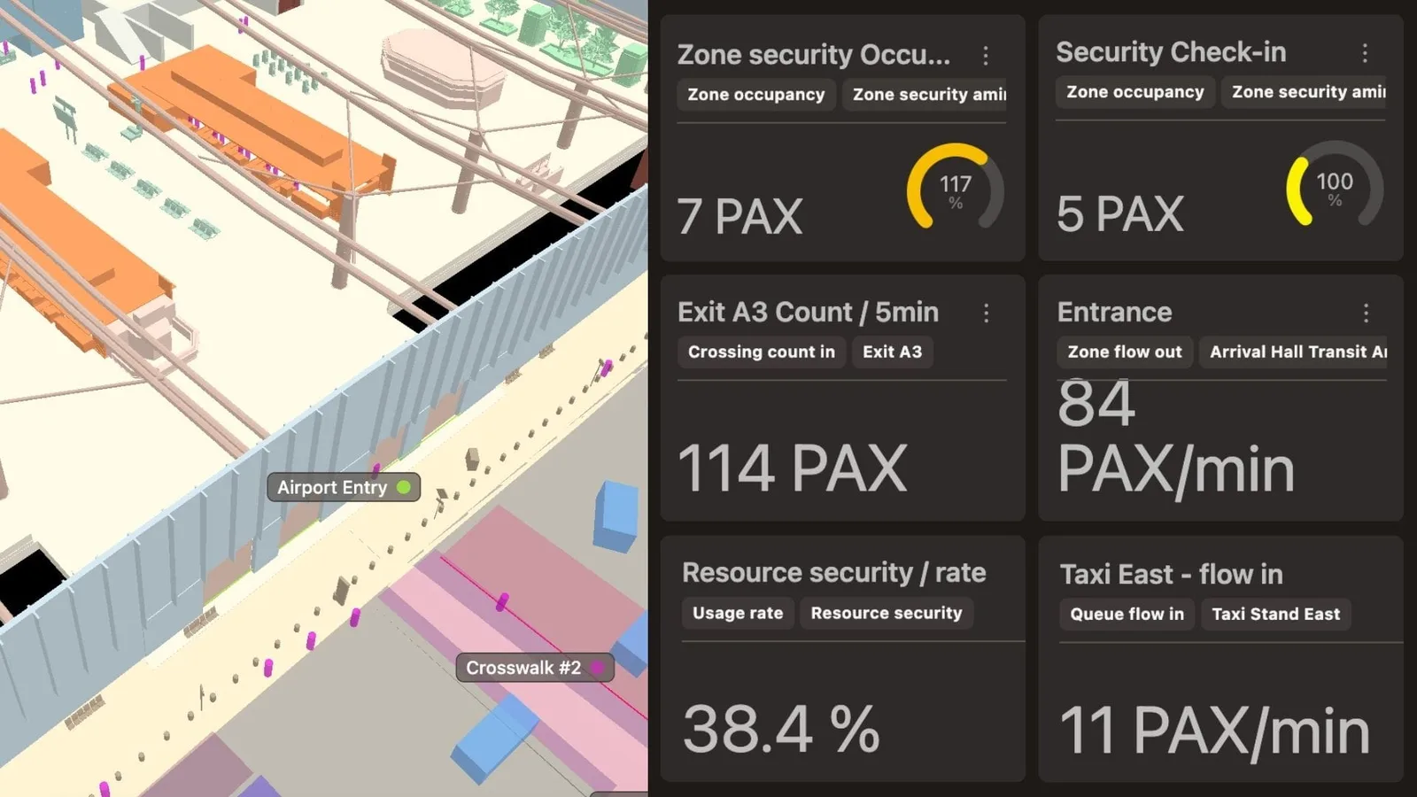
Outsight’s simulator software for optimizing airport operations.
Airports no longer need to rely on fragmented technologies to understand passenger flow. LiDAR-based Spatial Intelligence, powered by Outsight’s hardware-agnostic, provides comprehensive, privacy-preserving visibility across every part of the airport.
Learn more about how Outsight’s solutions are transforming airport operations worldwide at outsight.ai.