Skip to content
Insights
utsight develops real-time 3D LiDAR software that turns spatial data into actionable insights.

Outsight in a nutshell

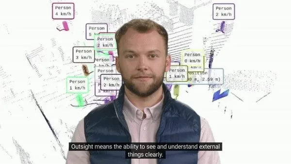
Outsight means the ability to see and understand things clearly: we transform Raw 3D data from different manufacturers into actionable information.


In the context of the autonomous car, billions of dollars have been invested to develop a new type of sensor called Lidar.

Its working principle is simple: the sensor sends laser beams that bounce off all the objects around.
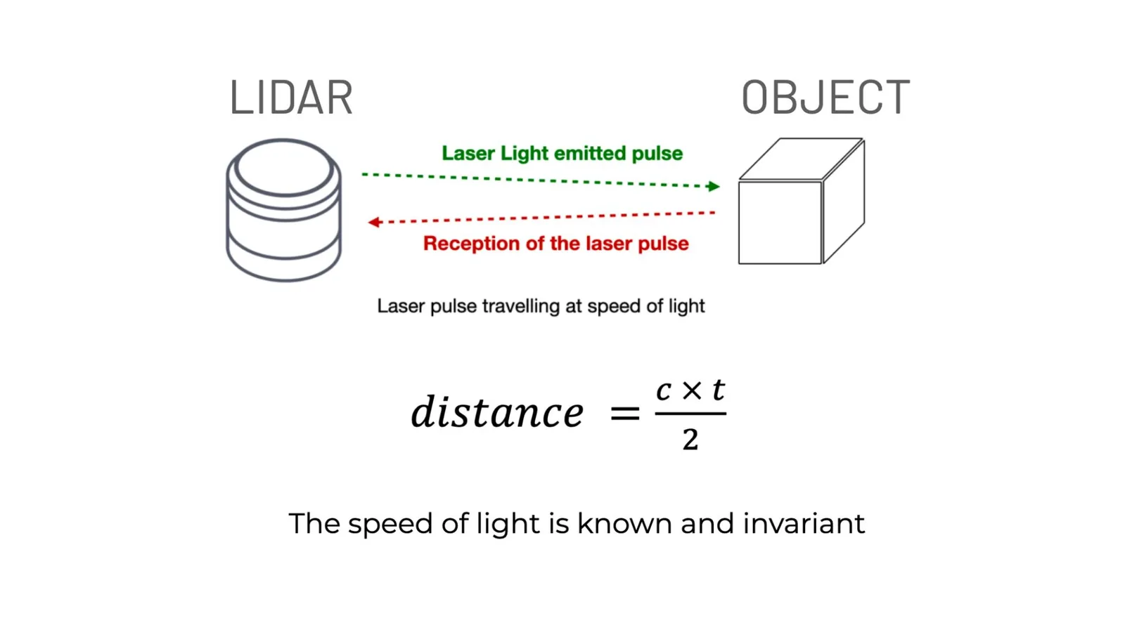
How lidar works by emitting laser light pulses to an object and measuring the distance from the reflected laser pulse

LiDAR is an active sensor: it creates its own light and works in any lighting condition

As the speed of light is known, the distance can be easily calculated, but also the size and volume of the objects.

This information is critical for many applications and cannot be obtained directly with cameras, which only provide colour.

LiDARs also provide a unique benefit for privacy: unlike cameras, they do not allow identification of people.

Anonymous vs. Anonymized : Learn the Difference

Understanding Anonymity in Sensor Data: discover the inherent privacy characteristics of each type of Sensor data and the potential risks associated with anonymizing sensitive information

Read article →

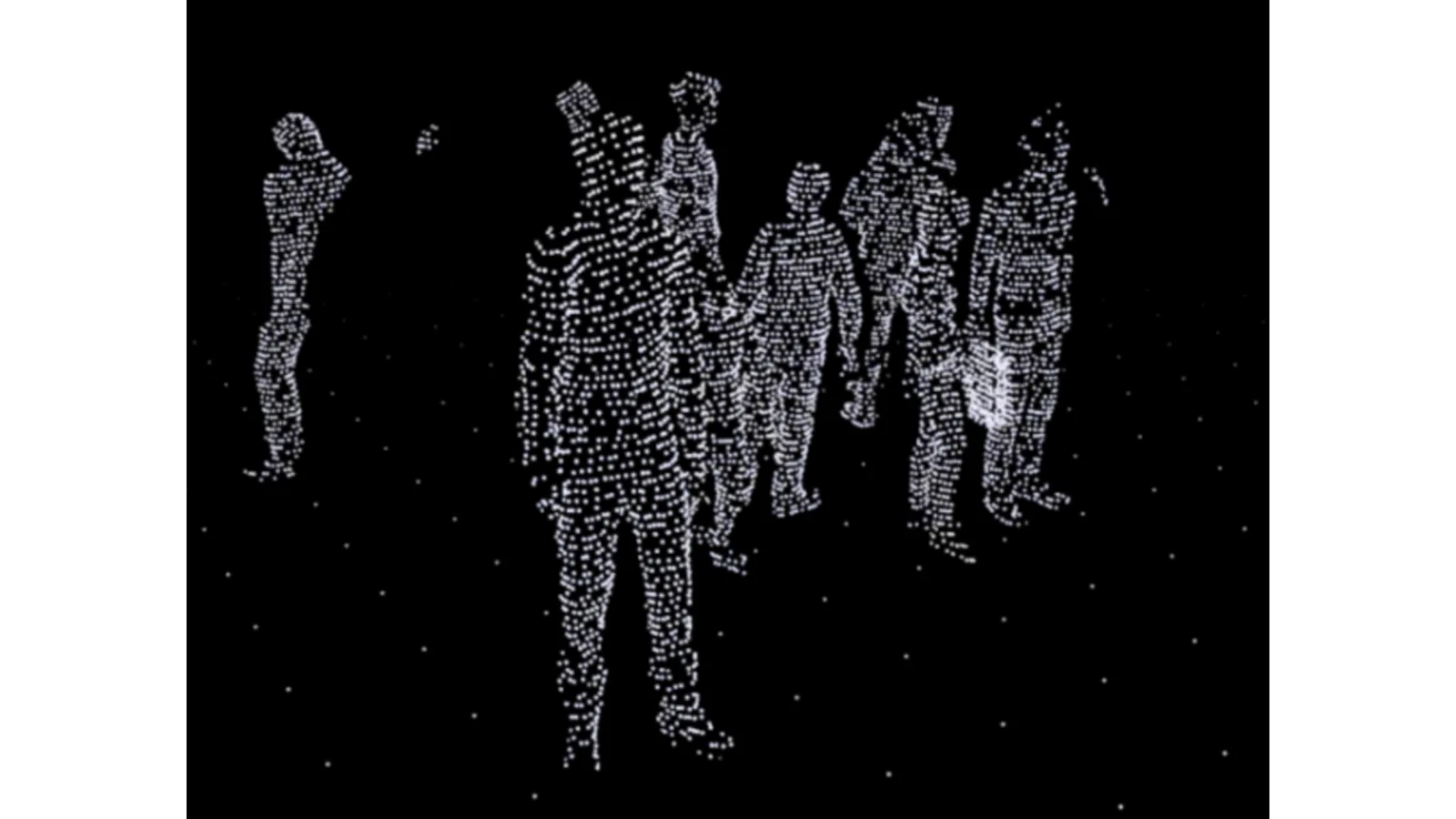
3D point cloud from lidar scan showing the innate anonymity

LiDAR technology does not capture any personal information.

Understanding the basics of 3D LiDAR Technology

Light Detection and Ranging, also known as LiDAR, is a technology for remote sensing that is used to measure distances in an environment.

Read article →
Competition from dozens of companies manufacturing these sensors has resulted in dramatically lower prices, along with improved performance.

This now makes it possible to deploy it in a wide range of industries, well before the automotive industry.

However, 3D data is new and much more complex to process than traditional images.

Other difficulties, such as the lack of standards, are also obstacles to their adoption by clients who are not interested in the technology itself, but in the value it brings.

Solving these problems is the mission of Outsight.
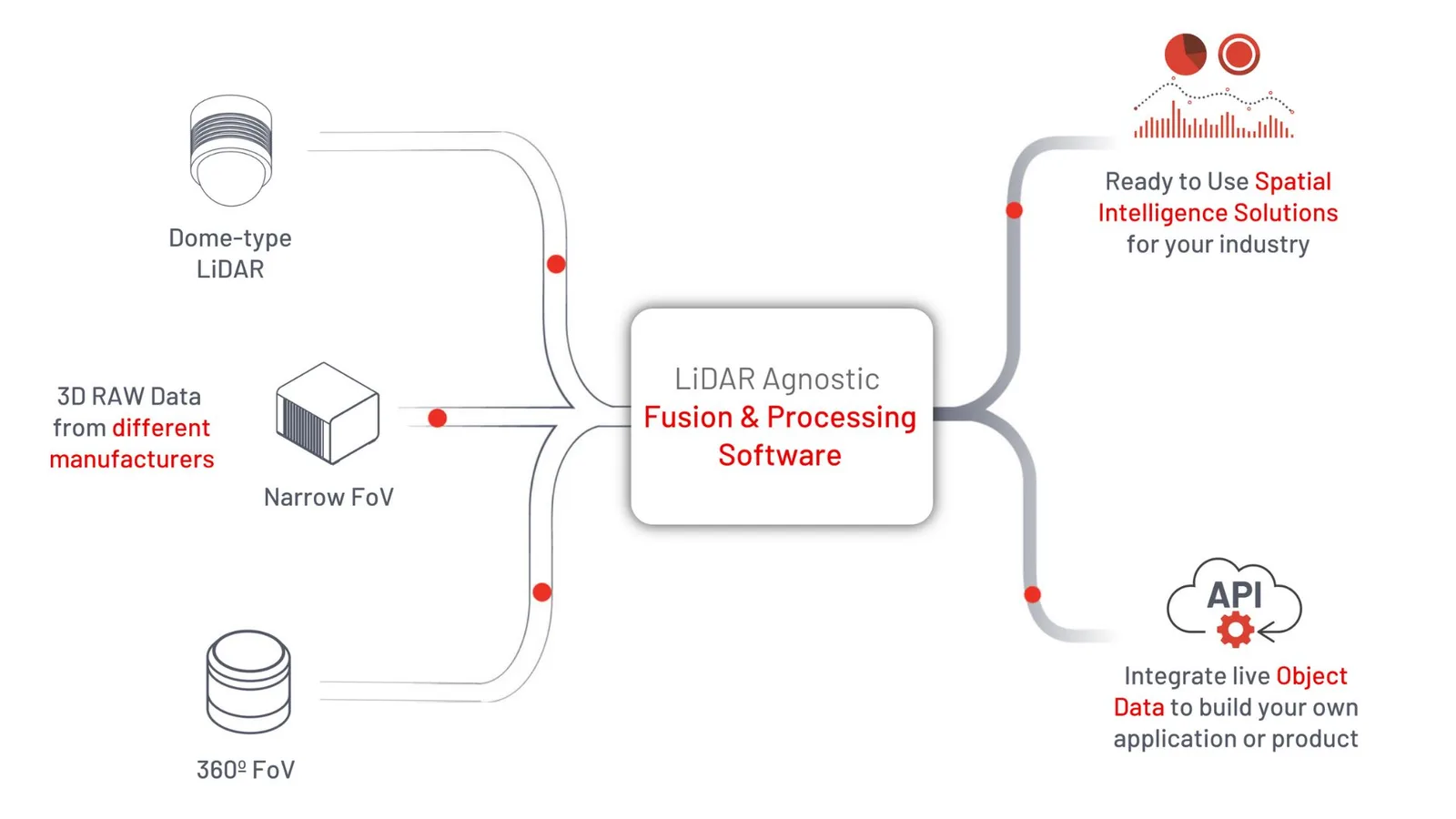
How Outsight turns 3D raw data into Spatial Intelligence Solutions

Based on raw sensor data, our software solutions enable the anonymous monitoring of people and vehicle flows in a variety of contexts such as airports and railway stations, shopping centres and sports facilities.

LiDAR Manages Increased Airport Traffic

See how and why Airports are increasingly using LiDAR-based software solutions to tackle their biggest challenges, leveraging the unique value of Spatial Intelligence.

Read article →

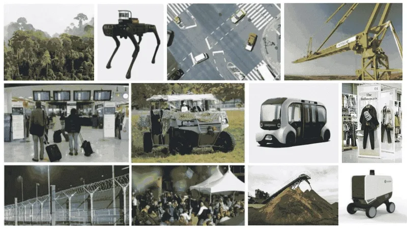
We also equip industry, agriculture, defence and many other sectors.
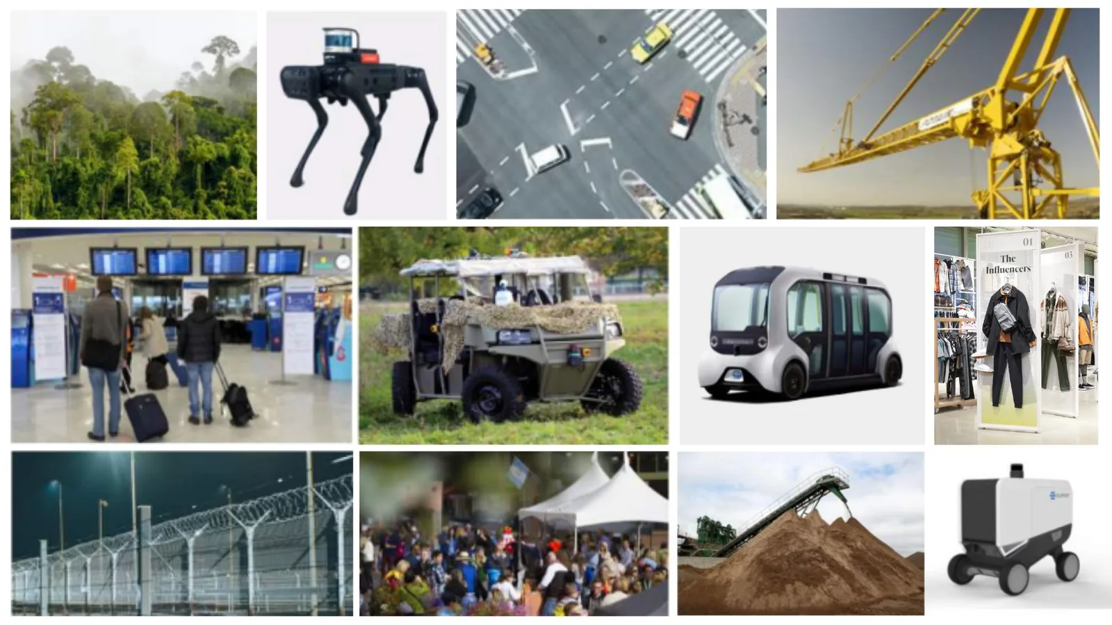
Multiple lidar applications and use cases

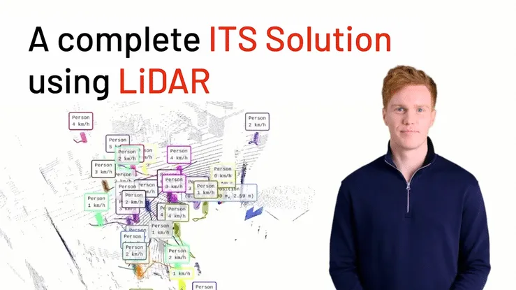
Many applications in the area of Intelligent Transportation Systems (ITS) benefit from 3D LiDAR perception:

Outsight’s Comprehensive ITS Solution

Outsight provides the easiest and most comprehensive way to use LiDAR in ITS: from Simulation to Deployment and Analytics’ Dashboard.

Read article →
As pioneers and global leaders, we have established strategic partnerships with most sensor manufacturers, such as Ouster, Velodyne, Robosense, Innoviz and Hesai, all of whom have strengths and weaknesses.

This allows us to respond to ambitious customer problems, as we did at Charles-de-Gaulle to track the simultaneous individual movement of thousands of travellers.
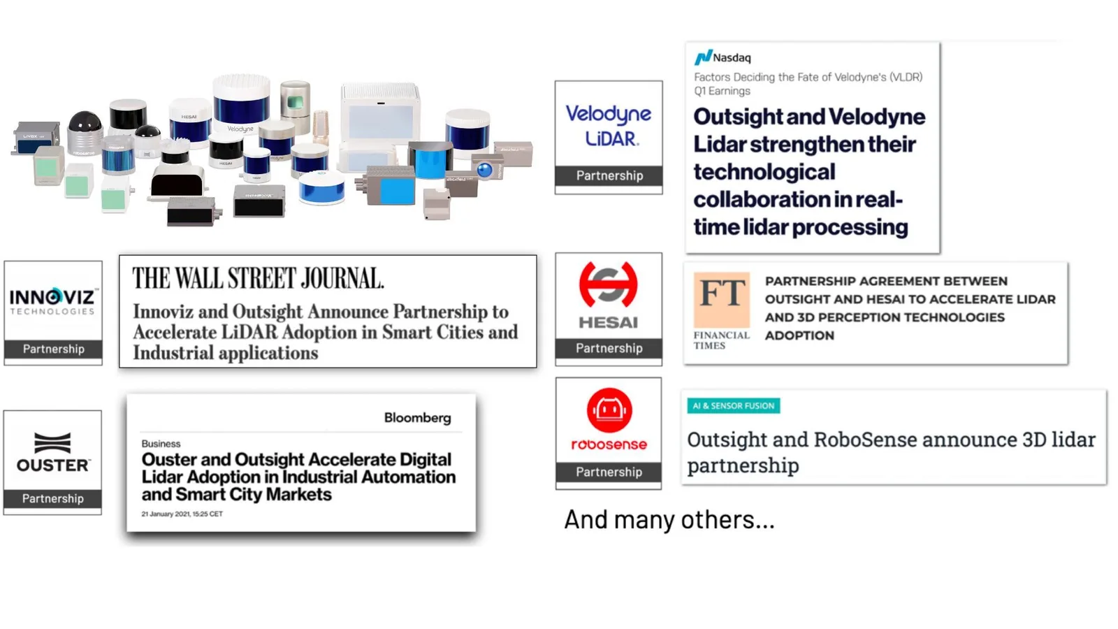
Different partnerships that Outsight has done with various lidar sensor manufacturers

We obtain operational information of a richness and value unimaginable with traditional technologies.
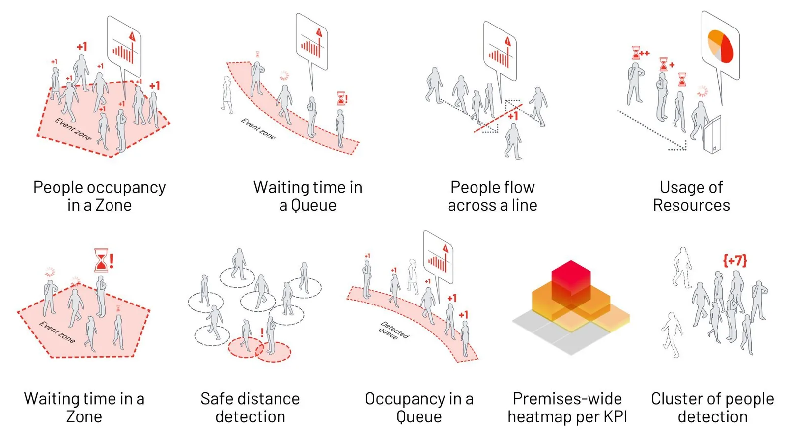
Different KPIs Outsight's Spatial AI solution has for people tracking

Our solutions have been awarded many times, but above all developed thanks to the constructive feedback of hundreds of users from different industries.
Numerous awards that Outsight has won

Finally, all of this is made possible thanks to solid shareholders and the best experts in the field, more than eighty Outsighters based in Paris, Sophia-Antipolis and San Francisco, as well as UK, Belgium, Spain and recently in Hong-Kong.

Thanks to 3D data, made accessible with our software solutions, the world is becoming more efficient, more sustainable and safer.

Related Articles

TECHNOLOGY

How does Lidar work? (in detail)

3D LiDAR is a complex technology that enables unprecedented Spatial Intelligence. Many engineering choices are possible when building a new device.

TECHNOLOGY

LiDAR Software: An Overview of Solutions and Use Cases

Outsight's software combines LiDAR data from different sensors, converting this data into actionable KPIs in a user-friendly dashboard that supports many industries.

Let's connect

Send us a Message

Drop your email and we'll get back to you as soon as possible.

Frequently Asked Questions

  • Why did LiDAR prices drop enough to make non-automotive deployments viable?

    Automotive investment drove the sensor hardware competition: dozens of manufacturers entered the market targeting the self-driving car industry, and that competitive pressure reduced unit costs substantially. The byproduct is that fixed-infrastructure deployments in airports, stations, and industrial sites now access sensors at price points that make large-scale coverage economically feasible. Outsight's SHIFT platform reflects this shift directly, supporting multi-vendor hardware from manufacturers including Hesai, RoboSense, Ouster, and Velodyne, so operators are not locked into a single supplier's pricing. The software complexity of processing raw 3D point cloud data, not sensor cost, is now the dominant barrier to adoption in most non-automotive industries.

  • What makes 3D LiDAR data harder to process than standard video feeds?

    Video pipelines operate on a well-established 2D pixel grid with decades of tooling, open standards, and trained models behind them. Raw LiDAR output is an unstructured stream of millions of 3D points per second, varying in density by distance and angle, with no shared encoding standard across manufacturers. Each sensor vendor uses its own data format and calibration convention. Software that consumes multiple sensor brands must normalize these differences before any perception or tracking logic can run, which is a non-trivial engineering layer that does not exist in conventional video analytics. Outsight addresses this directly: the SHIFT platform ingests raw 3D data from multiple manufacturers, including Hesai, RoboSense, Ouster, and Velodyne, and normalizes it into a unified representation that feeds real-time perception and tracking within a sub-50ms end-to-end pipeline.

  • Can a LiDAR-based flow monitoring system track people and vehicles simultaneously?

    Yes. Because LiDAR captures 3D shape, size, and motion, the same point cloud stream feeds classification models that distinguish pedestrians, cars, buses, and two-wheelers concurrently. Each entity type gets its own bounding box, behavioral label, and anonymous ID. Mixed-traffic environments such as airport curbsides, where passengers, taxis, and shuttle buses interact, are a common deployment pattern precisely because a single sensor network covers all entity classes without requiring separate hardware for each. Outsight's Motional Digital Twin operates on exactly this principle: at Dallas Fort Worth, the world's largest 3D LiDAR airport deployment, the system tracks people and vehicles together in real time across the full terminal curbside environment, feeding a unified anonymous 3D replica of how every entity moves through the site.

  • Why do infrastructure operators care about sensor-vendor interoperability when buying LiDAR software?

    Sensor manufacturers have different strengths: some lead on long-range outdoor performance, others on indoor density or cost per unit. A multi-zone site, such as an airport with outdoor curbside, indoor terminal, and covered parking, typically benefits from mixing models to optimize cost and coverage. Software locked to a single hardware brand forces operators into a single vendor's product roadmap and pricing. Outsight addresses this directly through its LiDAR-native, multi-vendor architecture, which supports hardware from Hesai, RoboSense, Ouster, Velodyne, and Seyond, among others. That breadth means procurement teams at sites like Dallas Fort Worth can select sensors on operational merit rather than software compatibility, without rebuilding the perception pipeline each time hardware choices evolve.

  • How does a physical AI deployment improve sustainability outcomes?

    Accurate occupancy and flow data lets building operators align HVAC, lighting, and escalator schedules to real demand rather than fixed timetables. When headcount in a zone drops below a threshold, building management systems can reduce conditioning loads in real time. Outsight's Motional Digital Twin captures this kind of continuous, anonymous movement data across a facility through infrastructure-mounted LiDAR, feeding real-time signals directly to building management integrations. On the logistics side, throughput optimization lowers idle time for vehicles inside a facility, reducing fuel consumption or battery cycles per unit of cargo moved. The efficiency gains compound: fewer sensors needed per square meter, because of multi-sensor fusion, also reduces hardware manufacturing and e-waste relative to camera-dense alternatives.

  • What prevents a competitor from building the same multi-vendor LiDAR compatibility?

    The barrier is accumulated engineering depth, not a single patentable trick. Normalizing data from 210-plus sensor models requires tested calibration routines, per-firmware adaptation, and continuous regression work as manufacturers release hardware revisions. Outsight holds 73 patents covering the underlying perception and processing methods, and the founding team's work on real-time LiDAR and SLAM predates the current autonomous-vehicle wave. That depth underpins the SHIFT platform's multi-vendor compatibility across hardware from Hesai, RoboSense, Ouster, Velodyne, and Seyond, all feeding a unified pipeline with sub-50ms end-to-end latency. New entrants face both the intellectual property landscape and the years required to validate software against a hardware matrix of that breadth in live production environments.