The demand for both passenger and cargo air travel has risen in a much less gradual way than we anticipated. - Thomas Romig, Vice President of safety, security, and operations at Airports Council International (ACI)
Airports Council International Europe | ACI EUROPE - Media
Airports Council International Europe | ACI EUROPE
Read article →
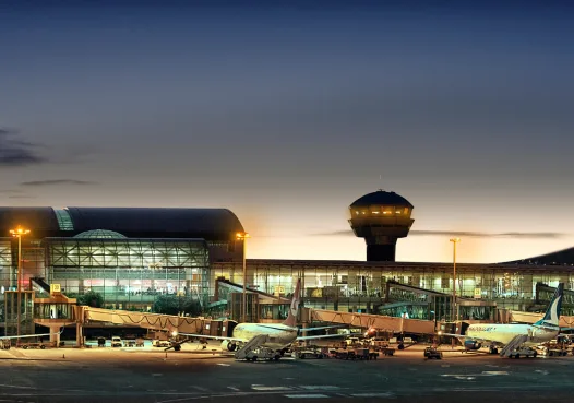
European air passenger volumes almost back to pre-pandemic in March 2024
Several large airports have exceeded their pre-pandemic volumes, the best performances came from Paris-Orly (+10.8%), Istanbul Sabiha Gokcen (+8.8%) Athens (+8.4%), Lisbon (+5.4%), Palma de Mallorca (+2.1%), Antalya (+1.4%) and Dublin (+0.8%) – (August 2023)
The growing difficulties airports, airlines, and travellers are encountering are all too familiar to anyone who frequently travels.
Due to the pandemic, thousands of travellers are now flocking to the airport to make up for missed travels over the past few years.
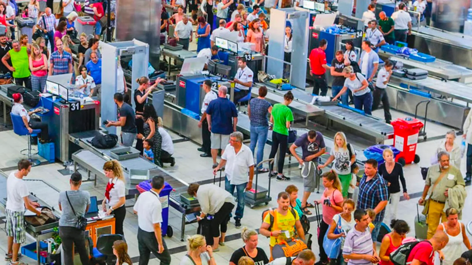
Thus, we are experiencing a surge in airline delays and cancellations, longer TSA wait times and misplaced luggage. To make matters worse, airports continue to face staffing problems, such as a shortage of baggage handlers, which has resulted in even more lost bags.
According to the Guardian, in April 2022, almost six bags per 1,000 pieces of luggage checked in by passengers were at least temporarily lost by US airlines - 67% higher than April 2021.
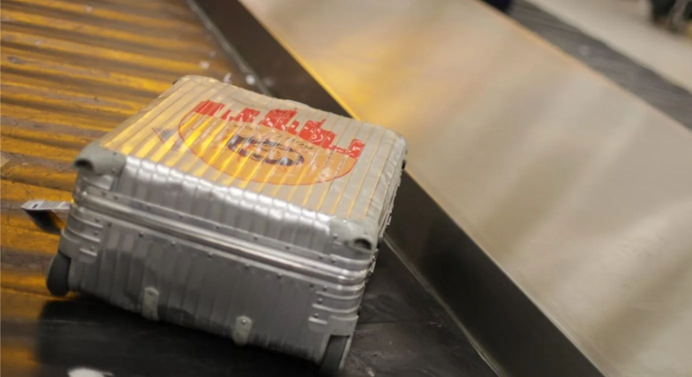
Consumer complaints about airlines are up 300% as a result of all these problems.
Airports operators are responding by introducing new technologies to simplify procedures and improve the traveler experience.
This article explores how and why they are increasingly using LiDAR-based software solutions to tackle these challenges, leveraging the unique value of Spatial Intelligence.
Why LiDAR?
Many people first learned about the value of LiDAR data because of the Self-Driving Car application, which will be widely deployed at scale sooner or (more likely) later.
Unlike existing 2D-based perception technologies such as cameras, the 3D data from LiDAR produces highly detailed, precise, and accurate spatial measurements. It also works in a range of environments and contexts, such as during the night and under direct sunlight.
That is what its name, Light Detection And Ranging (LiDAR), actually means. If you want to understand more the basics of 3D LiDAR, check-out our previous article:
Understanding the basics of 3D LiDAR Technology
Light Detection and Ranging, also known as LiDAR, is a technology for remote sensing that is used to measure distances in an environment.
Read article →

This new kind of sensor also offers an important nontechnical advantage, no personally identifiable information is ever captured.
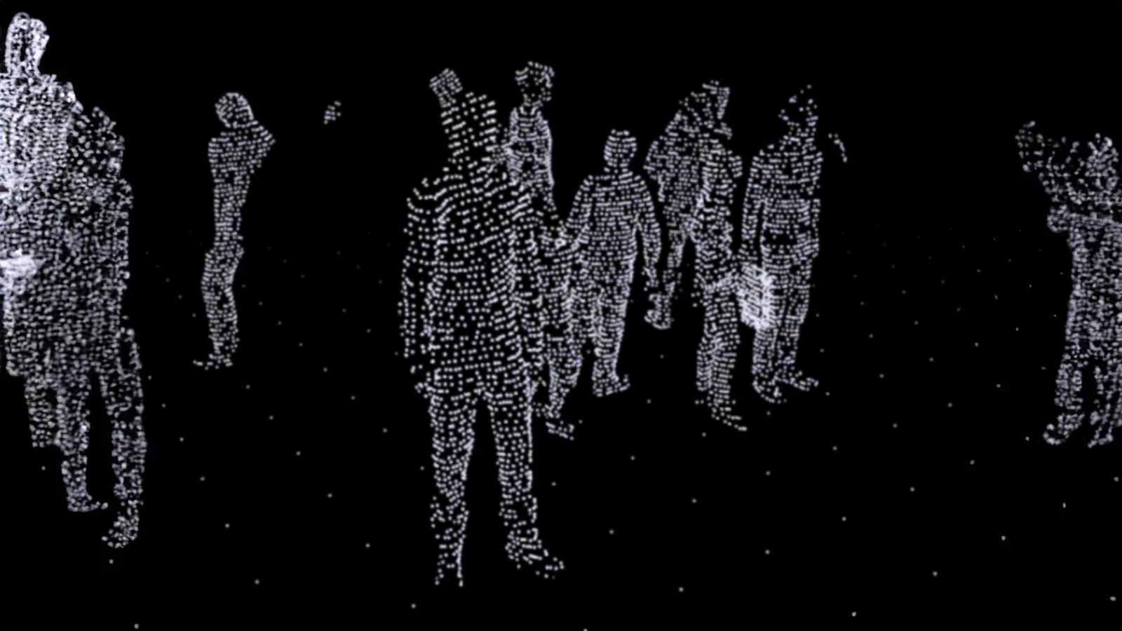
The data collected by LiDAR sensors is anonymous and lacks any and all personally identifiable information
Anonymous vs. Anonymized : Learn the Difference
Understanding Anonymity in Sensor Data: discover the inherent privacy characteristics of each type of Sensor data and the potential risks associated with anonymizing sensitive information
Read article →

This technology has recently attracted a lot of attention, which is unsurprising because it can monitor moving things and measure large volumes in an effective and safe way, a capability that is required and/or useful in many applications.
There is a big market for such a useful technology, in fact, several billion dollars have been spent on the development of LiDAR hardware technology, and approximately 100 businesses manufacture different types of LiDARs.
Why now?
As a direct consequence of this fierce competition and ample resources in hardware development, several consequences have emerged that make LiDAR an effective solution for airports.
Low prices and high performance
In just a few years, performance has greatly improved and price has dramatically decreased, making LiDAR competitive against legacy 2D sensing solutions in most market segments.
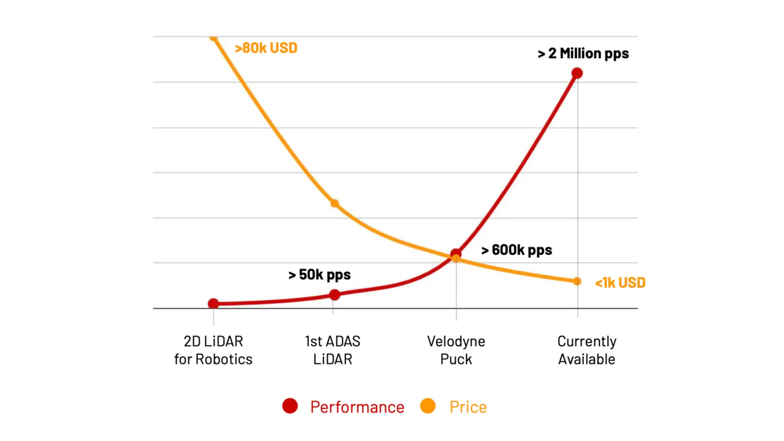
This is especially relevant for airports when one considers the total number of units, installation, and processing costs that are required to monitor a certain area.
Apt for a diverse set of environments
When it comes to selecting the most appropriate hardware, airport buildings, terminals, parking lots, and the tarmac are all very different locations: in some circumstances, such as perimeter security, you may need long-range detection, whereas in others, short-range but 360-degree coverage is much more crucial (i.e., Check-in zones and baggage claim).
There are literally hundreds of different LiDARs. For example, a new kind of sensor of type “Dome” has been designed for low-ceiling situations typically found in passport control zones or inter-terminal aisles.
Quick and easy conversion into actionable insights
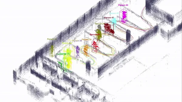
LiDAR hardware only provides raw data that can’t be used “as is” without the appropriate software. You can see in the picture hereafter what a luggage claim area looks like when using LiDAR raw data that has not been processed:
Raw data from LiDAR sensors cannot be used by humans “as is”
As a human your brain is processing this image so you see people moving, among 95% of other LiDAR points that are just not relevant.
For airports to actually use LiDAR data, they need the equivalent of this processing brain:
Companies like Outsight have created a new category of LiDAR Software that receives a heterogeneous set of data from different manufacturers and LiDAR types as an input and processes it in real-time to deliver only relevant information, in this example, tracking people with their position, speed, etc.
Instead of the complexity of many proprietary protocols and massive amounts of raw data, Outsight’s software delivers a light-weight data stream in an open format that enables many different use cases, using the right LiDAR or combination of different kinds of them depending on the situation.
Achieving Operational Excellence
We have seen that the Hardware is finally affordable, well-functioning, and well-tuned for infrastructure applications like airports.
In addition, the Software necessary to make it functional has finally been developed.
So, how is this technology being used in busy airports like Paris Charles-de-Gaulle?
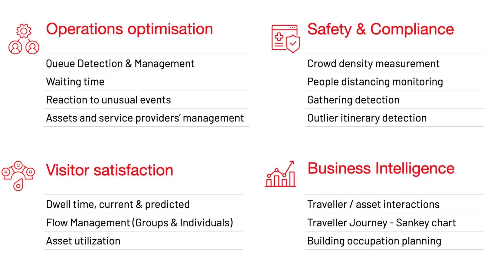
LiDAR is actually being deployed in multiple applications to optimize operations, increase traveler satisfaction, ensure safety and compliance, and enhance business intelligence.
The figure below summarises some applications:
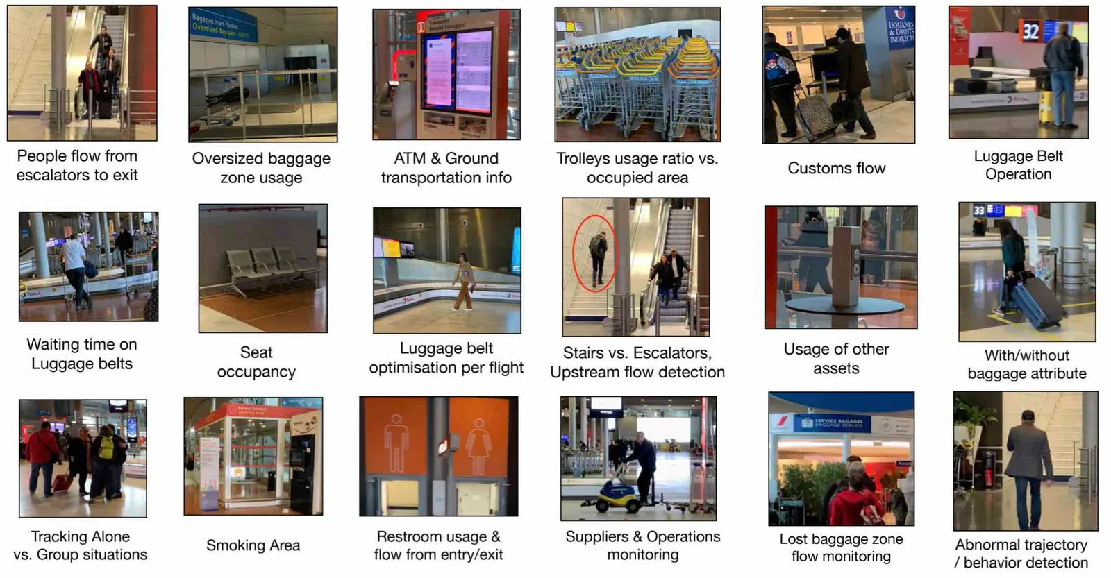
Only in a Luggage Claim zone you can find many concrete use cases:
In a Passport Control zone, the precise tracking of each individual allows streamlining the process and allocating the right resources at the right time:
In order to deliver this new level of Spatial Intelligence to Airports, several requirements are mandatory for such a software Solution:
Ability to monitor wide areas
Monitoring a wide area of many thousands square meters, in different levels, from Parking to Departures and Arrivals, requires much more than a sensor and object tracking software.
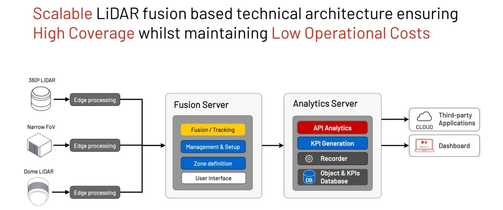
A comprehensive solution that enables the smooth integration of dozens to hundreds of sensors must be used, such as multi-LiDAR Fusion provided by Outsight.
It is crucial to manage the precise position, orientation, and timing of each individual LiDAR, simultaneously, to maximize performance.
The strain on the local network caused by processing millions of points per second can only be handled by the best edge processing software.
This will become increasingly important when sensor resolution grows - during the next 18 months, some manufacturers may provide sensors with a fivefold improvement in resolution.
Once that has been developed, the benefits are significant.
6 Key Benefits of LiDARs for Airports
LiDAR technology and Software is shaping a new wave of operational excellence, passenger experience and safety for airports of all sizes.
Read article →

Ability to extract Instantaneous and Aggregated KPI data
Airport LiDAR Solutions like Outsight’s don’t stop at object tracking.
They also deliver an actionable Dashboard, where the right KPIs can be set by the users, easily accessible from any web browser.
All relevant information and customisable KPIs can be tracked using Outsight’s Shift Software
The Dashboard gives both in-the-moment warnings and cumulative data over time, with the option to delve into historical data to better understand events and trends.
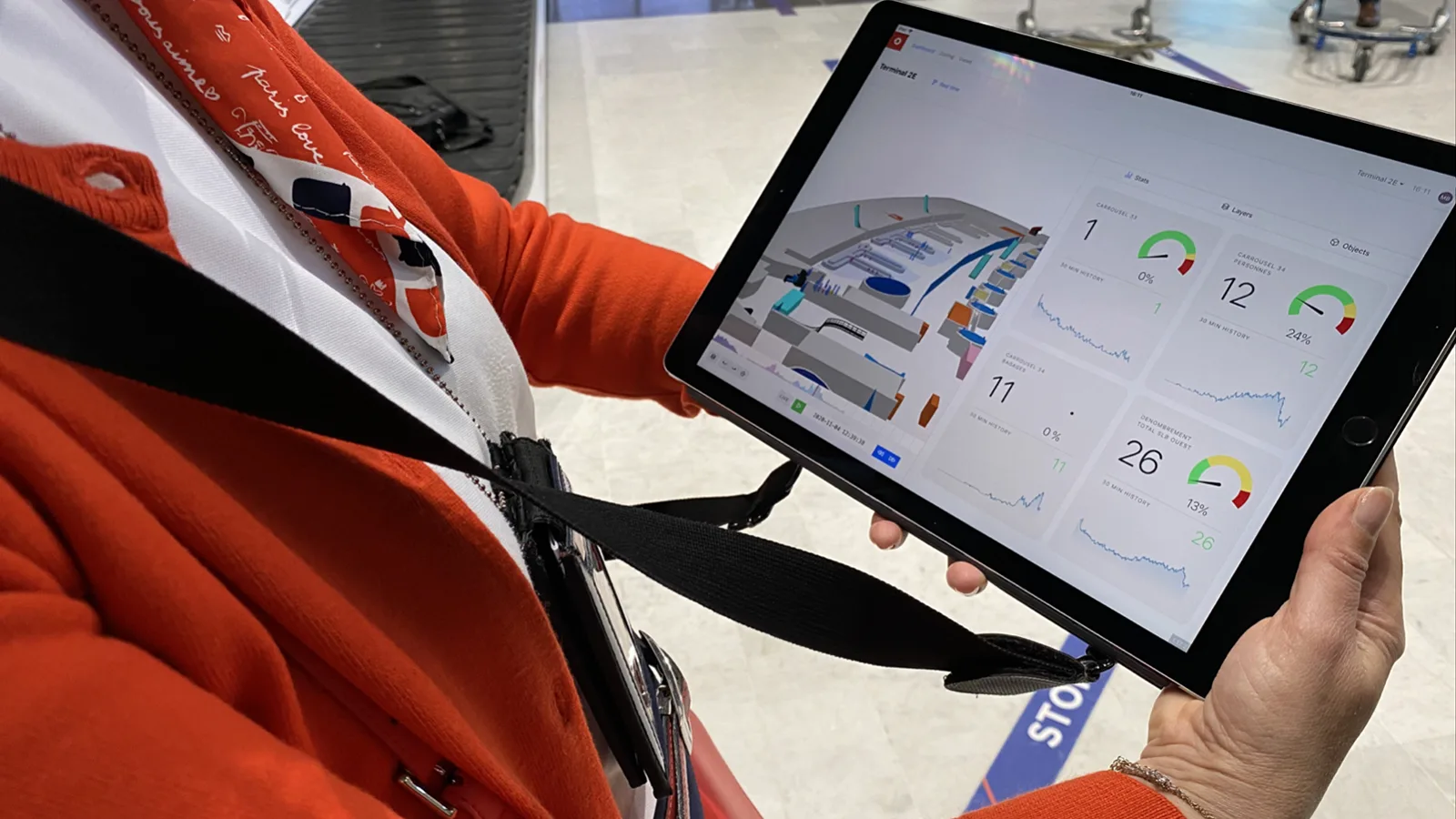
Outsight’s Spatial AI Software in use by by Group ADP at Charles de Gaulle Airport in Paris
This ensures that the information is both comprehensive and valuable.
To give you an idea of scale, the Outsight solution installed in airports like Charles-de-Gaulle Airport in Paris has already accumulated 3.8 billion anonymous data points, which are easily available to authorised operators.
ADP Group Testimonial at CDG
Interested in the applications of LiDAR in Airports? Learn more about how our customer Groupe ADP used our LiDAR Software solution.
Read article →

Ability to be scalable and future-proof
As we’ve seen, the LiDAR hardware industry is quite diverse and dynamic.
As different sensors and manufacturers have varying pros, cons, and price ranges, there is no one-size-fits-all solution.
Here are the three types of LiDARS that can be used in airports:
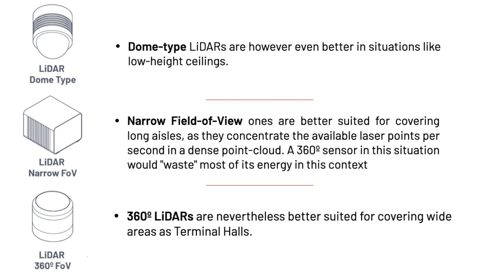
The types of LiDARs that we recommend for use in Airports
Short-range sensors, typically working at 905 nm wavelengths, are better for constrained spaces, as they optimize resolution.
On the other hand, long-range sensors, typically working at 1550 nm, are great for covering long distances, especially helpful in the tarmac and for perimeter security purposes.
Airport operators must be certain that the best sensor is being used for the right purpose.
Employing, integrating, and combining various sensors from different manufacturers is essential for both immediate and long-term success.
For example, an international airport operator, who is one of Outsight’s clients, deployed a first site with a particular manufacturer. Because of the distinct physical architecture and constraints, a combination of gear from two separate manufacturers was used to deploy the second site. The first two sites consequently needed three distinct hardware sensors.
Eventually, more sites might need different ones.
Ability to manage the whole project lifecycle
Due to the complexity of integrating 3D LiDAR to obtain Spatial Intelligence, airports must rely on purpose-built comprehensive solutions that span the entire project lifecycle.
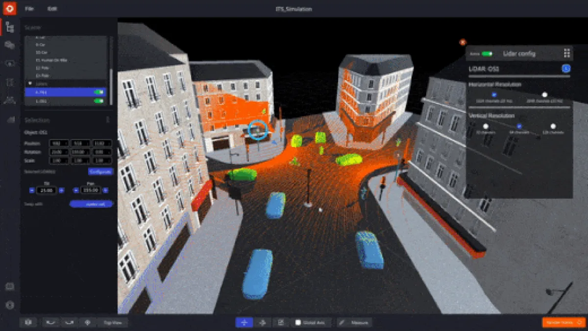
To understand the best solution for the entire project lifecycle, 3D planning
and simulation are crucial. This is the role of the Outsight’s Spatial Intelligence Platform developed by Outsight with this purpose in mind:
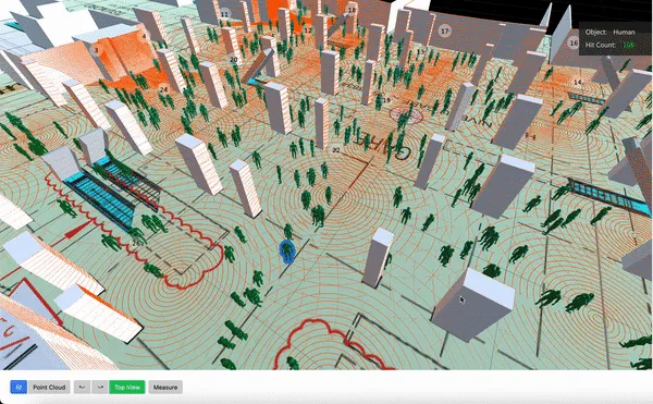
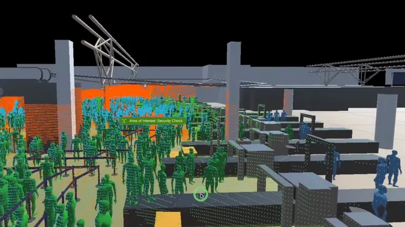
First Multi-Vendor 3D LiDAR Simulator Unveiled
Outsight has developed a LiDAR simulator for any use case and application, from airports to mobile robotics, smart cities and industrial applications.
Read article →
As the project evolves and the solution becomes increasingly interconnected to other airport systems, only open API solutions with standard protocols can guarantee the required flexibility.
Conclusion
Airports are leading the way among all applications in Smart Infrastructure when it comes to the implementation of large-scale LiDAR-based solutions.
This has been made possible by the introduction of LiDAR-agnostic comprehensive software solutions, like those offered by Outsight, as well as the correct timing of the hardware market’s prices falling.
Because of this, we are now able to access the unique insights that can only be obtained from 3D data, both for immediate reaction (alarms) or analyzing aggregated data over long periods of time (KPI’s in Dashboard).
This provides a level of Spatial Intelligence that was not previously obtainable by traditional 2D sensors such as cameras, with the additional advantage of native respect of Privacy.
Thanks to these new 3D LiDAR-based solutions, airports can reach a new level of Operational Excellence and Security, and deliver an optimized and user-friendly experience for travellers.