According to Allied Market Research, the global smart space market was valued at $30.53 billion in 2020, and is projected to reach $107.42 billion by 2030, registering a CAGR of 13.4%.
Recent statistics demonstrate that there will be a significant growth in the Smart Spaces sector, which means that an increasing number of businesses will be investing in technologies to make their infrastructure smarter.
What are Smart Spaces?
Smart Spaces are are physical environments equipped with advanced technologies that collect, process, and analyze data to enhance the overall experience, efficiency, and functionality of those environments.
These spaces utilize interconnected devices and systems, often referred to as the Internet of Things (IoT), to create intelligent environments that adapt to the needs of their users.
The integration of sensors, data analytics, artificial intelligence (AI), and automation transforms traditional spaces into smart ones, enabling more informed decision-making and improved outcomes across various domains.
LiDAR Based People Counting Technologies
A key element of enhancing efficiency and reducing costs in Smart Spaces is the integration of People Counting Technologies.
The demand for real-time actionable data is undeniable, yet it comes with significant privacy concerns. Traditional technologies such as CCTV cameras, radar, thermal imaging, and stereo vision systems suffer from limitations in depth perception and accuracy while also raising privacy issues.
These shortcomings underscore the need for more advanced, privacy-conscious solutions in data collection and analysis.
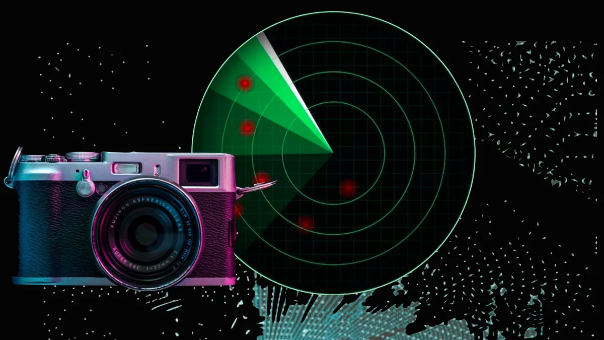
A detailed comparison of LiDAR, Radar and Camera Technology
This article explores the capabilities and limitations of each type of sensor, to provide a clear understanding of why LiDAR has emerged as a strong contender in computer vision tech race.
Read article →
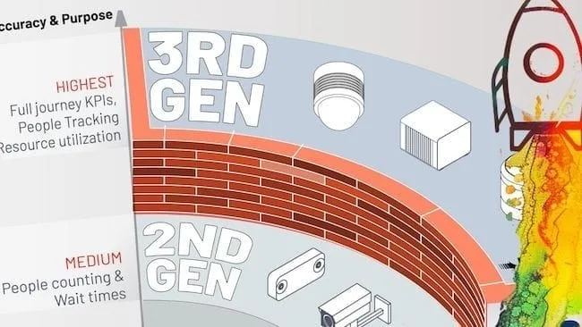
LiDAR-based Spatial Intelligence is the third-generation of People Flow Monitoring technology which address the need of the hour and can provide full user journey KPIs even in the case of multi-level and a mix of indoor-outdoor settings.
Introducing 3rd Gen People Counting Technology
Mirroring the technological evolution seen across various industries, People Tracking and Counting Technologies have already entered their third generation.
Read article →
With the help of Outsight’s Computer Vision software, it is now possible to digitize the displacements and interactions of people captured by LiDAR sensors within any infrastructure in real-time to derive valuable insights.
The Benefits of People Counting Across Multiple Sectors
- Retail Outlets
Understanding the movement patterns of customers in retail outlets has numerous benefits. By analyzing real-time 3D LiDAR data on how customers navigate the store, retailers can identify high-traffic areas and strategically place promotions and popular items to maximize visibility and sales.
LiDAR Boosts Quick Service Restaurant Efficiency
The Quick Service Retail (QSR) industry is perpetually evolving, with technological advancements playing a pivotal role in shaping customer experiences and operational efficiencies.
Read article →

LiDAR based Spatial Intelligence is being used in food retail
LiDAR data on customer counts, when used with an advanced analytics software can trigger alerts to open additional checkout counters, reducing wait times and enhancing customer satisfaction.
Efficient queue management improves the overall shopping experience, leading to higher customer retention and loyalty.
Outsight’s Spatial Intelligence Platform can analyze foot traffic and dwell times which are key elements of in-store customer behaviour.
This valuable data provides insights into the most frequented as well as under utilised areas, helping businesses optimise store layouts & ensure cost-effectiveness leading to a better return on investment.

- Office Spaces
In modern office environments, understanding the flow and occupancy of spaces is crucial for optimizing workspace utilization and enhancing employee experience.
Thanks to LiDAR data and sophisticated processing software like the one of Outsight, office space operators can access precise occupancy data and heat maps allowing for better space management.
This data can help in preventing overcrowding and ensuring that office spaces are utilized optimally, which can reduce the need for additional office space and associated costs.

LiDAR data-driven insights into space utilization can also help in optimizing cleaning schedules, Heating Ventilation & Air Conditioning (HVAC) systems, as well as lighting.
For instance, areas that are frequently used can be prioritized for cleaning, improving efficiency. While lighting and HVAC systems can be adjusted based on real-time occupancy, leading to significant energy savings and improved environmental sustainability.
- Large Venues
Real-time tracking of crowd density helps in preventing overcrowding and ensuring the safety of attendees at large venues like stadiums, concert halls, and exhibition centres. This is crucial input for managing large events where overcrowding can lead to safety hazards.
Owing to Outsight’s Spatial AI, large venues can access detailed insights into how people enter and exit the venue assist in designing more efficient pathways, reducing congestion.

This not only improves the attendee experience but also enhances security by ensuring smoother and more controlled entry and exit points.
Data on visitor movement and behaviour can be used to improve services such as food and beverage distribution, restrooms, and other amenities.
For example, by understanding peak times for concession stands, venue operators can ensure they are adequately staffed to handle high demand.
Outsight’s Olympic LiDAR project, which won the Innov’up Sport Laureate recently, is a great example of how large venues can leverage people flow monitoring insights.
Outsight Wins Innov’up Sport Laureate
We have been awarded the Innov’Up Sport award at VivaTech 2024 for the Olympic LiDAR project!
Read article →

In public spaces like parks, plazas, and streets, LiDAR technology enhances urban management.
Continuous monitoring of public areas helps in identifying and responding to potential safety hazards or security threats. This includes detecting unusual patterns of movement that might indicate a security concern and allowing for timely interventions.
Top LiDAR Benefits for Public Spaces
Discover the benefits of LiDAR technology in public spaces: people counting, anonymity, public safety, easy installation, and error-free data.
Read article →
Real-time 3D Spatial data aids in managing large public events by optimizing crowd control measures and ensuring smooth operations. This is especially important for outdoor festivals, parades, and other events.

Outsight’s Spatial Intelligence solution can provide insights into how people use public spaces inform urban planning decisions, leading to more effective and people-friendly city designs.
Planners can use this data to design spaces that encourage positive social interactions and better serve the community’s needs.
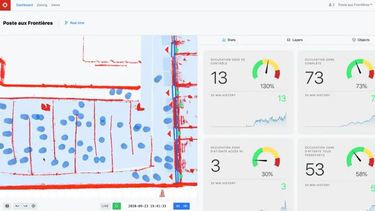
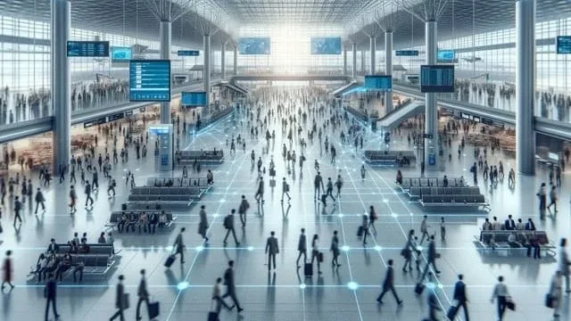
- Transportation Hubs
Real-time and anonymous tracking of passenger movement with LiDAR technology helps in managing queues, reducing wait times, and improving overall efficiency.
This leads to a smoother travel experience and can help transportation hubs like airports and railway stations in handling peak times more effectively.
LiDAR Enhances Airport Safety and Efficiency
Airports, as critical transportation hubs, play a dual role in ensuring passenger safety and maintaining a smooth flow of travelers.
Read article →
Detailed Spatial Intelligence insights aid in monitoring and managing security checkpoints more effectively. By understanding passenger flow, security personnel can be better positioned to handle potential issues and ensure safety.

Outsight’s Spatial Intelligence Platform on passenger flow and behaviour supports better resource allocation and improves the overall passenger experience. For instance, knowing peak times for different key areas can help allocate staff more efficiently, reducing bottlenecks and improving service levels.
Conclusion
People counting technologies, particularly those leveraging 3D LiDAR, are the new norm for the way Smart Spaces are managed and optimized.
Outsight’s Shift LiDAR Software stands at the forefront of this ongoing shift to the new norm, offering unparalleled spatial intelligence across a wide range of indoor and outdoor environments.
By delivering detailed insights while maintaining privacy and reducing infrastructure costs, Outsight is facilitating the shift to smarter, safer, and more efficient environments around the globe.