LiDAR technology has gained significant traction in recent years, primarily in the automotive industry, where it plays a vital role in advanced driver-assistance systems (ADAS). For illustration, the total LiDAR market is projected to reach $6.3 billion in 2027, up from $2.1 billion in 2021, at a CAGR of 22% between 2022 and 2027.
However, the full potential of LiDAR technology goes much beyond the automotive industry and, especially thanks to LiDAR Software Solutions, it is expected to see significant growth in non-automotive applications.
The smart infrastructure LiDAR market, for instance, is expected to grow at a 51% CAGR between 2022 and 2027.
According to a report published by the Yole Group approximately 63% of the LiDAR market, including hardware and software, will be outside of the automotive industry by 2027.
This growth is driven by the increasing demand for LiDAR technology in applications such as smart infrastructure, mapping and surveying, robotics, and security. In the next sections, we deep-dive on them.
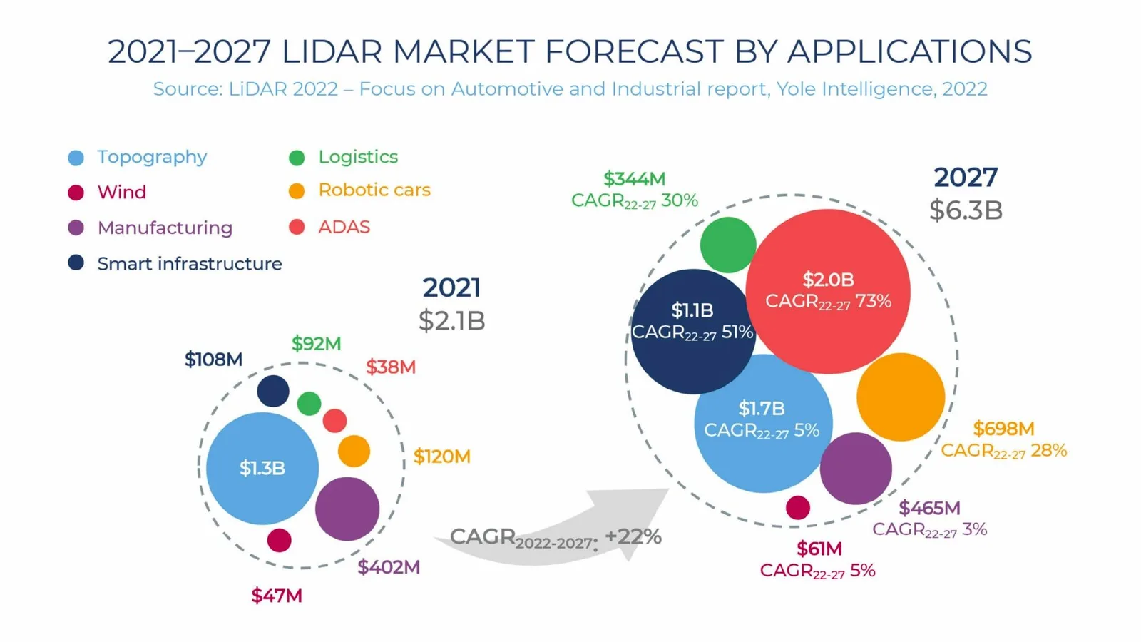
Yole Group’s report shows that almost ~2/3 of the LiDAR applications market will be outside automotive
Indeed, we listed not less than 100 applications and Use Cases of LiDAR:
The Top 101 LiDAR applications
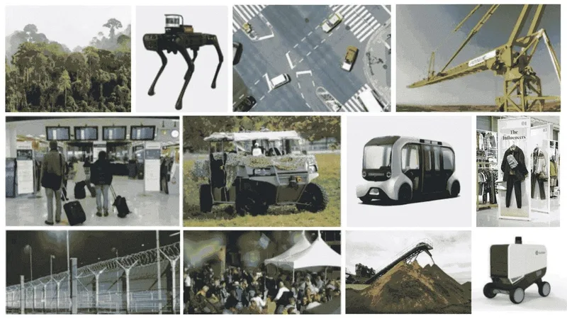
LiDAR can make anything that moves, observes other moving things, or needs to measure volumes smarter and safer. That makes for many applications!
Read article →

Smart-Infrastructure
Smart Infrastructure is a key area of growth for LiDAR applications, where the technology can be used far beyond the creation of 3D maps of terrain or buildings.
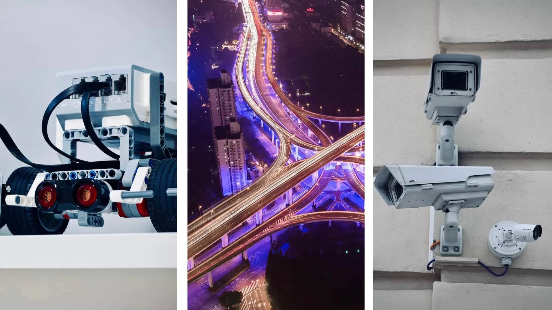
LiDAR systems, if equipped with the right software, are particularly useful in applications such as urban planning, safety monitoring at intersections, tolling management, smart parking, land surveying, and people flow monitoring solutions.
In one of Outsight’s customer applications, we have used the Augmented LiDAR Software Parking status feature to return the occupancy state of each parking slot. This is especially useful in truck parking monitoring situations where the visibility of where the available slots are situated is quite restricted.
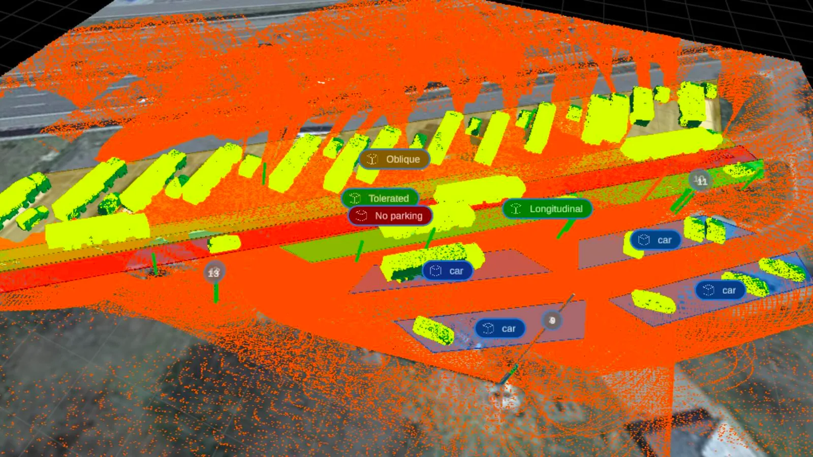
Parking status features works with high accuracy independently of lighting conditions
On another project, Outsight’s Augmented LiDAR Software was chosen to track high-speed objects and compute the inter-vehicle distance on highways for a European national main toll manager and operator.
In this solution, LiDAR sensors were combined with ANPR cameras, which were placed on a pole next to the road. The solution classifies the object type (car, truck, bus, or motorcycle), tracks it on a reference map, measures its speed, and informs its distance to the next coming object.
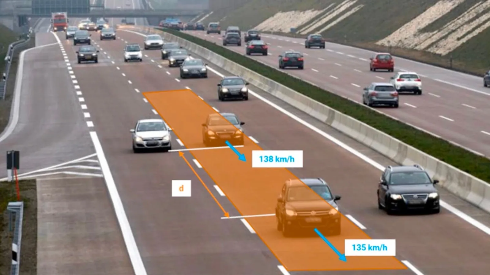
Illustrative example of a tailgating monitoring situation in highways
Finally, on another recent Smart City application, one of Europe’s biggest cities chose Outsight’s software to help them control traffic lights based on the number of cyclists in a certain zone of interest at many road intersections in the city.
In addition to that, this solution uses bicycles’ speed and traffic light timing data to propose an adjusted speed for riders with the goal of improving bicyclists’ safety and traffic flow.
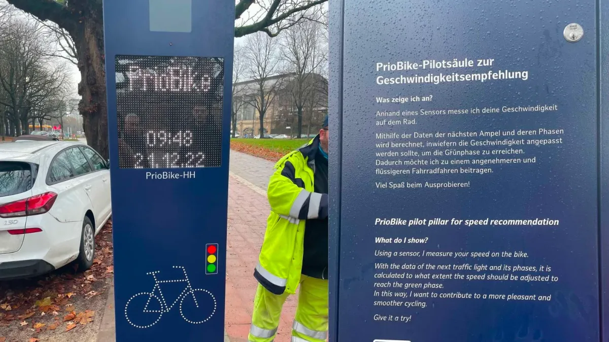
There are many ways to improve bicycles traffic flow and safety with the use of LiDAR software
LiDAR Software Expands ITS Solutions
With the global rise of 3D sensor demand, LiDAR has never been so accessible and it’s becoming essential for Intelligent Transportation System applications.
Read article →

Airports
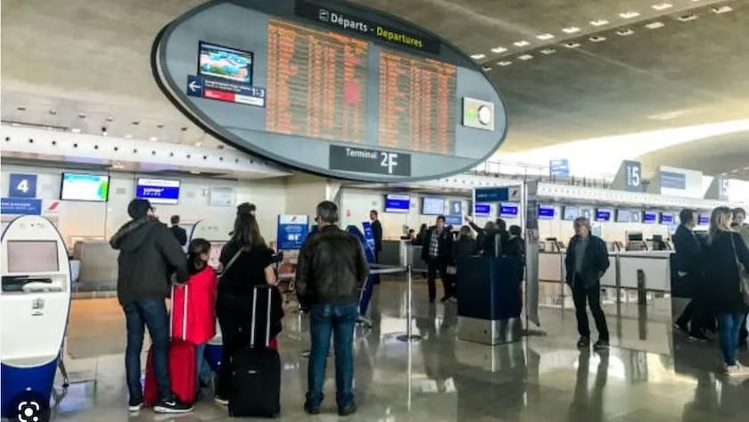
Airports are presently one of the most promising areas for LiDAR technology application expansion.
The fundamental reason is that LiDAR systems, which are backed by perception software, can detect and track people and items in environments with great precision, even in an enormous area or in poor lightening conditions.
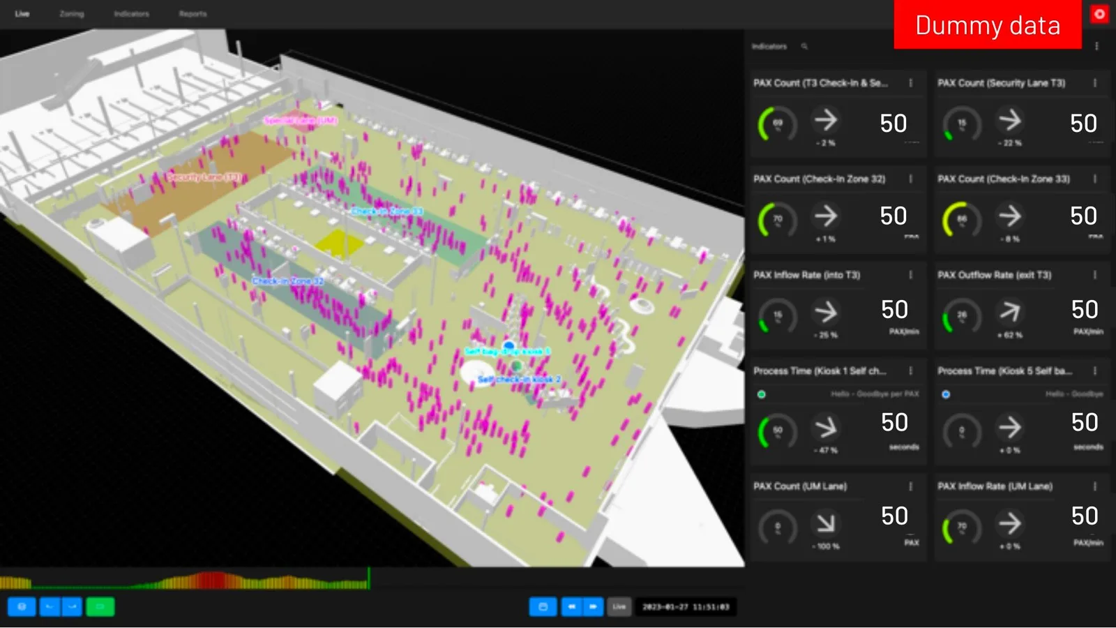
Outsight’s Spatial Intelligence Platform allows operators to continuously track passenger journeys and asset utilization across the Airport Terminal
The next article showcases how LiDAR is enabling a whole new level of situation awareness in many airport contexts, from security to operational excellence.
LiDAR Transforming Airport Flow Monitoring
LiDAR is a game changer technology enabling a whole new level of situation awareness in many airport contexts, from security to operational excellence.
Read article →
Robotics
LiDAR sensors and software are also critical for robotics applications, enabling robots to navigate and perceive their surroundings with greater accuracy and precision.
This is particularly important in applications such as warehouse automation, agricultural robotics, and autonomous delivery.
In one of Outsight’s customer applications, we have used the Augmented LiDAR Software SLAM algorithm to enable an autonomous robot to navigate through a warehouse.
On a different note, an European defense company that makes drones, robots, and other projects for the civil security and defense industries, chose Outsight’s LiDAR Software to provide the processed 3D images and data that would help operators control robots and their arms more precisely.
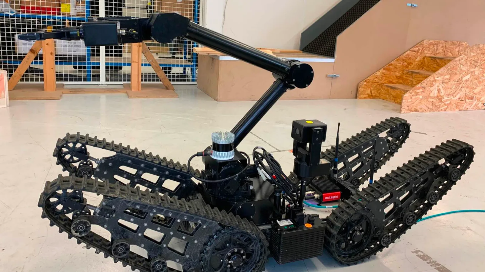
In this security solution, the ultimate goal of the robot is to neutralize a suspicious parcel or package.
Security
Finally, LiDAR technology and software are also finding an increasing number of applications in the security industry, where it is used to detect and track objects and people in real-time.
This is particularly useful in applications such as border control, critical infrastructure protection, and law enforcement.
It is crucial to note that LiDAR security systems are not in direct competition with camera-based video systems in this market; rather, they serve as an alternate solution when precise and accurate information on individuals and objects is required without breaching GDPR and integrity.
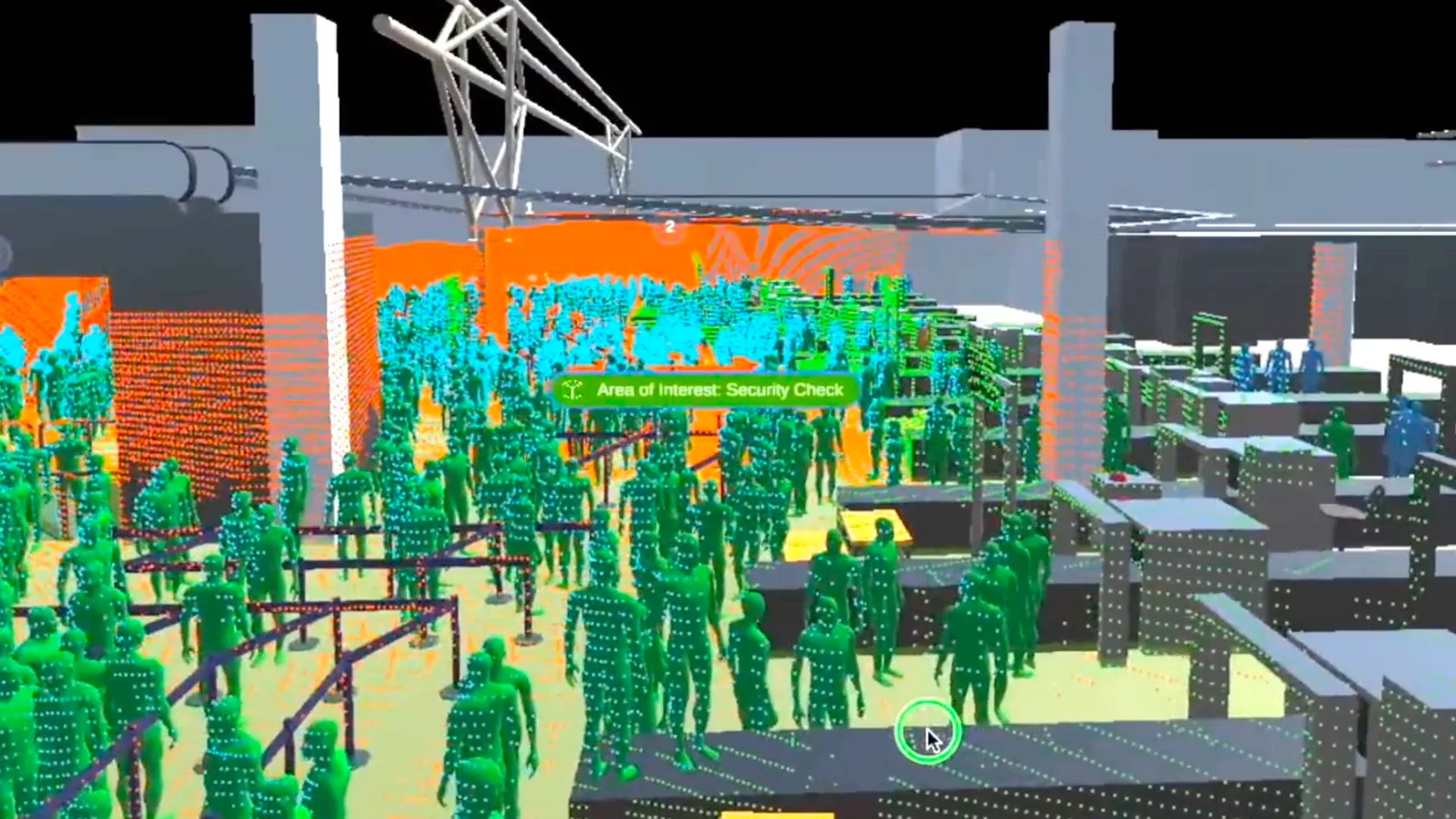
LiDAR monitoring simulation at a security check zone of an airport
In security applications, LiDAR systems can severely help reduce the number of false positives and are less affected by weather, low-light conditions, and partial obstruction such as tree branches and bushes.
This level of accuracy is not possible with cameras alone, as they are unable to distinguish between distant and small objects.
Another great advantage LiDAR technology is its inability to capture personal information, including facial features, which is a critical feature to enable security applications.
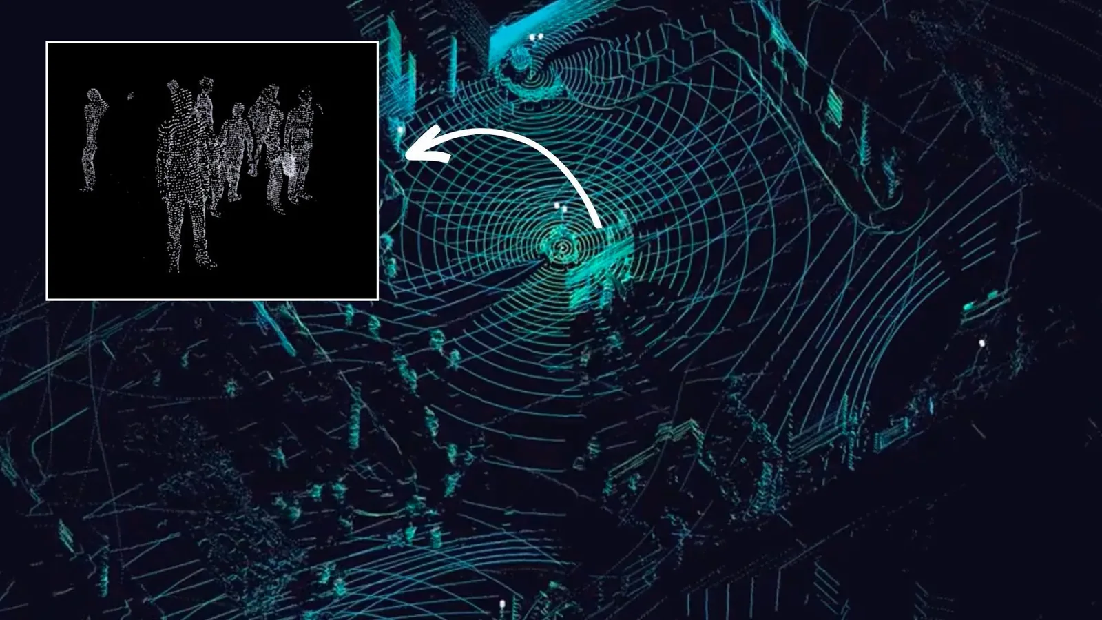
LiDAR-generated data is completely anonymous
LiDAR Enhances Security Solutions
LiDAR-based security systems, with the right perception software, provide smart, efficient, and automated means of preventing threats and avoiding false positive detections.
Read article →

What to expect
The Yole Group’s report predicts that the future of LiDAR technology will extend beyond the automotive industry, with a significant focus on smart infrastructure, mapping and surveying, robotics, and security applications.
As the non-automotive applications for LiDAR technology continue to grow, companies such as Outsight, which offer innovative LiDAR Software Solutions and seamless integration with existing infrastructure, are likely to see a surge in demand for their products.
As the traditional imagery systems used in most sectors comes with increased costs and inaccuracies, LiDAR systems can help us overcome these limitations to increase effectiveness and reliability.