Light Detection and Ranging, also known as LiDAR, is a technology for remote sensing that measures distances in an environment.
It is accomplished by illuminating the environment with invisible light to the human eye and timing how long it takes for the light to reflect.
This advanced sensing technology enables robots and computers to accurately “see” their surroundings in three dimensions.
Unlike existing 2D-based perception technologies such as cameras, the 3D data from LiDAR produces highly detailed, accurate spatial measurements and works in various environments and contexts, such as during the night and under direct sunlight.
One of the non-technical advantages of deploying LiDAR at scale is its ability to operate without capturing any personally identifiable information, ensuring privacy by design.
Anonymous vs. Anonymized : Learn the Difference
Understanding Anonymity in Sensor Data: discover the inherent privacy characteristics of each type of Sensor data and the potential risks associated with anonymizing sensitive information
Read article →

LiDAR technology does not capture any personal information.
And why should we talk about it?
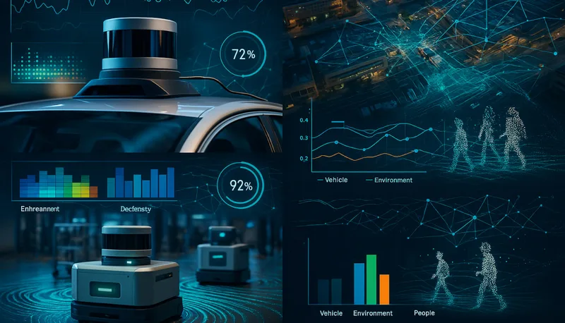
LiDAR technology is increasingly critical across multiple fields, such as autonomous vehicle design, people flow monitoring in smart infrastructure, robotics, industrial safety, and environmental monitoring.
Are you curious about all the LiDAR application possibilities?
Key Advantages of LiDAR for Airports
LiDAR technology and Software is shaping a new wave of operational excellence, passenger experience and safety for airports of all sizes.
Read article →

If you want to get started working with LiDAR or even have a passing knowledge of it, read on. This article will teach you the essential information that you need to know about LiDAR.
The Top 101 LiDAR applications
LiDAR can make anything that moves, observes other moving things, or needs to measure volumes smarter and safer. That makes for many applications!
Read article →

How Does a LiDAR Work?
LiDAR technology was developed as a way to measure distance accurately using light.
In LiDAR, a laser pulse is sent from a source (transmitter) and reflected from objects in the scene.
The system receiver detects the reflected pulses, and since the speed of light is constant, the time of flight (ToF) is used to develop a distance map of the objects in the scene (i.e., the amount of time that elapses reveals how far away the object is from the source of the light).
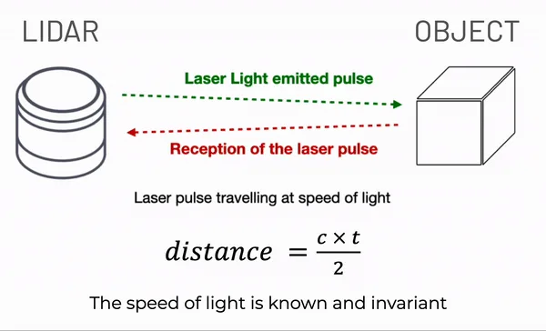
In the figure above, we illustrate how one laser pulse measures the distance to the object.
In practice, a LiDAR sensor can send millions of laser points per second in different directions to obtain a comprehensive understanding of its surroundings.
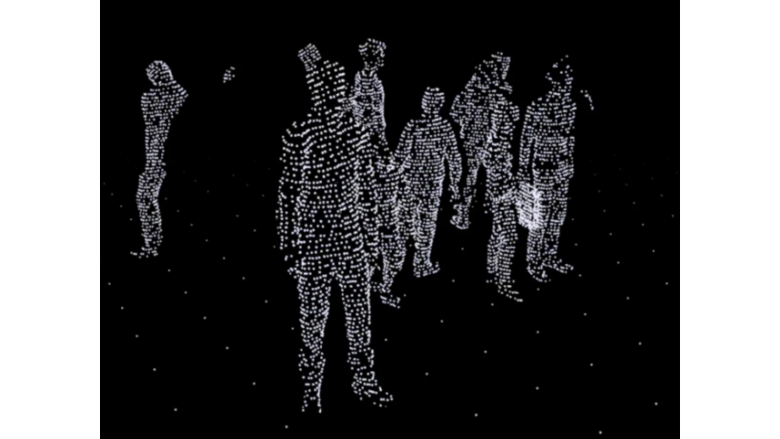
The instantaneous three-dimensional data acquired by the sensor is referred to as a point cloud and is meant to be represented by the term “Frame” in 3D LiDAR. This is analogous to a picture taken by a camera. LiDAR systems will typically provide data in some 20 frames per second.
With the appropriate software, you can combine many frames (or point-clouds) to create a 3D Map, that many people call a “Point-cloud 3D Map”:
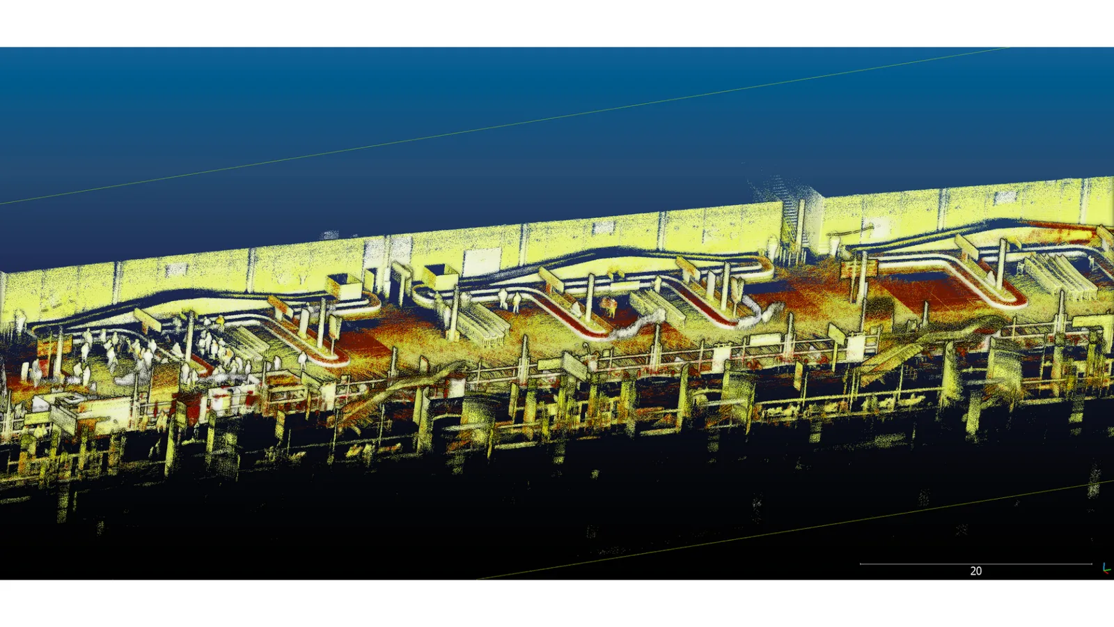
Point-cloud 3D map generated over an airport scene
The source of measurement can be a ground-based unit or something flying overhead, such as vehicles, satellites, airplanes, or robots:
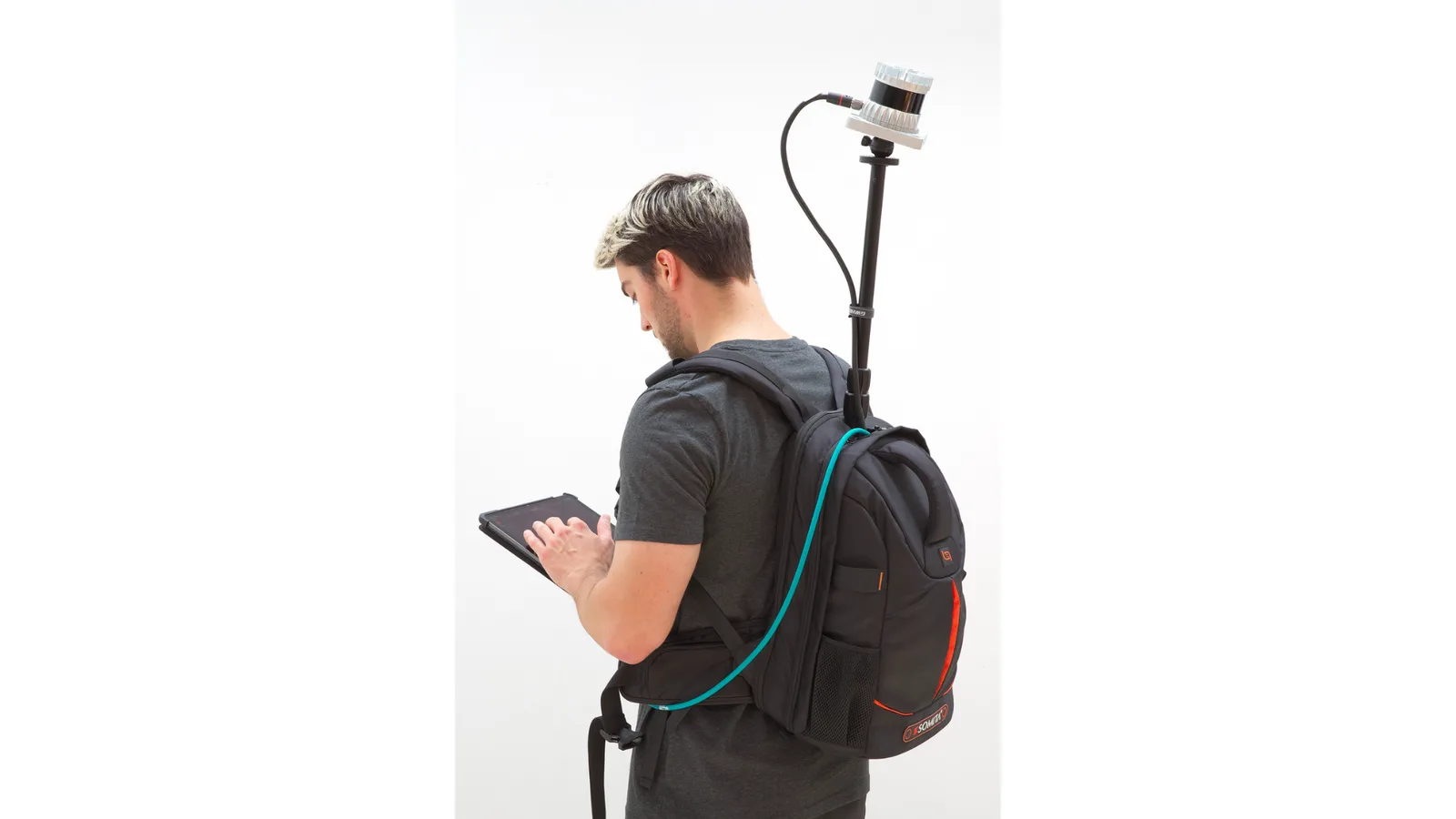
An example of a 3D LiDAR mapping kit in a backpack
LiDAR can measure the distance to almost anything, including terrain, vegetation, buildings, and other moving objects like vehicles and people.
Where Does LiDAR Come From?
LiDAR is an old technology, but it’s been rebranded and redeveloped for new applications. The basic idea behind LiDAR is to measure distance with light.
The word “LiDAR”, Light Detection and Ranging, dates back to the 1950s when it was used as a short-range radar system to measure the distance to buildings, trees, and other obstacles.
It was a precursor to the modern-day scanning technique called LiDAR (pronounced LIE-dar). In the early 1970s, scientists began experimenting with LiDAR to measure the distance to the earth’s surface. In 1971, Apollo 15 astronauts used LiDAR to map the moon’s surface. In the 1990s and 2000s, LiDAR sensors started to map terrain and create digital elevation models.
LiDAR has been a valuable tool in construction, forestry management, and mineral exploration for decades.
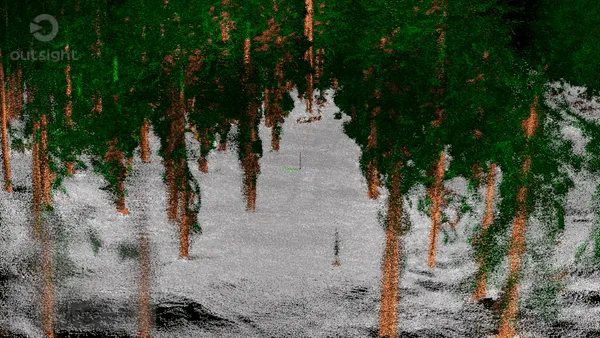
Forestry mapping with LiDAR, processed by Outsight’s software
In 2021, the program LiDAR HD started collecting high-density LiDAR data over the entire metropolitan area and overseas French territories to meet the needs of observation and spatial analysis in many areas of public action (risk prevention, observation of forest resources, land use planning, etc.).
In the early 2020s, Apple started including LiDAR technology in its iPads to enhance the environment’s 3D modeling for augmented reality applications.
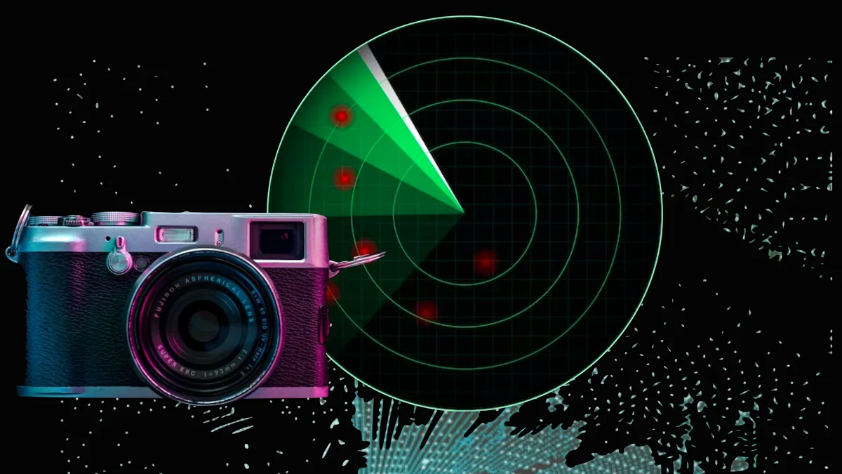
What’s the difference between a LiDAR and a camera?
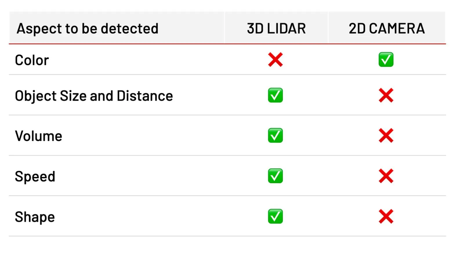
LiDAR and Cameras serve different purposes in detecting objects, focusing on other aspects.
- A Camera captures colors, but it has no notion of distance (a big object far away is the same size as a small object close to the camera)
- A LiDAR captures Spatial Data, which is objects’ distance, shape, volume, and velocity.
Consequently, if one wants to answer a question like “Is it a cat or a dog?” a camera is a more appropriate tool, thanks to the precise colored image and the right computer vision software.
However, if one wants to answer more sophisticated questions like “What’s the size of this object?” the 3D LiDAR is a more appropriate solution.
The table below summarises which object features are detectable by each technology.
Another key difference between LiDAR and cameras is that the latter are passive sensors, meaning they depend on the external light to grab the colors (no light → no information).
In contrast, LiDAR is an active sensor that generates light to grab spatial information. Thus, it works in any lighting condition, including complete darkness (no light → still has information).
As a result, LiDAR allows vehicles and robots to identify other nearby vehicles, people, and other objects in the environment in almost any situation:
A detailed comparison of LiDAR, Radar and Camera Technology
This article explores the capabilities and limitations of each type of sensor, to provide a clear understanding of why LiDAR has emerged as a strong contender in computer vision tech race.
Read article →
Learn more about the differences between these sensors (LiDAR vs Camera, LiDAR vs Radar)
Dive deeper
You’re now ready to get into more details, thanks to the continuation of this article:
Understanding How Lidar Works
3D LiDAR is a complex technology that enables unprecedented Spatial Intelligence. Many engineering choices are possible when building a new device.
Read article →

Conclusion
LiDAR is a remote sensing technology that measures the distance to a target by illuminating it with laser light and measuring the reflected pulses with a detector.
LiDAR has been used to measure and map the earth’s surface since the early 1970s, and today it has been adapted in order to fulfill the needs of many applications in different markets.
However, it still offers integration challenges, such as a lack of standardization among manufacturers, high computer processing demand, and overall complexity.
Not All LiDAR Sensors Are Equal: Key Differences Explained
This article explores LiDAR differences and why customers use multiple vendors to meet their needs.
Read article →
Today, it’s finally easy to overcome these challenges thanks to Outsight’s 3D Software Solutions.
Ready to unlock the power of LiDAR perception?
Contact a Product Specialist if you want to know more!