Introduction
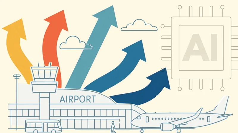
The world is filled with complex physical phenomena that shape our daily experiences, from the flow of people through airports to subtle changes in environmental conditions.
While artificial intelligence has made significant strides in processing text, images, and speech, a new frontier is emerging, one that seeks to understand the physical world itself through direct sensor data.
LiDAR stands out as a leading technology for capturing real-time 3D spatial information about environments, objects, and movement.
Understanding How Lidar Works
3D LiDAR is a complex technology that enables unprecedented Spatial Intelligence. Many engineering choices are possible when building a new device.
Read article →

This article explores how Physical AI is transforming our ability to perceive, interpret, and interact with reality by leveraging advanced sensing technologies, including those developed by us at Outsight, to create actionable insights from raw data.
Defining Physical AI: A New Era in Artificial Intelligence
Physical AI represents an evolution beyond traditional artificial intelligence systems. Rather than relying solely on digital content like text or images found online, this approach focuses on perceiving and reasoning about tangible events using real-world sensor inputs.
By doing so, it aims to capture patterns underlying physical behaviors, whether it’s tracking vehicles at an intersection or monitoring air quality inside large facilities based on people flow.
Unlike earlier generations of machine learning models limited by human-recorded data sources, Physical AI enables direct observation of phenomena previously inaccessible or too complex for manual analysis.
Physical AI, also known as Spatial AI, handles the fourth major data modality in artificial intelligence:
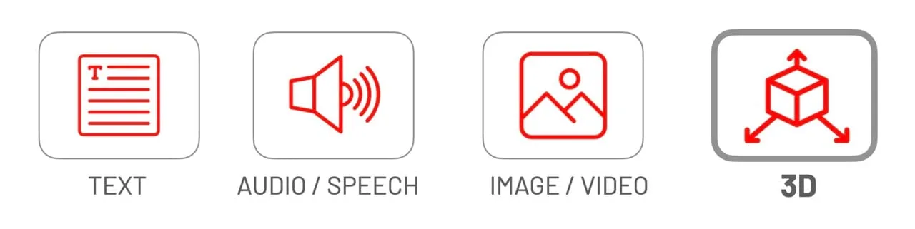
Physical AI deals with a specific modality of data, 3D real-word phenomena
Through this lens, Spatial Intelligence becomes not just a technical capability but a foundational shift toward understanding how things move and interact within space over time, a core mission we pursue at Outsight across industries such as transportation hubs and industrial automation.
Why Now? The 7 Key Drivers Accelerating LiDAR Adoption in Airports
Discover the 7 key drivers making LiDAR-based Spatial Intelligence a reality in airports, real-time, anonymous, and ready for global deployment.
Read article →

Limitations of Text-Based AI Models
Current generative models like large language models (LLMs) excel at processing vast amounts of written material but are inherently bounded by what humans can document or describe.
This means their knowledge omits countless aspects: Many critical variables, such as precise individual movement patterns, waiting times in crowded environments, or bottleneck formation across large infrastructure spaces, are invisible to traditional observation methods yet vital for operational efficiency, security and customer experience optimization.
Relying only on text-based datasets restricts both scope and accuracy when addressing these challenges.
LLMs cannot process native 3D spatial data from physical environments; they rely entirely on secondhand descriptions or outputs from specialized systems capable of real-time Spatial Intelligence.
What is Shadowless 3D Perception
Unlike cameras, which perceive reality from a single point of view, 3D native data from LiDAR opens up new possibilities.
Read article →
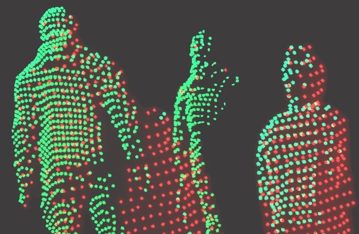
By contrast, Physical AI leverages sensors and spatial data capable of detecting nuances well beyond human perception, a necessity for robust monitoring solutions deployed worldwide by organizations including ours at Outsight.ai .
The Power of Multimodal Data in Physical AI
To overcome these limitations, modern approaches must harness diverse streams from both sensors (e.g. cameras capturing visual scenes) and other data sources (e.g. Flight Information, Point of Sale data).
However, to be leveraged as true Spatial Intelligence, this data must be anchored to physical reality through native 3D understanding.
This requires two critical components: first, the right 3D sensing capability, such as LiDAR technology that natively captures spatial data with centimeter-level precision, and second, an appropriate Physical AI software stack capable of processing, fusing, and analyzing this multi-modal information in real-time.
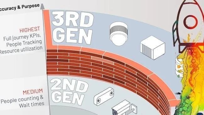
Introducing 3rd Gen People Counting Technology
Mirroring the Technological Evolution Across Industries, People Tracking and Counting Technologies Have Now Entered Their Third Generation of Performance and Scope
Read article →
Without this foundation of accurate 3D localization and continuous individual tracking, even the richest data streams remain disconnected from the physical world they’re meant to represent, limiting their actionable value for infrastructure operators.
Combining multiple sensor types allows systems powered by Spatial Intelligence to achieve comprehensive situational awareness, even under challenging conditions where one modality may be insufficient alone.
At Outsight.ai we have demonstrated how fusing LiDAR’s high-resolution 3D data with other sensors leads to more reliable detection outcomes across applications ranging from airport crowd management to smart city infrastructure analytics (Outsight’s Spatial Intelligence Platform).
Three core processes performed by Physical AI drive the transformation of raw data into valuable business outcomes, as illustrated below:
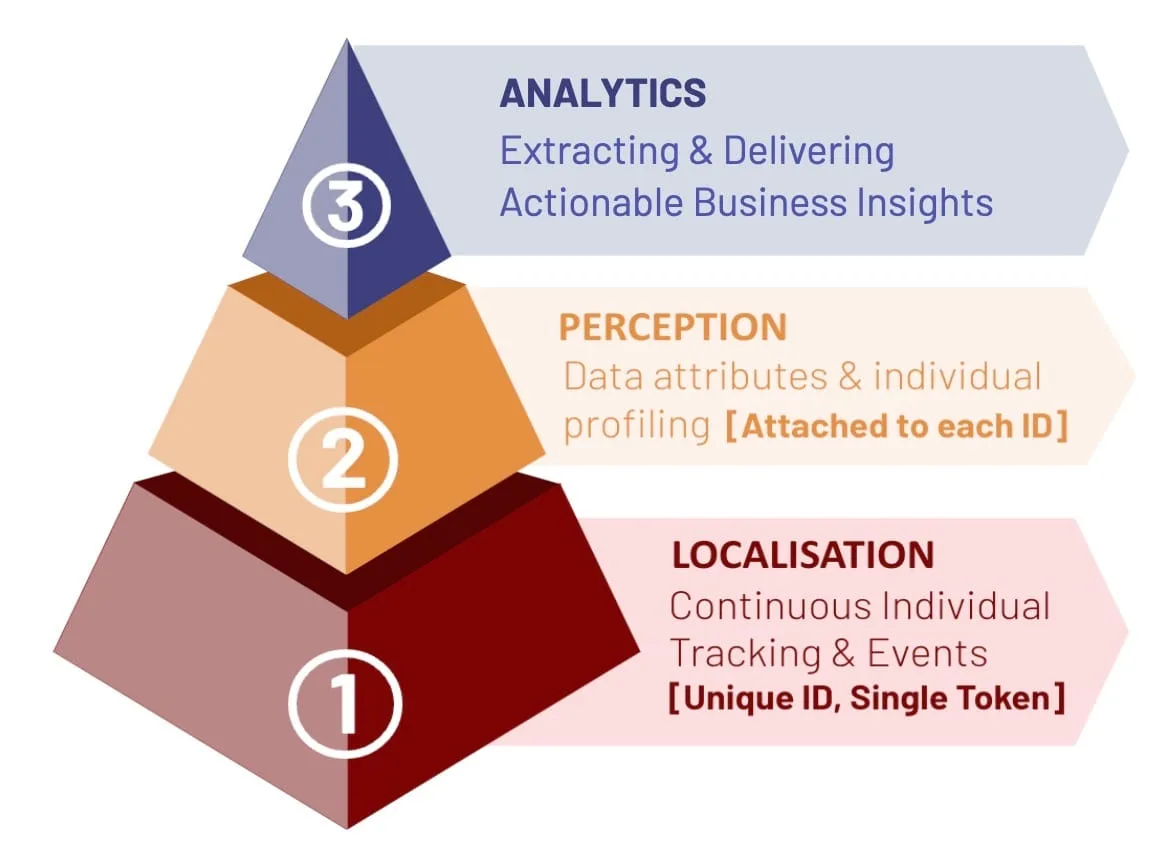
The three main processes that Physical AI must perform to deliver Business Outcomes
- [LOCALISATION] Continuous Individual Tracking: Precisely positioning each individual person or object, without interruption, across large distances, while assigning a unique anonymous ID to every object.
- [PERCEPTION] Situational Awareness: Perceiving the environment to understand behaviour and associating external data and attributes with each ID.
- [ANALYTICS] Actionable Insights: Converting raw tracking and perception data into business intelligence, performance metrics, and predictive insights that inform strategic and operational decisions.
From Raw 3D Data to Actionable Business Intelligence: Real-Time Spatial Analytics
Once diverse data streams are unified within a comprehensive Physical AI platform, the critical step involves transforming complex 3D spatial data into formats that infrastructure operators can immediately understand and act upon.
Modern Spatial Analytics systems convert raw 3D spatial data into clear business insights (“Security queue exceeds 15-minute wait threshold”), API outputs that trigger automated alerts (“Activate overflow management protocol”), or live Digital Twin dashboards visualizing passenger flow patterns in real-time.
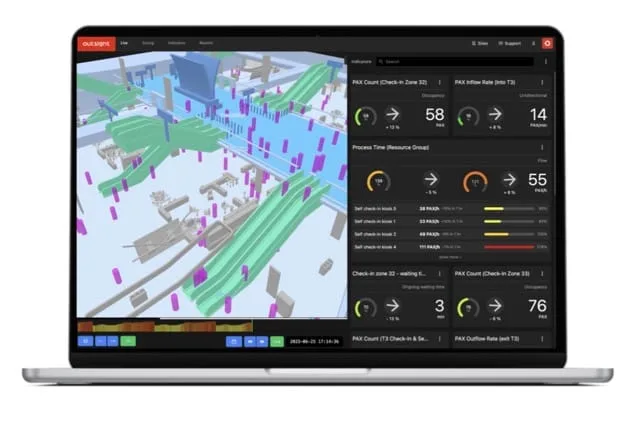
Physical AI in action through a Digital Twin
Leading Spatial Intelligence platforms deliver intuitive interfaces built upon proven 3D perception technology, enabling users, from airport operations teams optimizing passenger journeys to retail managers tracking shopper behavior, to make data-driven decisions based on precise, real-time observations of physical flows.
Toward Comprehensive Spatial Intelligence for Infrastructure Operations
The evolution of infrastructure management increasingly relies on Spatial Intelligence solutions trained on massive volumes of real-world 3D behavioral data rather than theoretical models or limited datasets.
These advanced systems learn generalized principles governing how people and vehicles move through complex spaces under varying operational conditions, enabling breakthroughs including:
- Predictive alerts before bottlenecks impact passenger experience
- Automated optimization routines adapting resource allocation based on real-time flow patterns
- Behavioral insights revealing hidden operational inefficiencies invisible through traditional monitoring
Crucially, all achieved through anonymous, privacy-preserving 3D data that captures authentic spatial behavior without personally identifiable information.
Anonymous vs. Anonymized : Learn the Difference
Understanding Anonymity in Sensor Data: discover the inherent privacy characteristics of each type of Sensor data and the potential risks associated with anonymizing sensitive information
Read article →

Spatial Intelligence solutions grounded in native 3D sensing represent a fundamental shift toward truly objective operational understanding, and more efficient, safer infrastructure environments worldwide.
Conclusion: The Transformative Impact of Spatial Intelligence
As operators of transportation hubs, smart cities, and commercial spaces seek deeper operational insights, Spatial Intelligence represents a pivotal advancement enabling them to monitor, understand, and optimize the physical flows that define their performance.
3D LiDAR technology serves as the foundational sensing modality for enterprise deployments, delivering unmatched accuracy, reliability, and coverage for mapping dynamic three-dimensional passenger and vehicle movements.
Industry analysts, including Gartner, which has featured Spatial Intelligence solutions in seven reports and recognized Outsight as market leaders in both Spatial Computing and Digital Twins, validate this technology’s transformative potential.
Gartner® Recognizes Outsight as a Key Player in Spatial Computing
In its latest Emerging Tech Impact Radar: Computer Vision report, Gartner identifies Outsight as a key vendor in Spatial Computing, alongside major technology players such as Nvidia, Meta, Alphabet, and Matterport.
Read article →

Spatial Intelligence, powered by Physical AI, will increasingly define competitive advantage wherever operational efficiency matters most, from reducing wait times and enhancing passenger experiences to strengthening security protocols and optimizing retail revenue across global infrastructure.
As the field continues evolving through innovation across the ecosystem, leading practitioners remain committed to transforming raw spatial sensing potential into measurable business value that benefits operators, passengers, and communities globally.